Here Comes A Backdoor Cold Front In The Northeast Heading Into This Weekend
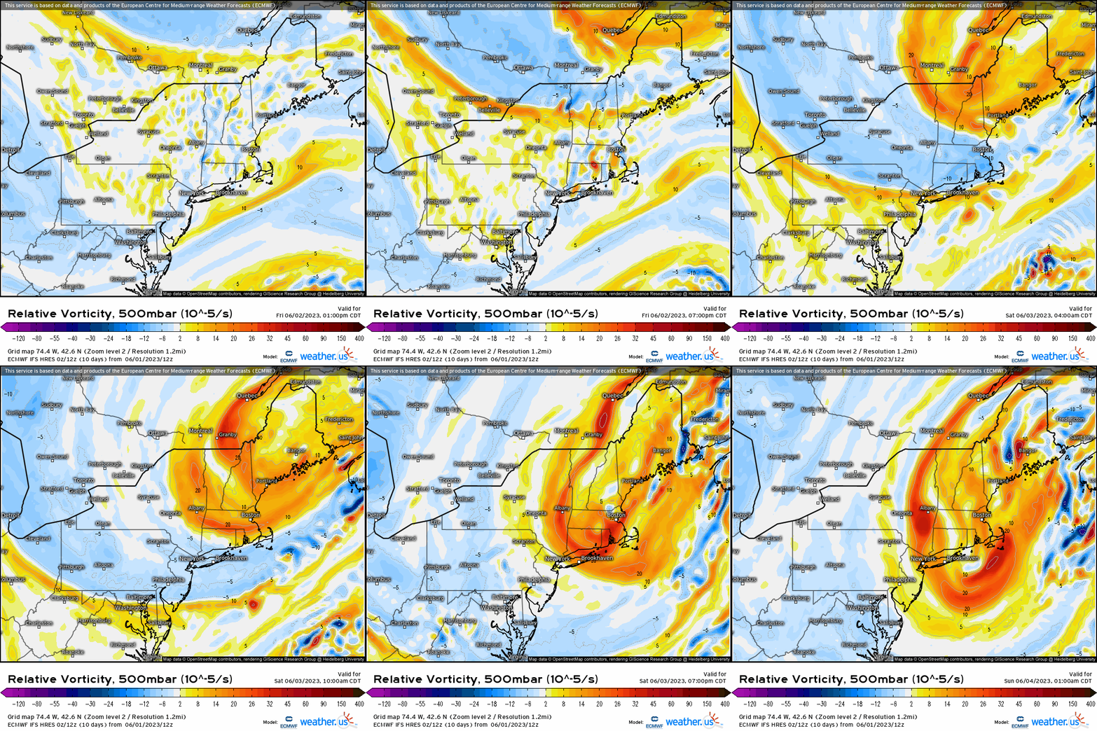
Tonight across the Northeast, we’ll see a mesoscale phenomenon that typically occurs during the Spring months in the Northeast. This is dubbed a “backdoor cold front”, meaning a cold front of lower density and cooler temperatures pushes in from the northern Atlantic offshore of New England, and advects inland. If you analyze the 500mb pattern, we see a large cyclonic upper low denoted by the vorticity max (deeper oranges / yellows) swing through. It’s at the surface that a cold front is at the leading edge of this trough.
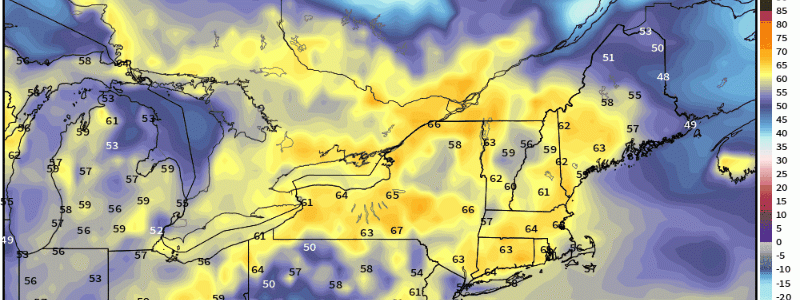
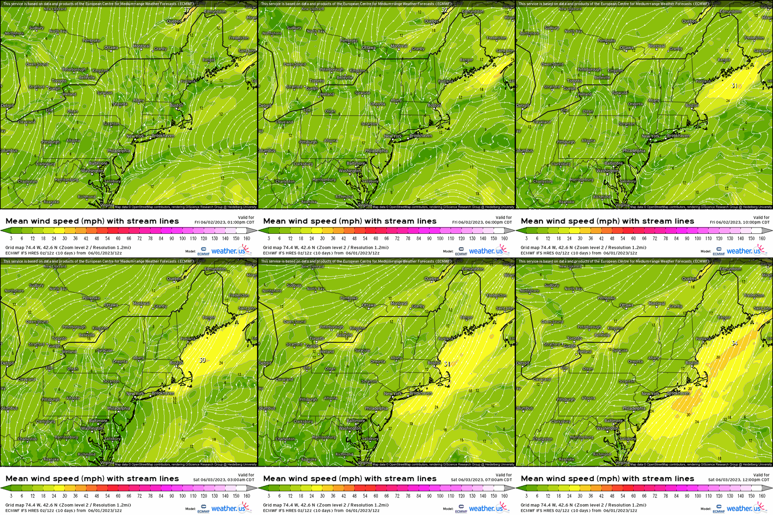
At the surface in the boundary layer, watch through the course of the day the wind direction suddenly switches to a northeasterly wind, and wind gusts pick up just offshore of New England tonight into early tomorrow morning.
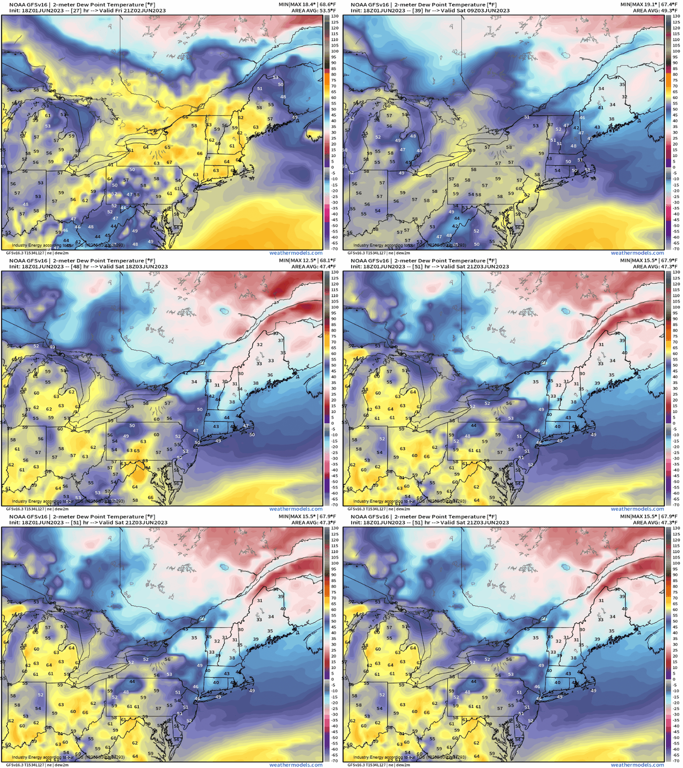
It’s even easier to visually “see” this by observing the dewpoint change. You can see the wide swath of dewpoints in the 40’s and 50’s gradually sink from northeast to southwest behind the surging cold front.
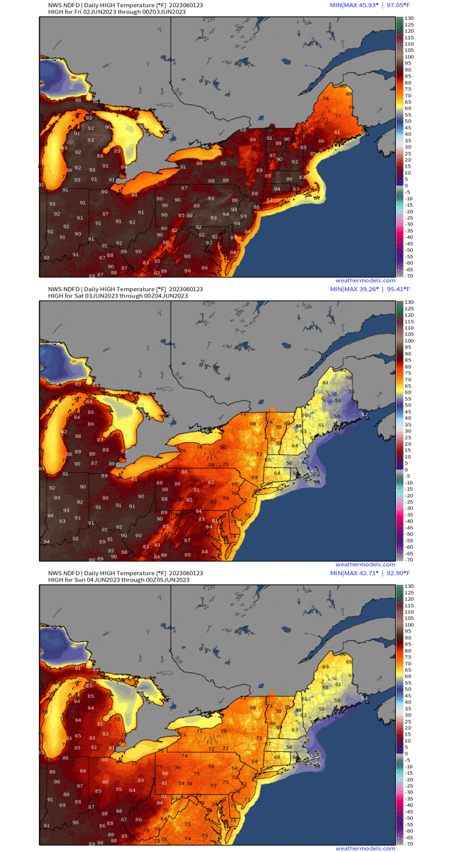
After one more day of temperatures in the 80’s and 90’s with records today across the Northeast, we’ll see temperatures 5 – 15 degrees below normal tomorrow and into Sunday thanks to an anomalous cool air mass.
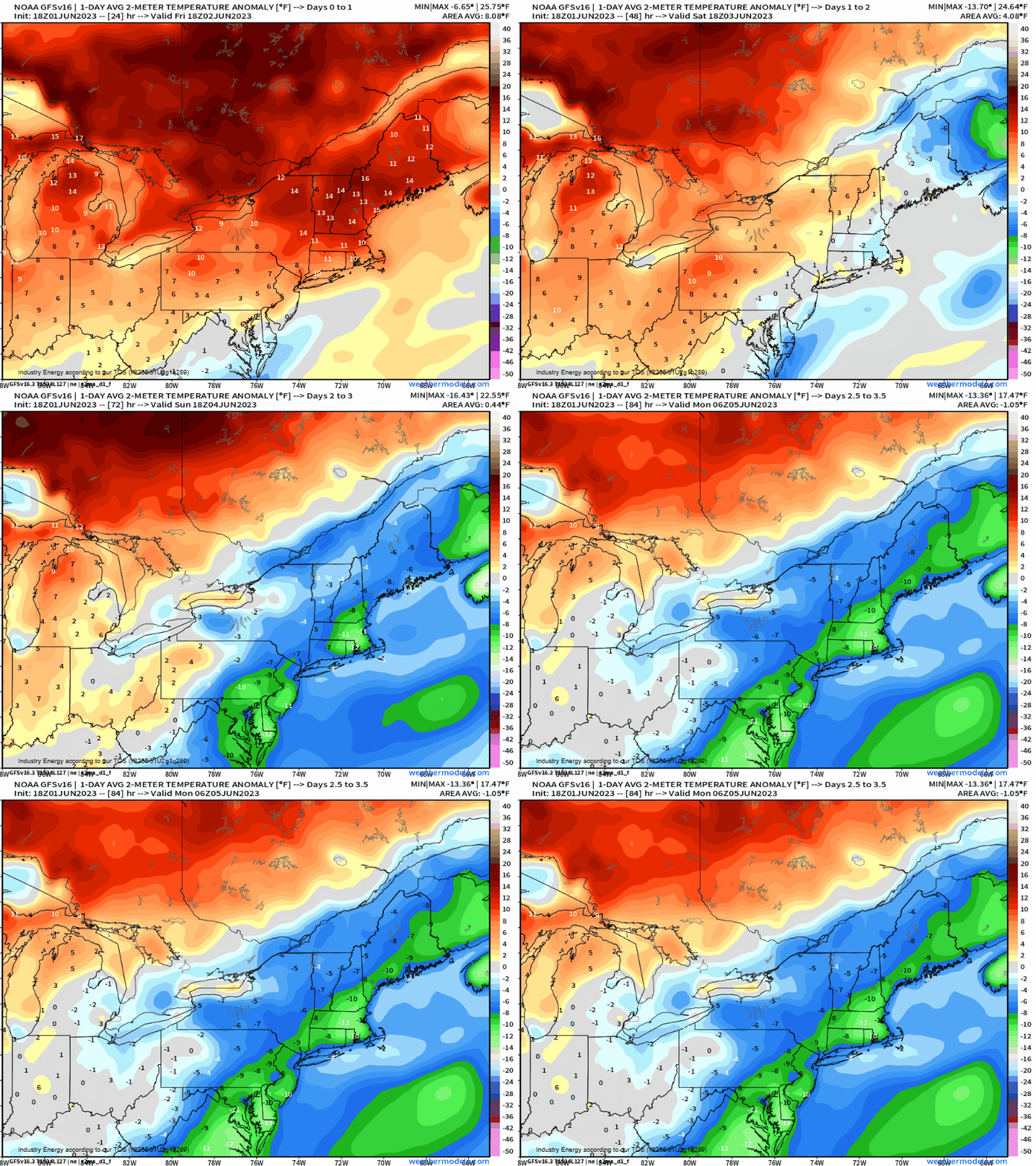
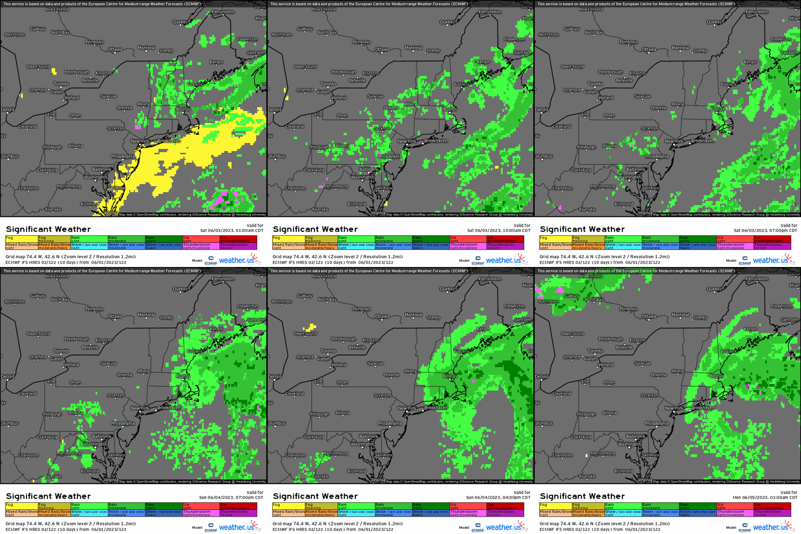
Up in New England, high temperatures will come as a shock with 50’s and 60’s, and into the 70’s further into the Mid-Atlantic. To add insult to injury, due to this cyclonic flow, periods of rain will wrap around into New England and parts of the northern Mid-Atlantic tomorrow and into Sunday, likely extending into early next week for parts of New England. In the very least, it does help alleviate some minor drought areas across New England and into Southern New England. At least there’s relief from the heat for those who dislike it, especially during the Summer months.
