Hedging Closer To June: Pattern Outlook Heading Deep Into May
We’re going to be dealing with quite the anomalous ridge across North America starting later this weekend and into early next week, as Meghan mentioned it in her blog from earlier this week. A near 4 standard deviation anticyclone will essentially “cut off” and retrograde across the Pacific NW and southwestern Canada. This will result in record daily high’s tomorrow and Monday for the interior West and Pacific NW with temperatures reaching and just exceeding 90 degrees; however, this upper air pattern doesn’t necessarily stagnate leading a the infamous summer “heat dome” that we’ve been familiar with over the past few summers.
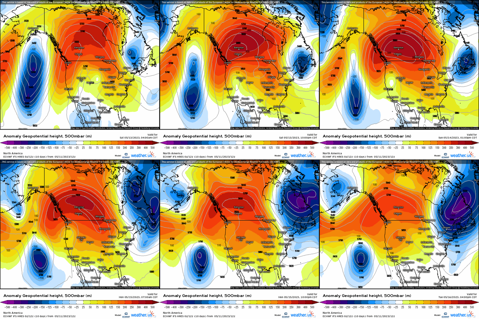
Going into next week and into the last week of May, we’re going to see a more stable upper air pattern without the extremes. For instance, lets roll the Canadian ensembles valid later next week and into the unofficial start of summer centering closer to Memorial Day. What we see is that Pacific omega ridge from the start of next week (resulting in some new daily record temperatures upcoming), breaks down and retrogrades westward. Semi-zonal flow with mainly positive heights across the Intermountain West, Pacific NW, and Rockies largely prevails while below average heights as a result, impose downstream across southeast Canada and into the Northeast. Positive heights expand the western Atlantic.

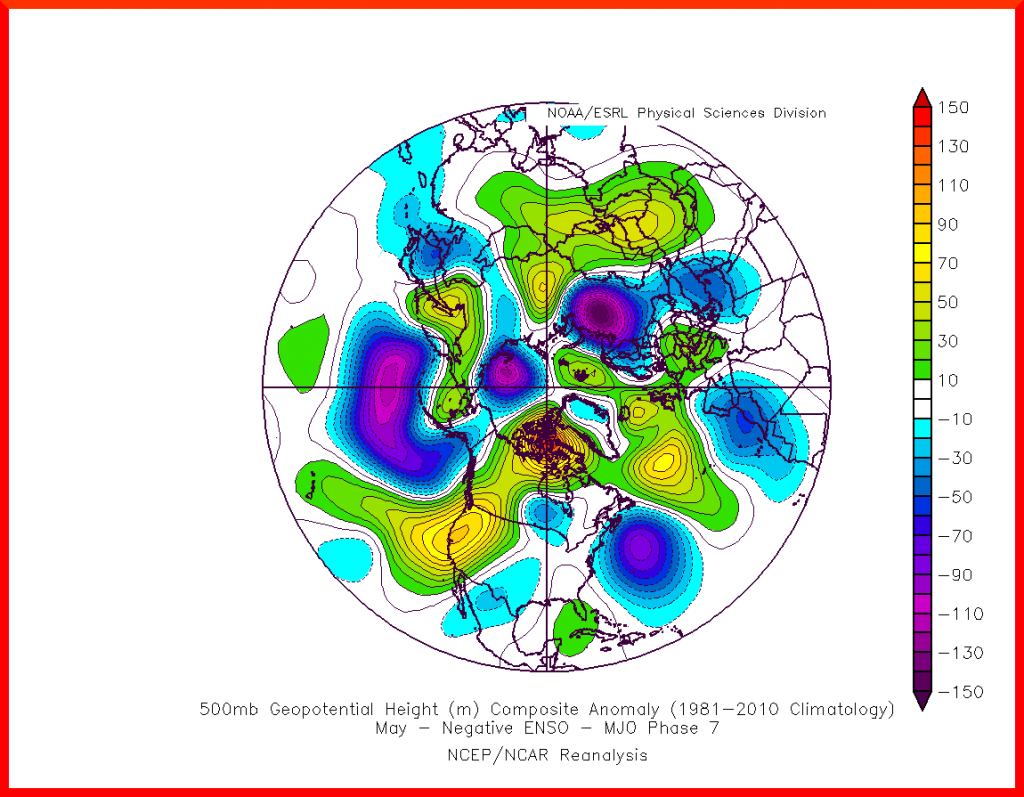
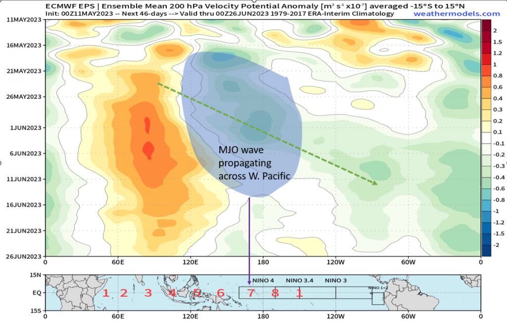
Is this supported, however, and with what confidence you may ask? Lets take a look below at two graphics with one composite of phase 7 500mb on the top, and the hovmoller on the bottom showing where our MJO (again, areas of divergence and convergence are propagating across the oceanic basins using a time-longitude visual) wave is prognosticated to move. I’ve outlined the upcoming period in the hovmoller where our MJO wave will be shifting, and that happens to be into the Western Hemisphere and in particular the West Pacific. Notice how it aligns with phase 7, after shifting through phase 6. It’s pretty remarkable how the Nina-based phase 7 composite contrasts with the ensembles, isn’t it? It gives a “base” for what the pattern may look like without even looking at numerical weather prediction, and now confidence is increased quite drastically with ensembles showing this. Positive heights across western N.A., below average heights east.
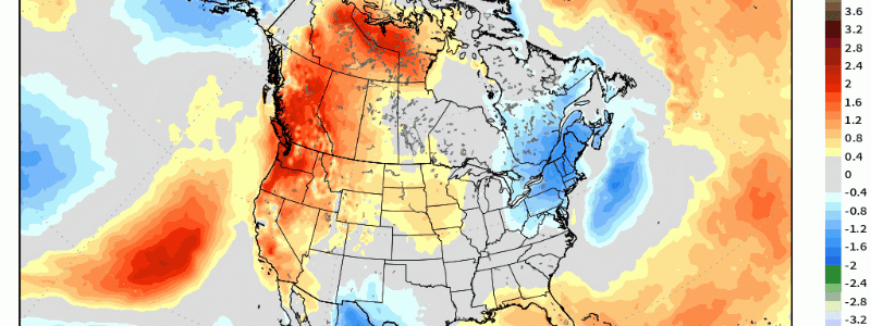
In terms of 2m temperature anomalies, without surprise we see the “core” of above average temperatures reside where our upper level ridging corresponds to out across the Pacific NW and northern Rockies. Further east, we do see a bit more in the way of near average to below average across the deep south given that in these regions there’ll be a propensity for troughiness downstream the ridge upstream across the West. Further east, we’ll see around average to possibly above given the influence of the western ridge.
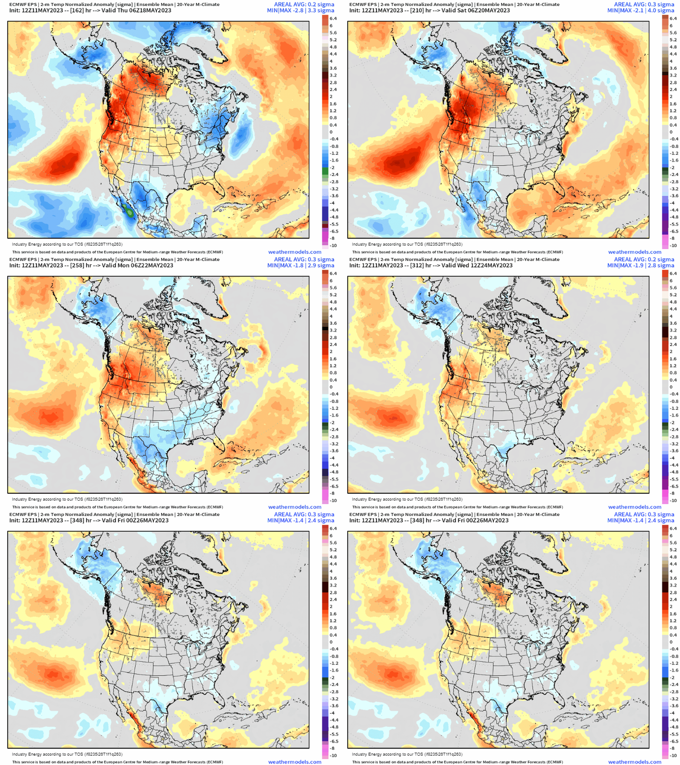
Lastly, in terms of aggregated precipitation anomalies, we’ll see the main focus center across the deep south in the form of convection, shortwave troughs, and downstream unsettled activity thanks to the ridging as aforementioned. Further east, it appears to be more on the drier side, though with a northwest flow aloft across the Northeast we can get some MCS / MCV type action and some severe weather setups bringing rain.
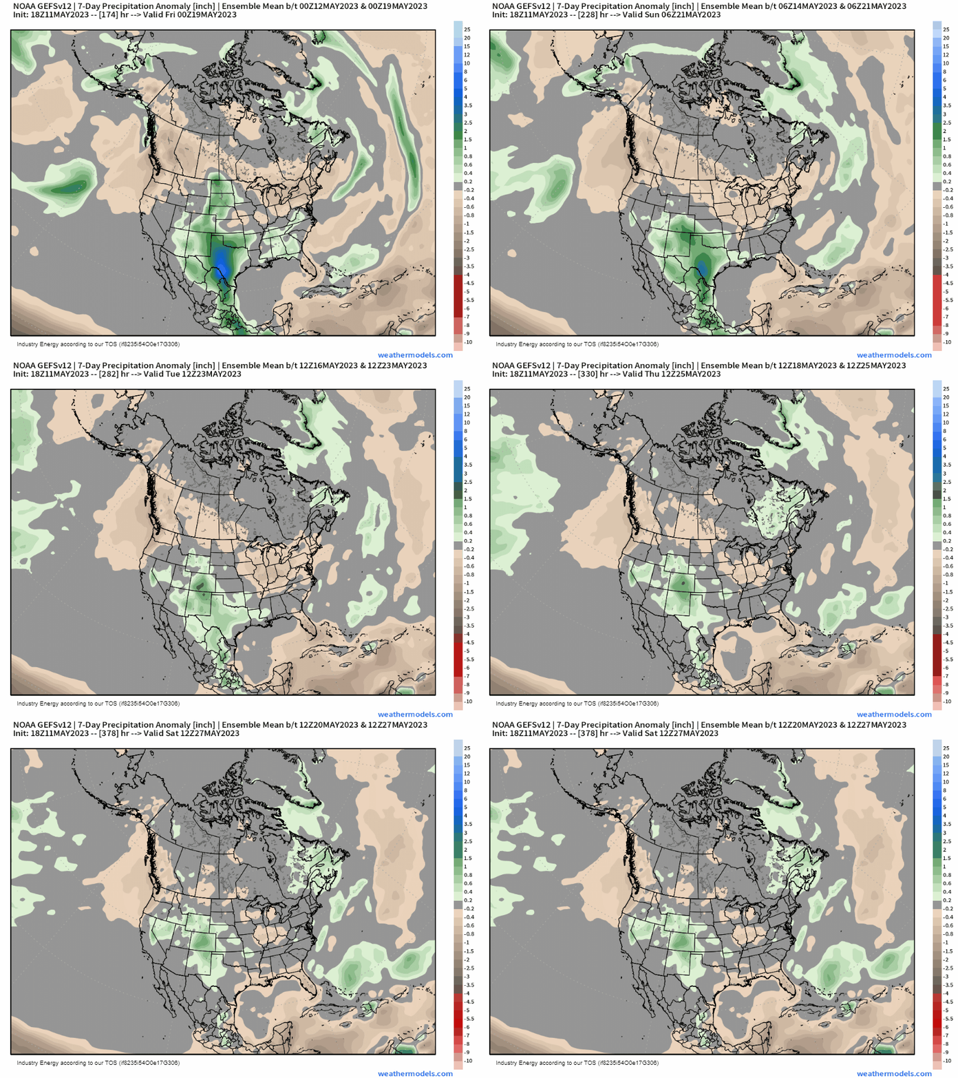
We’ll touch more in the way of what we can expect Memorial Day Weekend as we get closer, but for now we’re seeing a solid consensus for this pattern to prevail as we round out the month of May.


