Heavy Rainfall Threat Well To Eta’s North Likely For Second Half of Week
Tropical storm Eta produced catastrophic flooding over Central America, and is slated to continue dropping significant rainfall over Florida. But the storm has (at least) one more heavy rain surprise in store this week, one expected to impact areas hundreds of miles away from the storm’s circulation.
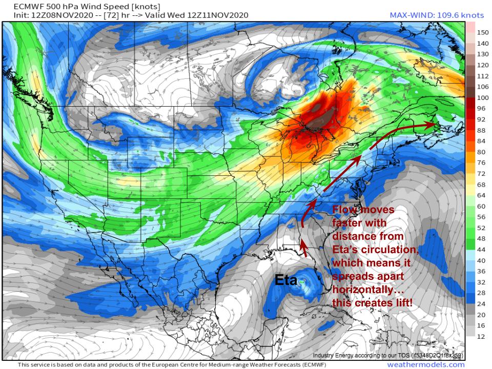
As Eta meanders west of Florida over the next few days, a powerful belt of midlevel flow ahead of a longwave will position itself to the north and west of the storm. This will set into motion an atmospheric event capable of siphoning Eta’s moisture into rain as far north as New England- a predecessor rain event, or PRE.
Basically every single aspect of this heavy rain event can trace back to the trough’s position relative to the tropical storm. Buckle in- this is a fun concept!
The midlevel jet itself will create an environment with horizontal speed divergence stretching across much of the east coast, as speed increases with northward extent. As parcels move along the northern periphery of the Bahaman ridge mid-week, they will accelerate, promoting rising air over a wide scale. This will set up the type of synoptic lifting regime broadly supportive of widespread rain.
 Link: https://weathermodels.com/index.php?r=site%2Fmodels&mode=animator&set=9-km%20ECMWF%20Global%20Pressure&area=United%20States¶m=500%20hPa%20Wind&offset=0&thumbs=1
Of course, broad lift is an important part of any widespread rain event, but it isn’t the only ingredient in the cake of a PRE.
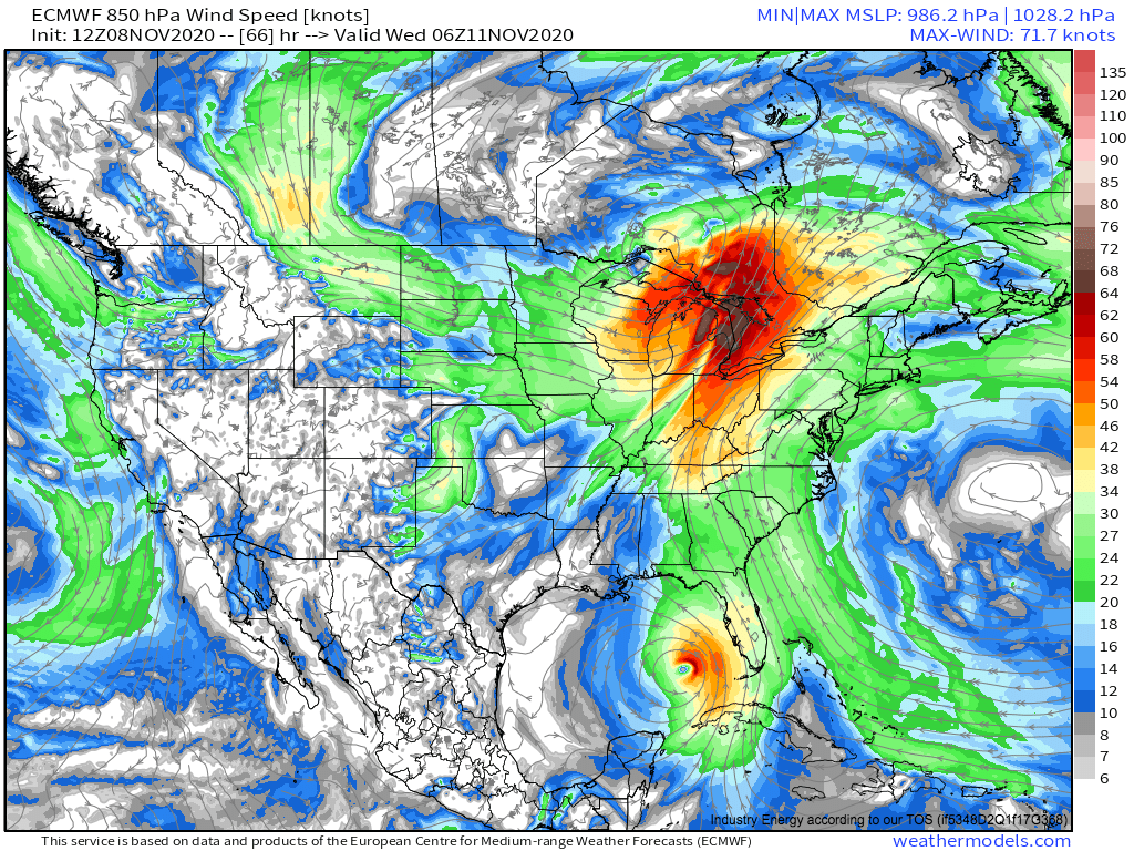
As the long wave matures mid-week, a strong low-level low pressure system will develop northeastward through the Great Lakes region. As it rounds the Atlantic anticyclone and strengthens, a powerful low-level jet will develop, with southerly flow anywhere from 30-60 knots in a band from Florida through southern Canada.
Acting as a conveyer belt that begins over Eta and ends over the Northeast, the roaring LLJ will suck moisture from the tropical storm and carry it north across the east coast.
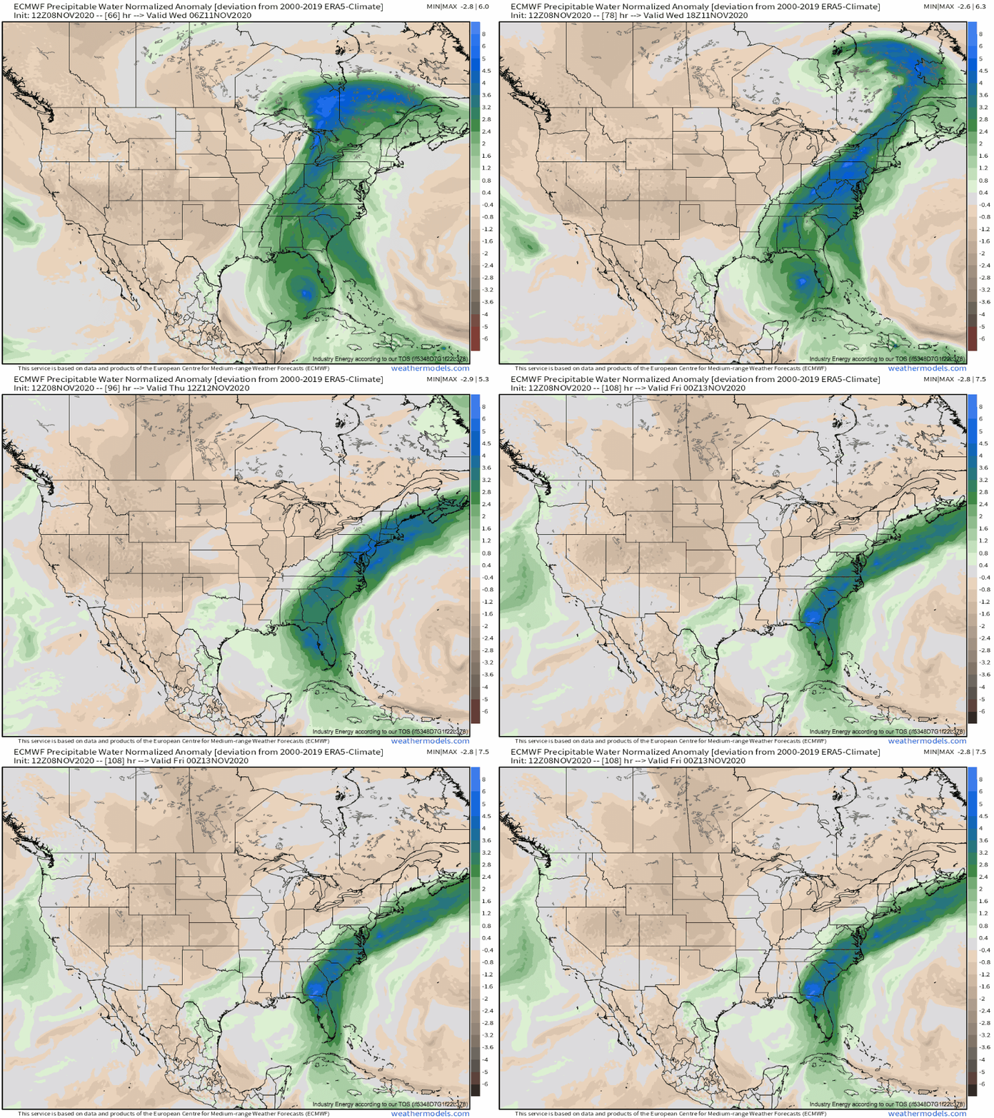
The low-level jet/Eta combo, and its moisture advection, can be clearly seen in the footprint of precipitable water dumped in the mid-Atlantic and northeast mid-week. Models depict a massive swath of precipitable water 3-6 normalized anomalies above the mean from the central Gulf Coast to southeast Canada.
This is the kind of signature only seen in the most extreme atmospheric river events: I’m reminded of 10/31/2019, for example, which featured similar PWAT anomalies and ended with 5-7″ of rain in parts of the northeast. These PWAT anomalies will be persistent, too, as slow-moving Eta keeps source moisture steady, and as a large north-south component to the surface cyclone’s motion maintains largely constant southerly flow across the east coast.
The final ingredient in any heavy rain recipe is surface convergence. This part is easy: as the midlevel trough stretches out midweek, the surface cyclone’s motion will take on an increasing northerly component. This means the surface cold front stretching south from the low will move east very slowly, providing low-level convergence the whole time.
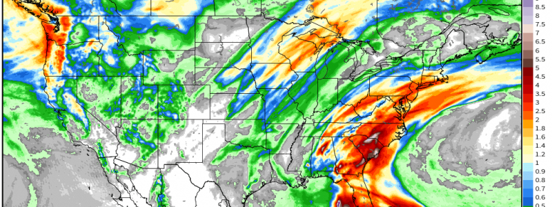
So, there we have it. Persistent low level flow siphoning moisture from Eta amidst favorable upper-level divergence will write the check for heavy rain over the east coast, and long-lived convergence along a slow moving surface front will cash it. From Wednesday through Friday, the result will be a swath of heavy rain stretching hundreds of miles away from slowly meandering Eta.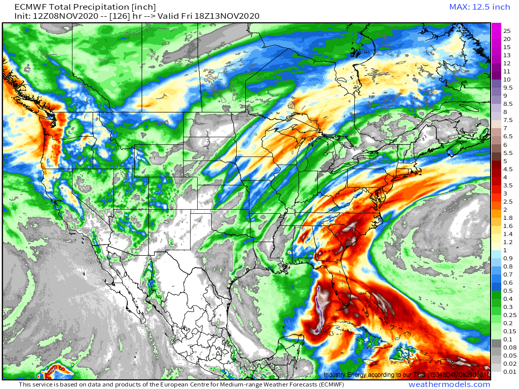
2-5″ of rain from Alabama to Massachusetts isn’t going to cause significant flooding, but it is a fair amount of rain, especially for the still somewhat drought-stricken northern half of the east coast.
Stay tuned to the all of the impacts of Eta, from Florida to New England, with us at our blog and our twitter feed.
