Heavy Rainfall Event (“PRE”) In Sight For The Northeast This Weekend
There are certain key ingredients within patterns that over the years, have manifested specific case studies and research that have led to highlighted topics. For example, nor’easters are common in notable -NAO (i.e. high latitude blocking) patterns; therefore, pattern recognition is a major factor. This weekend, one notable potential synoptic event is poised to take place across the Northeast thanks to the development of Nicole from this week.
What is a “PRE”, or predecessor rain event? There are several main aspects that embody this specific setup:
- A hurricane or tropical entity first is apparent and exists.
- Advection of the tropical storm’s moisture poleward away from the circulation, that extends greater than 800 miles.
- A boundary/ baroclinic zone is in place for moisture to stream up and along within 36 hours ahead of the frontal passage.
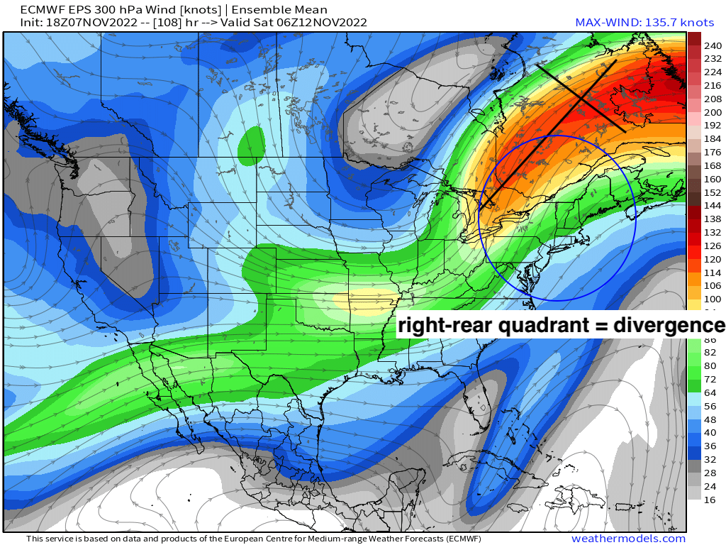
- Right rear quadrant of the upper level jet.
- Trough axis is west of the tropical cyclone’s center.
Lets dig into this synoptically, and show step-by-step how all of these synoptic features will play an ultimate role in producing a heavy rainfall event with flash flooding in some regions along the Eastern Seaboard.
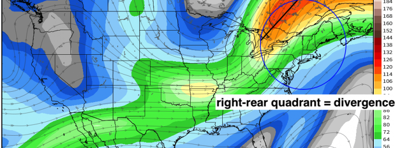
First, aloft. Here is the progged 300mb jet stream. Notice that the right rear entrance sets up ideally across the Northeast.
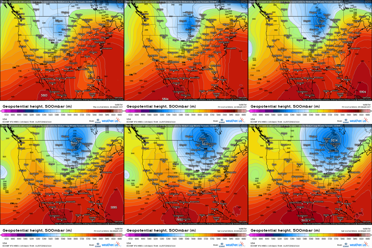
Next, lets analyze the mid levels at 500mb. We have the trough axis digging into the Midwest and shifts into the East. This synoptic feature is important because not only it supports enhanced divergence downstream, but it basically is responsible for steering the tropical remnants and moisture poleward.
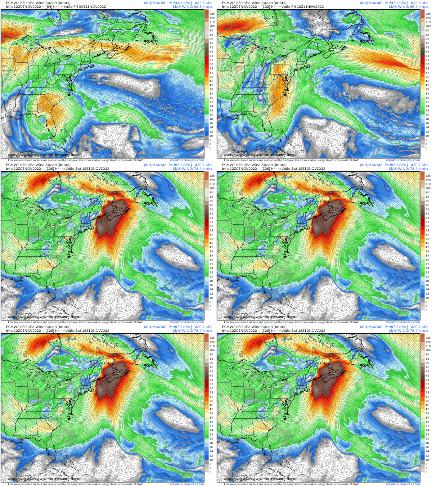
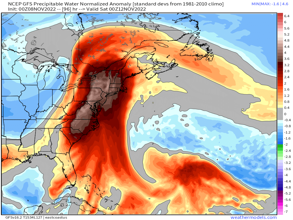
Lets then go further toward the boundary layer by identifying the low level jet at 850mb. Why this is important is because of the advection of the moisture plume from Nicole’s remnants, and helps to narrow the corridor of high PWAT’s. Compare that with the GFS’s progged anomaly PWAT’s, which stands verbatim over 3 standard deviations from normal from VA up to New England!
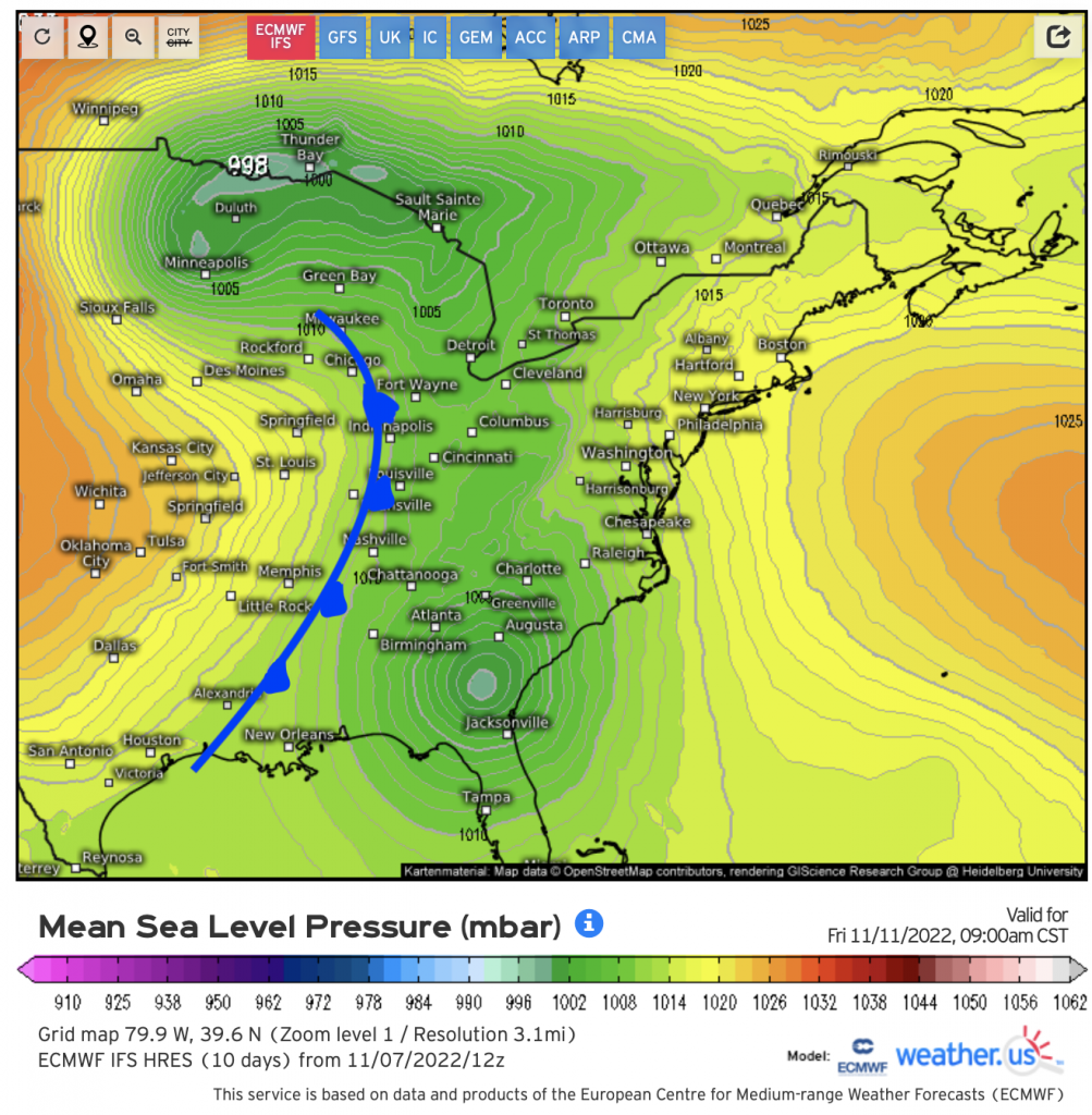
Next, we get down now to the surface. Lets see where the boundary is in this case, and it happens to be such that a strong cold front will be stretching across the Midwest and down into the Deep South. So we have our baroclinic zone, which is within that 24 – 36 hour timeframe of when we see that moisture plume get advected northward.
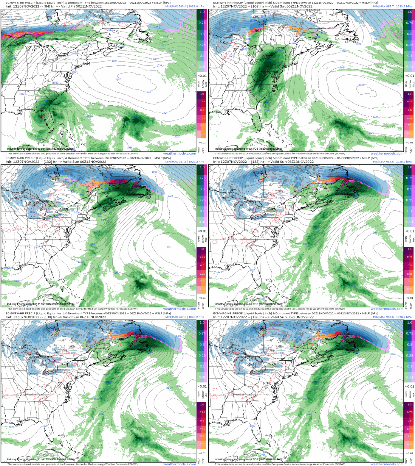
Here is what the entire picture looks like showing MSLP and precipitation type, along with the general track of the surface low (which becomes an extra-tropical low pressure as it interacts with the mid-latitude trough). Note the huge plume of moisture in the form of heavy rainfall that impacts the entire Eastern Seaboard.
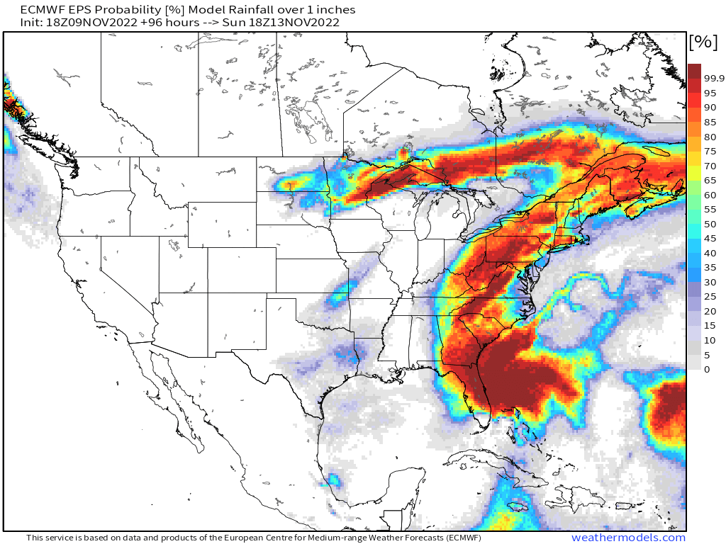
What this translates to, is a higher than 50/50 chance of many places seeing at least 1”+ of rainfall. The good news is that regional places including central/northern VA and northern NJ into the Hudson River Valley have seen a good stretch of dry conditions, so they’re not as susceptible to flooding as opposed to other locations; however, we’re bound to see a good deal of localized urban flooding especially areas that have poor drainage issues.
It certainly doesn’t happen often these types of setups, but in anomalous patterns you do get anomalous results. Nicole formed in a climatological uncommon spot out in the SW Atlantic and took a unique track due to the surrounding steering patterns, so it aligned perfectly with the mean long wave pattern across the U.S., in which will result in a healthy swath of rainfall this weekend!


