Heavy Rainfall Along A Front This Week: MS River Valley
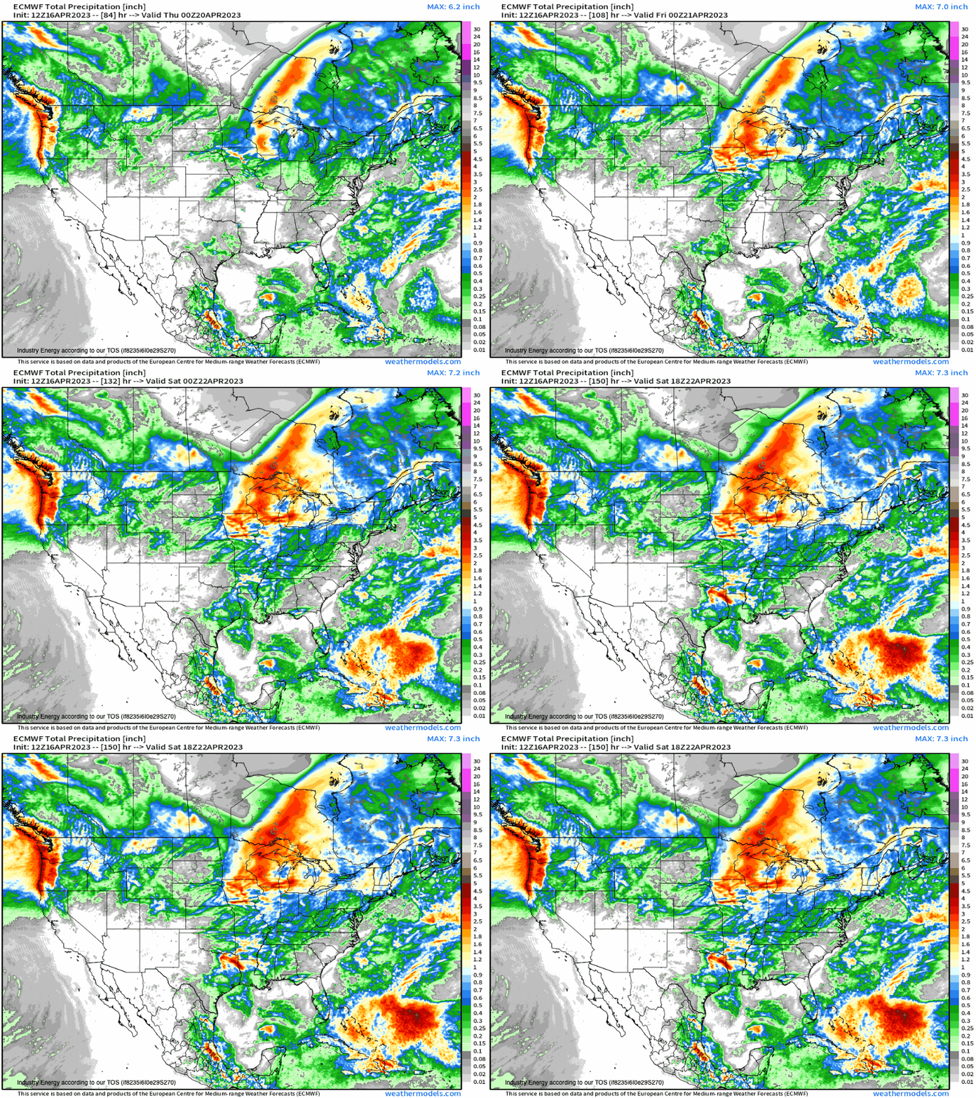
The stage will become set for heavy rainfall and potential flooding concerns across the Mississippi River Valley and into the Midwest later this week (Thursday-Friday). Favorable atmospheric ingredients are poised to culminate to produce aforementioned heavy rainfall where we first begin with a favorable mid-upper level air pattern denoted by the large long wave trough that digs into the West Coast by midweek. Downstream of this trough, divergence through shortwaves rotating through the base of the trough along with warm air advection will juxtapose along a surface front, creating an axis of enhanced lift from the surface.
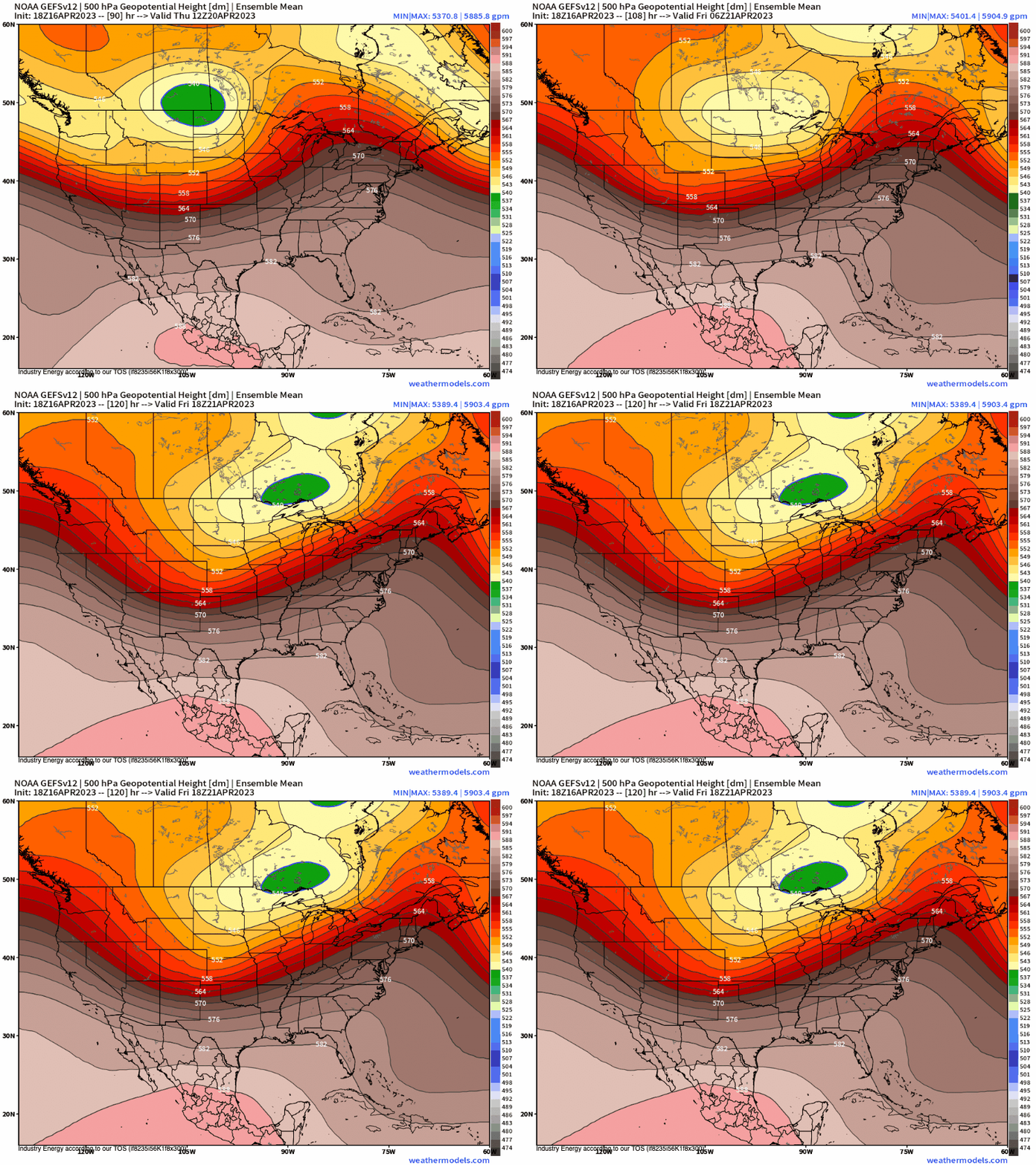
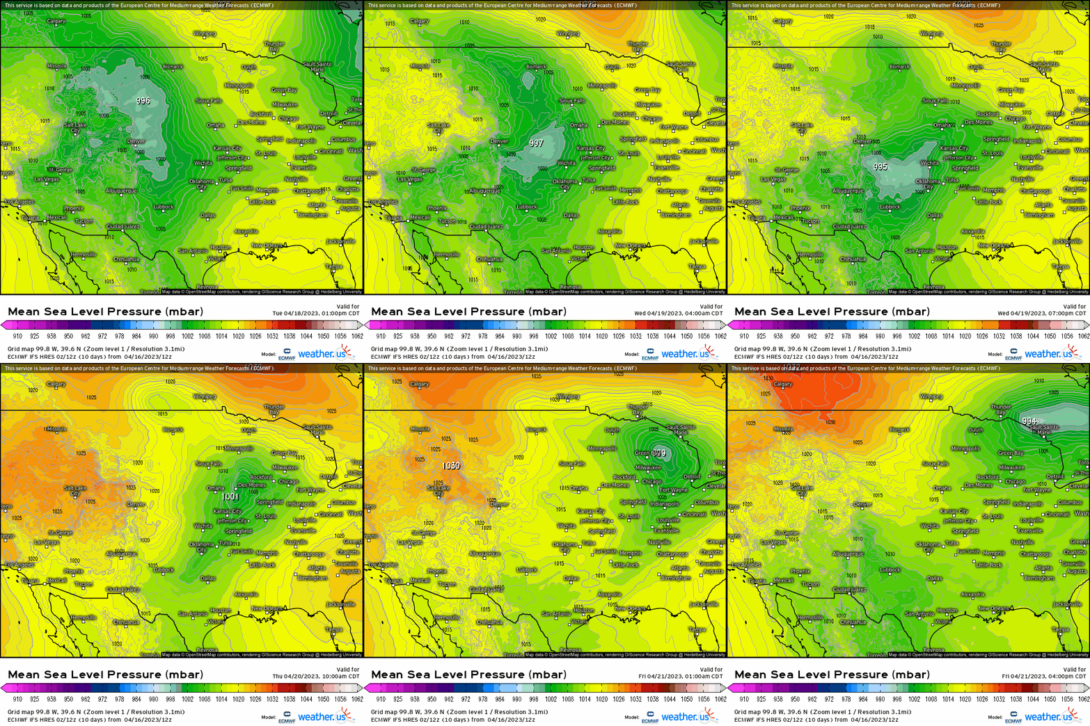
As this longwave trough swings through, a surface low pressure will develop forming frontal boundaries. It’s this system that from which a cold front develops, where a new low pressure forms along it as we see the original low pressure trekking into the northern Plains, where then the main new surface low tracks through the Plains before shifting into the Midwest/Great Lakes.
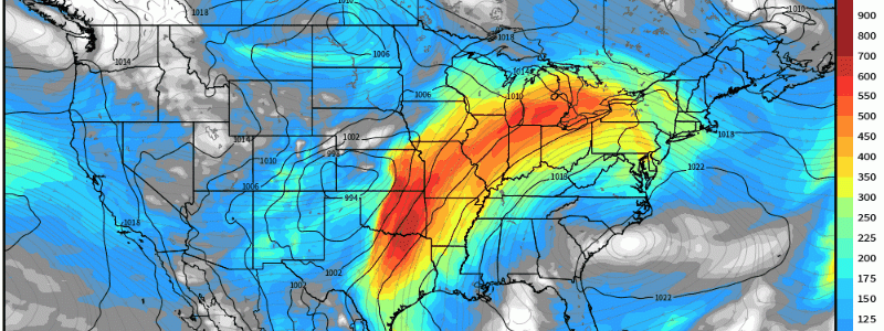
With upper level divergence and a low pressure at the surface riding a quasi-stationary cold front that bisects the central U.S., ahead and along the front we see a robust 60+ knot low level jet (850mb) advect rich Gulf moisture northward from the Deep South up to the Upper Midwest. We can then see this be reflected through the integrated water vapor transport showing robust energy in the form of water vapor that’ll carry northward, leading to a favorable environment for heavy rain. This dynamics that become parallel to the surface front can result in training convection and slow moving storms.
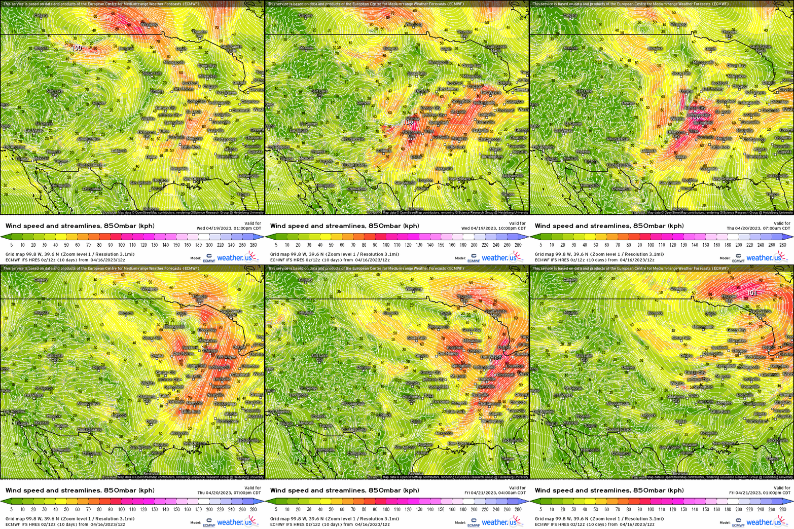
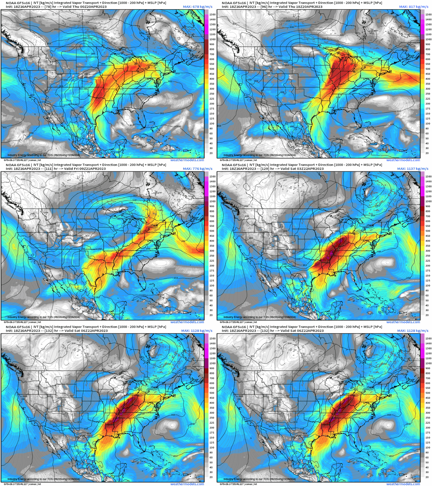
When we put these favorable ingredients together, we see a widespread axis of 1-2” (locally more) of rain across the Mississippi River Valley up into the Lower Ohio River Valley. In terms of flash flooding, while the overall pattern is somewhat progressive, localized flash flooding (urban locations with poor drainage especially) will likely be realized given the synoptic setup. There could be discrepancies in terms of how much falls in this area, but given the meteorology behind it, you know heavy rainfall and flooding is coming.
