Heavy Rain/Storms Now, Frigid Temperatures Later
I certainly hope everyone was able to take advantage of yesterday’s beautiful weather because changes are already underway this morning.
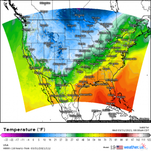
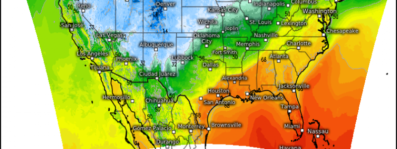
Even if you’ve never taken a course in meteorology, it’s not hard to spot the cold front pushing the soggy weather and dramatic temperature changes eastward. The deep south and far southeast is making a last, desperate, but futile, stand against the incoming cold even as they face heavy rain and the possibility of storms.
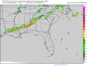
Severe storms are on the table for today through the early evening hours, especially in places like Mississippi and Alabama (early afternoon) and then shifting to Georgia, South Carolina, and North Carolina later in the day.
These severe storms will generally come embedded in a pre-frontal convective line as bowing segments. Damaging winds are the most likely risk at this time, however, a brief tornado can’t be ruled out. The latest sim radar run has a few lone cells trying to form ahead of the line, especially in SC and NC this afternoon. We saw this yesterday in Mississippi (in a marginal and general risk) and a few tornadoes were indeed able to materialize. So, although the tornado threat is low, it is not zero. That goes for any part of the south/southeast today regardless of risk category. Have multiple ways to receive warnings and be prepared to shelter if need be.
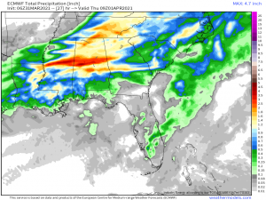
Beyond the storm threat, we also have a flooding threat.
The south has endured wave after wave of heavy rain over the last two weeks resulting in over-saturated ground and swollen rivers. Heavy rainfall with rates of up to 2 inches per hour inside heavier bands will add to that. Since the ground is saturated, any rainfall seen today will go straight into runoff, possibly leading to significant flash flooding. This rainfall will also raise the level of the rivers. At least a few rivers in Tennessee (that I’m aware of) are running high. Middle Tennessee received around 7 inches of rain last weekend in two days and is expecting another 1 to 2 inches today. With that addition, they could come dangerously close to/exceed flood stage in the next few days.
Behind all this rain, we have some seriously cold air incoming. Temperatures will take a long walk off a short cliff as the day progresses. Significant snow is even possible for the northeast, as Jacob wrote in his blog yesterday.
(gif) Link
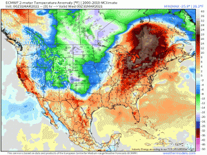
By Friday morning, we have widespread temperature anomalies of 2o degrees below average as cold air from Canada sinks south. This will bring a late season freeze deep into the southern part of the country. If you’ve planted already this spring, make plans to cover those fragile plants. The freezing line could extend all the way to the Florida Panhandle by dawn on Friday.
Fortunately, the cold won’t be particularly long-lived and above average temperatures return early next week. For now, take this opportunity to use those fireplaces and drink hot chocolate while snuggled under a thick blanket one last (I hope) time.
