Heavy Rain, High Winds Continue Over Northwest As Significant Atmospheric River Shifts Inland
Potentially significant sensible weather is set to intensify today and tomorrow across the Pacific Northwest, as the most impressive atmospheric river event of the year continues to bring an onslaught of precipitation and winds to the area.
Meghan talked about the event in her blog yesterday. Atmospheric rivers (ARs) in the Northwest, like lake effect snow or Santa Ana wind, is a type of weather event caused by a topographical ‘machine’ that outputs sensible weather with relatively simple atmospheric input. The topography in play with ARs is a combination of the massive fetch of very moist air to the west at the hands of a huge ocean, the frictional convergence allowed by the coast’s relative roughness compared to the ocean, and the orographic lifting caused by mountains, which can force parcels to ascend to condensation. With minimal atmospheric input, in this case a flow regime capable of transporting moisture east amidst synoptic scale lift, rain can occur. The stronger low level flow gets, and the longer it’s maintained, the more significant the impacts can be.
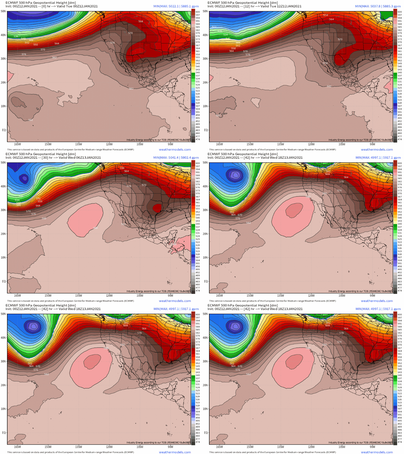
As Meghan talked about in her aforementioned blog, in this case, high-end flow speed and unusual persistence are both occurring at the hands of an unusually impressive 500mb height gradient, allowing flow to be as unwavering as it is powerful.
Notice how persistent the height field over Oregon and Washington is, as a series of shortwaves through tomorrow afternoon reinforce the broader flow regime.
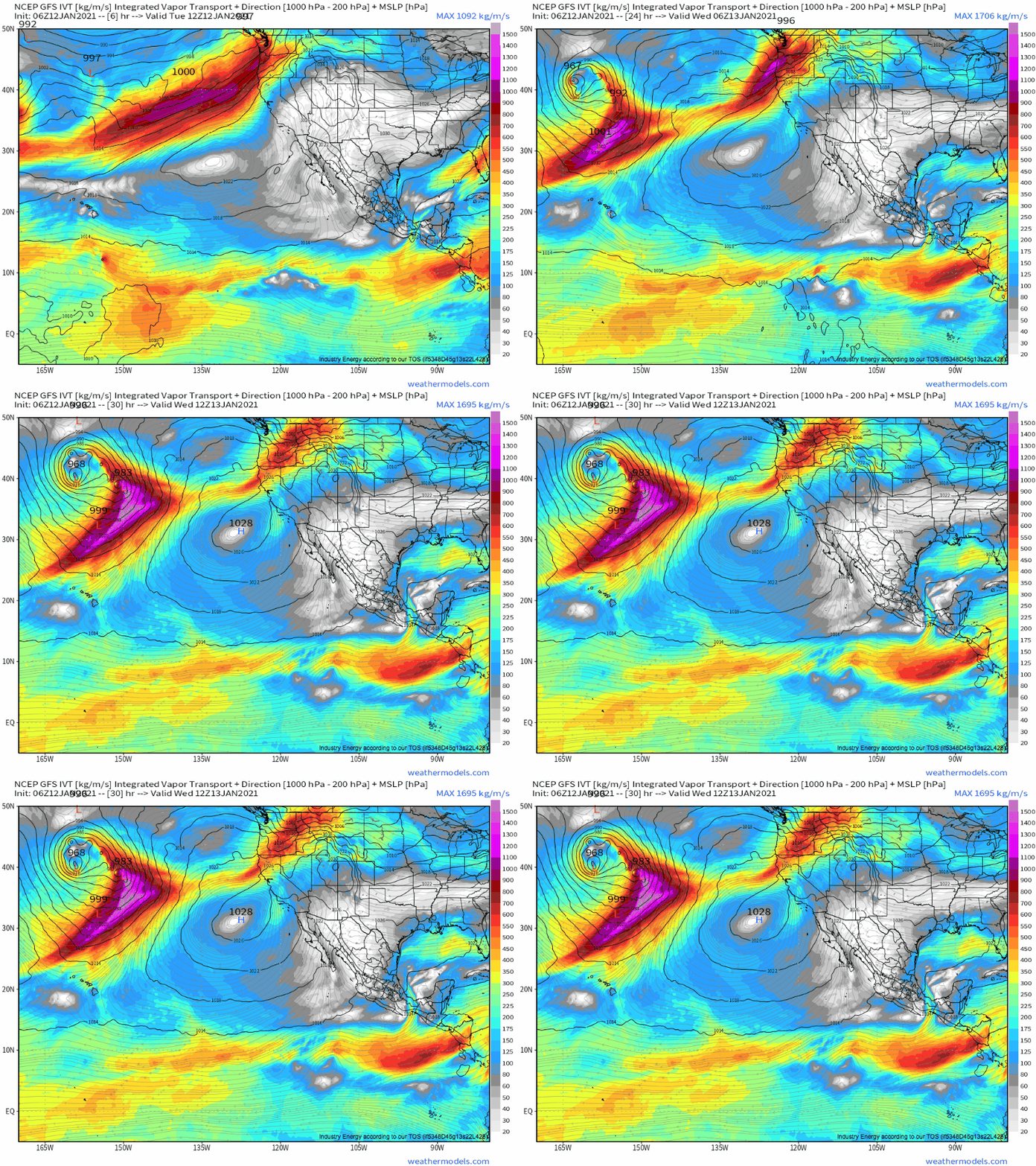
To the south of these shortwaves, low level flow will continue persistently pulling a great deal of moisture towards the aforementioned topographical lifting sources. A combination of mixing from the powerful midlevel flow and of an unusually intense series of low-level cyclones will continue to allow this flow to be quite strong, meaning the total amount of moisture being brought ashore is very high. A parameter called integrated vapor transport does a good job showing how much total moisture is being moved in the atmosphere, and a loop shows how onshore advection of high IVT values will be both persistent and powerful over Oregon, Washington, and NorCal through tomorrow morning.
ADDITIONAL precipitation could locally approach a foot, with a more widespread 2-6″ likely. Even though the northwest sees a lot of rain, this is an unusually severe storm falling atop an unusually wet ground. As a result, there’s a real risk of flooding, some of which could be flashy, and mudslides. The main concerns for these hazards will be today into tonight, and so residents of areas in the northwest prone to flash floods and/or mudslides should be sure to stay weather aware.
The mountains will continue to see several very heavy snow as well, which will promote a risk for avalanches.
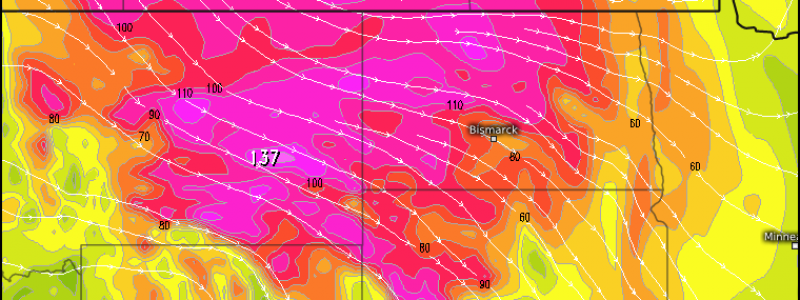
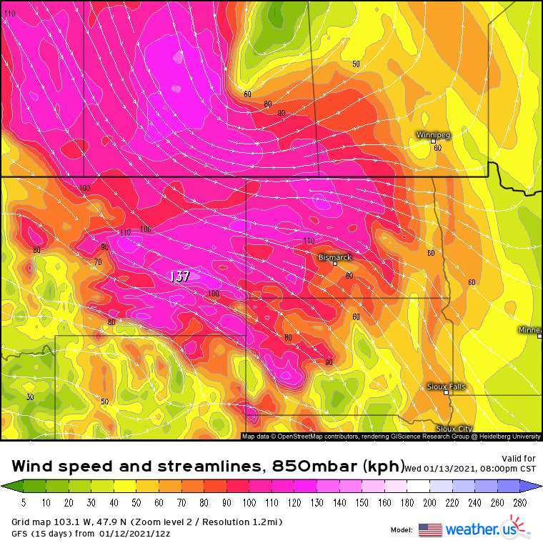
Tomorrow, the impressive low level jet will shift inland, intensifying as a cyclone consolidates east of the Rockies.
Amidst favorable mixing, strong wind gusts will likely cause scattered damage. This could reasonably be the strongest wind event of the year for parts of the interior northwest and north-central highlands, with gusts exceeding 75mph possible in favored areas tomorrow. Strong wind gusts will expand southeast into the central plains by Thursday.


