Heating Up In The Pacific Northwest
We’re talking about more heat this Monday morning. This time, it’s centered on the Pacific Northwest which, up until now, has managed to avoid any prolonged heat this summer. In fact, they managed to exit June with overall temperatures just slightly below average.
But conditions are changing.
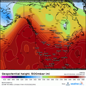
A strong ridge is beginning to build into the Pacific Northwest today. This ridge won’t just be here and gone in a day or two, but is forecast to linger into the weekend, amplifying between two troughs.
The result: nearly a week of intense heat.
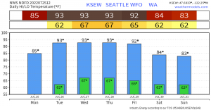
Heat will build as we move through the week. It will likely peak on Thursday before slowly waning into the weekend.
So what can be expected in terms of high temperatures?
Before I go further, I want to clarify that this particular heatwave will not be on par with the all-time record breaking heatwave of June 2021. Yes, it will be hot. Yes, it will last a few days. Yes, a few daily records could be broken. But temperatures will not be nearly as intense. I’m not saying it won’t be rather hot, just that it won’t be of the magnitude seen last year.
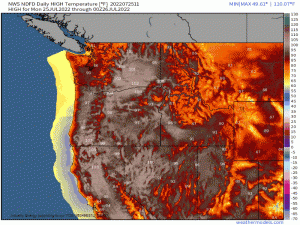
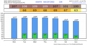
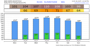
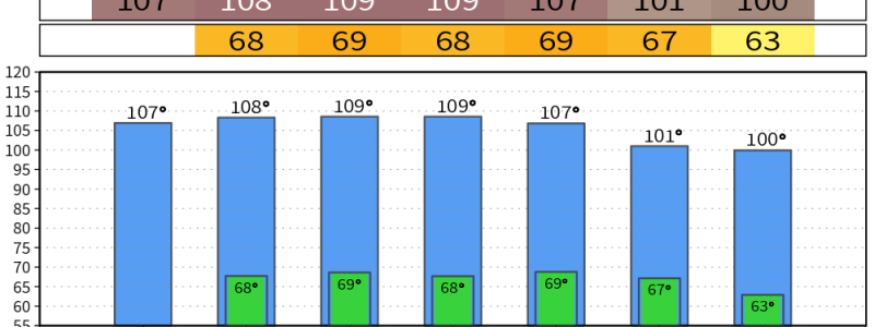
Locations far enough away from the coast and not subject to the moderating effect of the water/intrusion of the marine layer will experience multiple days near/at/over 100 degrees, depending on how far north or south they are.
Further north, in places like Seattle, temps will hover in the lower/mid 90s. Further south, in places like Medford, OR or into northern California, multiple days above 100 degrees can be expected.
Additionally, locations in the lee of the Cascades could experience the most intense heat. Downsloping winds, though not forecast to be terribly strong, will aid in the warming and drying of the atmosphere and thus result in higher temperatures. Some models suggest temps in the mid/upper 110s. This is a possibility, but we’d need a decent amount of downsloping to achieve them.
The above charts are available via the City Charts section at weathermodels.com. Similar charts exist at weather.us. If you’re looking for your specific town, go check them out to get the info you need!
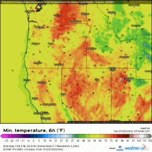
Some good news about the impending heat: overnight lows won’t be in dangerous territory for many.
Although concerns exist for those in the lee of the Cascades and further south into Northern California, overnight temps elsewhere are forecast to cool enough to where your body will be able to reset from a day of heat.
However, still be cautious and practice heat safety, especially if you’re in a location NOT forecast to cool to comfortable levels overnight.
Some tips:
- Eliminate strenuous outdoor activities, especially during peak heating.
- Wear light-colored, lightweight clothing.
- Stay out of the sun.
- Eat light meals.
- Drink more water than you think you need to stay hydrated.
- Spend as much time in air conditioned places as possible.
- Keep your shades closed to reduce heat in your home.
- Take cold baths or showers.
More tips and resources can be found here: https://www.weather.gov/safety/heat-during
Take care of yourself – and remember to check on friends and family, especially those who are more vulnerable to heat (older folks, children). Stay cool and hydrated!
