Heat “Dome” Weakens This Week Across The Deep South
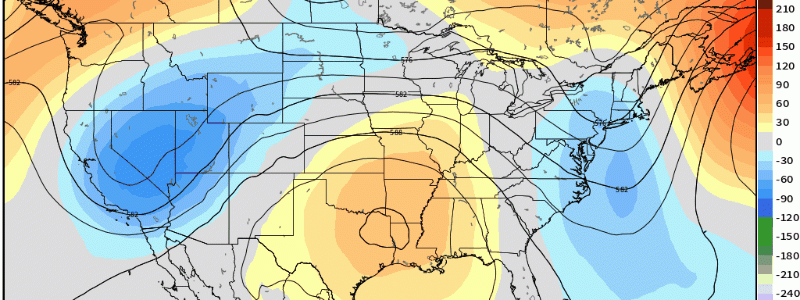
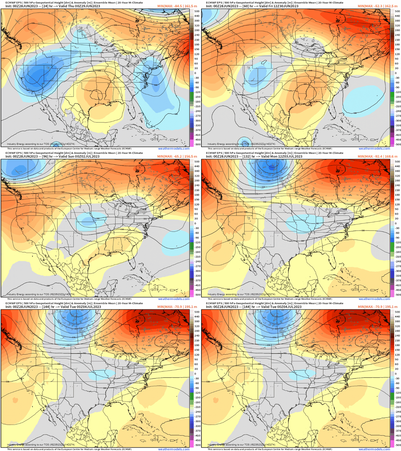
Some reprieve from the relentless heat dome across Texas is in the works this week, and into this weekend. For instance, we see the height pattern development play out currently that leads into the holiday weekend across the South, and in general across the U.S. The closed-off strong heat ridge, with only a few more days across the Ark-La-Tex region, finally shifts eastward and weakens quite dramatically relative to what it has been since mid June. A shortwave trough (demarcated by the blues) ejects out of the Southwest, and “shears” the periphery of the ridge as it becomes suppressed across the Southeast.
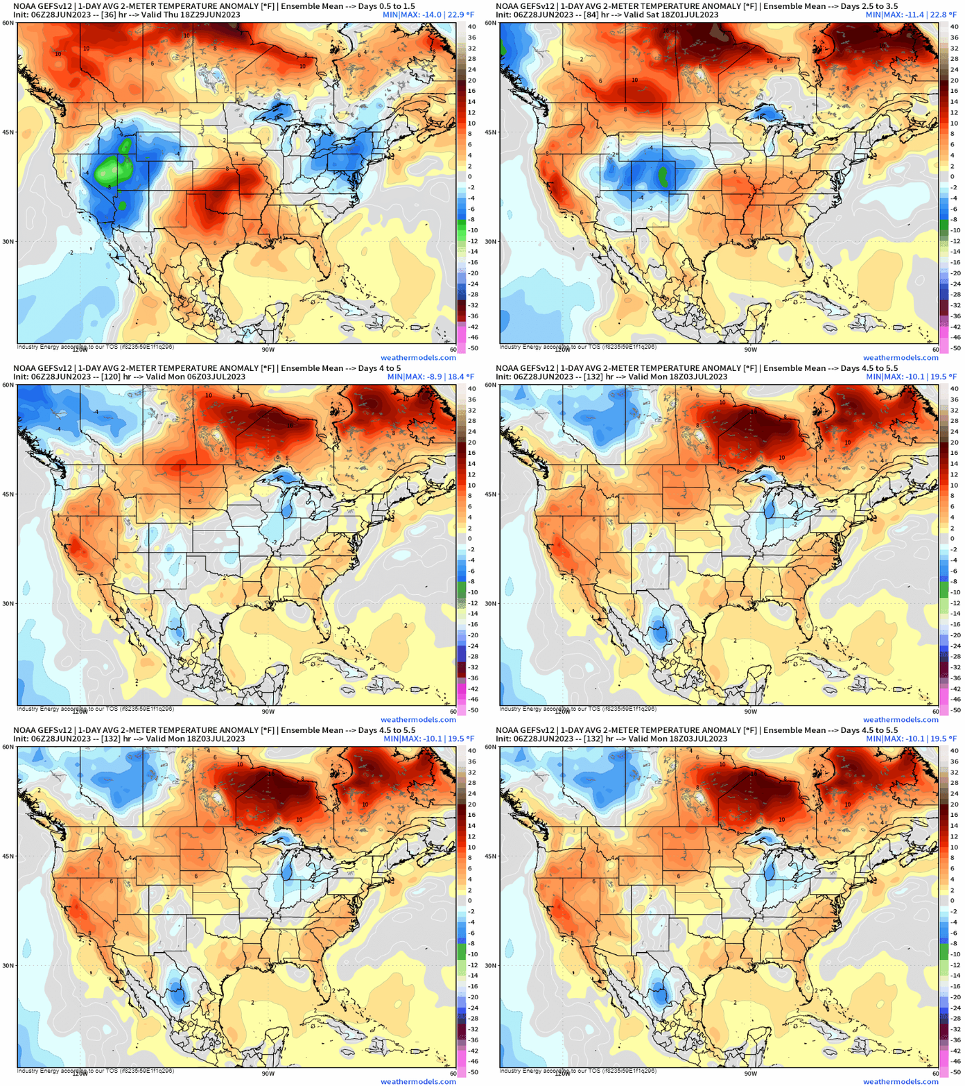
Using 1-day temperature departures through the usage of anomalies, we can clearly see at least the bulk of the heat shift from Texas to the Southeast. A swath of average to below average temperatures are here seen moving into at least the northern tier of Texas, while the rest of the state will still have to deal with the heat, just not as intense as it has been for a few days.
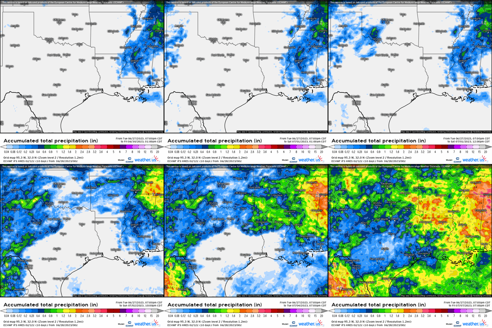
As that trough slides through, a cold front will push into the northern half of Texas, and while it’s not a lot, rain and storms at least will provide some much needed rainfall along with keeping clouds around; therefore, this caps temperatures. While the air temperatures in general will be “capped”, the humidity will still be in place given the flow from the Gulf as the heat indices in the triple digits advances eastward toward the southeastern states.
When we take a look at the daily surface air temperature forecasts via the ECMWF, we can see the widespread triple digits wane in the coming days and even get knocked down quite drastically as the cold front shifts through this weekend across the northern tier. Out across the eastern half, while the front looks to not clear the region entirely, we do see the temperatures trickle down at least thanks to the broad weakening and shifting of the heat ridge that has been in place since mid month astonishingly.
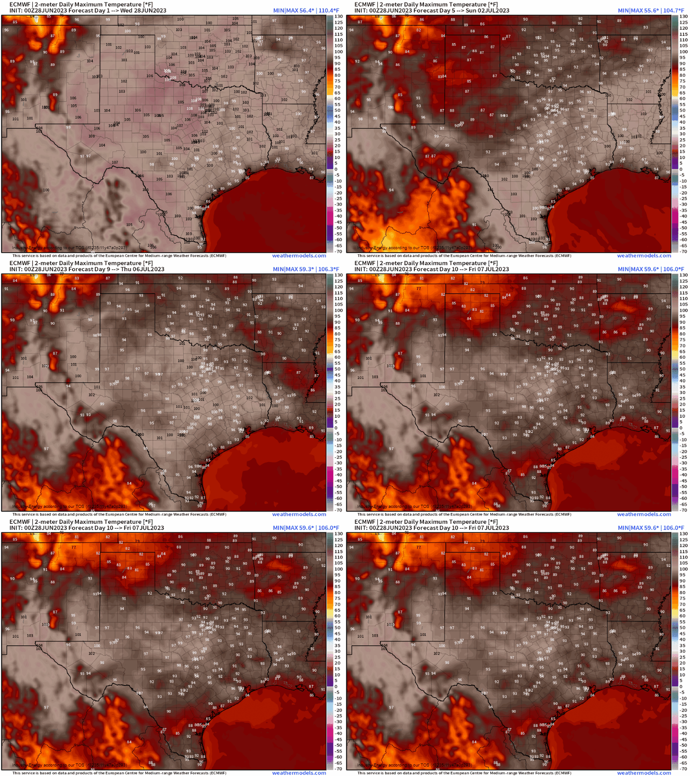
Unfortunately, there are indications that more ridging and the core of the heat returns to the deep South once again as we make our way toward the middle of July. For now, however, any reprieve we can get is in the very least a positive, especially heading into the big holiday weekend!


Solid post! Let’s hope this bears true the next several days. 104 here in Dallas is hoooot! Thanks!