Grace Intensifies Overnight. What’s Next?
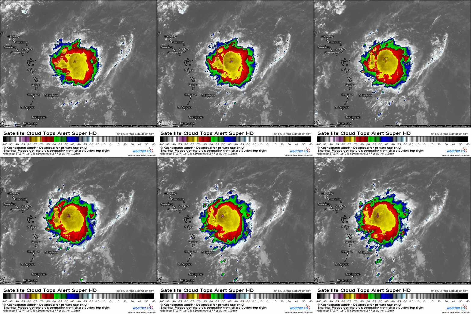
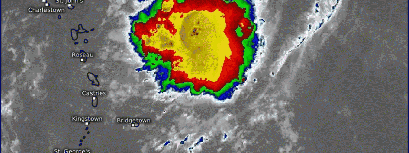
Tropical depression 7 has intensified into Grace, the seventh named storm of the accelerating 2021 Atlantic hurricane season. The delineation comes as the storm’s convection, impressive since day 1, takes on increasing cohesiveness and curvature around a stacking low-level center on approach to the Lesser Antilles.
Grace’s satellite appearance indicates a healthy tropical storm. Wispy outflow fans symmetrically outward from bubbling convection, indicating low shear, midlevel divergence, and a healthy degree of oceanic heat energy. The Hurricane Center pegs the storm at 40 mph, but winds could conceivably be higher given satellite presentation. Unclear at this time is whether the low level center has become vertically stacked under the upper level center, a requirement for runaway intensification. With surface data sparse this far east, we have few clues as to whether such vertical organization is occurring. But the environment Grace finds itself in is largely quite favorable.
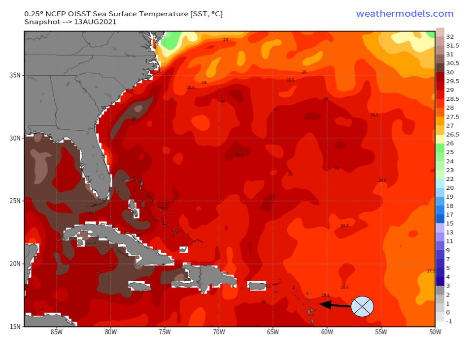
The tropical storm is steered by brisk westerly flow south of a bulky Atlantic ridge. This sort of rapid forward speed could be inhibiting vertical alignment, prohibiting the low level center from ‘catching up’ to the midlevel center. But the motion also places Grace amidst SSTs more than sufficient to support tropical cyclone intensification, with temperatures in the vicinity of the storm currently exceeding 28ºC. As Grace moves west today, its track will coincide with increasingly stagnant, sun-baked ocean, supporting SSTs approaching 29ºC.
Oceanic heat to this degree provides the fuel that tropical cyclones convert into kinetic energy via runaway convection. For this convective energy transfer to occur efficiently enough for TC intensification, thunderstorms need a moist atmosphere and a well-organized structure.
Satellite data confirms Grace is imbedded within a sufficiently moist environment, with small amounts of dry air unable to penetrate the tropical storm’s cohesive, well-organized thunderstorm envelope.
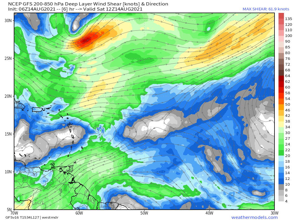
Meanwhile, a look at bulk shear indicates favorable kinematics for continued intensification. Shear directly ‘felt’ by the storm is likely in the single digits, and there’s an argument to be made that diverging midlevel winds are working to vacuum up low level air, synoptic support for deepening Grace. This position is certainly supported by aforementioned fanning outflow visible on satellite, which likely indicates symmetric support for venting in the upper levels.
This all leaves us with some stuff we do know, and some stuff we don’t. We can be confident that persistent thunderstorm activity has created a symmetric, curved zone of deep updrafts and cool cloud tops, and that this convective cluster has assured a moist envelope for Grace. We don’t know whether the low level center is colocated vertically with the upper level center of this dense thunderstorm mass, and we do know that rapid forward speed could be making such stacking more difficult. We also know, though, that low shear, synoptic venting, and warm SSTs support continued organization and intensification, leading to a degree of confidence that Grace could develop stacked characteristics today if it doesn’t already have them, and intensify fairly quickly thereafter.
What happens next is really hard to say. Until the next ASCAT pass confirms low-level center position, forecasting the storm’s exact future is a difficult and largely futile task, so I won’t attempt specifics. But we do have a broad idea of what Grace may do.
The most important thing Grace will/won’t do in the next couple of days is track over Hispaniola. For Haiti, which just this morning saw a violent earthquake, the distinction is critical. And, because the mountains of the island are known to rip hurricanes to shreds, it’s important for the US, too.
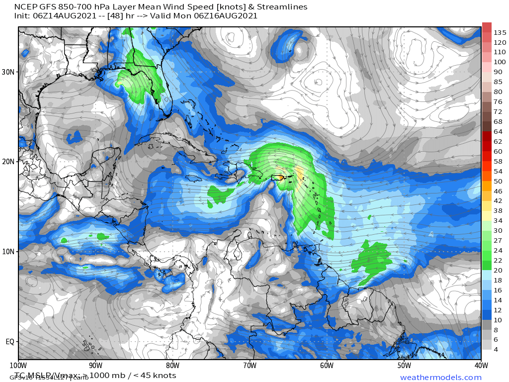
Usually, we can say with confidence that a stronger storm will track north, while a weaker storm tracks south. But an unusual midlevel pattern will actually force us to scrutinize this rule of thumb.
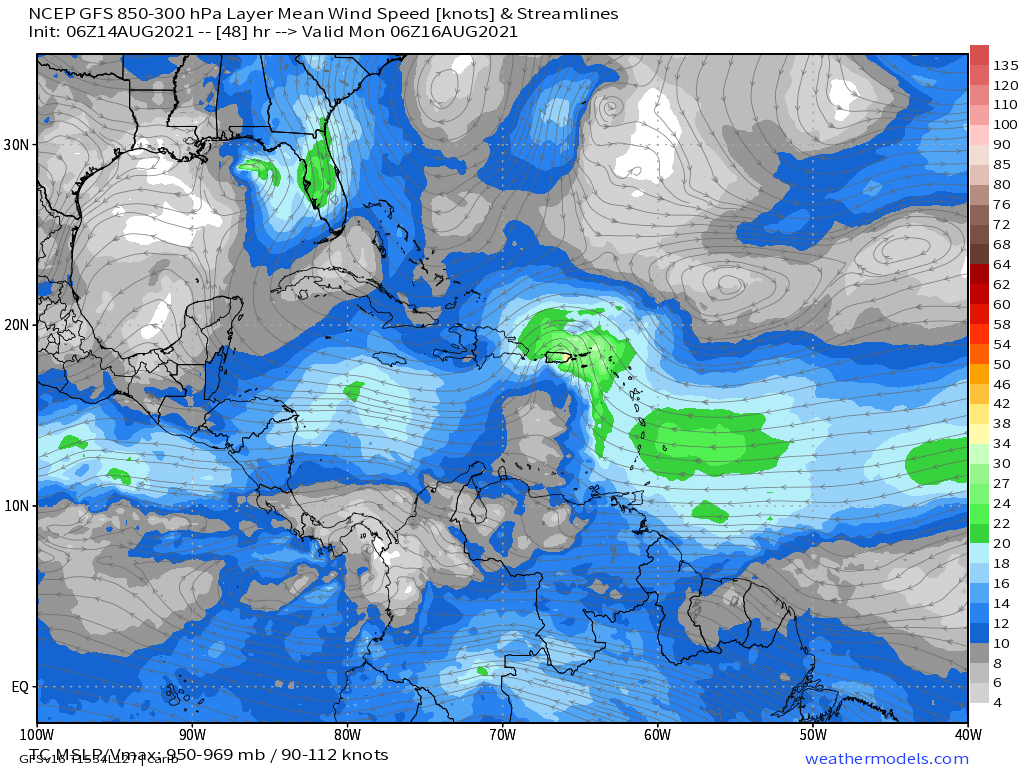
GFS steering data indicates an anticyclone that tilts south with height, with a notable greater E->W component in low level flow than upper level flow. This is important because stronger storms are more heavily impacted by higher-altitude flow regimes, meaning a weaker Grace will feel more of a northerly tug from synoptic winds than a stronger Grace.
Which intensity of Grace we end up dealing with is still up in the air. But it’s interesting to note that the storm won’t be under a simple “stronger north, weaker east” steering regime, and should be watched carefully to determine whether climatology or synoptic steering will win.
That’s all for now- stay tuned for more in the way of forecasts for Grace. Those in the Southeast should make sure they have active hurricane plans and preparations- don’t wait until you’re in a cone!
