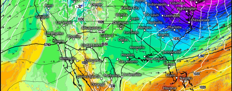
From A Deep Freeze To Nearly Spring
Light the fireplace and get out the heavy blankets! The Arctic air we’ve been talking about for the last week is sinking into the Northeast as we speak.
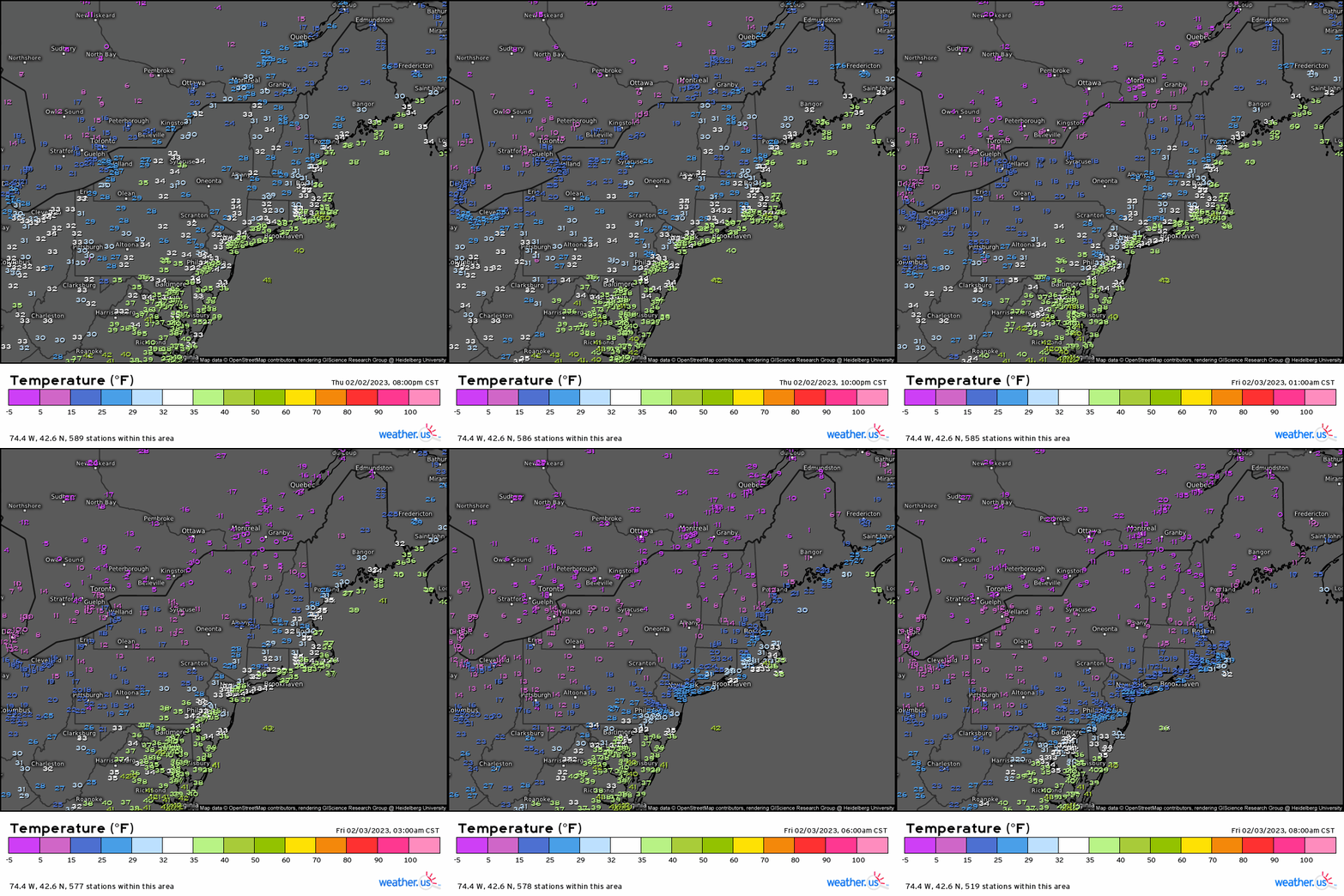
Temperatures are taking a nose-dive across the region, quickly falling toward single digits and even values below zero. Wind chills are even more brutal as it “feels like” colder than -30 F for some – specifically those closer to the Canadian border.
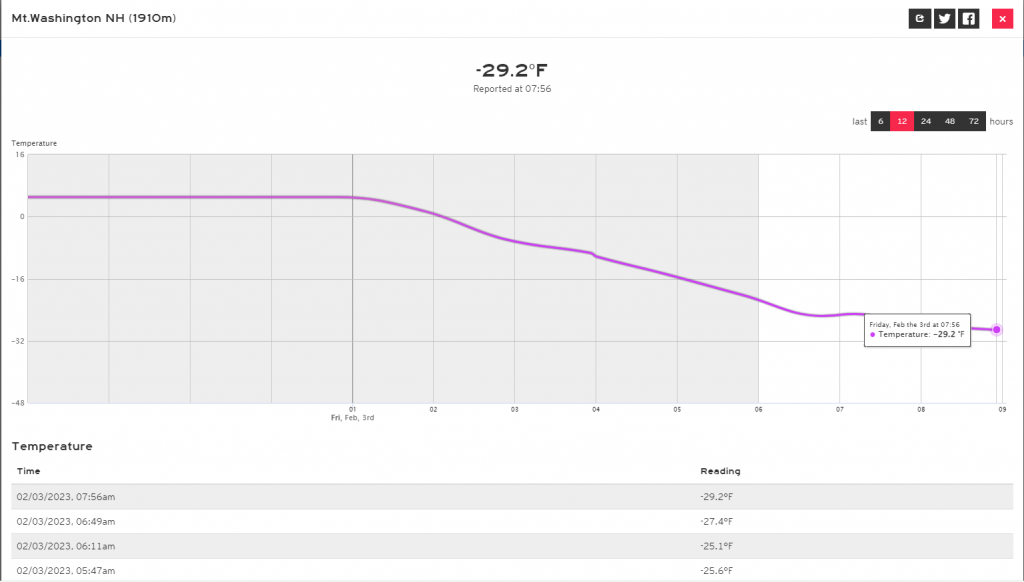
Most notable among these current temperatures is an observation of -29 F at Mt. Washington. According to the official website, this station – located at 6,288 ft above sea level – is also currently experiencing wind gusts of up to roughly 95 mph. Temperatures of -29 F combined with gusts over 90 mph works out to a bone-chilling “feels like” temperature of -81 F.
Hard pass.

Arctic air combined with gusty winds will continue to bleed southeastward today and tomorrow. Dangerously cold conditions are expected for many, especially in the overnight/early morning hours.
Fortunately, there is no feature present (like a Greenland block) to keep this Arctic air mass in place. It will begin to exit quickly by Sunday afternoon.
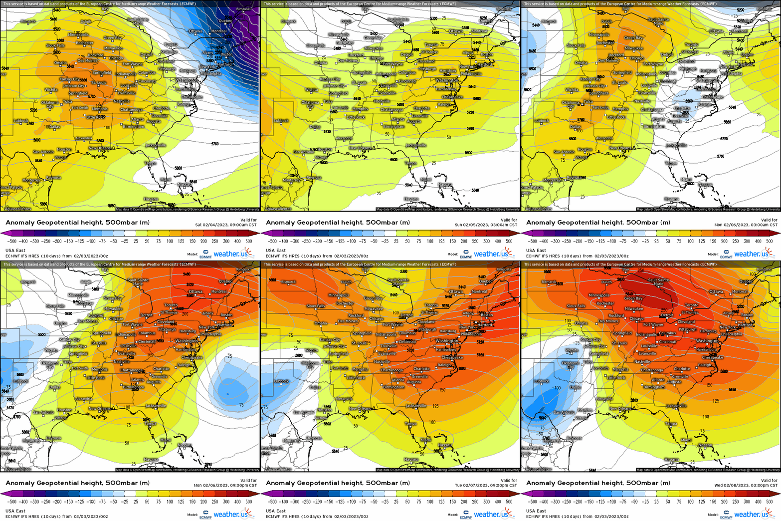
Weaker ridging pushes the Arctic air mass out at first, before stronger ridging works its way in by mid-week.
What does that mean in regards to temperatures? It’ll go from feeling like the dead of winter this weekend to feeling like spring not half a week later.
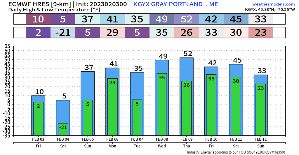
Take Portland, ME as an example. They are forecast to bottom out around the -20s on Saturday morning. They then have the potential to climb to around 50 by Wednesday/Thursday. That’s a swing of ~70 degrees in 5 day’s time!
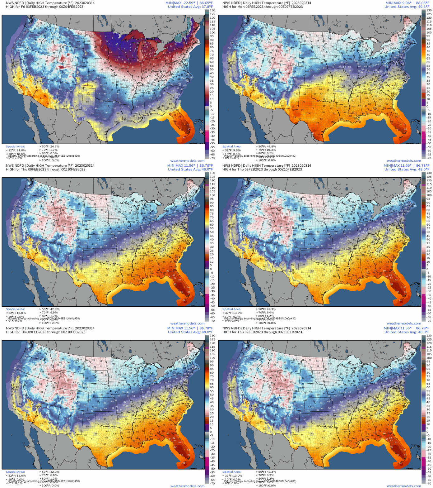
The sudden warm-up isn’t just for the Northeast. As ridging builds in over the East, spring-like temperatures come flooding in.
The south hasn’t had much of a winter as it is, so an additional stretch of above-average temperatures will likely allow trees to begin to leaf out.
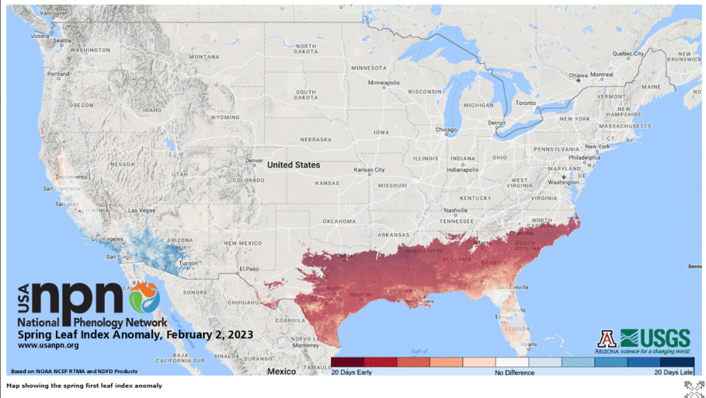
In fact, it has already begun across the Deep South and Southeast. The current bloom is roughly 20 days earlier than is average for this region.
I’d expect it to spread further north this upcoming week as temperatures soar near/over 70 for this region. I know I’ve seen signs of an impending bloom here in the East Tennessee valley in the last few days.
And so continues the winter that never was for a decent portion of the Eastern US. While it’s still a bit too early to write off cold snaps and snow storms completely, after this weekend it seems unlikely at least through mid-month. Sorry, winter lovers.


