Frigid Air Swings Into Northeast
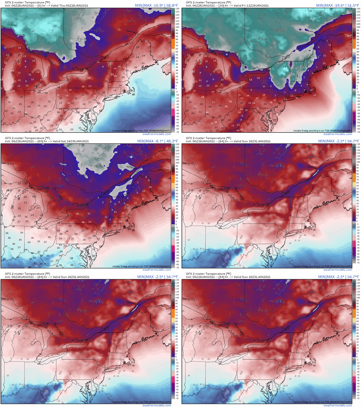
For really the first time this season, truly frigid air will spill into the Northeast, with dangerous cold across the interior and windchills dipping well below zero as far south as southern CT and southeast NY.
This winter has suffered, in part, from generally zonal flow over central Canada that’s prevented polar midlevel air from dislodging south, even as the polar vortex weakened earlier in the season. The broadly W->E flow aloft not only kept cold air ‘locked up’ well north of the international border; it also allowed repetitive, relatively warm Pacific air to intrude into the US. Parts of the north-central country have seen +20°F temperature anomalies like a broken record, as this Pacific air warms through downsloping. The partially modified warm air then has been reaching the northeast; cities like Boston didn’t see a single day below average through the first 2/3rds of January.
Well, anyway, that’s all about to change, at least for the next three days.
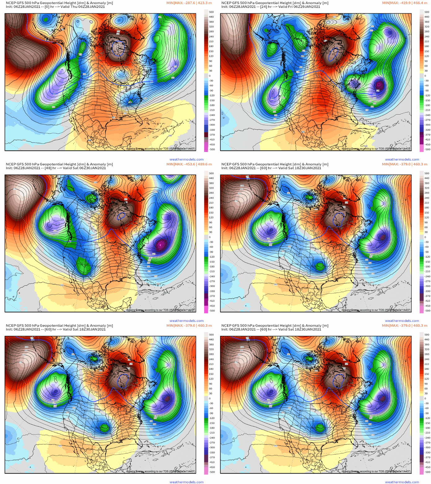
It appears that at most direct fault is a very high-amplitude pattern over western North America, with the dip (trough, if you will) bringing extreme precipitation in an unusually cold storm to California and the crest (or ridge) bringing anomalously large heights to the northern Hudson Bay, associated with +35°F thermal anomalies in that part of the Arctic.
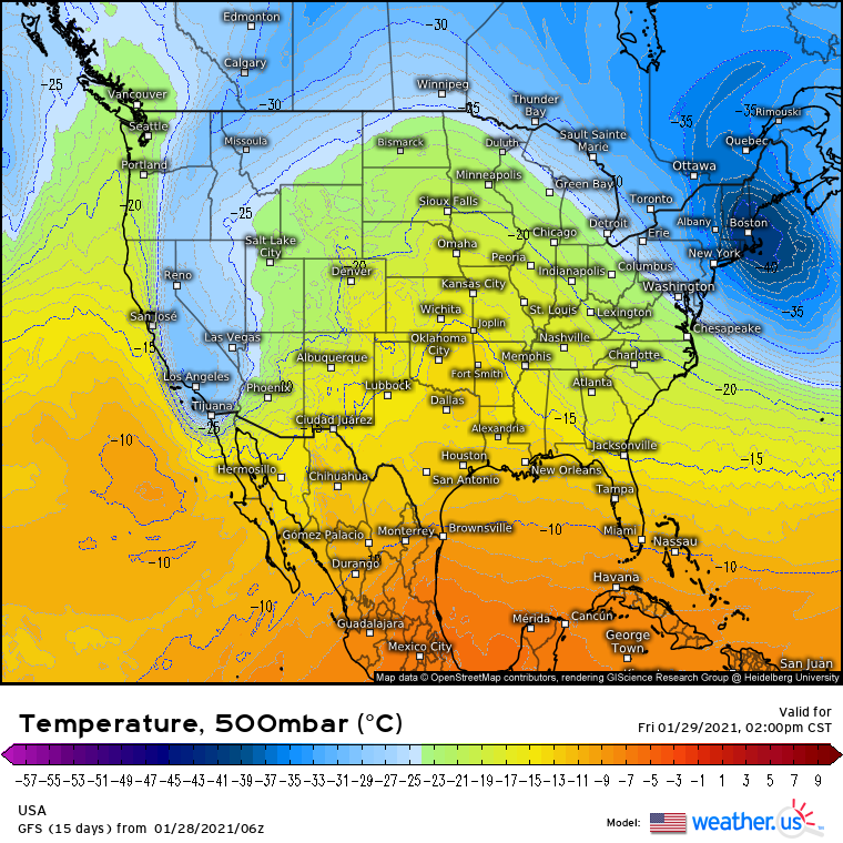
This ridging, then, will displace a ball of very low heights southeast into New England.
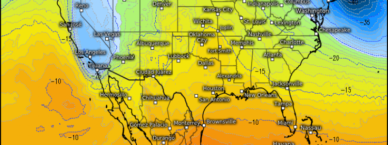
Cold air takes up less space than warm air, meaning midlevel heights can approximate how cold the bottom half of the atmosphere is, especially at the level in question. This polar low will, not surprisingly, be associated with absolutely frigid midlevel temperatures.
Cold midlevels don’t always correlate with a cold surface, as was demonstrated earlier this month. A lot of the discrepancy is often caused by either an unfavorable advection regime or a more typical NW-ly advection pattern but with an anomalously warm source airmass via excessive modification. But directly under this ball of frigid temperatures, a typical northwesterly low level jet structure will advect air from the polar continental airmass of central Canada, fast enough that there won’t be much in the way of modification.
The result will be several days of fiercely cold temperatures.
Compounding the cold temperatures is the threat posed by a moderate offshore wind event that began last night with the rapid offshore intensification of the Carolina snow storm. As high pressure builds into the country, and as secondary surface low development stretches the pressure field over the west-central Atlantic, sustained winds near 20mph for basically the entirety of the next three days will contribute to potentially dangerous windchills.
For much of interior New England, wind chills dipped below 0°F this morning and won’t rise above until Sunday. Windchills overnight will plummet, with negative chills down to NYC and Cape Cod Friday and Saturday morning. Minimum chills in the Adirondacks will approach the dangerous -40°F mark, and potentially dangerous chills below -20°F are also likely across much of the rest of the interior northeast.
If you must be outside overnight or early in the morning, wear very warm clothing and take frequent breaks inside! This is especially true in the Adirondacks, where exposed skin could see frostbite in as little as 10 minutes.


