Friday’s Severe Weather Day
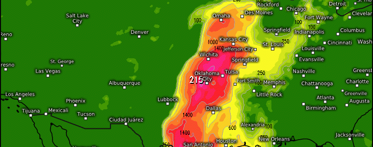
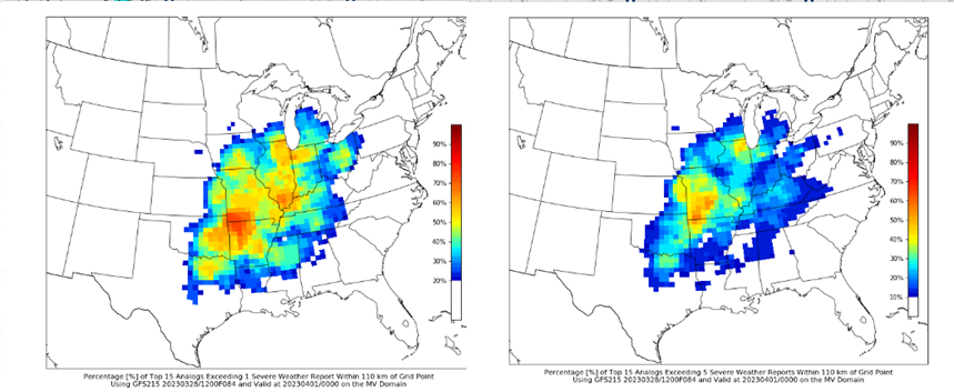
Utilizing analogs are a helpful way to identify a signal for inclement weather days, and here below is a prime example of using the CIPS site to show where there may be hazardous weather incoming. Typically we use this like we do when using ensembles (i.e. when forecasting at longer lead times), but this shows where (left) an area within 110km of a grid point may see 1 severe weather report (hail, wind, tornado) and (right) where it’s the same exact situation, except it’s 5 severe weather reports. Verbatim, the main area of concern being highlighted is the southern Plains and into IL.
Diving into the synoptic evolution:
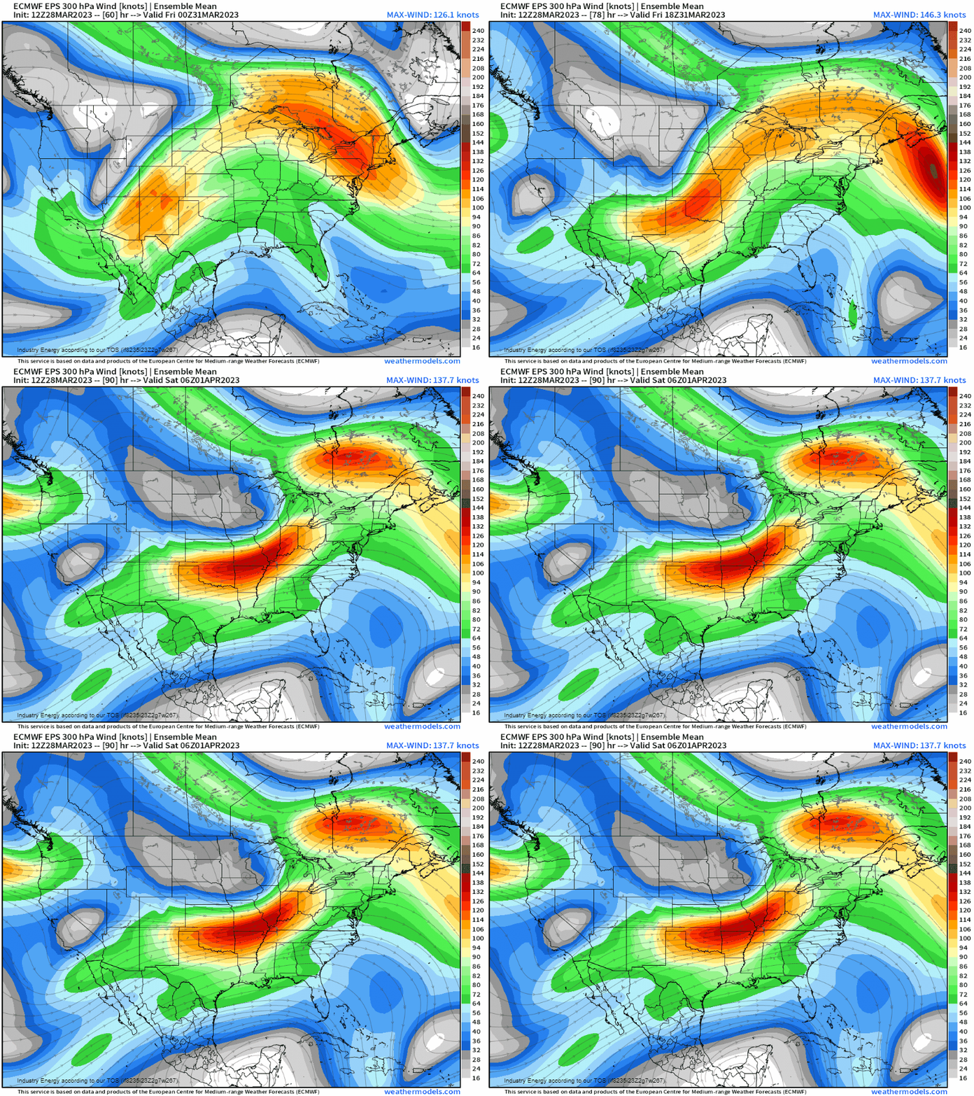
At 300mb, a potent jet streak will be rounding out the base of a longwave trough, which will overspread the Plains and into the Midwest tonight and into tomorrow. This jet streak will allow for enhanced surface divergence.
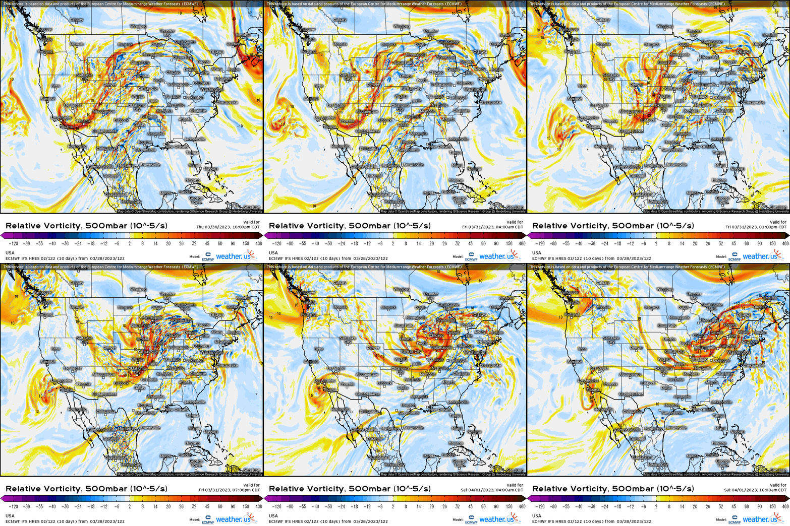
At 500mb, we can see the “big picture”, as it speaks a lot in this instance. The trough ejects out of the Southwest, and lifts into the northern Plains along with obtaining a negative tilt (slightly progressive in nature). Out ahead, strong forcing for ascent in the form of positive vorticity advection shifts downstream the trough axis and into the Midwest.
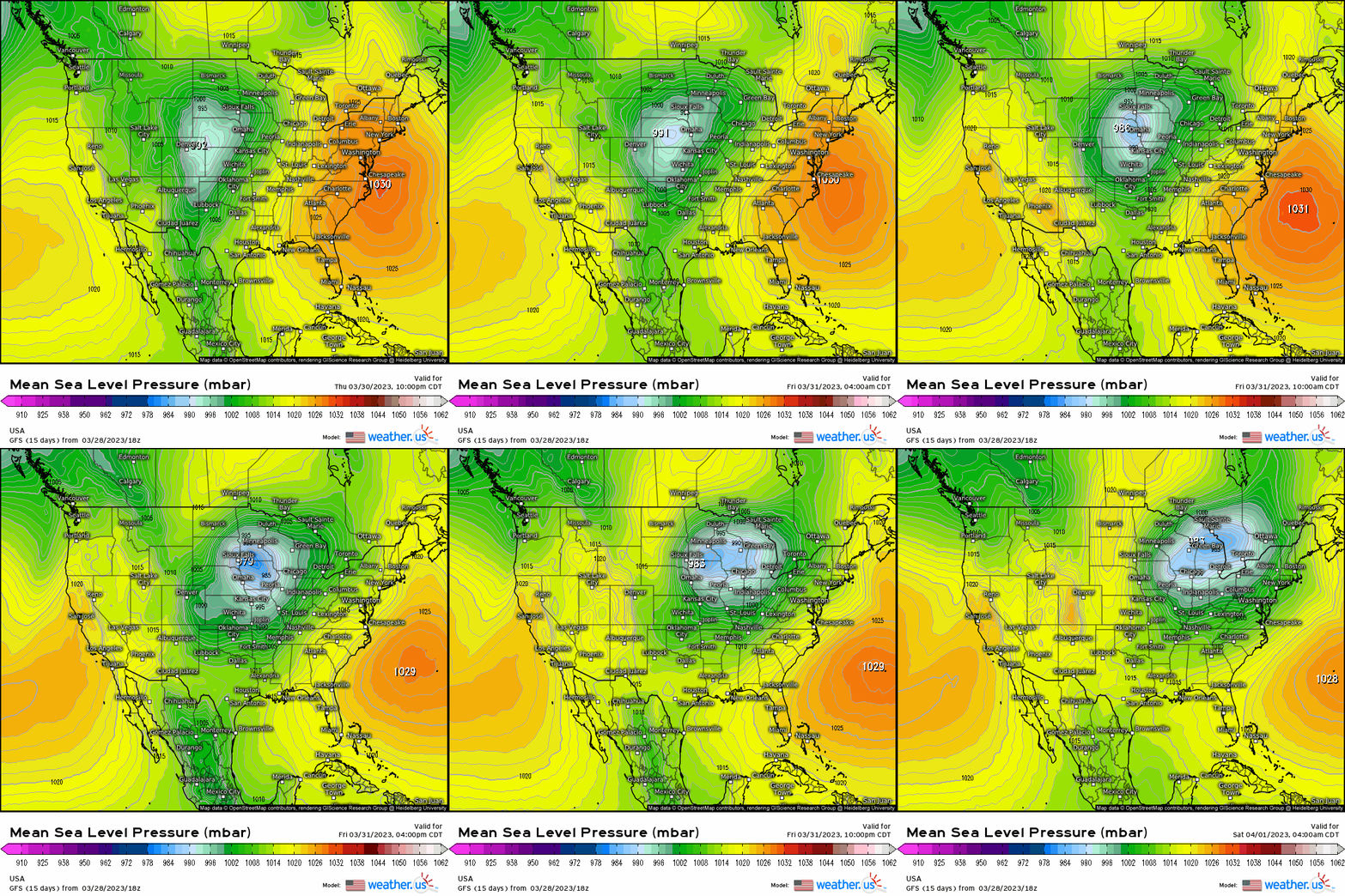
Skipping down to the surface, this corresponds to cyclogenesis manifesting out across the Front Range, and begins to strengthen as it crosses into NE through the day today before lifting into IA by tomorrow morning, before eventually tracking into MI by Friday night into Saturday.
At the surface, this allows for a warm front to ascend the majority of the Plains and Midwest, with a developing cold front that’ll drape from the low that’ll eventually translate eastward. The key here is that as the surface low moves north/northeastward, as the warm front advances north, locations south of it become warm-sectored tomorrow; this does have implications since warm air and moisture will begin to shift northward and with this comes cloud cover – cloud cover inhibits instability so we’re seeing some uncertainty regarding the CAPE.
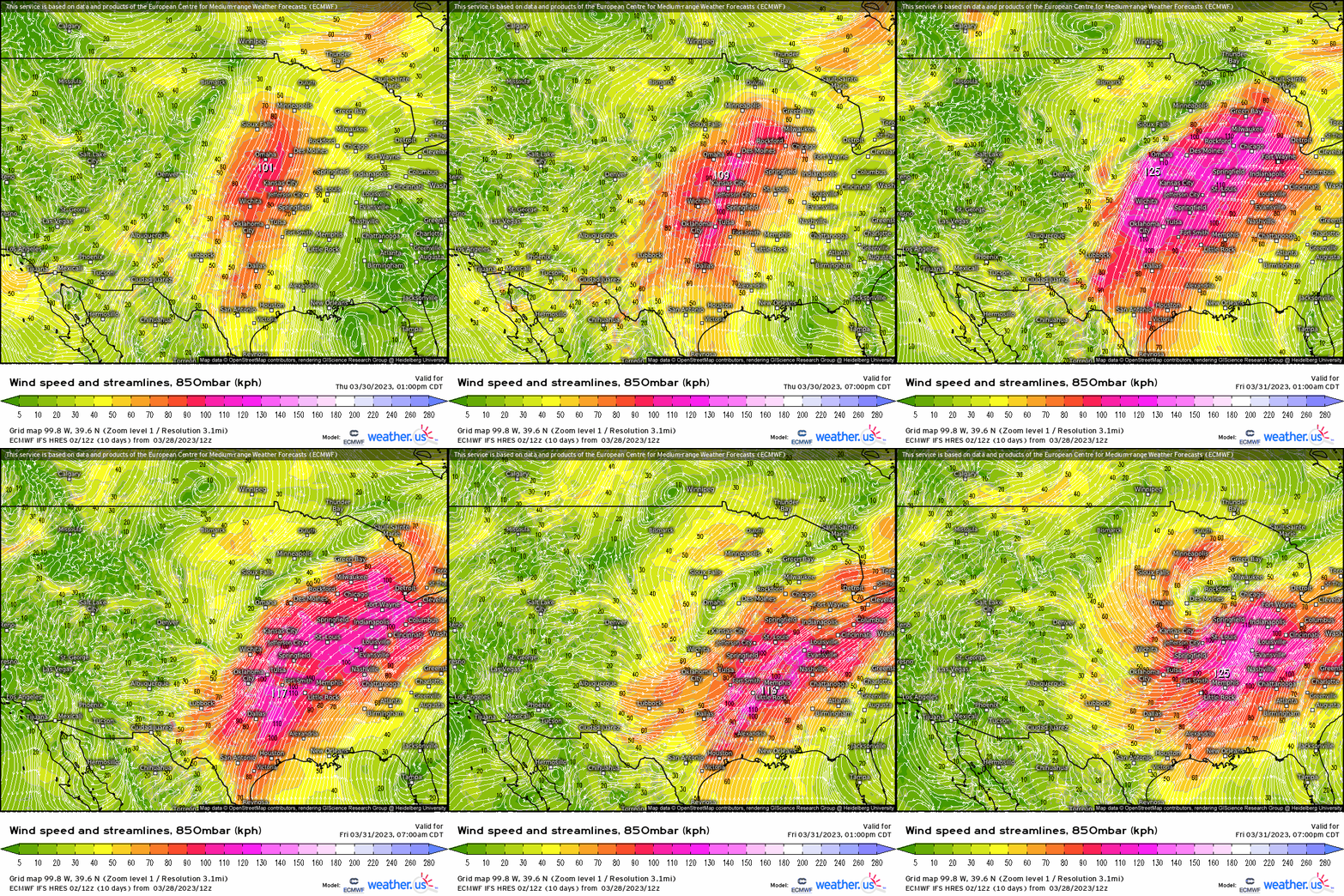
Jumping back up in the atmosphere to the 850mb level, we do see an impressive, expansive low level jet feed from the Gulf and intersects the warm sector. This implies moisture transport, along with vertical lift with warm air advection as well.
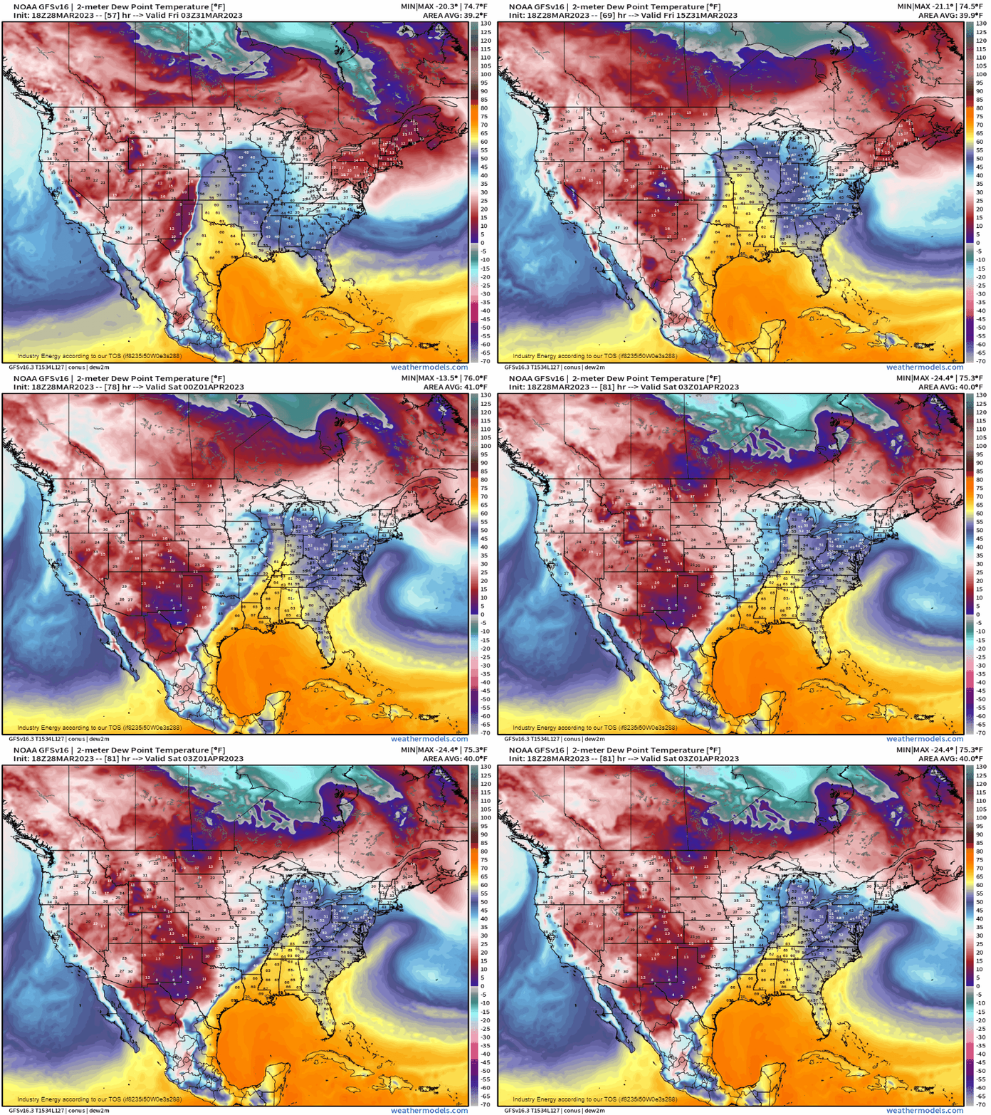
Speaking of moisture, what we can see is the transport in the form of dewpoints as it advects northward. Widespread 60 degree dewpoints will be transported up to IL, expanding from eastern NE, OK, and IA to the Midwest and MS River Valley – which can be more than conducive to support strong to severe storms.
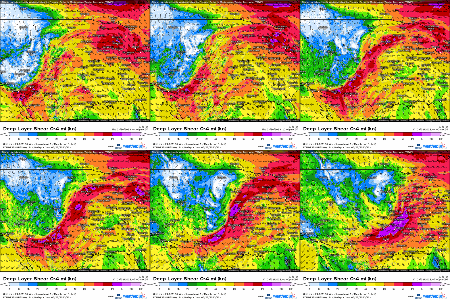
So we have the strong forcing for ascent, moisture, instability, and now we need to see if we’ll gather storm organization and in what form. Below, we have now deep-layer vertical wind shear, which is crucial to allow separation between updrafts and downdrafts to keep a thunderstorm maturing. We’re going to have no shortage of shear, as typically with any supercell we look to see if 0-6km shear values are in excess of 35-40 knots. This threshold usually portends whether a storm is capable of becoming a supercell, and we’re going to see 60+ knots of deep layer shear overspread a wide area within the warm sector.
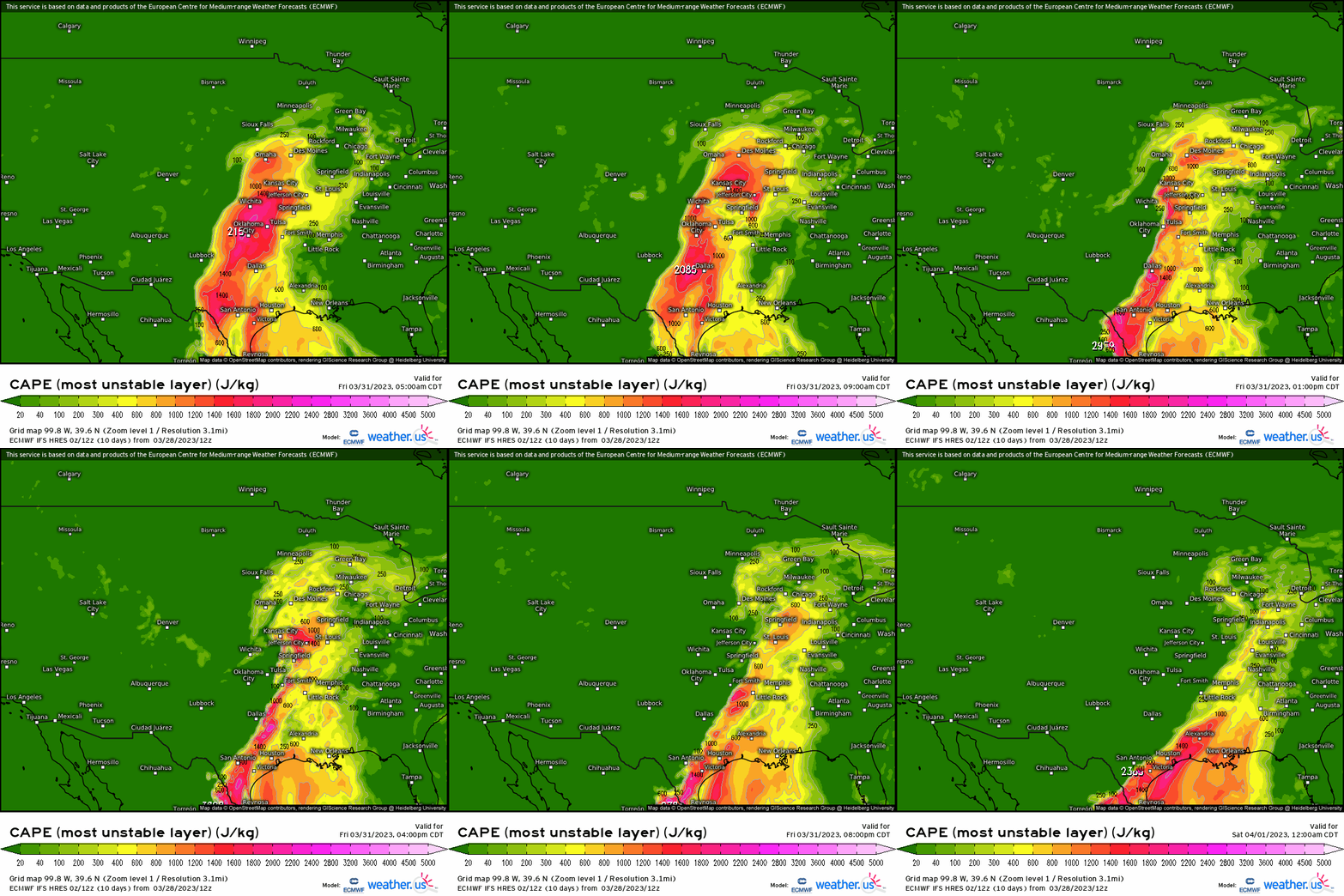
So we know the dynamics for this severe weather setup is more than auspicious for severe weather, and all modes of it too, we now need to see if we’ll have enough instability to allow for an even more favorable environment all-together. Below, we see MLCAPE surge northward within our warm-sector, and an approaching cold front translating eastward (where there is a sharp delineation between near zero values of CAPE and where it’s rising). However, tomorrow morning with cloud cover that’ll form as a result of the lift, this may limit the extent of any discrete supercells – however, in cases like these where the instability could be lacking, the intense dynamics (shear) can compensate for this! We do see however, over 500 j/kg rise up to central IL, overspreading eastern TX, up the Ozarks, and shifting eastward into the Midwest. Verbatim, we’re going to likely have enough tomorrow for there to be some discrete, open warm-sector supercells before upscale growth occurs with a convective squall line forming that pushes eastward ahead of the cold front. While the forcing may be further north with the better instability south (ArkLaTex), both areas are in line to see severe weather as of now we’re going to see all severe hazards including damaging wind gusts, large hail, and tornadoes – though the latter is much more favorable to form closer to the surface low in IA and has a better chance forming further north in places like northern MO and eastern IA.
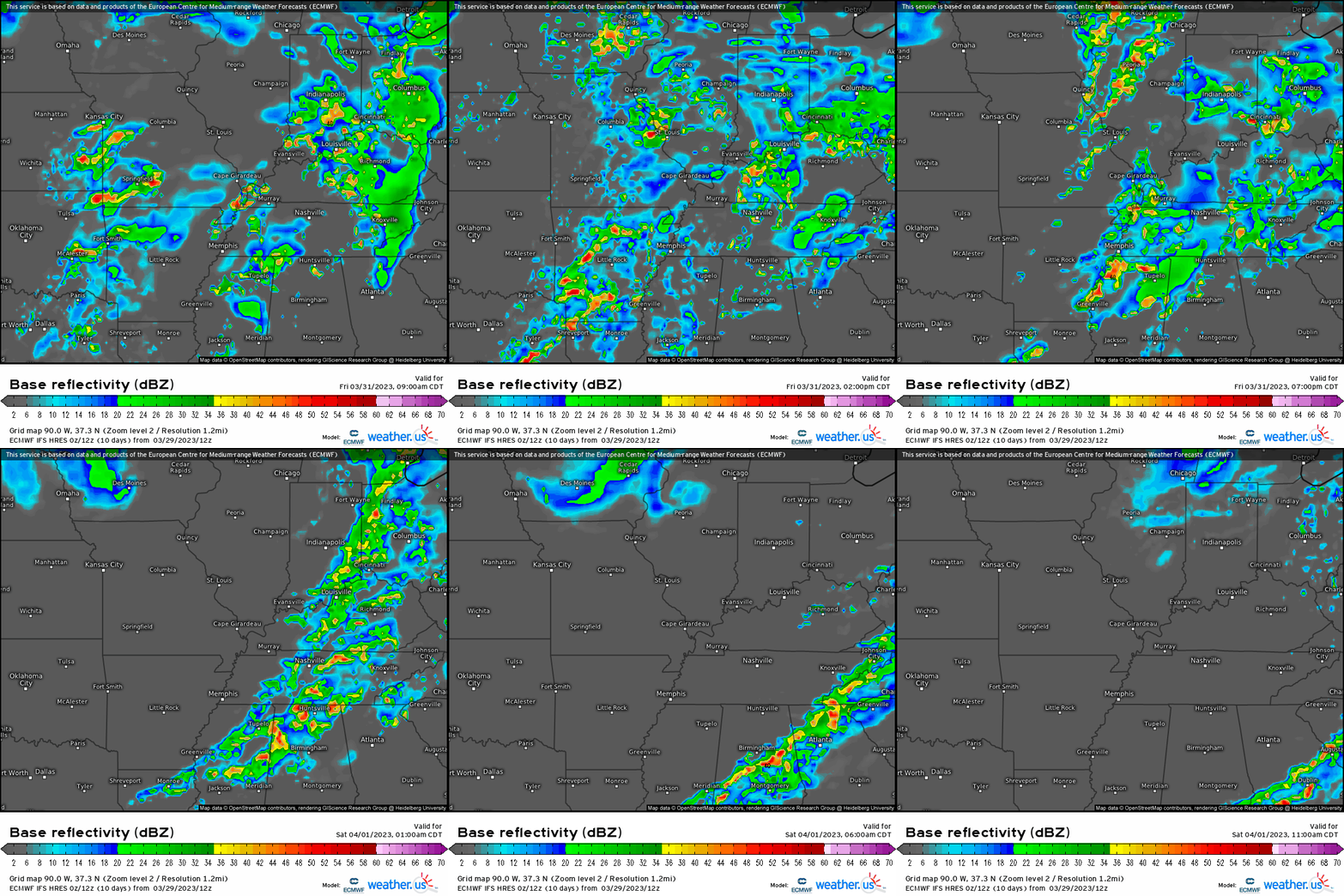
Below, here’s how it’ll look to play out beginning tomorrow morning and through the day. Mixed modes of supercells and linear segments will form (former closer toward the surface low with the latter more south). beginning around late morning-midday. As the cold front then progresses eastward, upscale growth commences and convective lines then push eastward into the TN River Valley by tomorrow evening into tomorrow night.
Damaging gusts and tornadoes with isolated hail will accompany any severe storm, with again the greater risk for tornadoes near the triple point (surface low), with expected wide swath of damaging and strong gusts.
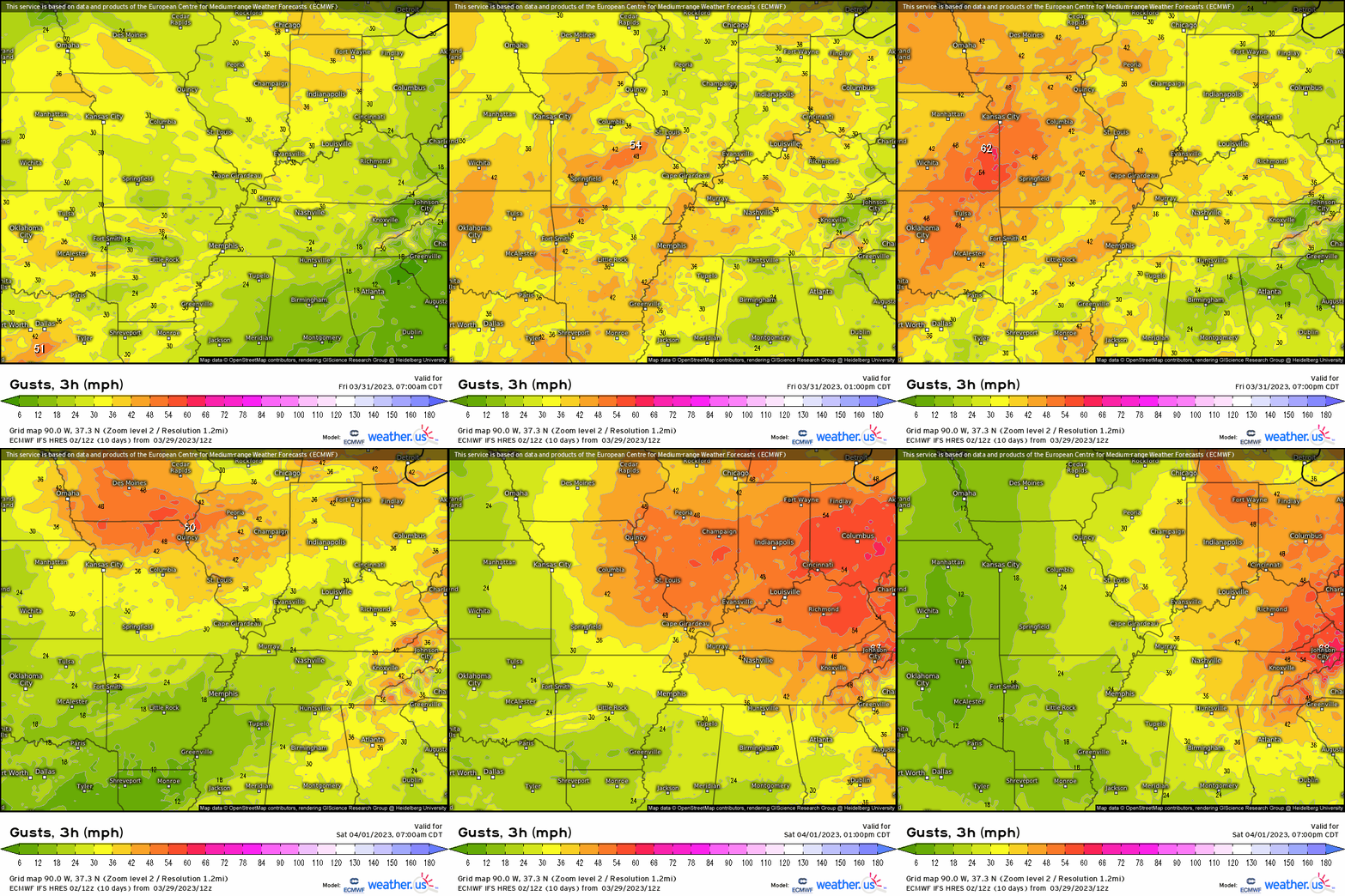
Here verbatim are some of the modeled wind gusts, with values exceeding 40 – 50mph, especially with any strong-severe storm. What’s more, it’s on the backside into Saturday that due to the tightening pressure gradient, we’ll see gusty winds continue across the northern Plains and into the Midwest.
So to recap:
-A severe weather outbreak culminates tomorrow across the ArkLaTex region, up to IA, IL, and the MS River Valley.
-Damaging wind gusts, large isolated hail, and few tornadoes are favored with warm-sector supercells (though still have uncertainty regarding discrete and what can manifest amidst some cloud cover), with linear segments becoming the dominant storm mode by afternoon.
-Risk begins 10am – 12pm along eastern OK, TX, NE and then into afternoon east with convective line segments prevailing toward the afternoon and evening before shifting eastward.
- Take precautionary action if you live in this general area outlined, and have preparations ready to go!


