Fred: Definitely Not Dead
So, about that Tropical Storm Fred: what a comeback! When we last discussed Fred on Friday, it was a badly disorganized open wave and, though reorganization was discussed, not too much beyond a weak TS was expected in the way of intensification before landfall.
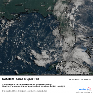
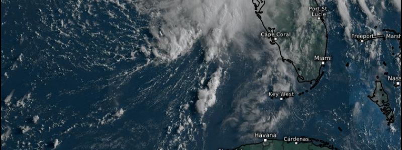
But look at this. Here we have Fred early Saturday morning:
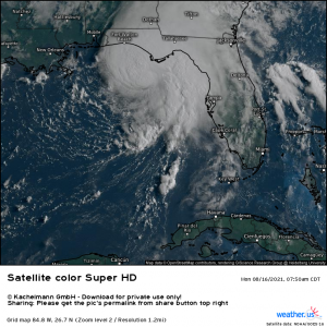
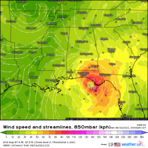
And here we have Fred this morning:
I’ll say it again, W-O-W. Though Fred had a decent amount of shear to fight against, the toasty SSTs in the Gulf helped Fred explode from an open wave to a TS that will possibly be knocking on the door of Cat 1 hurricane status by landfall late tonight- and all in 48 hours. As we saw with so many storms during the 2020 season, never underestimate the Gulf warm waters and their effect on a TC.
Fred is currently packing maximum sustained winds of 60 mph and a central pressure of 993 mb and is a solid TS. Some further intensification is possible, though Fred is rapidly running out of water and time with landfall imminent.
The threats from this storm will be the same whether it comes ashore as a strong TS or a Cat 1 hurricane. These threats being: heavy rain leading to freshwater flooding, storm surge, and perhaps a few tornadoes to the east of the center.
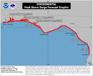
Storm Surge
The onshore push of water, or storm surge, could be fairly significant for areas east of the center, especially if it lines up with a rising or peaking high tide. For the Big Bend area, where the highest surge is forecast, low tide is expected around roughly 4 pm. From then on, the tide will be rising, enhancing the onshore push as Fred makes landfall. If you live in a coastal area that will be threatened by these levels of storm surge, take action now to protect your home and yourselves.
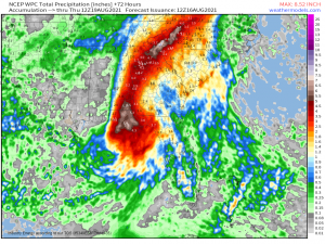
Heavy Rain
A wide swath of heavy rain is expected, mostly east of Fred’s center as it is still a heavily eastern-weighted storm. And this won’t just be for the coastal areas. Fred, as it moves north, will interact with a front near the Appalachians and enhance the rainfall this region will see. If you recall, this is known as a PRE event and Jacob mentioned this exact possibility in a blog last week. The possibility for freshwater flooding will extend far inland so more than just the coastal region needs to be prepared.
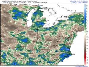
There is an upside to all this incoming moisture. The southern Appalachians, from roughly the PA border south, are very dry and entering drought status.
A good soaking from the remnants of Fred combined with frontal moisture should go a long way toward making a dent in that deficit.
As always, if you encounter flash flooding, or any type of flooding really, in the next few days, do yourself a favor and don’t drive through it. The risk is not worth your life. Take the longer way around.
Tornado Threat
As with any landfalling tropical system, there will be the threat for a few tornadoes. In fact, a watch has already been issued for portions of the FL Panhandle, far southeast AL, and far southwest GA.
As Fred nears landfall, increasing speed and directional shear will facilitate conditions conducive for the potential formation of a few tornadoes. These tend to be spin-up tornadoes which form quickly, so be prepared to act if a warning is issued. You may have a shorter than normal lead time. Also, though a portion of these tornadoes remain relatively weak, we have seen and will continue to see stronger tornadoes (EF2 or more) with landfalling systems. Don’t ignore a warning. Get to shelter right away.
Look to your local meteorologists and branch of the NWS for more detailed forecasts for your specific area. Trust their assessment – they’ve got your backs. To all in the path of Fred: be safe!
