Fred Barely Hanging On, Could Pose Heavy Rain Threat
Tropical depression Fred, the sixth-earliest sixth named storm in Atlantic history, is struggling this morning.
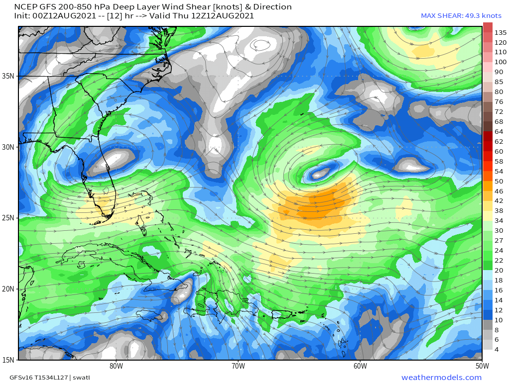
A combination of atmospheric shear associated with a diffuse, double-barreled upper level low over the tropical Atlantic and mountainous Dominican Republic topography are disrupting the complex but fragile heat engine that allows tropical cyclones to run, injecting Bahaman dry air into the core of the storm.
The result is a system that looks incredibly frazzled on IR Satellite this morning, with deep convective bursts disorganized to the east of a difficult-to-discern center. Fred is pumping moisture-laden, unstable air into the convergence-inducing topography of Hispaniola, which is likely leading to flash flooding in the Dominican Republic and Haiti. Aside from that, though, the news is good (if a tad widely anticipated): Fred is likely not holding together nearly well enough to pose a surge or wind threat to Cuba or Southern Florida.
So, what’s next for our scrappy little cyclone, barely hanging on to designation as a weak depression?
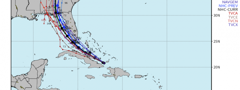
Intensification prospects for Fred look minimal over the next 24 hours, as the depression hugs the northern Cuba coast. It’s possible the cyclone will completely dissipate (which it’s already pretty close to doing), which could obviously throw a wrench in the forecast. But let’s assume, for a moment, it survives through tomorrow morning. Later on Friday, eastward progression of the Bahaman upper level low and westward progression of the tropical cyclone will shift steering currents to a more northerly degree, which will allow Fred to move away from Cuba and towards deeper waters over the Florida Straits.
A brief period of intensification is probable at this point, if there’s still a storm left to intensify, as a function of warm SSTs, deeper water, potentially favorable divergence aloft, and somewhat low shear. Re-intensification to a tropical storm is probable. But the honeymoon period with the Gulf won’t last- even if Fred can remain offshore Florida by the end of the weekend, a dramatic increase in shear from a compact upper level trough over the Southeast and relatively tame oceanic heat content should conspire to weaken it, or at least prevent it from further intensifying, before landfall.
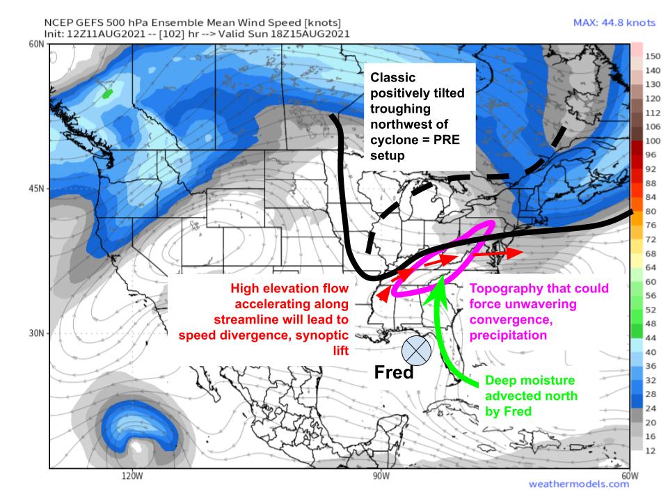
So the prospects of a strong hurricane making landfall in Florida appear extremely low with Fred. But that doesn’t mean impacts aren’t likely. In fact, the tropical cyclone could well collaborate with an unusual synoptic setup over the Southeast to produce very heavy rain from Florida to the Appalachians.
When a tropical cyclone is positioned southeast of a mid to upper level trough with winds that increase along streamline, an atmospheric machine can bring heavy, persistent rain hundreds of miles inland. Known as a predecessor rain event, or PRE, this type of event happens when speed divergence associated with flow accelerating away from the trough’s base promotes synoptic scale lift of moisture advected north to a tropical cyclone’s east. Because tropical cyclones evaporate huge quantities of very energetic, warm water, this moisture advection regime can result in incredibly potent ‘atmospheric rivers’ that move only as much as the parent trough- often quite little. When the advection regime clashes with a lifting mechanism of sufficient slothfulness, either a slow moving cold front or immobile topography, very heavy rain can occur for a long time, causing significant flooding. It happened over the Carolinas with Iota last year, and could happen again with Fred over a similar region.
I expect heavy rain to be associated more directly with Fred over Florida, and with the PRE over the interior Carolinas, where topography will most likely promote convergence of the advected moisture.
Those in the path of Fred should stay weather aware, and be sure to have a plan in place- hurricane season is just now ramping up! Those in the southeast, especially the interior Carolinas, should iron out flood safety plans.


