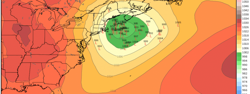
Forecasting a Potential Nor’easter
The new year is off to a running start as the first three days of 2022 threw nearly everything but a hurricane at the Eastern US.
From record highs to tornadoes to flooding to a rapid cooldown followed a rather impactful snow storm… Well, I’m tired already. But there’s no rest for the weary as we turn our eyes to another potential snow storm.
An energetic shortwave is forecast to swoop down out of Northern Plains early Thursday. A surface low will form and deepen. With cold air already in place and more not far behind, this will translate to another snow threat for the mid-Atlantic before it passes offshore and potentially becomes a nor’easter.
Even though we’re less than 72 hours out, a fair bit of uncertainty remains. And, as usual, those uncertainties could make quite a bit of difference in the forecast. So, let’s look at what we’ve got.
Location of the Low
Where the low tracks is especially important when forecasting winter weather. For this upcoming storm, it will make a difference not only once the low is offshore but also in the early stages in the Mid-Atlantic.
While the EPS is fairly settled on the low tracking near the VA/NC border, the GEFS solutions range from the VA/NC border all the way to the PA/MD border.
A more northerly solution as indicated by some of the GEFS members would mean a northward nudge of the rain/snow line. Basically, it could be the difference between Central Virginia seeing accumulating snow or just rain.
Additionally, where the low tracks once it emerges into the Atlantic also matters – and matters quite a bit.
This time, EPS guidance is a bit scattered. Though there is a tighter cluster offshore, more than a few members show solutions that are too far out to sea for impacts to be felt in the northeast. The GEFS, however, is more or less settled on the center of the low tracking close enough to the coast for impacts to be felt. It’s worth mentioning, though, that both the deterministic ECMWF and GFS are currently on board with a low close enough to the coast.
Strength of the Low
Just like location, strength can make a difference as well. If you’ll refer back to the last image, you’ll notice that in both the GEFS and EPS, a few stronger solutions exist. Now, this is more the exception than the rule in both but, should the storm trend stronger AND be closer to shore, warm air being advected in from the south around the low could cause overrunning issues and lead to a corridor of mixed precipitation.
For this to be an all-snow event, we want a low that isn’t too strong, but also not too weak. And, ideally, we want the placement of the low to be far enough offshore that any mixing is kept over the water, but not too far that the precipitation shield stays mostly offshore. It’s quite a balancing act that the atmosphere has to perform to get the perfect nor’easter.
Interaction with Preceding Disturbance
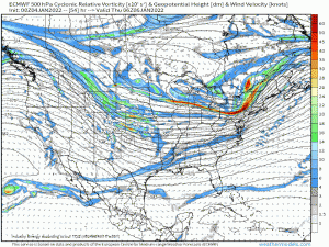
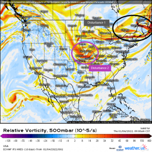
A mid-level disturbance is forecast to affect the northeast previous to the arrival of the potential nor’easter. How this disturbance develops, its strength, and its speed can affect the potential nor’easter in its beginning stages.
If Disturbance 1 is sluggish in exiting, it can force disturbance 2 to track further south. If disturbance 1 trends stronger, it can suppress the development of disturbance 2, leading to a weaker storm – at least initially.
Interaction between these will be an important factor and the trends should be watched in the next day or so.
Now, the question on everyone’s mind: Who is getting snow and how much are they getting?
Considering the unknowns we just discussed, it’s best at this point to use probabilities to get an idea of what to expect.
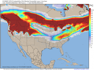
The EPS is fairly enthused about the possibility of much of the Mid-Atlantic/Northeast seeing SOME (1 inch +) snow, however…
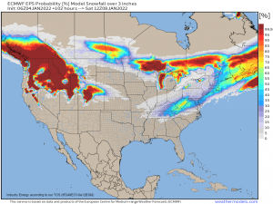
It seems less enthused about the possibility of a widespread heavy snowfall (3 + inches).
Remember, this is an ensemble view so it looks at all the possibilities and averages them together. There are still quite a few unresolved moving pieces in this forecast so it will continue changing, much like yesterday’s storm.
We’ll take another look at this forecast in a blog on Thursday morning to see what changes have occurred and outline what is expected at that point.


Excellent piece. I like how you provided a lot of detail but simplified it down for a novice weather geek like me. I hope you don’t mind that I put a link to your blog on mine (https://nyweather.blogspot.com/). I am starting a new one soon called https://weathermatt.blog/ and plan to include your content with attribution as long as you and weather.us don’t mind?
Thank you for the kind words! I’m glad you enjoyed reading it and that it was understandable as well!
Feel free to link our content in your blog going forward!