Flushing the Block: Changes Ahead
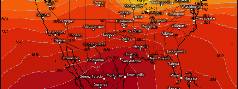
We’ve been in a pretty stagnant pattern lately. The ridge that has moved in over the eastern third of the country has brought record-breaking heat, very dry weather, and poor air quality to the region as we lack any meaningful forcing to get things moving. It has also provided a “path” for some weaker disturbances to move along over the plains states providing severe weather enthusiasts with multiple days of picturesque supercells and even tornadoes. But, all good things must come to an end – and the east really could use some rain right now anyway. So when, exactly, can we flush this block out of here?
Well, soon. In fact, things are in motion for a bit of a flushing out right now.
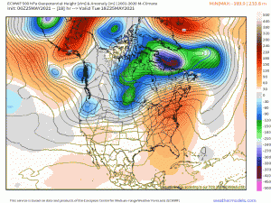
Downstream conditions are moving right along while, upstream, an upper level trough is currently swinging into the Pacific Northwest. This trough will perpetuate eastward and descend the Rockies tomorrow, initiating surface cyclogenesis in the lee of the mountains.
Without going into too much detail in this particular blog, this system has the potential to bring at least two days of relatively significant severe threats to the Plains states. The SPC notes an enhanced risk for Nebraska and Kansas for Wednesday and Kansas, Oklahoma, and Missouri for Thursday. But we’ll flesh that out in the coming days. We’re just looking at the overall pattern today.
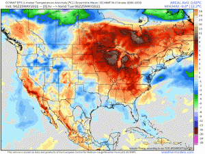
Ahead of this system, the northeast, which had been granted a brief reprieve from the heat by a sneaky back-door cold front, will once again experience widespread temperature anomalies of 10 to even 20 degrees above average tomorrow. It won’t last, however, as temperatures come crashing down with the passage of a powerful cold front courtesy of our next coast-to-coast system.
By the weekend, our once-stagnant pattern does a bit of a flip flop with much below average temperatures in the east for the holiday weekend while the west slowly warms up again.
Eastern US- Hope you’ve been getting your swimming in this week. Might be a little chilly to celebrate in the water on Memorial Day.
So in summary: a couple more days of above average heat are in store for the east before a cold front knocks us back below average while severe weather lurks for the center of the country starting tomorrow. Stay tuned for more on the severe threats in tomorrow’s blog!


