Flooding Concerns: MS River Valley To the Ohio River Valley
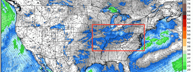
Ingredients are coming together for there to be expansive flooding concerns from the lower MS River Valley through the Midwest, TN River, and into the Ohio River Valley today and into tomorrow. Synoptically, a quasi-stationary front will stall out across the area outlined using surface winds to display the boundary demarcating surface convergence (forcing mechanism).

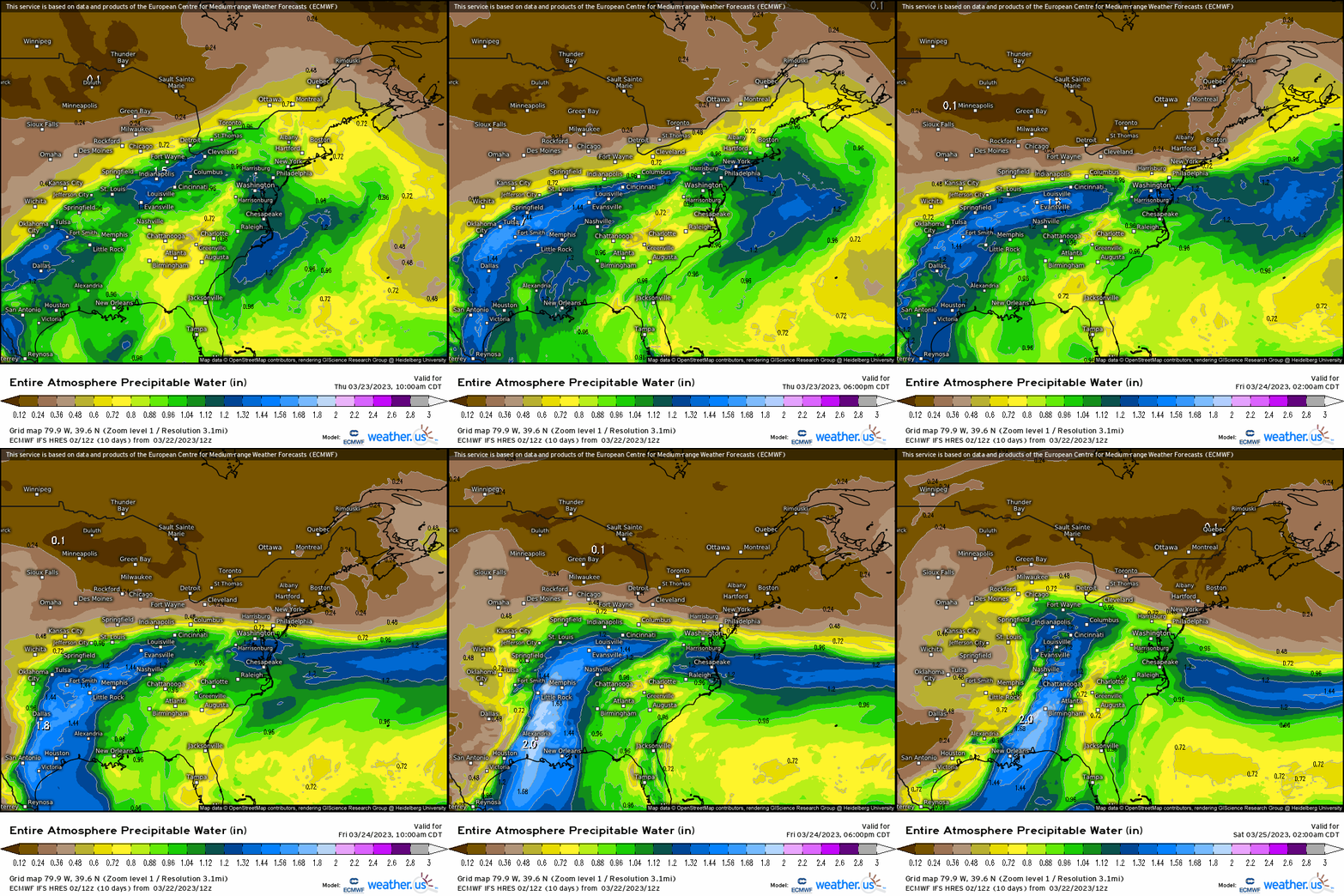
Next, we have a wide-open source from the Gulf with plenty of moisture and energy that’ll be transported along the boundary. Verbatim, we’re looking at an anomalous saturated environment that consists of PWAT values nearly exceeding 2 standard deviations from the Deep South up to the Ohio River, so no shortage of condensing vapor into liquid and the potent amount of energy available!

Next, we look at 850mb to show the LLJ and where we’ll see depth of moisture and warm air advection. Notice how the low levels from the surface to 850mb in this case is oriented parallel, which is extremely favorable for training storms and a recipe for continuous periods of rainfall given the supply of moisture, warm air, and all being forced by the boundary.

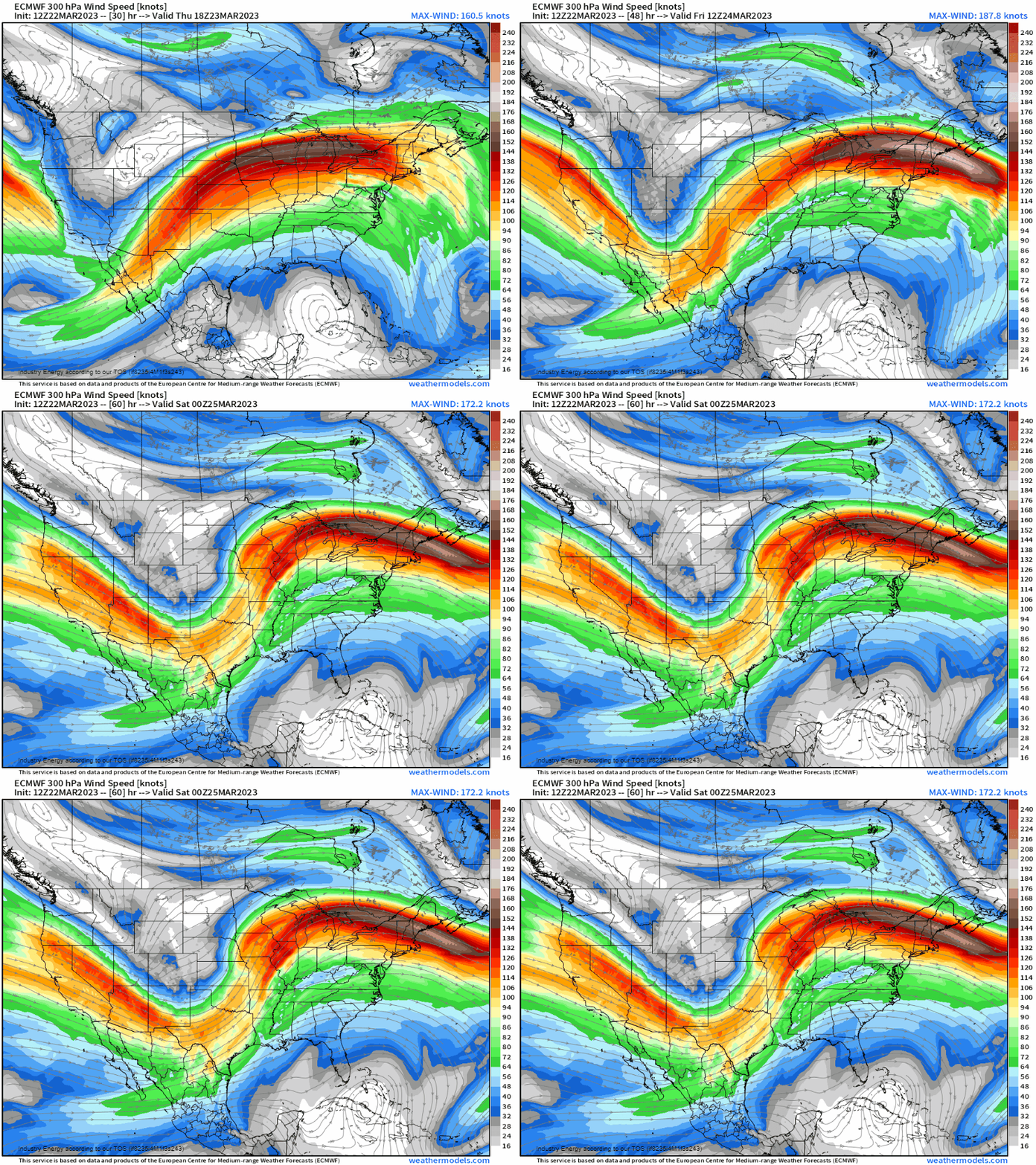
Furthermore, we have yet another catalyst for rising motion, augmenting what is presently a conducive environment for heavy rainfall and storms. A jet streak will propagate into the Great Lakes and Northeast region, which happens to allow for the right-entrance region to juxtapose the area of concern thereby exacerbating the setup.

Putting this all together, we’re likely to see a narrow swath of rain totals 2-4”, locally higher possible from SW OK into OH with many nearby locations seeing in excess of 1” through Friday night. Then into Saturday, a system develops from the TX Panhandle that’ll make its way northward into the Midwest and Great Lakes that’ll bring yet another swath of rain to the same places that become impacted by the setup today and into tomorrow.

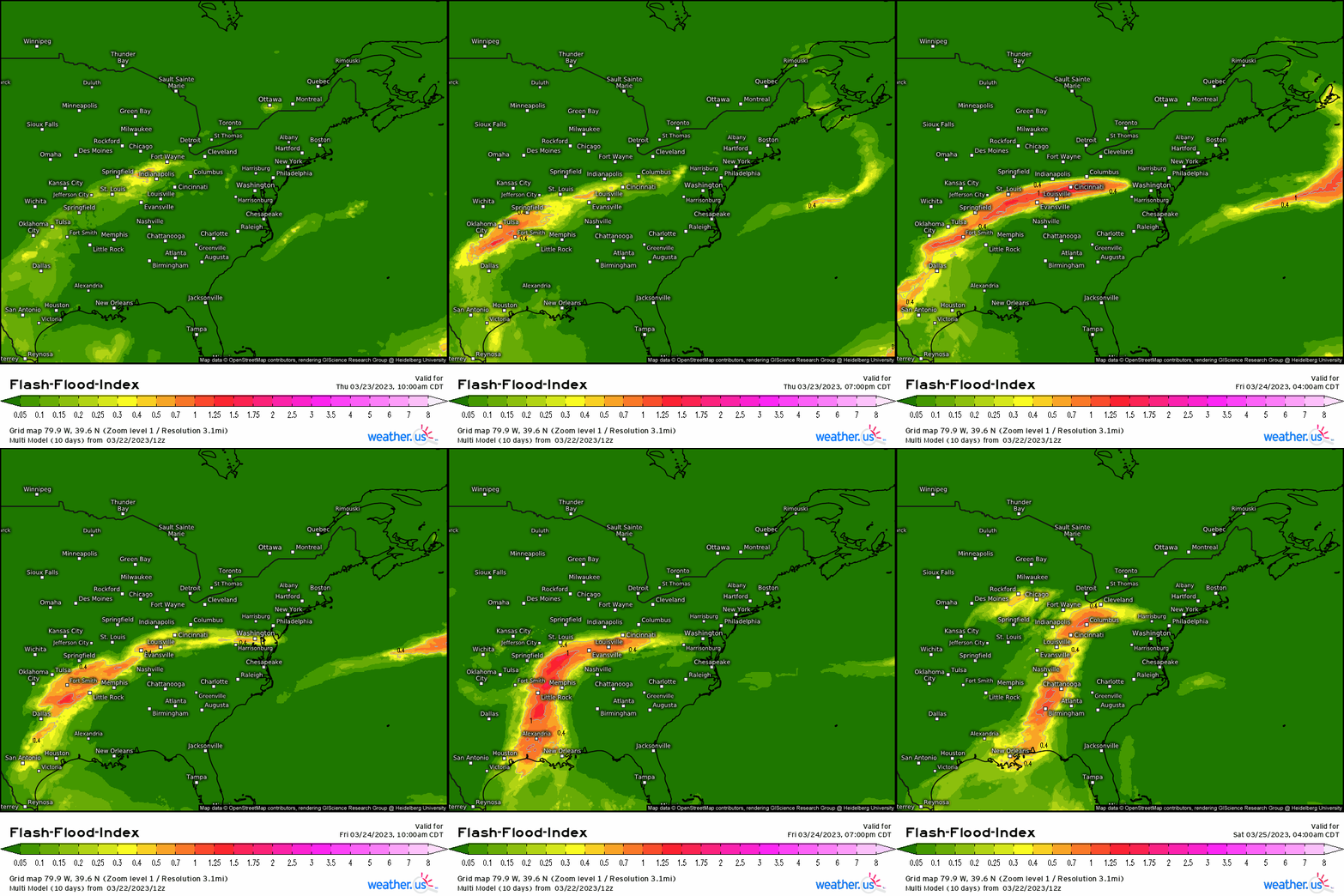
Here we see the flash flood index via the Multi-model reveal values in exceess of 1, indicating an extreme environment capable of flash flooding where urbanized areas (poor drainage flooding especially) become susceptible to such instances and likely to be given the extremely favorable environment for heavy rainfall and flooding!

If you live in this general area, be prepared with any backup items and key essentials in case power goes out for a while. Remember, DO NOT drive through standing water as it takes only 6” to allow cars to stall, and you never know if any power lines are down this can result in extremely hazardous circumstances! Be safe and take the precautionary measures.


