Fire Weather in the West; Lake Effect in the East as High Pressure Dominates
Good morning!
The surface system beneath an upper level low that brought significant weather from coast to coast will clear New England today, and high pressure will dominate much of the CONUS, meaning a relatively light weather blog today.
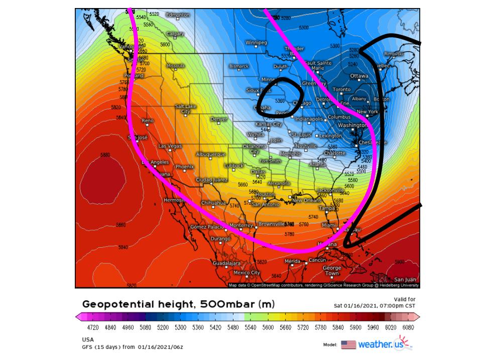
It always seems that big weather systems are followed starkly by calm conditions, and there is meteorological basis for that. When longwaves the size of continents swing coast to coast, they foster environments favorable for big low level cyclones to bring wind, precipitation, thunderstorms, etc. to their east, where heights spread apart dramatically and promote lift.
To the west, though, convergence often dominates as the height gradient increases with eastward extent towards the ‘pinch’ of a trough. This forces air to sink, and high pressure at the surface generally promotes offshore flow, weak pressure gradients, and clear weather.
I painted regions of convergence (pink) and divergence (black) with a pretty broad pen, so this is hardly an intricate analysis. But what’s apparent is that, for effectively the entire CONUS save northern New England, where a major winter storm is wrapping up, convergence dominates. Another small exception is a shortwave slinking down the longwave’s western edge into the corn belt, which lacks both moisture access and surface baroclinicity to become much more than incentive for a few snow showers.
Also notice that I did not annotate the closed low itself. This is because a series of small shortwaves rotating around its axis will produce small-scale height rises and falls today.
The point of all of this is to say that, atmospherically, ‘uneventful’ is a pretty fitting descriptor of the forecast for the next couple days. But there are a few spots in the country that have topography capable of working sensible weather wonders with minimal atmospheric inputs.
The first place we’ll be looking is the region just downwind of the Great Lakes towards the east.
Remember, precipitation requires two things:
- Moisture
- Lift
For snow, an option #3 is cold air.
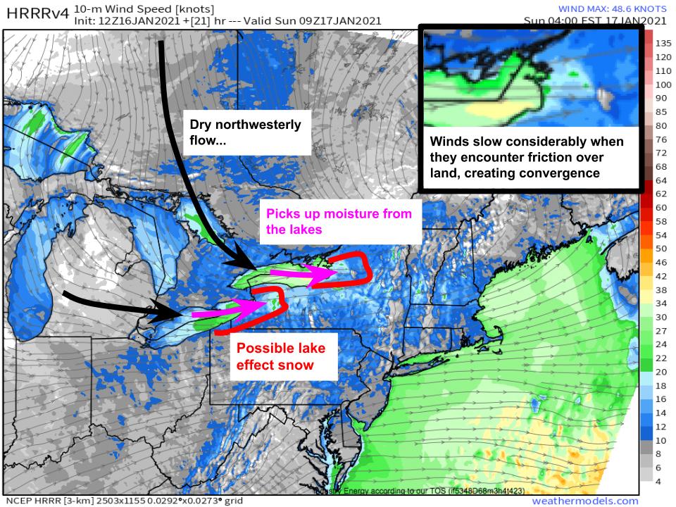
The Lakes serve as a moisture source in the middle of the continent, meaning fairly atypical flow regimes can produce precipitation downwind. This affect is accentuated by the shape of the lakes, especially Erie and Ontario, which promotes especially long fetches of moisture with northwesterly winds, which are typically associated with cold, dry air elsewhere. Air that moves over these large bodies of water picks up plentiful moisture, which then eagerly condenses into precipitation when the parcels encounter frictional convergence and colder temperatures over adjacent land.
This combination of physical attributes of the Great Lakes region allows a simple atmospheric input, well-angled northwesterly flow with some degree of synoptic-scale lift, to produce heavy precipitation. When it’s cold enough, which is common in NW flow events in winter, this falls as heavy snow. The snow continues as long as NW-ly winds persist, which won’t be for that long tonight but is sometimes on the order of days. And, where topography is really favorable, like over the Tug Hill Plateau, orographic lifting boosts the amount of moisture that can be sucked out of the air into precipitation. This is where we can expect maximized snow from this storm tonight, likely approaching a foot.
The other topographical machine that will be cranking out sensible weather despite lackluster atmospheric input? The SoCal fire weather conveyer belt.
A fairly unusual lack of rain to date in parts of Southern California means fuels are still primed for wildfire growth, given the right atmospheric conditions. When it comes to wildfire, these conditions are:
- Strong wind
- Dry air
The stronger the winds and the drier the air, the worse the wildfire threat.
As we’ve discussed many times in this blog (what a wildfire season it’s been!), an input of a strong Rocky Mountain high is all that it takes for the mountains of Southern California to produce both #1 and #2.
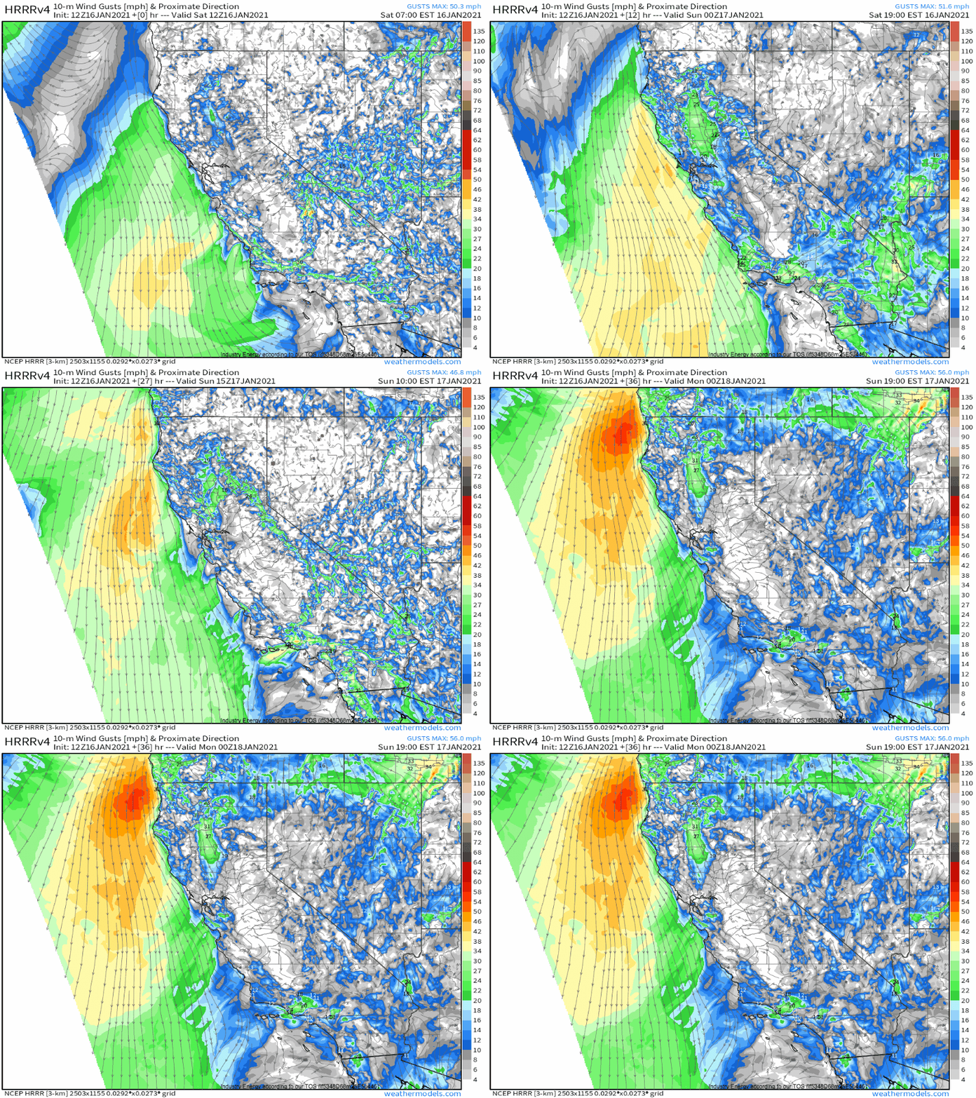
#1 comes as the high peaks that line the spine of California refuse to permit much of the low level high pressure from spilling all the way to the coast. This allows an impressive pressure gradient to pile along the mountains, driving a stiff offshore wind. The strength and position of the surface high are the biggest determinants of how formidable this PG can get. Over the next couple days, the position and strength favor strong winds over SoCal and even more impressive winds over NorCal. Because the fire weather season is over for NorCal, though, this will simply be a high wind event there.
But in SoCal, these strong winds moving offshore will interact with the mountains to allow #2 to develop.
As wind moves downslope, it expands, forcing it to warm adiabatically. Because the moisture content remains unchanged, this significantly reduces relative humidity, and allows for incredibly dry air to remain entrenched in SoCal.
With a lot of help from topography, then, #1 and #2 are satisfied. Given sufficiently dry fuels, which are still sadly present, and ignition sources, which are often inevitable, wildfire growth and spread will be quite possible.


