Extreme Fire Weather Returns to Southern California
It seems interesting weather tends to happen all at once, doesn’t it?
All eyes are currently on a storm set to impact the northeastern US this weekend, a challenging forecast that Meghan talked about in her blog yesterday. As a CT native and snow junkie, I would love to write more about this potential storm, but I don’t consider it to be today’s most pressing, unusual, or significant threat.
Well, if what everyone on twitter is talking about isn’t the most important thing currently happening in the atmosphere over America, what is?
In fact, an unusually, significantly volatile week for fire spread will begin today in Southern California, as the atmosphere continuously shoves input into the SoCal topographical fire weather machine.
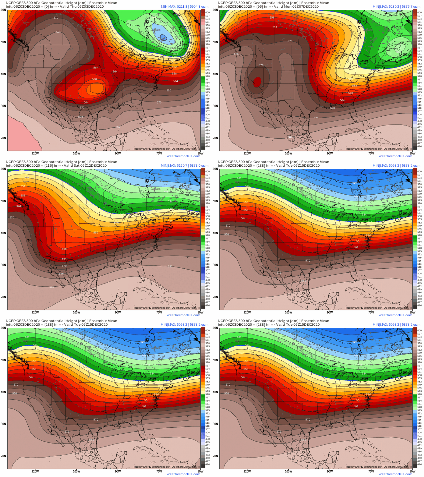
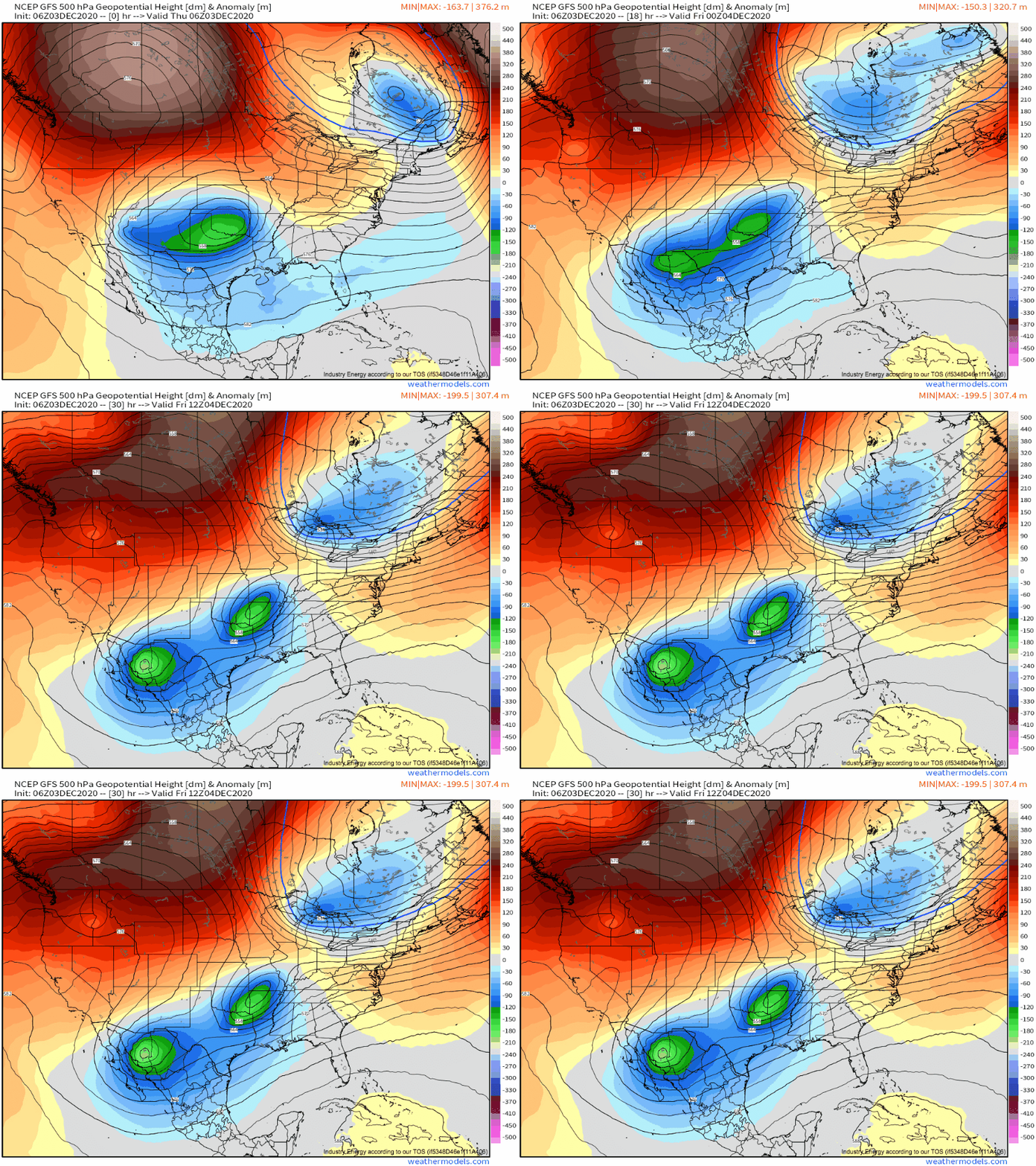
Our threat begins, as it often does, with a significant, very positively tilted trough digging into the central US, with a secondary lobe over the mountainous West.
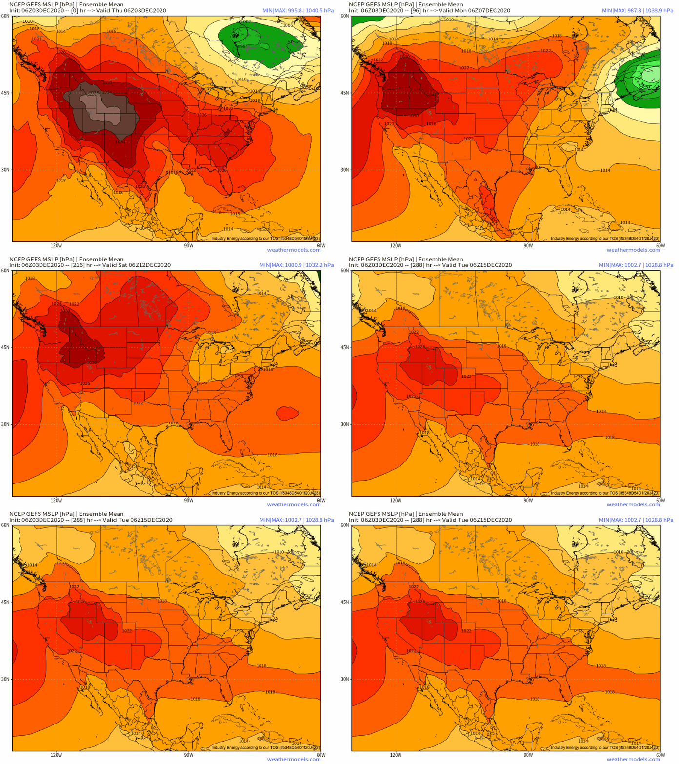
As this ball of midlevel cold air skirts the persistent EPac ridge, it will drive significant midlevel convergence south into the Great Basin region. This has driven very strong surface high pressure into Nevada and Utah.
This is where the topography of California starts to set the fire weather machine into motion. To a large degree, the mountainous terrain of interior California prevents this high pressure from spilling all the way to the West Coast, which means pressures west of the SoCal mountains are much lower than they are to the east.
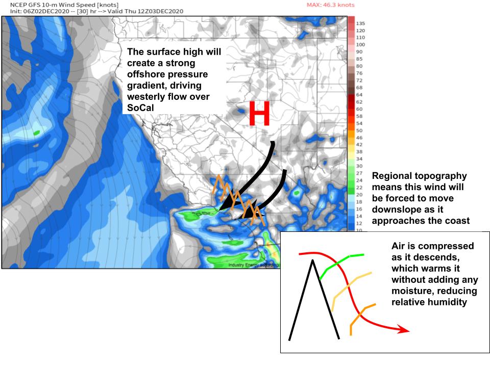
This allows a sharp pressure gradient to develop in Southern California, directed from the east of the SoCal mountains towards the Pacific ocean. The HRRR models this PG to be around 8mb, which is not unheard of for the region, but is definitely sufficient to pass the ball to the next stage in the fire weather machine.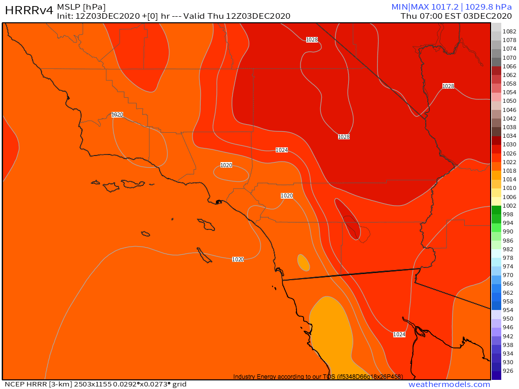
Gusty winds can induce dangerous fire behavior, fanning flames and promoting rapid spread, and this pressure gradient is strong enough to mean offshore flow will be quite powerful. Producing these winds is one important way that the topography/surface high combination can incite conditions favorable for fire growth, but it is not the only one.
Ideal conditions for fire growth and development also include dry air, which increases the ease with which fuels can burn. Here, too, the SoCal topography can output conditions very favorable for wildfires, as I’ve detailed in this nifty little infographic.
The resulting single-digit relative humidities are very supportive. So, not only can a surface high sliding east of SoCal’s mountains incite very strong offshore flow, this strong offshore flow is considerably drier than basically any other air that can form in the US. This is how, with relatively minimal input of a positively oriented Western US trough, the topography of California can kick off high-end fire weather.
There is another variable, of course, being antecedent fuel moisture, or basically, how wet is plant matter in the region. Being that it still has yet to really rain this season in SoCal, on top of areal seasonality promotes a degree of fuel dryness for this time of year, the fuel is quite combustable across the area.
This all means that today will feature extreme fire weather potential in SoCal, at the hands of gusty winds and very dry air.
Hopefully by now you’re convinced that, given a degree of antecedent dryness that the area currently possesses, fire weather potential in SoCal can be modeled reasonably well by the intrusion of surface high pressure systems, typically at the hands of south-facing convergence behind midlevel cold air balls. To that regard, the next few weeks look to offer little respite.
Unfortunately, it looks like a series of favorably oriented midlevel troughs look set to push surface highs right up against the California mountains, one after the other, for at least the next week and a half. Not only will the next couple days bring high-end fire weather to SoCal, then, but a series of reinforcements will hinder firefighting moving forward, too. Not a very good situation.
 \
\