Expecting Idalia
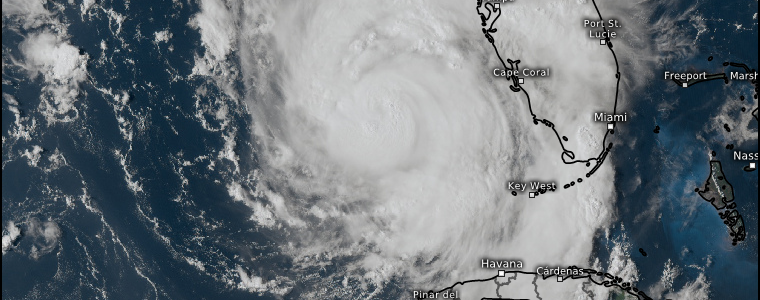
Idalia has made it into the Gulf and, as of the 5 PM advisory from the National Hurricane Center, is currently a strengthening category 2 hurricane with max sustained winds of 100 mph and a central pressure of 972 mb.
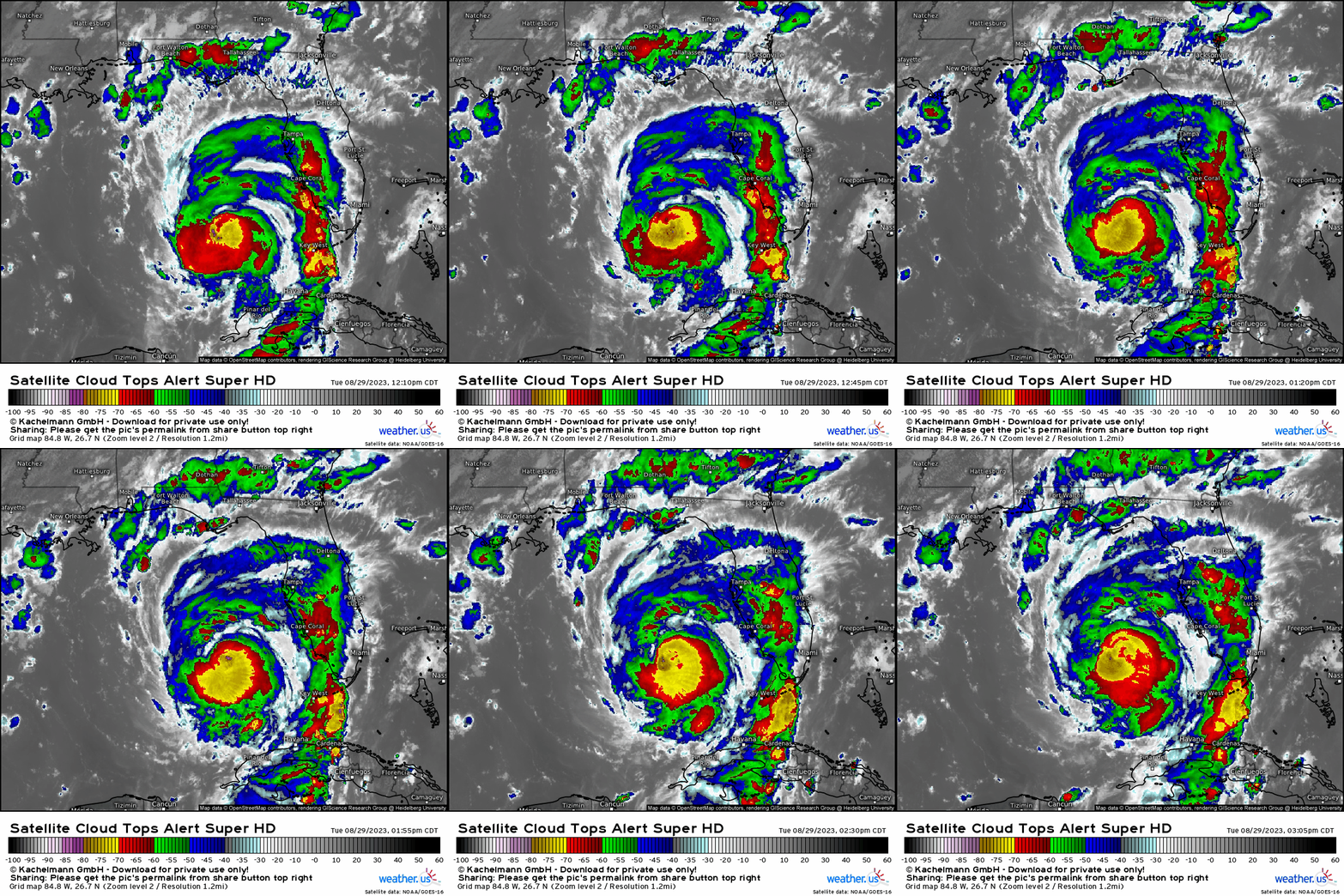
It has become increasingly well-organized with a stacked core, plentiful deep convection around the core, and has even been trying to clear out an eye in recent scans.
All signs point to Idalia continuing to intensify up to landfall and, per NHC’s official forecast, subsequently making landfall as a Category 3 hurricane.
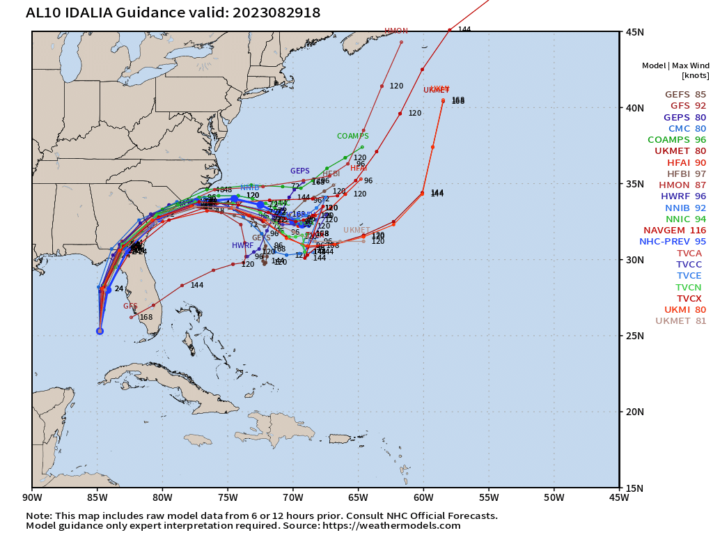
Models have more or less converged on a Central Big Bend landfall sometime tomorrow morning.
At this point, we will need to watch the center and where it tracks. Little wobbles or deviations aren’t a concern as it is bound to occur. However, continuous wobbles or deviations that bring it further and further off track with each scan could be a problem and ultimately change the impacts for some.
This is now a “now-casting” situation. Anyone under a hurricane warning needs to be prepared to take a hit. Do not focus on the cone alone. Impacts will extend much beyond that small cone on the map.
I highly encourage anyone in the path of this storm to head over to the NWS Southern Region Tropical Webpage and take a look at the Hurricane Threats and Impacts Graphics maps. These will tell you exactly the impacts expected for your area and include the wind threat, storm surge threat, flooding rain threat, and tornado threat.
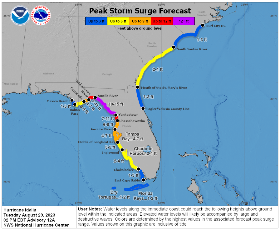
Speaking of storm surge, take a look at the latest estimates from the NHC.
That 10 to 15 ft outline is horrifying and brings to mind the forecast we saw for the Ft. Myers region ahead of Ian last year.
A recent tweet from NWS Tallahassee really puts this into perspective:
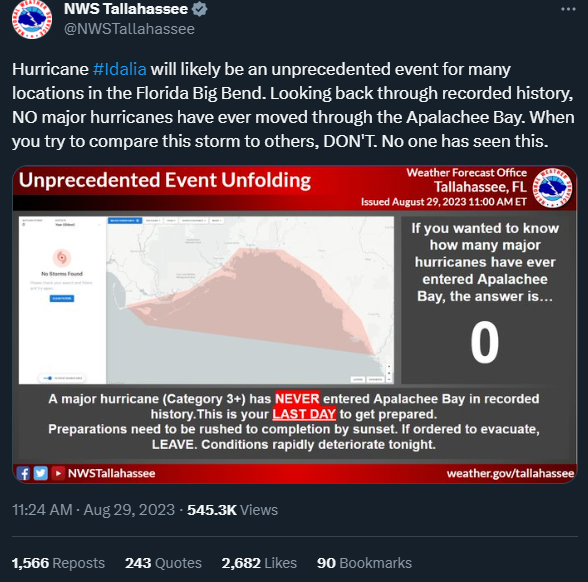
Strong wording for a very serious situation.
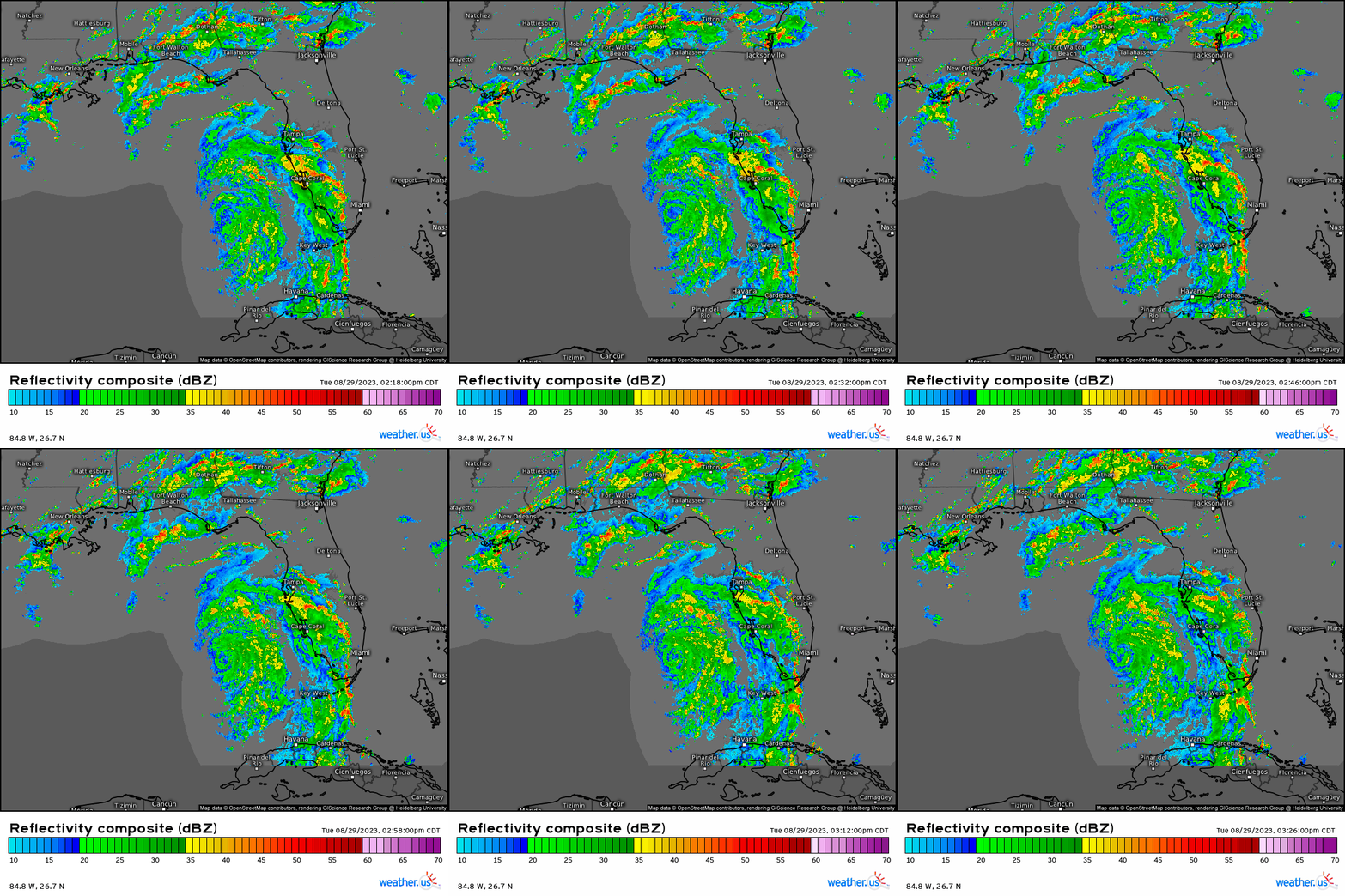
As they said, if evacuation orders have been issued for your zone and you haven’t left yet, there is still time. Please get to higher ground before conditions deteriorate this evening. As we can see from the radar loop above, the outer bands are already beginning to move in.
You can find a list of open shelters here: https://www.floridadisaster.org/shelter-status/
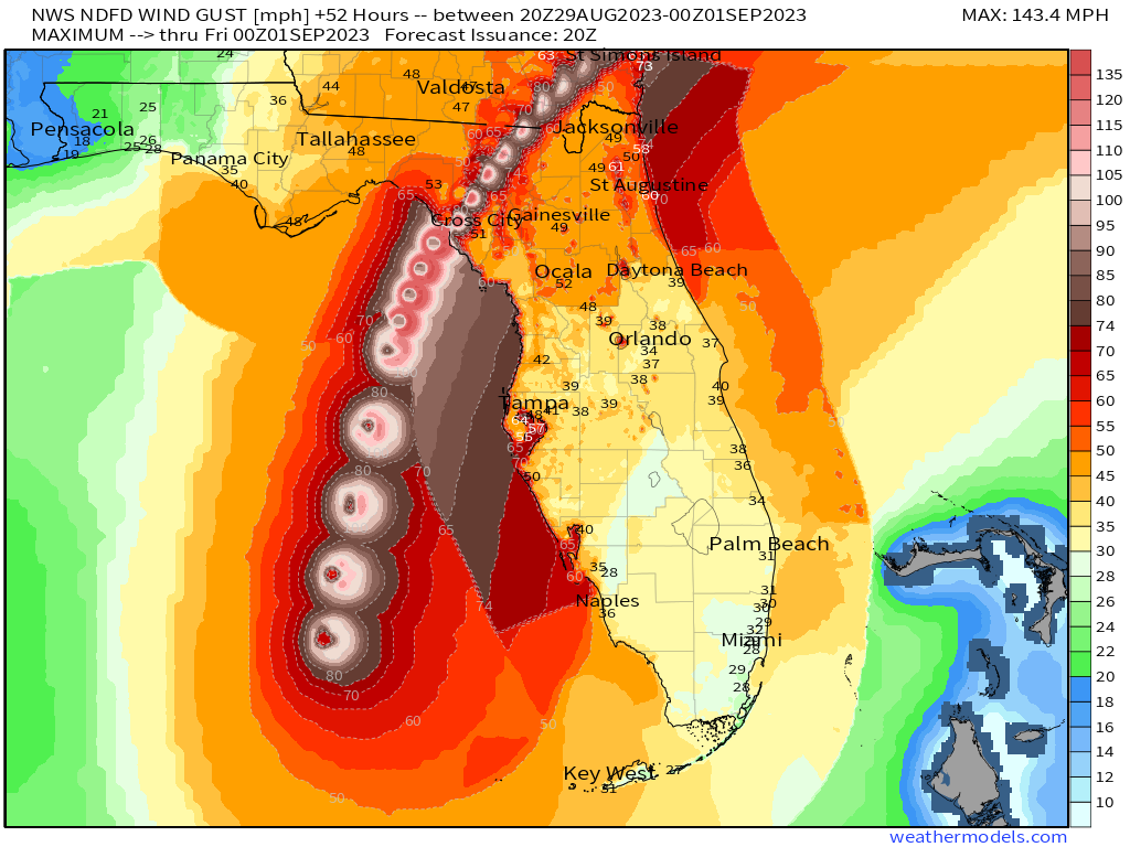
If you’re a regular reader of my blogs, you know that I will hammer home that the water component of a hurricane is the most dangerous. That remains true in Idalia’s case, but we do need to talk about the winds for a moment.
If you’ve ever been up in the Big Bend region of Florida, you may have noticed there are pockets of civilization, but also a great deal of trees. This is especially true around Tallahassee.
Tallahassee is basically a city inside a forest. Once those winds start blowing and trees start coming down, this is going to leave the city – which is Florida’s capital – without power for quite awhile.
Of course, the intensity of the winds depends on where the eyewall tracks. But, with heavy rain and tropical storm force to hurricane force gusts, there is no doubt trees will be coming down somewhere in this heavily forested part of the state. If you reside here, plan for power outages that last multiple days.
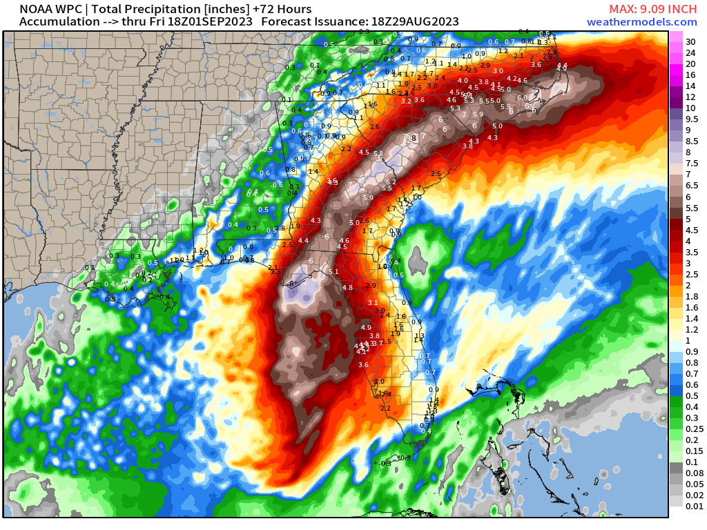
Let’s not forget that impacts will extend far from the cone.
As Idalia speeds away northeast, much of the Southeast US will be in line for heavy rain potentially leading to flooding, gusty winds, and some storm surge along the Georgia/South Carolina coastlines.
Rush all preparations to completion in the next few hours. Be where you need to be by this evening – and stay there. If you were told to evacuate and haven’t yet, please get to higher ground ASAP. This storm is going to be unlike anything the Big Bend has ever experienced before as no major hurricanes have ever made a direct hit on this region.
Stay safe!


