Expansive Central US Severe Threat Today
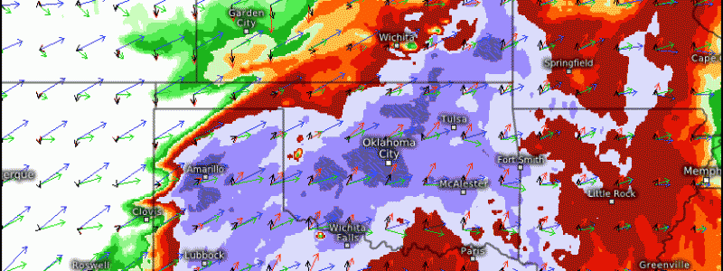
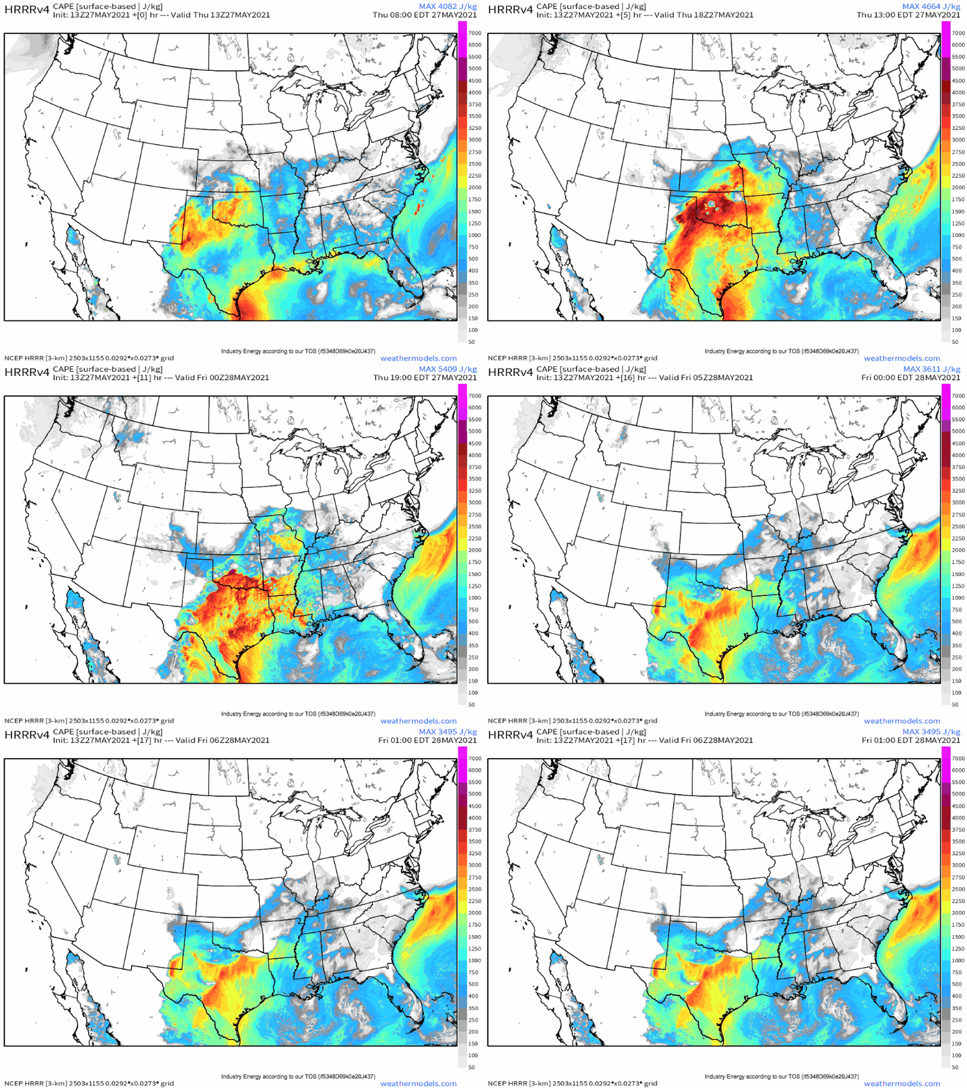
This morning sees an expansive low level moisture plume having overspread much of the south-central and south-eastern US, being overspread from the west by midlevel flow exceeding 40 knots. This southwesterly flow aloft is transporting a stout EML that’s already promoting lapse rates exceeding 8ºC/km over parts of the moisture plume, contributing to high instability exceeding 4000j/kg already that will grow to extreme values by the afternoon.
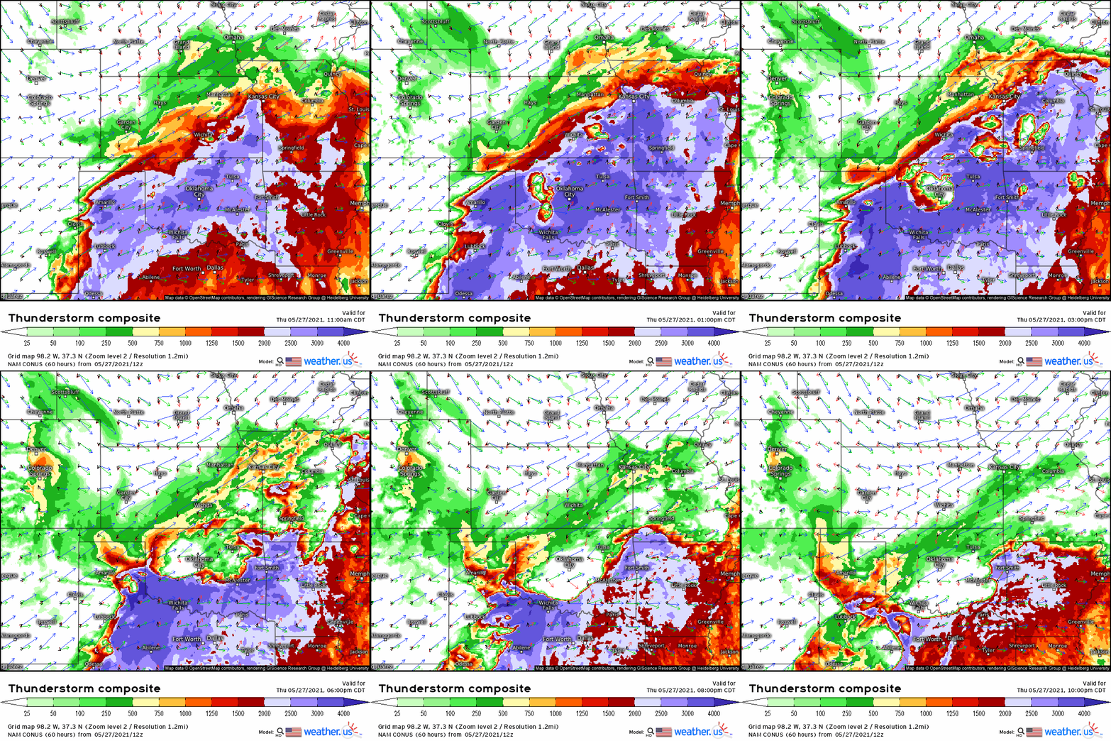
The aforementioned midlevel flow encroaching on this excessive CAPE plume will ensure that a swath from Texas through Oklahoma and Arkansas into Missouri sees an overlap of moderate shear and high end instability very favorable for the development and maintenance of updrafts. This favorability will come to fruition by the early afternoon, as a combination of inhibition-eroding heating and outflow from last night’s storms ignites initiation.
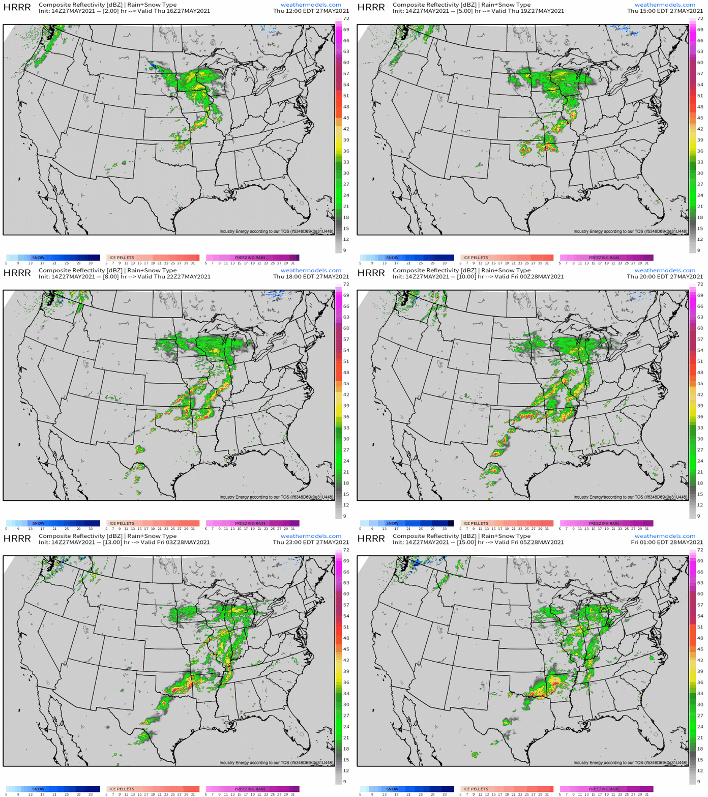
Storms will probably form in three swaths today. The first will be storms currently ongoing near the northern Oklahoma border, which will strengthen as the parameter space improves with time. These storms may pose a moderate severe risk, likely in the form of damaging wind gusts.
The second cluster of storms will evolve in the mid-afternoon over NW Oklahoma as several broad supercells posing a significant hail threat and something of a tornado threat, before quickly coalescing into a surging squall line/bow echo. This line could bring swaths of significantly damaging wind gusts to part of the area into the overnight.
The third cluster of storms will evolve south along the Texas dryline, featuring high-end supercells capable of large to giant hail in the mid to late evening.


