Eta, Approaching Hurricane Status, Eyes Florida
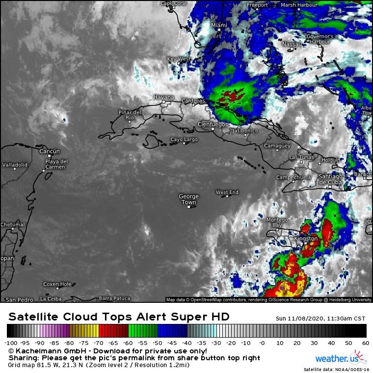
Eta made its second landfall today, as a strong tropical storm in central Cuba. The storm, now in the Florida Straits, is looking pretty ragged on satellite this morning. 
Link: https://weather.us/satellite/815-w-213-n/top-alert-superhd-15min/20201108-1730z.html#play-0-12-5
The system is clearly feeling the impacts of moderate vertical wind shear, serving to ’tilt’ the storm with height and keep much of the convection to the north/northeast of the low-level circulation. The impacts of this shear are apparent in the asymmetries of the system on the satellite imagery above- they serve to prevent the system from organizing the type of CDO conducive to strengthening. 
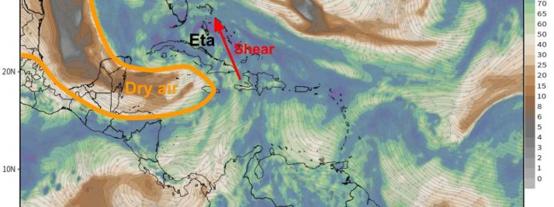
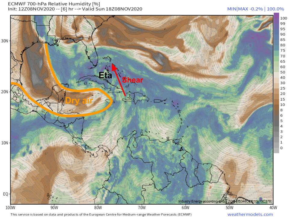
This shear comes with the northeast exit region of the upper level trough that’s been steering Eta as of late. The same trough brings a slug of very dry mid/upper level air towards the storm, which is now located to the south and west of Eta’s circulation.
As Eta moves into a region of low shear and warm SSTs later today, this dry air will be the only atmospheric condition that may prevent strengthening. The bulk of very dry air is located upshear of the storm’s circulation, which opens up the possibility that it will be entrained into the storm’s circulation by the same flow keeping Eta disorganized at the moment.
Will Eta weaken with dry air, or will the storm manage to remain in a moist enough environment to strengthen? It will be close, but Eta seems to be departing the zone of high shear faster than the dry air is working its way north. As the storm increasingly moves to the north of this shear zone, convection will be able to develop more symmetrically, helping Eta buffer against dry air with its own envelope of moisture. And as Eta will be moving through an environment characterized by RH exceeding 75%, if dry air isn’t entrained into the storm by shear, it probably isn’t getting there at all.
So it looks to me that Eta will probably be able to out-run the approaching dry air for long enough that it won’t matter, at least in the medium term. As I’ve already mentioned, the storm will continue moving into an environment characterized by 28-29°C SSTs, relatively low shear, and moist air. It probably won’t be all systems go for rapid intensification, due to a lack of favorable outflow channels, low base-state organization (look at that satellite imagery!), and the proximity of aforementioned dry air to the south that could moderate intensification even if it doesn’t entrain enough to stop it outright. With that being said, I expect Eta to steadily intensify over the next 24 hours, during which time it will probably regain hurricane status. It will approach the Florida Keys while it does so, as the upper level low sliding south of the storm pushes Eta west. It will brush the southern and western keys through tomorrow morning, with one or more landfalls in the island chain possible. Where the center moves on or near shore, expect 2-4 foot storm surges, low-end hurricane force winds with a reasonable high-end intensity of 80-85mph, and continuing heavy rain as the slow-moving Eta allows persistent convergence of very moist flow near its center.
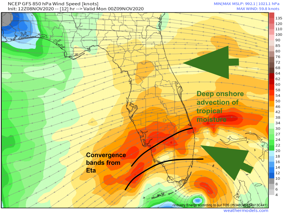
This heavy rain will continue to be a threat outside of the near-landfall zone, too, with a strong northeasterly low level jet arcing north of Eta pulling very moist air inland over Florida, where favorable jet dynamics and storm-related convergent banding will create widespread lift. 
This will continue southern Florida’s onslaught of rain, with up to 6″ of additional rain and corresponding flash flood potential likely over the next 24-36 hours as this regime continues.
After southern Florida weathers Eta’s rain, wind, and surge through tomorrow evening, there will likely be something of a respite as the storm moves far enough east for the heaviest rain and strongest wind to be away from land. But Eta won’t go away, instead getting stuck under an upper level low, well to the south of stronger jet forcing. This means the storm will stick around the eastern Gulf, likely slowly moving back towards the Tampa region of Florida by the end of the work week. Predictability here gets much lower as a function of time and the unpredictability that comes with such a weird upper level pattern, but there are still a lot of scenarios on the table, including a hurricane landfall along the central Florida coast to end the week.
Stay tuned to this blog and our twitter for more on this potential developing threat- hurricane season is not over!


