End Of The Month Pattern “Shake-Up”?
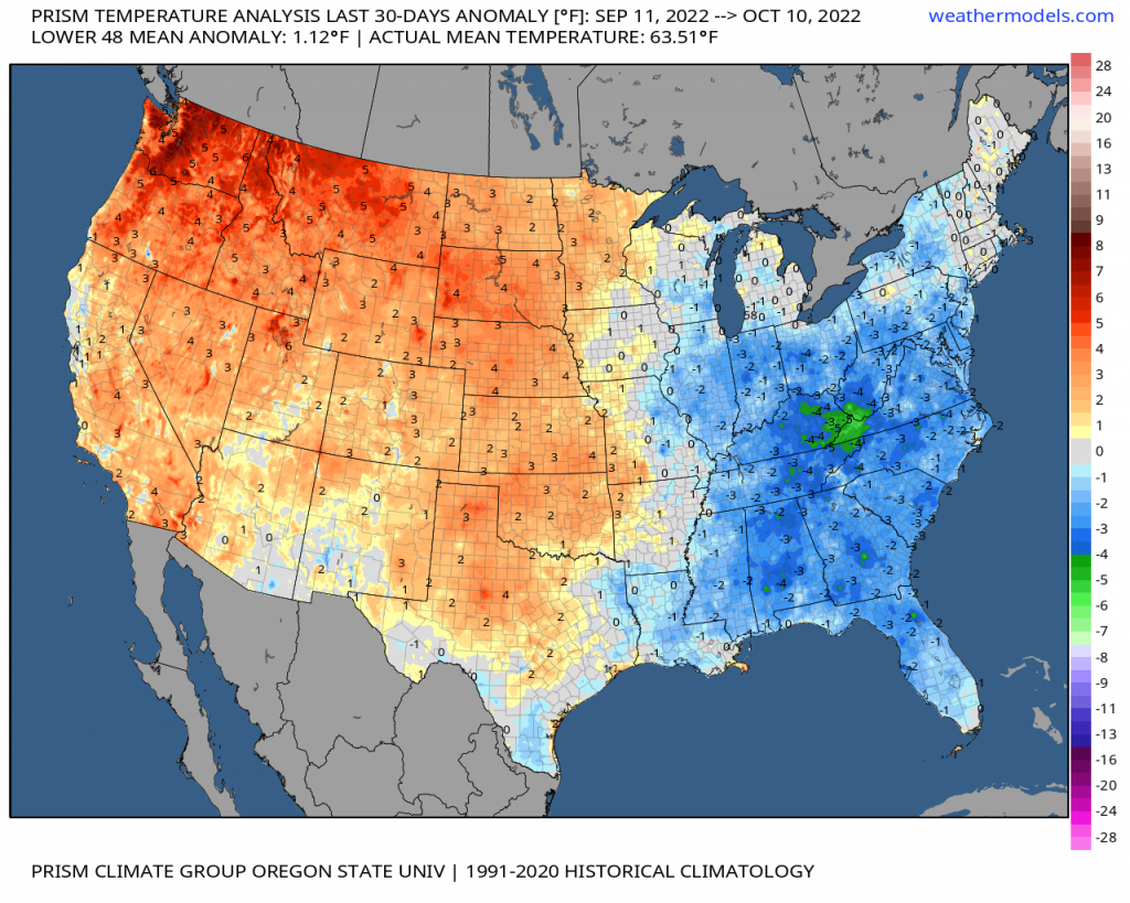
There is a growing probability in a temporary pattern change for the latter end of the Month, leading into the last 10 days of the October. With what has been a persistent temperature pattern the last 30 days as shown below from an anomaly perspective – and even extending back into the end of the summer with warmth west, cooler east; this looks to swap within the next 1-2 weeks. There appears to be a change across the Pacific where it’ll have a downstream effect on the U.S. pattern.

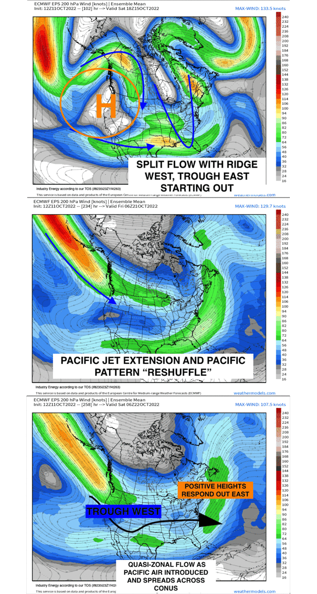
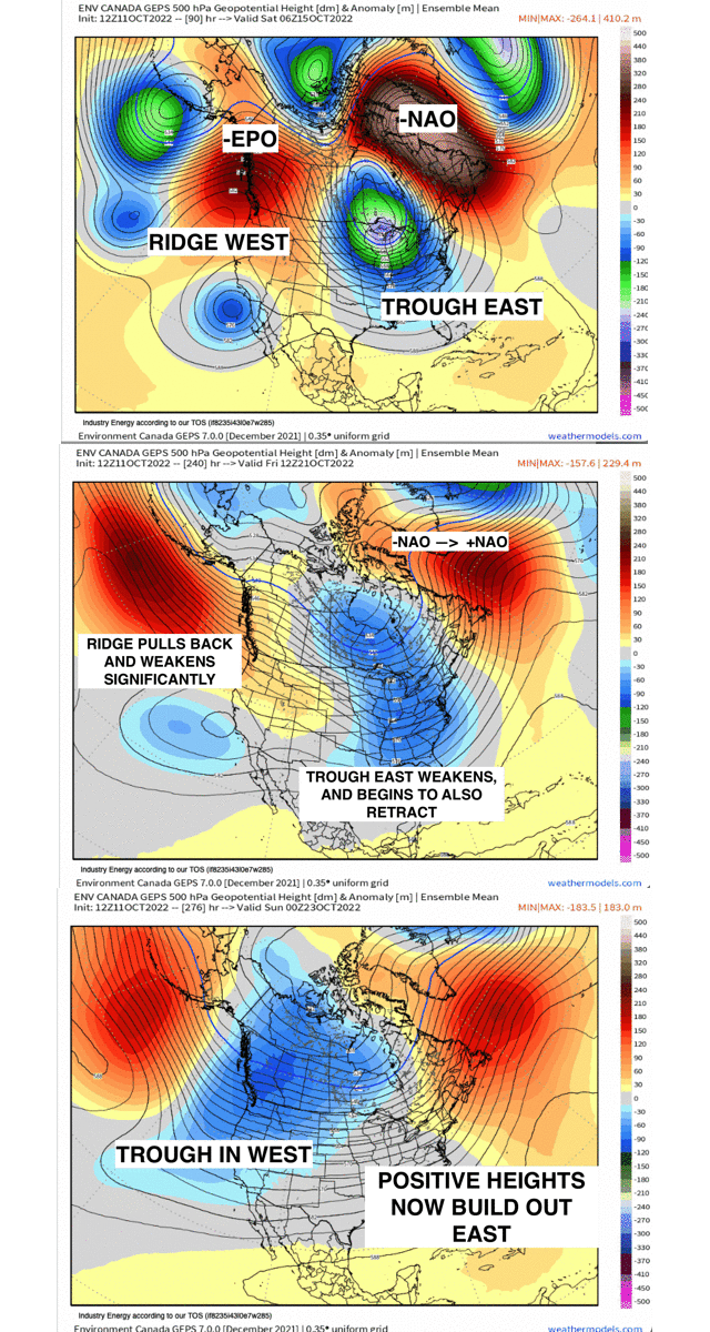
Below reveals both the upper-level jet of 200mb along with the z500mb geopotential height pattern. Initially, the current state of the pacific and rossby wave pattern is meridional (amplified) with a deep Aleutian trough and large-scale ridge nosing into Alaska and British Colombia – this sends constant troughs down and east of the Rockies and along with it, polar high pressure systems.
Toward the end of week 1 and into week 2, we’ll see a pacific jet extension, whereby the ridge across Alaska and British Colombia fades as the Aleutian trough pulls back and weakens. This cuts off the polar air “supply” since the ridge, or –EPO now flips toward a +EPO while we see a transition from a -NAO toward a neutral/positive NAO. The pacific jet that extends into the Southwest not only renders an active pattern for that region supplying moisture (which is a great thing!), but it ushers in milder air and allows for positive heights to build out across the East as displayed in the annotated 500mb gif below. This’d put many areas east of the Mississippi River Valley into in the very least, normal to above normal temperatures with the west entering into more of a below normal regime. This doesn’t necessarily appear to have “hit and hold” power, but it’ll be temporary from the looks of it barring any significant change. It’ll be a nice change of pace for a bit, especially since it’s fall and we’re not just there yet with winter “gloom”, so outdoor activities for places that largely haven’t been able to enjoy some milder days will get to experience those nicer sunny days soon enough!


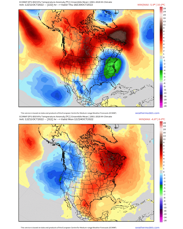
How this translates toward the lower portion of the atmosphere and the surface (using 850mb temperature anomalies) aligns nicely with the mid-upper level heights rather nicely! Notice the below average temperatures out east are replaced by average to above average temperature anomalies while we see the reversal occur conversely in the west.

A nice change of pace in terms of the general pattern that has been rather persistent for several months! With this type of pattern out west, we can expect wintry systems to begin to show up, especially for many higher terrain regions across the Rockies and Sierra Nevada to name a few.


