Elsa, Ragged and Sheared, Aims for the Gulf
It may be a holiday weekend, however, weather doesn’t sleep. Tropical Storm Elsa is still out there chugging along so this is your Monday afternoon update on the expected forecast.
When we last wrote about Elsa, there was a fair amount of uncertainty on track, impacts, and whether or not it would survive its journey through the Caribbean. Elsa’s center managed to “shoot the gap” between the more mountainous islands of the Caribbean, keeping it from being torn apart completely. It was not without lasting effects, though. Elsa weakened to a tropical storm with unusually high central pressure (currently 1006 mb) and became rather disorganized with very little recognizable structure.
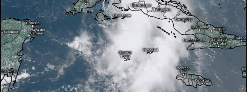
Southwesterly shear is also taking its toll on the storm:
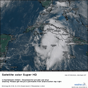
Elsa is rather lopsided – most of the convection is on the east side of the storm. While the center is not exposed, it is near the edge of the cloud mass. This is less than ideal, not only for the storm as lack of symmetrical distribution of convection precludes intensification, but for future impacts. If Elsa remains skewed, the heaviest US impacts will be felt to the east, over land – the Florida Keys/Peninsula.
Elsa is expected to make landfall in Western Cuba within the next few hours. Western Cuba is likely the best area for a storm that wants to survive to cross this island. There is only a narrow strip of land to traverse. In addition, most of the rough terrain lies in central and eastern Cuba. The circulation will past west of it, avoiding disruption and possibly even gaining a convective boost from orographic lifting.
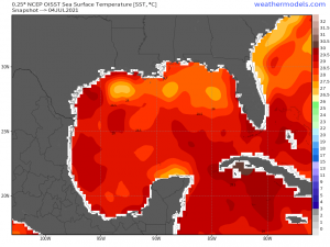
If it can cross quickly and remain relatively intact, it will emerge into plenty of warm water in the Gulf between Cuba and the Florida Peninsula.
The official track has been shifted slightly west which would give Elsa a little more time over water.
Normally, this would be ideal for strengthening. Unfortunately for Elsa (and fortunately for those about to be affected), moderate westerly shear is expected to persist and will likely limit any serious intensification. Is some intensification possible? Well, yes, of course. We’ve seen a few storms strengthen in warm waters while affected by shear. Significant intensification, however, is extremely unlikely and most models keep Elsa at tropical storm strength through US landfall.
As with the other storms we’ve seen so far this season, it doesn’t have to have the “hurricane” title for it to be impactful. Heavy rain leads to freshwater flooding, storm surge leads to coastal flooding, and southeasterly flow on the right front quadrant of the storm leads to the possibility of a few tornadoes.
As of the current official forecasted track, populous areas like Tampa would fall inside this quadrant. Tampa Bay is particularly prone to flooding from storm surge as the narrow mouth of the bay acts like a funnel, allowing the surge to pile up in rather small area. The current surge forecast from the NHC for this area is 2 to 4 ft. Residents prone to flooding from this amount of surge should make plans accordingly – if you aren’t already aware, find out which “zone” you are in and whether or not this amount of surge places your property in danger.
All those in the projected path should use the remainder of today to prepare as effects from the outer bands of Elsa are already being felt in the Florida Keys.
We’ll keep you updated on any new developments and Jacob will have a new blog out tomorrow with any changes to the forecast after Elsa crosses Cuba.


