Elsa Becomes the First Hurricane of the 2021 Season – US Impacts Still Uncertain
In a bit of a surprise move, Elsa has become a hurricane as of this morning.
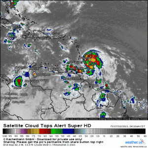
If you’ll watch the cloud tops loop a few times, you’ll notice a couple of “hot towers” (areas of deeper convection) rotating around the center. You’ll also notice that, despite the roadblocks to intensification Jacob mentioned yesterday in his blog – namely shear and a fast forward speed – Elsa has managed to fire significant convection upshear which is a clear indication of a move toward intensification. This little storm is fighting hard to endure.
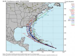
Despite the sudden intensification, guidance is still a bit murky on Elsa’s future path.
While there is still some general disagreement amongst the models, I will note that in the past 24 hours, there has been a *slight* shift in agreement toward a more western solution. This is likely a product of Elsa’s intensification and the forecast strength of the Bermuda/Azores High. As currently modeled, this high will block any exit into the Atlantic, forcing some sort of interaction with the Eastern Gulf.
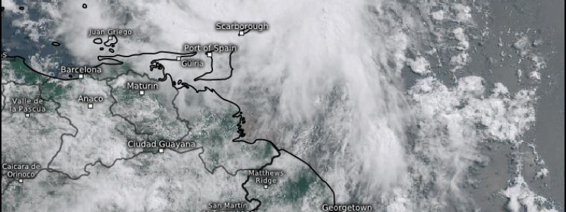
Elsa will next have to move through the Caribbean. This could be the part of it’s journey that makes or breaks it.
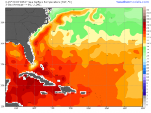
Land interaction and time over warmest waters are going to be key here. The mountainous islands of the Caribbean are notorious hurricane killers. If Elsa is able to navigate around/in between the islands instead of crossing them directly while staying over the warmest waters, we could very well see an intact storm emerge in the general vicinity of Florida. As of now, some of the models suggest that Elsa will try to do just that. Of course, that can change.
Right now, it is mostly a waiting game:
- We’re waiting to see how Elsa evolves amidst westerly shear and a fast forward speed – how much will these factors impede further development? Will the storm weaken, maintain strength, or intensify?
- We’re waiting to see what happens in the Caribbean – what sort of land interaction will there be? Is it enough to destroy the storm? If minimal land interaction, will it strengthen over the warm waters and, if so, how much?
All of these factors will influence what sort of impact the US sees early next week. Nevertheless, it would be prudent for those with interests in Florida and the East/NE Gulf Coast to begin preparing in case you should need it. Better prepared than sorry, in my opinion.
In the short term, heavy rain is likely to incite flooding and mudslides on these small Caribbean islands. It does not take a powerful hurricane for significant impacts to be seen here.
So, just to sum up: US impacts are uncertain due to questions about land interaction and unfavorable conditions (forward speed, shear). Those with interests on the Florida coasts and the NE Gulf should prepare in case it is needed as time to make decisions will likely be short, given the speed of the storm.
We’ll keep you updated with any further developments!


