Early Spring Severe and Flood Risk
A persistent southwesterly flow under a stalled boundary draped over the Midwest will bring us a variety of “fun” weather this week. That is, before the boundary finally pushes through by week’s end and we go back into the freezer. Fun, right?
This week will feature a couple rounds of severe storms, a flood risk, and much-above-average temperatures in the warm sector while threat of heavy snow and ice exists for the cold sector.
In this blog, we’ll talk about the severe threat and the flooding risk.
Severe
Much like last week’s severe event, this will be a late evening into the next day type of event.
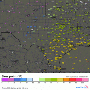
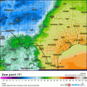
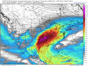
Already we see moisture steadily working its way northward.
If you look at western Texas, you’ll notice very low dewpoints.
This dryline will migrate eastward throughout the day and will eventually assist in convective initiation this evening. The threat will then persist into the overnight hours.
Storms are forecast to remain elevated at first. As they travel east and encounter more favorable conditions, strengthening is expected. Though there will be a cap in place early, instability, along with the forcing via the shortwave, is expected to be enough to allow the formation of a few stronger storms.
A messier, multicellular mode is likely given that forcing is needed to break the cap, however, sufficient mid-level lapse rates indicate that hail can be possible in the storms that are able to form stronger updrafts.
Like last week, given the less discrete mode, damaging winds will be the main threat. A few tornadoes are possible IF storms can strengthen enough – especially with 0-6 km shear of ~55 to 60 kts.
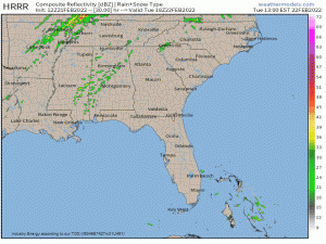
The activity will decrease some toward dawn before picking up again in the afternoon hours on Tuesday. Again, like last week, we’re looking at the greatest threat being in the area of eastern AR, the northern half of MS, NW AL, western TN, western KY, southern IL, and SE MO.
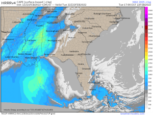
This event is actually fairly similar to last week’s event. Instability is expected to be on the lower side and dependent on any daytime heating via breaks in the clouds.
This once again suggests a more favorable zone of CAPE in the MS/AL border region, where we saw activity ramp up last week.
Changing topography in Central Alabama due to the presence of (very low) foothills to the Appalachians can often lend extra shear or a slight lift to storms, making tornado formation in this zone more likely. I’d watch the area from the MS/AL border to Central AL for development – similar to last week.
Unlike last week, lapse rates are expected to be much better. This indicates a slightly larger risk for hail, especially in the more discrete storms with stronger updrafts. Colder air aloft would also increase the likelihood that a storm can strengthen. One of our “issues” last week is that the lapse rates were terrible and storms didn’t have the ability to grow and become more powerful.
With the presence of a little greater instability, some short range models suggest that open warm sector development is a possibility. As these pockets of instability break through the cap, a discrete mode would be most likely. In this case, these storms would hold the highest possibility of both hail and tornadoes. The threat would then transition to mainly damaging winds as the main line sweeps through in the late evening hours.
It’s important to note that this scenario does require pockets of higher CAPE, as mentioned above. If we don’t see breaks in the cloud cover lending additional daytime heating, a convective line with little to no discrete cell activity preceding it becomes more likely. Discrete cells forming are contingent on enough instability to break the cap ahead of the main forcing.
As always, have multiple ways to receive warnings. Much of this activity will take place in the evening and overnight hours today and then in the late afternoon and evening hours tomorrow. You’ll want to be weather aware and ready to shelter no matter what time of day it is.
Flooding
I want to quickly touch on the flooding potential with these waves of rain and storms. Flooding often gets overlooked in severe weather and, honestly, it has the potential to do much more damage than a single tornado.
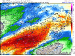
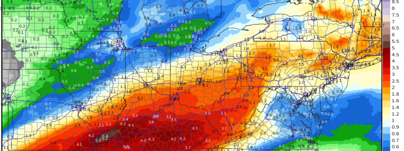
As this moisture is advected in from the Gulf, it will come up against a stalled boundary across the Midwest. This will provide a focus for the heaviest rain with the highest totals then falling in northwestern Kentucky and northern Tennessee.
The fact that this rain will fall over 4 or 5 days will likely mitigate the flash flooding risk some. The exception would be in heavier thunderstorms or if storms begin to train.
River and stream flooding, however, is a concern. Many of the waterways in this region are already running high due to recent rains and snowmelt. Additional heavy rain will likely cause some to overtop their banks by mid-week, if not sooner.
Check your local river/stream levels. If they’re already running high today and you’re vulnerable, have a plan to evacuate should you need it. This will be a long-fused event. Waterways that are fine tomorrow may not be fine by Thursday.
This week is Severe Weather Awareness Week! Look for a special blog out on Wednesday addressing awareness and how you can be prepared ahead of the Spring severe season!
