Earliest E Storm in Atlantic History, Currently Approaching Antilles, May Pose a US Threat
This morning, a rather insane meteorological feat was confirmed as tropical storm Elsa became the fifth named system of the 2021 Atlantic hurricane season. This makes Elsa the earliest forming E storm, snatching the trophy from a storm called Edouard that formed on July 6th… 2020. Hopefully, this is the first and last of the previous year’s hurricane records we break.
Like last year, the first four systems of 2021 have all been fairly messy and weak tropical storms, though Claudette did tragically cause several deaths in the Southeast. This is a streak Elsa could feasibly break as it churns eastward through the west-central Atlantic.
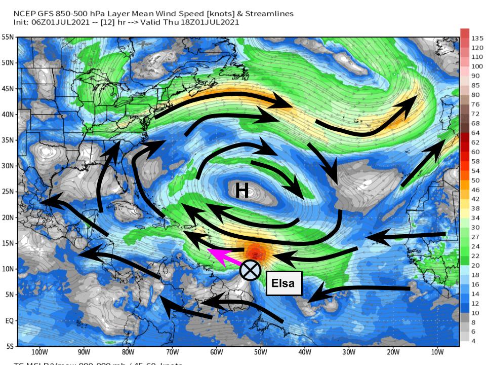
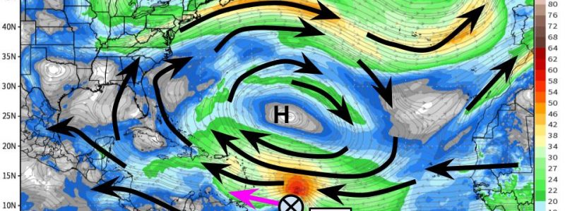
The tropical storm formed in a fairly unusual location for so early in the season, a part of the Atlantic known as the ‘main development region’, or MDR. A large, well stacked anticyclone currently sits over the north-central Atlantic with an attendant belt of anticyclonic midlevel flow, north of the MDR. This midlevel dome of high pressure will control Elsa’s steering almost entirely in the short term.
Modeled 850-500 mb shear can give us a good indication of what’s steering Elsa. Sometimes, forecasters have to pay close attention to the specific pressure levels used based on storm’s intensity, which can be especially difficult with immature cyclones like Elsa. Luckily, with such a well-stacked anticyclone, that won’t be a very important consideration.
With this in mind, the short-term motion of the storm will be brisk and just north of easterly as it remains to the south of the intense anticyclone.
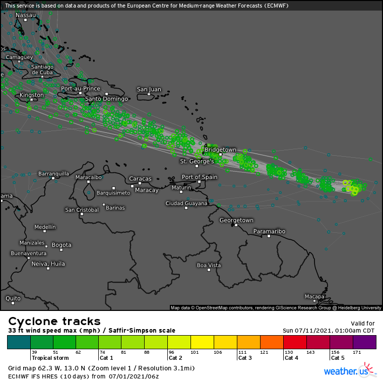
Ridging will maintain itself through the medium term, but the westward moving cyclone will quickly outpace its axis. By the end of the week, expect Elsa to take on more of a southerly component as it rounds a trough-induced weakness in the trough. This dynamic process leads to inherent uncertainty in track after the storm clears the Lesser Antilles. So far, there’s no signal that stronger storms will systematically steer differently than weaker storms in ensemble spread, as shown below, but it’s still important to understand how Elsa’s intensity will evolve.
As you probably remember from last year (how could anybody forget?), hurricanes are finicky beasts. This notion goes for both intensification and weakening, both of which are not always modeled well. This means that apparently simple questions like “will Elsa strengthen over the next 24 hours” are not as easy to answer as it may appear.
Conceptually, a tropical cyclone will strengthen if it can efficiently convert warm surface water to energy, and will weaken if it cannot. The main supporting factors for this efficiency are sea surface temperature and depth, high relatively humidity, and favorable venting aloft. The main inhibitors are dry air, cool SSTs, and unfavorable convergence aloft. Structure also makes a huge impact on this efficiency of energy transformation, which means factors like wind shear that disrupt storm organization can prove quite detrimental to storm intensification.
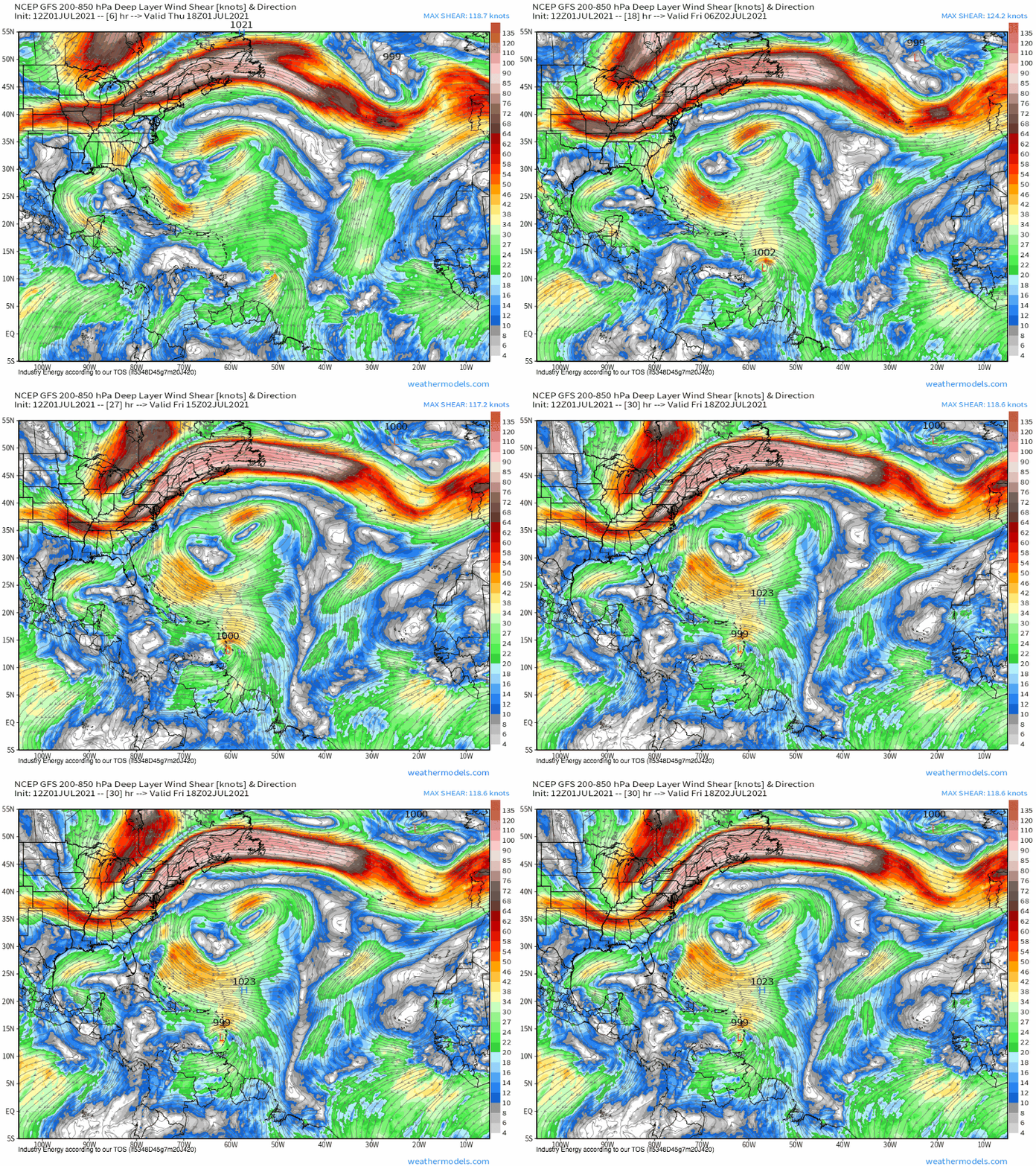
In the near term, moderately favorable relative humidity and warm SSTs will keep the storm in a thermodynamic environment favorable for strengthening. But the kinematics tell a different story- the rapid easterly motion of Elsa, paired with moderate westerly shear, could threaten to disrupt the fragile structure of the still weak storm, as it feels shear equivalent to the sum of forward speed and bulk winds.
If there were dry air upshear of Elsa, I would call it game over for the storm. But ironically enough, a cluster of the low-RH air common in the MDR this time of year will be outpaced by the speedy storm, which should keep it in an environment moist enough to prevent substantial weakening even with disruptive shear. Speed kills, but speed also saves.
I’ll be watching for two things: the ability of sneaky low-RH air to develop upshear and wrap into the storm, and the willingness of convection to form upshear. The former will leave me bearish on near-term intensification; the latter bullish.
The sum of all of this thinking? Expect steady strengthening to a strong tropical storm over the next couple days, with intensity waxing and waning as the storm battles shear. Should shear/dry air win, expect weakening and possibly even opening up of the system in the natural divergence zone of the east Caribbean. Should the storm win, hurricane intensity *could* be achieved by the weekend.
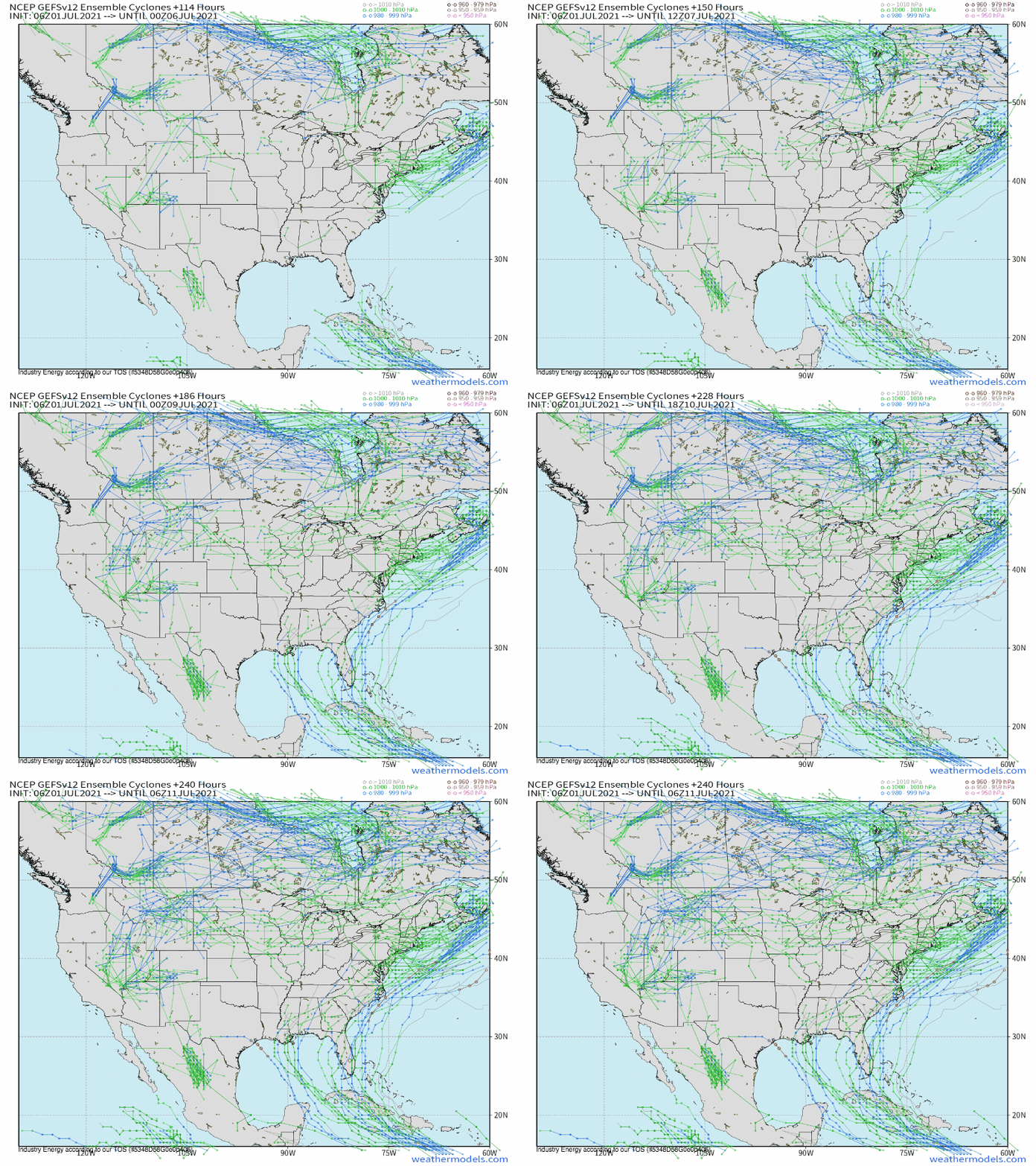
After crossing the Caribbean, Elsa will probably impact Cuba as a strong tropical storm, with aforementioned uncertainty potentially leaving intensity a couple notches higher or lower than this estimate. Interactions with the mountainous island and the midlevel ridge will prove crucial here, but there is a solid chance Elsa remains strong enough, and in the right place, to either impact Florida or move into the Gulf. It’s still too early to say more, but Floridians should keep an eye on the storm, and others in the Southeast shouldn’t “let it go” quite yet. Stay tuned.
