Dynamic System Brings Multiple Hazards
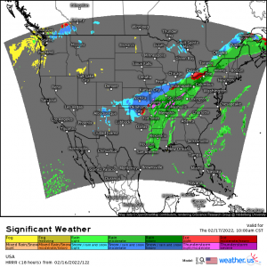
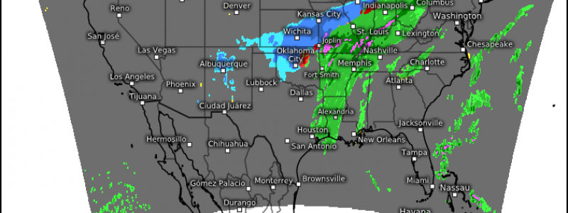
As expected, a dynamic system will bring a variety of weather to the eastern half of the US over the next 48 hours or so.
From possible severe weather in the warm sector, to ice where the warm sector meets the cold sector, to all snow in the cold sector – impactful weather is expected. In fact, some, like Oklahoma City for example, have the potential to go from a nocturnal severe threat to snowflakes in the space of 7 or 8 hours.
Let’s take a look at the severe threat since at least part of it is expected to be an overnight event.
Wednesday Late PM to Thursday Early AM
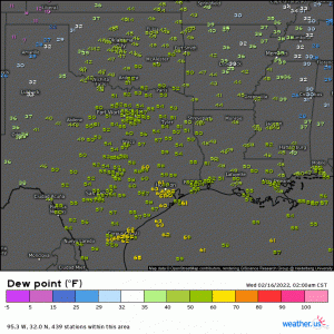
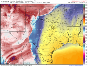
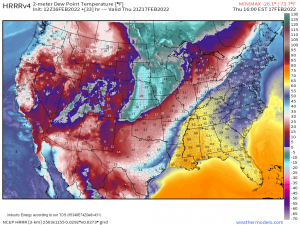
Moisture advection is already well underway this morning as dewpoints in the 60s steadily crawl northward.
As our upper level support descends the Rockies this morning/afternoon and undergoes surface cyclogenesis, storms will begin firing off a dryline in northwestern Texas late this evening.
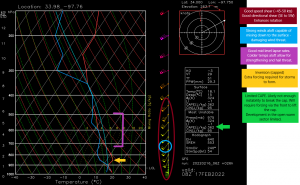
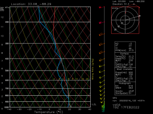
As they make their way east, they’ll encounter a warm, moist environment capable of supporting severe weather. Let’s take a look at a forecasted sounding to get an idea of what sort of hazards we can expect.
I tried to color code my notations on the Skew-T for easier comprehension, so hopefully that will help out.
As noted above, we expect to have more than adequate speed shear and directional shear. This indicates a tornado threat if storms can strengthen. Embedded supercells or QLCS spin-ups are the most likely scenario.
Strong winds aloft indicate a damaging wind threat should they mix down to the surface. This will be the primary hazard.
Good mid-level lapse rates are present – colder air aloft allows a storm to strengthen quickly plus introduces the threat of hail.
Limiting factors:
An inversion, or cap, is expected to be present. We will need enough instability to break the cap before storms will form.
CAPE is expected to remain on the lower side. This indicates somewhat limited instability and suggests we will likely need extra forcing to break that cap. The forcing will be available in the form of the cold front. Storms will likely be confined along the front in multicellular/QLCS mode and any open warm sector development will be limited.
Just because a somewhat messier mode is expected vs discrete supercells doesn’t mean impactful weather isn’t possible. As discussed above, all hazards are on the table.
Compounding this threat is the fact that this will be an after-dark, overnight event for many. Convective initiation isn’t expected until midnight or later. Have multiple ways to receive warnings including AT LEAST one that will wake you if need be. Perhaps even consider sleeping in your safe space tonight if you’re in the risk area. This will cut down on the time it takes to move from bed, round up the family, and move into said safe space.
Thursday Afternoon/Evening
This threat will continue eastward through the day Thursday.
The higher dewpoints, and therefore best instability, will remain limited to the Deep South – namely Louisiana, Mississippi, Western Tennessee, and Western Alabama. Though the severe risk extends into the lower Ohio Valley, the best chance of more impactful severe weather will be in the aforementioned locations.
Showers and thundershowers are expected to be ongoing in the morning hours ahead of the front. This means widespread cloud cover will likely put a limit to any extra instability added through daytime heating. However, should there be any substantial breaks in the cloud cover, instability could be boosted on a mesoscale level. We’ll have to see how that plays out during the day tomorrow.
Once again, the expected lower instability ahead of the front means that we will need the forcing from the front to initiate any severe weather. Like the night before, multicellular to linear modes are expected with possible embedded supercells.
This time, while we retain good speed/directional shear conducive to a few tornadoes and strong winds aloft to facilitate a damaging wind threat, our mid-level lapse rates aren’t that great meaning the hail threat will remain limited.
Damaging winds will remain the primary threat through the duration of the event though likelihood and severity is expected to trend downward into the overnight hours as the system passes over the Appalachians.
Still, if you are in any part of this region and included in the severe weather outlook, have ways to receive warnings. Mesoscale processes that can’t be forecast beyond the day of an event can often enhance things like rotation or instability leading to weather slightly more severe than expected.
Everyone remain safe and make sure you’re prepared and ready to receive warnings!
