Dual Thunderstorm Threat Possible Today
As an anticyclone pours into the middle of America today, sufficient overlapping of moisture and kinematics necessary to sustain severe thunderstorms will be difficult to come by. However, two regions will prove it is not impossible.
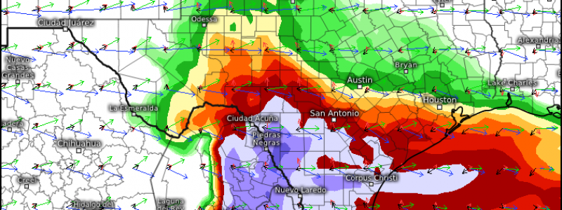
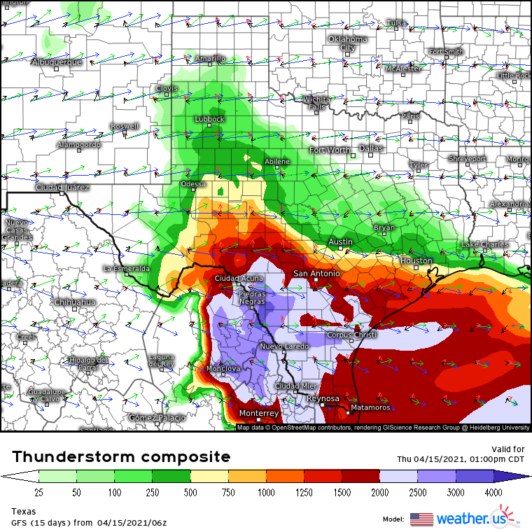
The first will occur over Texas, incentivized by a diffuse midlevel low smacking into ridging as it traverses southeastwardly today. It’ll incite cyclogenesis over a temperature gradient wedged along southern Texas, which will in turn promote a fairly widespread shield of showery precipitation across the state. With moderate wind shear, plentiful instability at the hands of large column moisture and a powerful EML, and some degree of turning winds aloft, a fairly supportive environment for supercells will develop, increasingly favorable by mid-afternoon.
But hold on to your horses- what looks like a great tornado environment at first glance will actually almost certainly fail to drop a single twister. The reason is that, safely to the north of the surface stationary front imbedded across southern Texas, flow near the ground will be directed from the north. The result will be cool, stable surface air amidst unusually curved winds with height, quite unfavorable for supercells to develop that are surface-based. This will effectively preclude a tornado threat, and will make it much more difficult to transport strong wind gusts to the surface.
Hail, though, once formed, has no trouble falling through stable, backed surface flow. Any hail that is able to develop in the elevated supercells will have the potential to pack about as much of a punch as any Texas supercell hail, with several storms containing stones exceeding 1″, and some exceeding 2″. This threat could well prove expensive and dangerous.
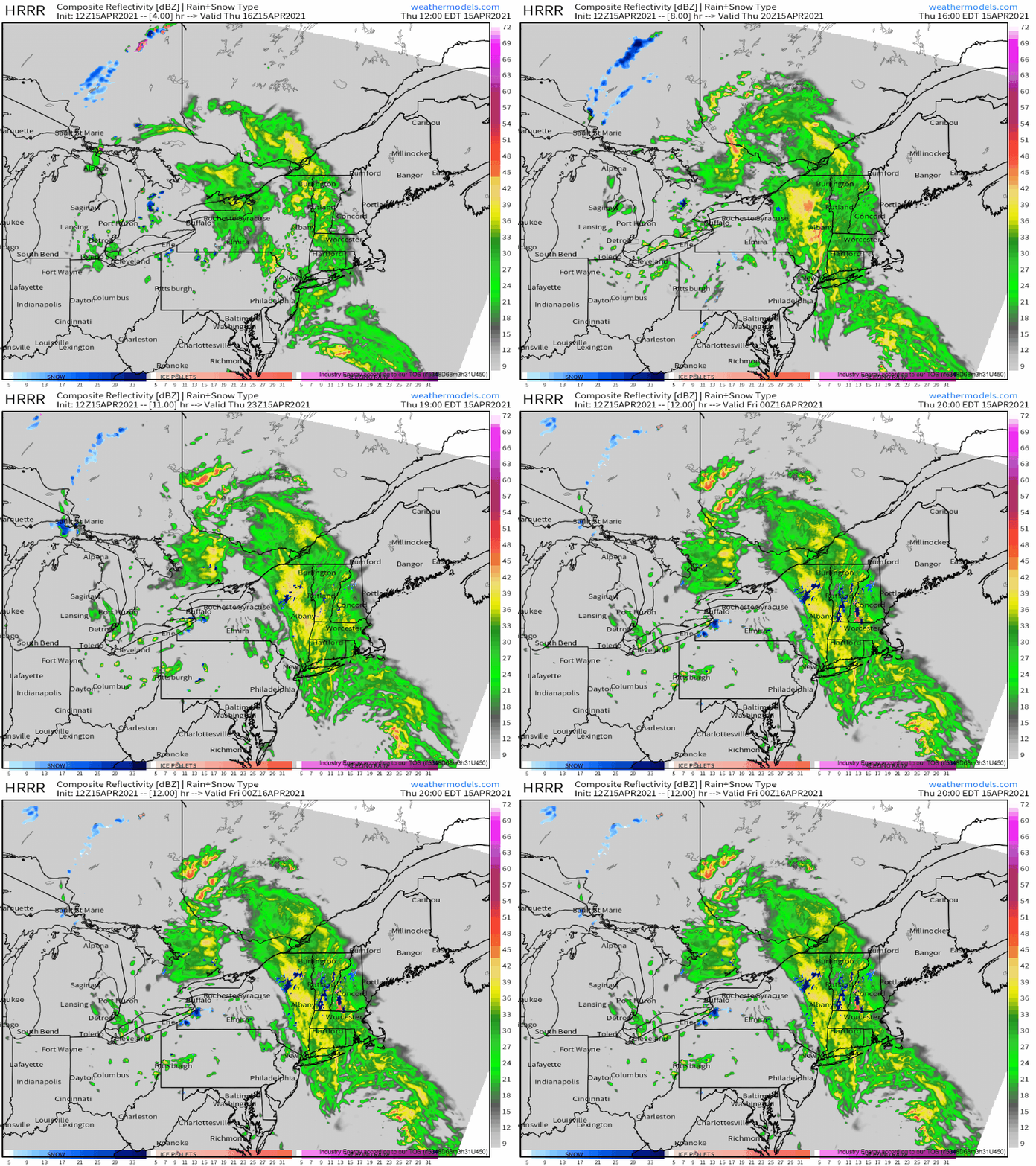
The second severe threat today will develop ahead of a much more intense midlevel cyclone bowling southeast into New England.
Impressive divergence and a sharp temperature gradient associated with the midlevel cold air ball will allow a strong cold front to surge east through the northeast beneath an intensifying surface low today. There isn’t much going for meaningful destabilization, with widespread rain, low temperatures and dewpoints, and dense cloud cover. However, the favorable lapse rates promoted by frigid midlevel temperatures will be just enough, when combined with sharp forcing and fierce shear, to get a low-topped line of surface based convection going.
Now, the storm prediction center hasn’t highlighted a risk area for these storms, but there’s certainly a medium chance of some strong wind gusts as these storms potentially pull strong midlevel flow to the surface.
Stay tuned to the storm prediction center and our twitter for updates on these two threats!


