Dual Severe Threat Targets Both the Plains and the Upper Mississippi Valley Tonight
The severe threat that we have been mentioning for the last two days has indeed materialized and will occur later today. However, in a bit of a surprise development, we have not one, but two separate areas to watch today for severe weather.
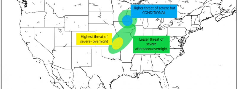
While a large part of the Plains into the Midwest has a marginal risk for severe weather, we will see our highest risks in two different locations: NE Iowa/SE Minnesota and E Kansas/SW Missouri/N Oklahoma. We will address these separately as they are very different.
NE Iowa/SE Minnesota
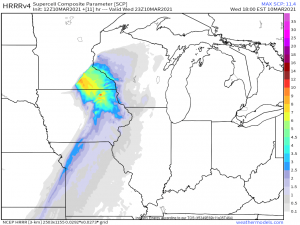
This threat was a bit of a surprise. For the last day or so, the HRRR, which is known to be a bit bullish with severe parameters, had been hinting at rising heat levels/dew points here leading to an environment conducive to severe weather. This will be a CONDITIONAL threat as, right now, temperatures and dewpoints are hanging out in the 40s or very low 50s. We will need some breaks in the cloud cover and consequential daytime heating to kick up the instability and jump start any storms.
This scenario is becoming more likely as the morning progresses with breaks in the clouds showing on satellite imagery. If these gaps are able to persist, we could see some significant daytime heating leading up to the possible onset of this event later this evening. That brings us to another issue. Not only is this a conditional threat, but it will likely peak after the sun has set, perhaps as we move into the evening. It will be important to monitor the progress of this threat as we move through the day so no one gets caught off guard later should it reach fruition.
Assuming the HRRR is correct as to the extent of warming and subsequent destabilization, conditions will be prime for strong winds and even a few tornadoes as a surface low and the associated forcing approaches from the west. Questionable heating aside, deep-layer shear of 50 to 60 kts is in place along with lapse rates approaching 7 degrees C per km materializing later in the day. This area will also be under the left exit region of a mid-level jet which aids with lift. Should the HRRR be correct and destabilization occurs, CAPE could top out near/over 1000 J/kg. So really, everything is in place for a legitimate severe threat, we are just waiting to see if destabilization can indeed occur.
We will need to watch for the development of a few supercells early in the evening (maybe around 5 or 6 pm) ahead of the convective line that arrives later on. It will be in these that the severe threat is greatest, should they be able to form.
Even as I’m writing this, conditions continue to evolve and point toward this becoming a legitimate threat this evening. This is one to watch and may end up actually being the greater threat today.
If you reside in this area, be sure to monitor the development of this situation closely. Once again, most of the activity will likely occur after dark. Statistically, night time events have a higher fatality rate due to people being less weather-aware. Have multiple ways to receive warnings and don’t let your guard down.
E Kansas/SW Missouri/N Oklahoma
This threat is the one we’ve been talking about since Monday. Heat and moisture levels will increase during the day today, however, a cap is currently in place and expected to remain in place through the evening/overnight hours.
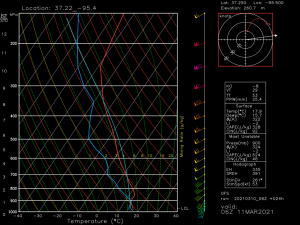
So, although adequate shear of 50 to 60 kts, steep lapse rates of 7 to 8 degrees C, dewpoints in the upper 50s, and CAPE topping 1500 J/kg is all likely to be in place, these, combined with the forcing from the approaching front is not expected to be enough to break the cap. Overnight, as the low level jet increases and the frontal boundary approaches, elevated supercells are possible with the main threats being large hail (due to the steep lapse rates and cold air aloft) and perhaps some strong gusts if they are able to mix down from aloft inside a storm.
Due to the cap, tornadoes are unlikely. Still, as the atmosphere is ever changing and evolving, I would still monitor this threat as the day progresses. Should anything change and result in enough destabilization or forcing to break the cap, more severe weather could occur, though it is unlikely at this time.
Again, this is an overnight threat, so monitor its evolution and have multiple ways to receive warnings as well as remaining as weather aware as possible through the night.
Enjoy the warmth during the day today, but don’t let your guard down as we move into the evening. Stay safe!!


