Dry Thunderstorms: Not Beneficial
It’s no secret that summer weather often equates to fire weather in the Western US. As drought conditions continue for much of the region, 3 large fires are currently burning.
These are:
- The Oak Fire – located near Yosemite National Park in California with ~19,000 acres burned and estimated 79% contained
- The McKinney Fire – located along the CA/OR border with ~55,000 acres burned and estimated 0% contained as of yesterday
- The Moose Fire – located in Idaho with ~58,000 acres burned and estimated 23% contained
(stats courtesy of USDA Forest Service)
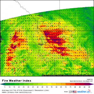
Thanks to the flow around a ridge over the Great Basin region, weather conducive to the rapid spread of wildfire will once again be likely today, especially in the lee of the Cascades and the lee of the Northern Rockies.
While these conditions – low relative humidity, dry vegetation, and gusty winds – rarely ever start fires (unless the wind blows down power lines), they can spread fire as mentioned above. Humans are the number one cause of wildfires in the US, mostly accidentally but sometimes through arson.
Another cause is something that would be assumed to be beneficial: storms.
As monsoon season continues in the southwest, a weather phenomenon known as dry thunderstorms become a concern for the drier areas on the fringes of the monsoonal moisture.
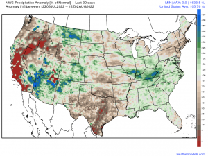
The last 30 days of monsoon activity has been good to the Southwest. Many locations have picked up rainfall in excess of 500% above normal. However, those on the aforementioned fringes remain much, much drier than normal – places like Central/Southern California and the lee of the Cascades. In these regions, waning monsoonal moisture can be dangerous rather than beneficial.
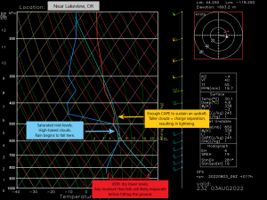
You may be thinking, “Well, moisture is good, right? It leads to rain.” Yes, but only if that rain actually reaches the ground. Let’s look at a sounding so I can explain.
- Moisture advected north is found in the mid-levels. This results in a very high cloud base (600 mb equates to around 15,000 ft).
- Enough CAPE exists to sustain updrafts. This is important for lightning. A taller cloud will allow the charges inside the cloud to separate (positive to the top, negative at the bottom).
- VERY dry lower layer. If you’ll notice the wind barb on the right side, you’ll see a roughly 20 kt wind out of the west. As this location is east of the Cascades, this is a downsloping wind that will dry as it descends, resulting in a large spread between the temp and dew point. Any rain that falls from the saturated mid-levels will fall into a very dry environment and likely evaporate before ever reaching the ground.
So, with all the ingredients above, we are set up for storms – but hold the rain. Any cloud-to-ground strikes hitting the very dry vegetation are in danger of being the spark to yet another fire.
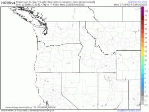
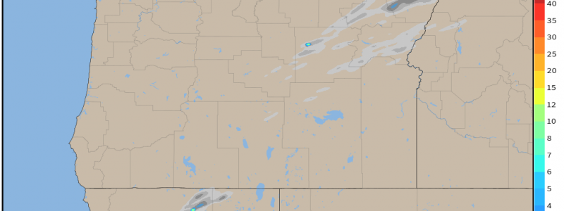
Isolated dry thunderstorms will be possible today, mainly in far Northern California and Central Oregon, east of the Cascades.
Though it is an isolated threat, as mentioned, it still isn’t great news as this is the region in which the uncontained McKinney Fire still burns.
The dry thunderstorm risk will wane after today, but fire weather conditions will persist for this region at least through tomorrow before the ridge shifts east and troughing arrives in the Pacific Northwest.
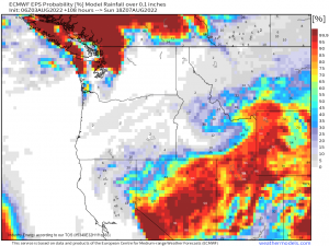
Looking ahead: though most of the work week will remain dry in this region, slight rain chances creep in by the weekend, perhaps bringing a small amount of relief to those fighting the already-burning fires.
