Drought Improves, Rain Continues
After focusing, and rightly so, on the Southeast yesterday as a handful of very dangerous tornadoes tore through the region, we’re shifting our attention back to the West Coast and its seemingly never-ending rain.
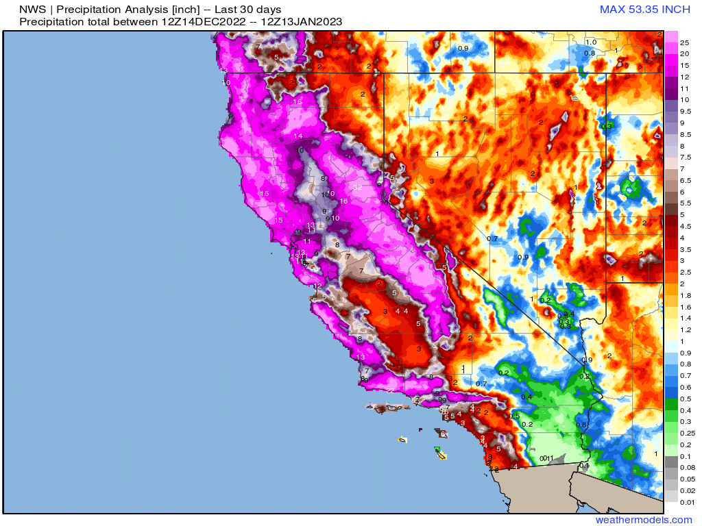
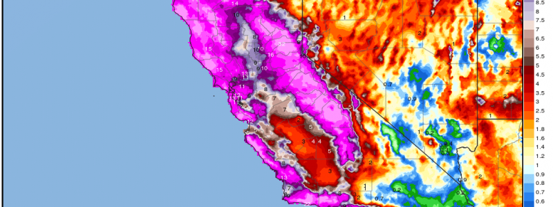
The 30 day rainfall analysis from the NWS is truly astonishing, especially for a region that typically doesn’t average more than around 12 inches of rain at best for the months of December and January – and with January not even half over, no less.
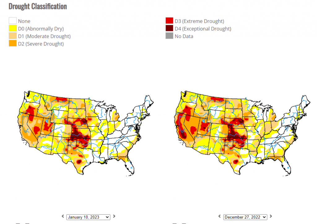
The upside to all of this rain is that, for the first time since April 14, 2020 (according to data available on the drought monitor website), no part of California is in Extreme Drought.
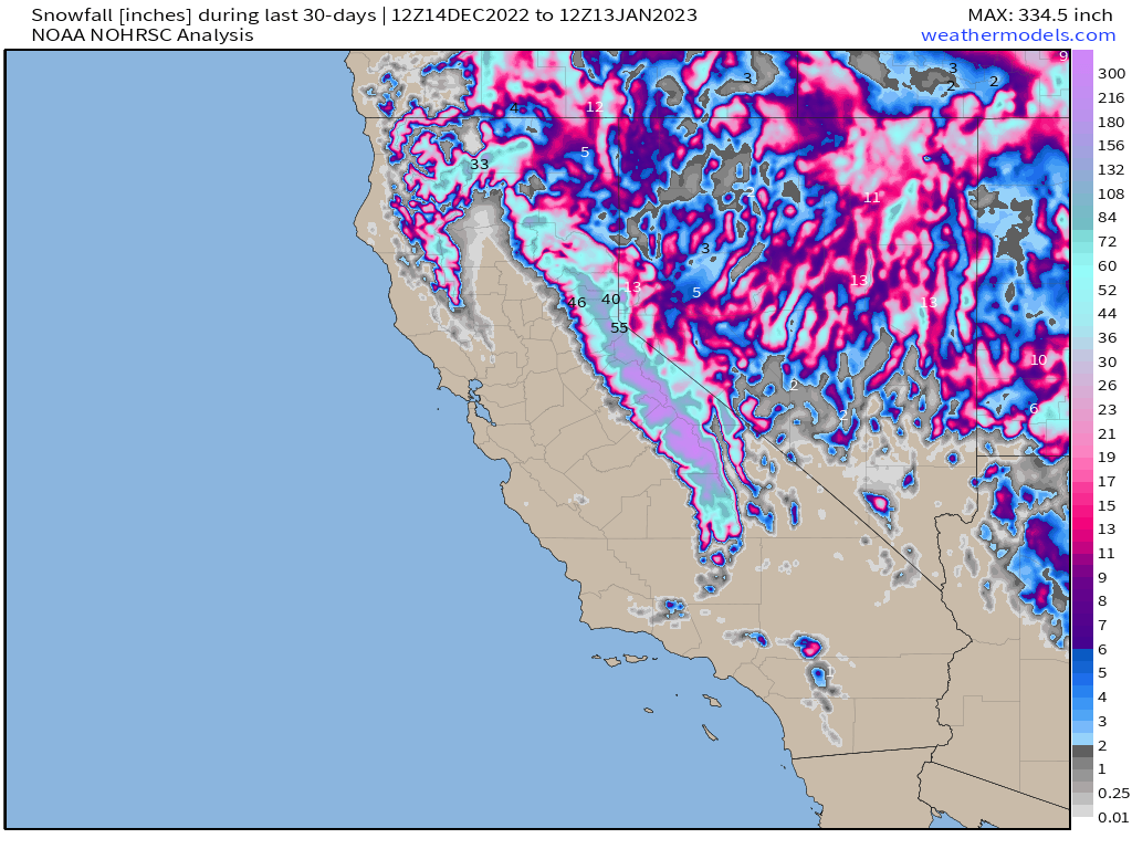
Another positive is the snowpack that has built up in the Sierra Nevadas. Over 300 inches of snowfall (in the highest elevations) has been recorded in the last 30 days.
This is great news for the water situation come spring. The snowpack will eventually melt and then provide replenishing waters for the lower elevations during the drier season.
The downside, however, is that this improvement to the drought situation has come at great cost.
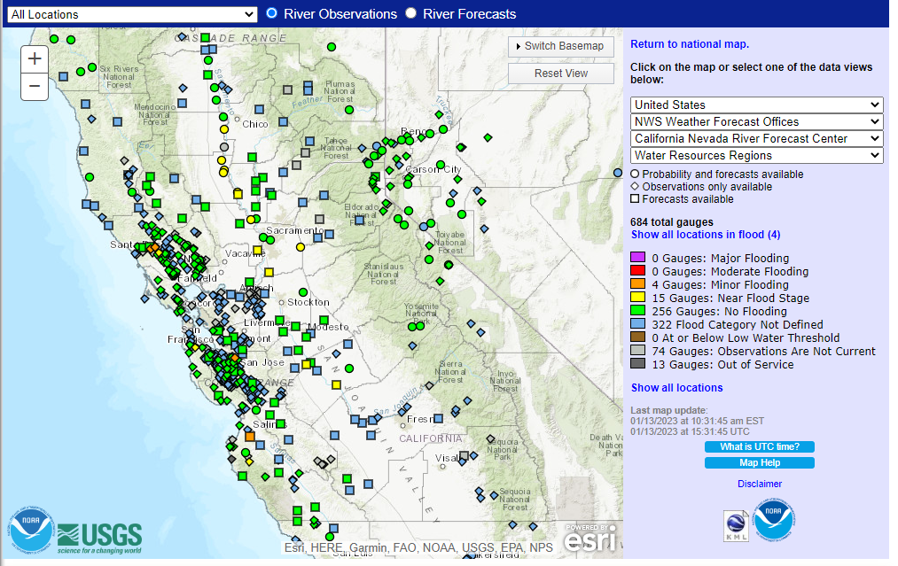
Though river levels have come down some since the strong Sunday/Monday event earlier this week, some still remain in minor flood stage. A few of these stations peaked at major flood stage.
Aside from river flooding, there have been numerous mudslides, debris flows, flash flooding, and coastal flooding that has wrought destruction up and down the state of California over the last 3 or so weeks.
I’m sure by now, most Californians are wondering if these atmospheric rivers are finally at an end or, at the very least, if there is a break ahead.
The short answer: Not quite yet.

The next atmospheric river event lurks not too far offshore. It will begin to move ashore early on Saturday and clear out in the morning hours of Sunday. Additionally, yet another AR will arrive later Sunday, lingering through Monday.
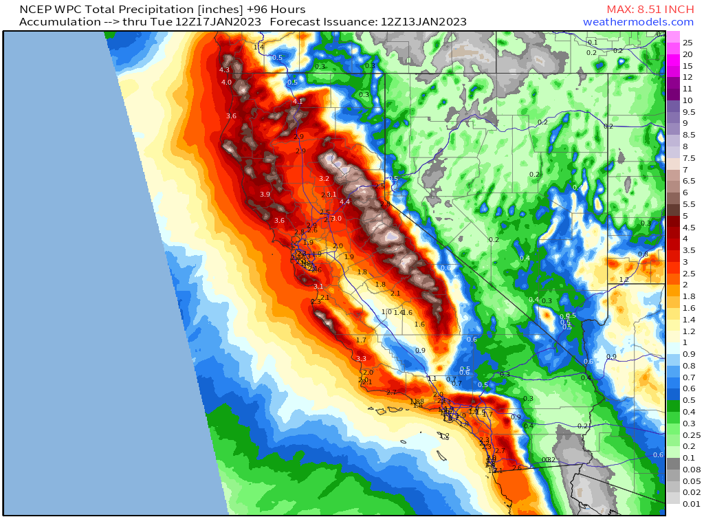
Unfortunately for this waterlogged state, these next two ARs could result in another widespread 3+ inches of rain through Tuesday morning. This will likely result in more flooding – both river flooding and flash flooding.
However, a glimmer of hope is in sight.
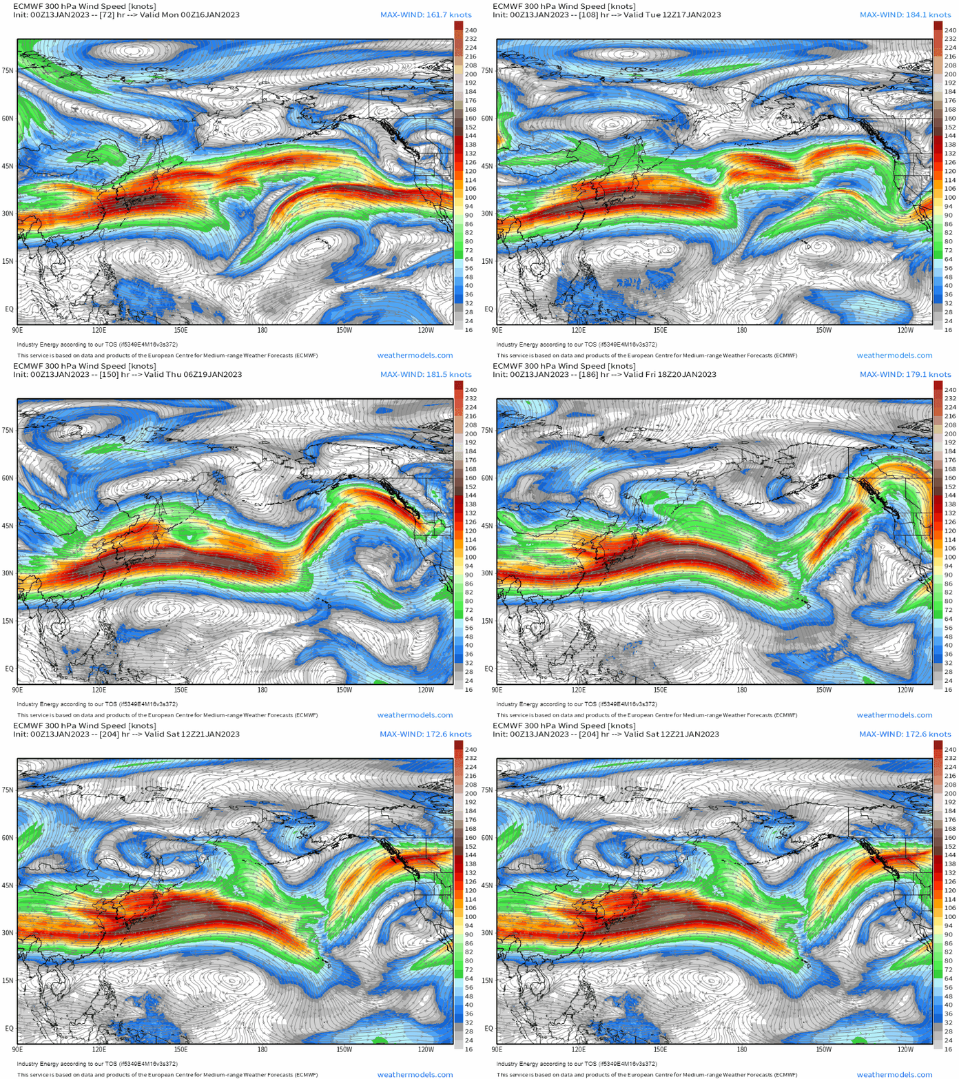
After Tuesday, high pressure will slowly start to build into the Southwest US off of the Pacific. In response, the Pacific jet that has been relentlessly aimed at California will lift north. The never-ending parade of storms will stop, and the region will have a chance to dry out as high pressure lingers.
While ensembles do not currently agree on the duration of the dry spell, they do agree on at least a fairly decent stretch of dry weather – perhaps a week? At this range, it’s not certain. What is certain, however, is that respite is coming, hold on just a little longer!


