Dreaming of a White Christmas: First Look at the Christmas Eve 2020 System
No doubt by now y’all have heard rumblings of a Christmas storm. Well, that much is true. There will be a system that comes through Christmas Eve into Christmas Day, however, there are a few aspects of the forecast we aren’t sure of yet. Let’s start off by taking a look at what we know so far.
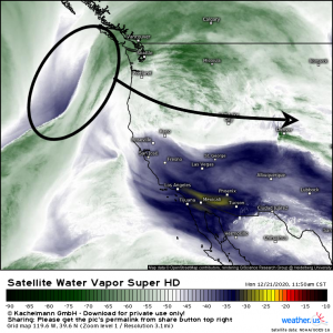
Right now, the main “piece” to our storm is still over the Pacific Ocean. Much like last week’s storm, some of the uncertainty stems from the fact that we haven’t been able to sample the environment for this energy yet. Once it comes ashore overnight, radiosondes will be launched, data will be gathered, and the forecast will come into sharper focus.
Over the next two days, this area of energy comes ashore and moves across the northwest and off the eastern side Rockies where it undergoes lee cyclogenesis and becomes our storm. From here, guidance differs on what happens next.
GFS:
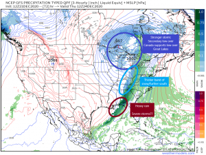
The GFS develops a stronger system. A stronger low = more rising air = more precipitation which means more in the way of total accumulation where that precip falls as snow. It also funnels the cold air south faster bringing the chance of more than just flurries to some of the southern states. Strong storms will be possible beginning Wednesday along the western Gulf coast and then Thursday along the Florida peninsula. The GFS solution suggests a weaker low level jet and less instability than the ECMWF though, which translates into less of a severe threat.
About that snow:
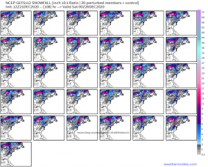
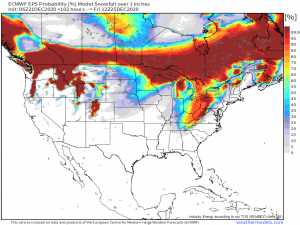
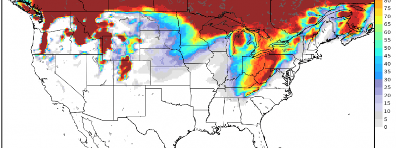
Since the GFS develops a stronger system, it also comes in a bit heavier with the snowfall totals. It also suggests the possibility of an inch or more across places as far south as Eastern Tennessee as well as heavy totals around the Great Lakes enhanced by lake-effect snow on the back side of the front.
ECMWF:
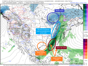
The ECMWF develops a warmer, weaker storm over the Great Lakes but a somewhat stronger solution on the southern end.
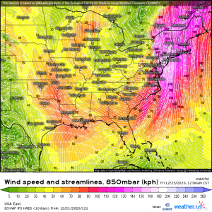
A stronger low level jet advects more moisture in which translates to heavy rain. Combine this with decent instability along the coast and you get a severe threat beginning Wednesday in the western Gulf and moving east throughout the day Thursday. The instability will be confined to the immediate coast, however, so we aren’t looking at a widespread severe outbreak.
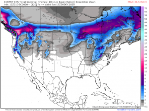
On the northern end, a weaker storm = less rising air = less precipitation, so the ECMWF is leaning toward much less in the way of snow accumulations.
Ensemble forecasted totals are light with the heaviest being around the Great Lakes where lake-effect snow gives a boost. Chances for more than an inch of snow aren’t exactly the best for this solution.
Regardless of which scenario plays out for the Great Lakes and the south, a couple of things are more or less a given.
First: the northeast looks to stay on the warm side with mostly rain for all of the major cities.
A powerful low level jet will advect warmth and moisture in ahead of the cold front. Winds will be gusty. Temperatures will surge into the 60s along the coast/50s inland. It’s possible that most, if not all, of the snowpack from last week’s storm could be melted at this time. Heavy rain may be seen, especially across the higher terrain through orographic lifting. Flooding could become an issue as meltwater and precipitation combine.
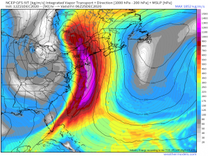
Integrated Vapor Transport imagery suggest that an atmospheric river may set up over New England bringing rainfall totals of 2 to 3 inches. Heavy rain and water from melting snow combine to create very soggy ground. Add high winds on top of that and we could be looking at power outages throughout New England as trees are blown down. Not a certainty, of course, but something to keep in mind.
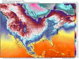
Second: Temperatures behind the front will be sharply colder as an arctic air mass settles in.
(gif) Link
Temperatures will drop 20 to 30 degrees as the front passes and then struggle to rise much past freezing in a decent part of the country on Christmas day. Perfect weather for those matching plaid flannel pajamas, no doubt.
And that’s about all I can say regarding the system at this time. We will continue to update you as track, intensity, and effects become more clear. Stay tuned!
Have a wonderful day!
