Digging Trough Brings Marginal Severe Thunderstorm Threat To Houston Tomorrow
The midlevel trough that brought stormy conditions to the Pacific Northwest yesterday will deepen steadily today while sliding east. Height gradients will initially be quite diffuse, but an impulse pivoting around the longwave axis will intensify a powerful belt of westerlies over the south-central US. 
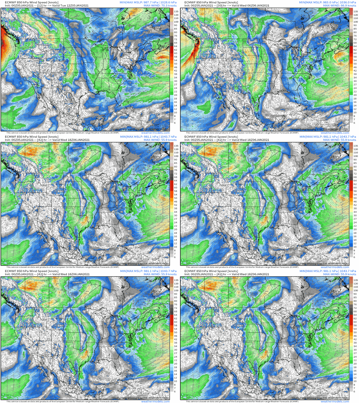
As early as this afternoon, diverging flow to the east of the deepening trough will incite rising air, and a Pacific low level cyclone should develop south, stretching an expansive, if somewhat weak, low level jet into the southern Plains.
As midlevel energy consolidates into tomorrow, so too will encouragement for ascent, and pressure falls over the central Plains will intensify 850mb flow.
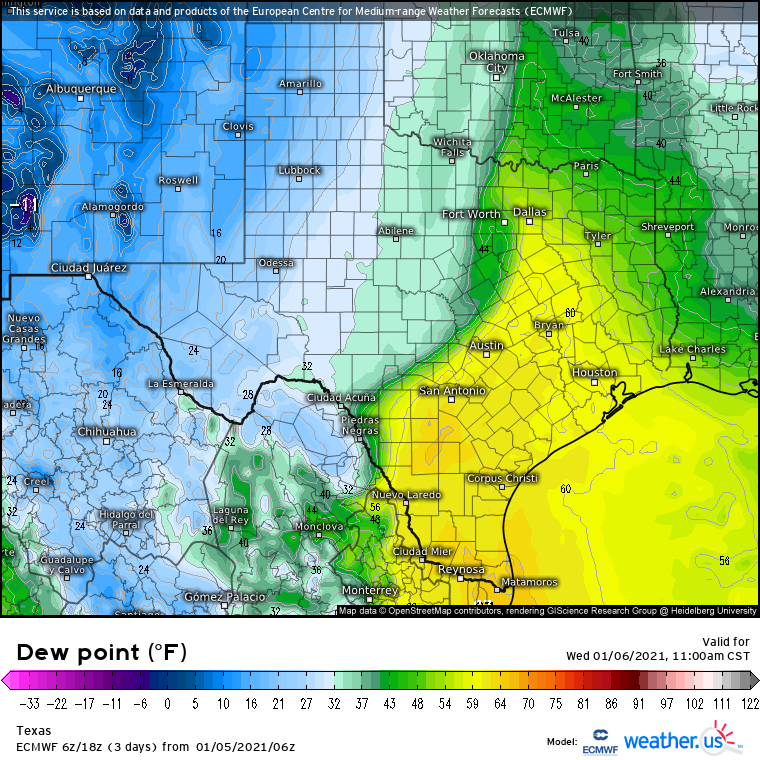
With a low level jet, entrance region parked over the SW Gulf, parked over Texas for around 24 hours, it makes sense that considerable dewpoint return could occur. That’s exactly what will happen, as a relatively warm and moist airmass flows north into the state.
In fact, by tomorrow afternoon, relatively widespread dewpoints in excess of 60°F are likely over SE TX.
With southwesterly flow transporting a modified EML above this moderately moist surface layer, parcels will have some degree of incentive to rise convectively into thunderstorm updrafts. The instability is tempered, though, by rather marginal surface temperatures which should depress low level lapse rates. So, overall, a pretty typical, low quality but non-zero instability profile seems likely.
Kinematically, an impressive setup looks likely. Intense divergence and powerful midlevel flow ahead of the pivoting closed low will overspread SE Texas with conditions conducive for lift and organization of convection. Meanwhile, the moderately strong LLJ aforementioned will mean moderate helicity will likely be present in the storm’s warm sector, too.
The favorable orientation of midlevel flow, largely perpendicular to the surface front, leads me to expect that a multicellular mode will be likely initially. With pretty good kinematics altogether, instability will be easily the limiting factor in potential for cells to develop surface-based rotation, largely due to modest moisture and poor low level lapse rates. This means that storms may have trouble becoming surface based, so when forecasting tomorrow for severe weather potential, nowcasting dewpoint advection and cloud cover trends will be unusually important. If these factors can favorably develop over the warm sector, there’s a shot at a few tornadoes with the discrete convection
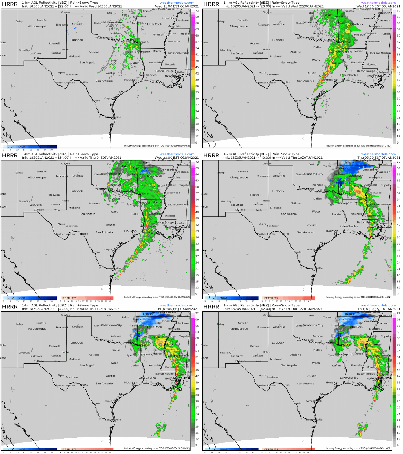
After a few hours of scattered cells, a surging cold front and cold pool coalescence will encourage storms to develop into a small squall line, which will likely impact Houston into far southeast Texas. With this line, the threat will mostly transition to damaging wind, although a tornado or two is certainly possible where any kinks can develop in the line. This threat will wane overnight as the front occludes and storms become increasingly elevated.


