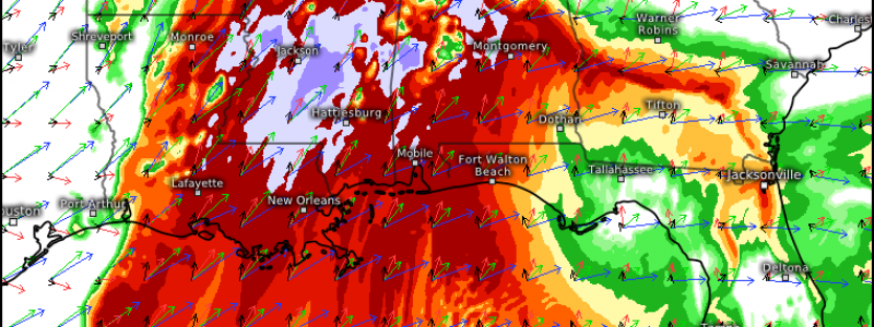
Dangerous Weather Expected Throughout the South Today
As I write this, tornado watches and warnings are already being issued throughout Arkansas so let’s jump right in and talk about what we can expect today/tonight from this potentially dangerous batch of weather.
Today – Morning to early afternoon
As I mentioned, convection is already ongoing in Arkansas. This activity will continue through the morning hours here and into western Tennessee and parts of NW Mississippi.
Storm mode will be mostly linear here ahead of the cold front. Conditions are less ripe, so to speak, here than in the lower Mississippi Valley so, while there is a risk for tornadoes, damaging winds, and hail, it’s not quite on the same level as we will see later this afternoon. That’s not to say all modes of severe weather aren’t possible; they are, just less likely to be extremely dangerous and widespread. We’ve already seen at least one tornado warning this morning in Arkansas so surely that’s enough to indicate the state of the atmosphere.
Temperatures and dew points here are in the low to mid 60s, keeping the pockets of active weather somewhat subdued and more scattered for now. That won’t be the case, however, as it shifts east.
This Afternoon-Evening
As the system slides east, it will encounter more favorable thermal support. Temperatures and dew points across southeastern AR, LA, MS, and AL are already approaching/breaking into the 70s and will only increase with the continued advection of warm, moist air from the Gulf. Ahead of the cold front, which will pass through with its associated convective line overnight, we expect scattered supercells to be able to form in the destabilizing warm sector.
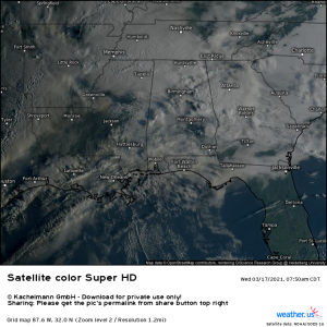
Most of this region is currently blanketed in cloud cover due to the ongoing convection near the warm front. This keeps the diurnal heating somewhat muted. However, we will need to monitor for breaks in the cloud cover. Any added solar heating will further destabilize the atmosphere, giving the forming storms more fuel to work with.
We are already seeing breaks over western MS/eastern LA, southeastern AR, and central AL. In fact, my mother-in-law, who lives in Birmingham, just informed me that the sky is clear. Not good! Should the lack of cloud cover persist, I would watch these areas very closely this afternoon for development of stronger, more violent storms, especially the corridor from, say, Alexandria, LA to Birmingham, AL.
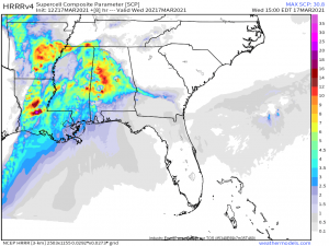
One thing that might hinder more widespread dangerous weather this afternoon would be the formation of numerous cells. If the warm sector is messy, as they compete for the “fuel” and bump into each other, the interaction could prevent individual cells from intensifying. Lone cells without any nearby storms for competition will be the ones to watch for as far as the most dangerous weather is concerned.
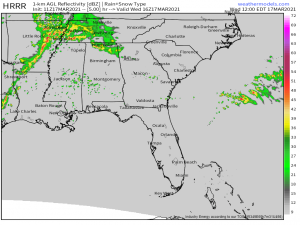
This is valid for 3 PM EDT. Some stronger signals for lone cells exist, especially in the areas I’ve mentioned. Of course, this is just a model run and things won’t evolve exactly as depicted. It does give us a good starting point and general outline, though. The HRRR model did well with the Texas event last Saturday so I’m okay with using it as a general guide.
One thing I want to mention, though, is the effect the terrain of central/northern Alabama has on storms. As you move northward from central Alabama, the topography changes from mostly flat to hilly and even somewhat mountainous, especially approaching the Tennessee border. This bumpy terrain has a history of assisting with the intensification of storms and producing dangerous, long track tornadoes. I would watch this region very closely not only this afternoon, but overnight.
Overnight
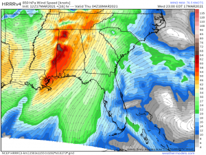
Unfortunately, the afternoon hours are just the “pre-show.” More favorable kinematics arrive this evening as the low level jet strengthens ahead of the cold front. We are expecting a widespread outbreak with the very real possibility of a few strong, long track tornadoes.
This speedy jet will increase the advection of warm, moist air into the MS and AL regions, providing an influx of CAPE that will be sufficient for the development of severe weather even with the loss of daytime heating. The approaching low will provide greater forcing, stronger shear and higher lapse rates, basically everything needed to kick off a round of very dangerous weather. Expect a few supercells out ahead of a more potent QLCS line that begins to swing through as we approach midnight.
I would keep an eye on the corridor between Jackson, MS to just NE of Birmingham, AL. Again, topography can assist in intensification and conditions will already be conducive to strong, long track tornadoes.
The threat is compounded by the fact that this period of weather will occur after dark. Nighttime tornadoes are statistically the most dangerous, not because they are stronger, but because the public is naturally less weather aware. Don’t be that person tonight. Have multiple ways to receive warnings that will WAKE YOU UP and be ready to act as soon as one is received.
A couple things before I wrap up this blog:
- Don’t get hung up on category colors. Everyone in the south has some sort of risk today. Some have a greater chance, some have a lesser chance. Just because you reside in an area with a less threatening color does not mean severe storms aren’t going to happen. Storms don’t read maps and don’t adhere to lines drawn by humans. Dangerous weather can still occur regardless of the color on the map. Prepare accordingly.
- Speaking of preparation: Make sure you can receive warnings multiple ways! DO NOT RELY ON AN OUTDOOR SIREN, EVER. At no time today should you let your guard down. It may be sunny and pleasant now or even this afternoon, but beautiful conditions often come before some of the worst weather.
- Don’t let fear rule you. I’ll admit, I’m not even part of this threat and my nerves are already shot. But you need to keep a clear head about you today. Regularly check the weather. Your local news will keep you up to date and switch to long-form coverage when it is needed. Check the national weather service for watches and warnings and read the forecast discussions to get a handle on what is expected to occur. Be ready to act quickly if necessary.
Your local meteorologists have your back today. Trust them to keep you informed and ahead of the threat. Be safe!!
