Dangerous Heat Targets The Plains
As forecast, record-breaking heat is currently impacting the Central US.
From Texas to Montana, temperatures have surpassed the 100 degree mark.
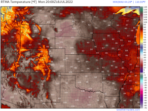
NWS Rapid City, South Dakota reported on Twitter that, as of 2:15 PM Eastern, they reached a temperature of 104 degrees F. This ties the record set on this date in 1934.
Similarly, Chadron, NE could be close to breaking a record. RTMA estimates a temp of 106 degrees F at 4 PM Eastern. The record for this date is 107 in 1926. We’ll have to wait for official confirmation of the temperature, though.
Anyway, my point is that it is hot. Dangerously so.
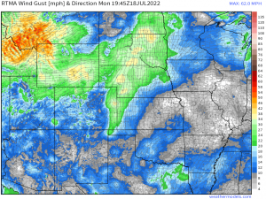
Gusty, downsloping winds are aiding in reaching these temperatures, at least in places like South Dakota and Nebraska. These winds are warming and drying as they descend the Rockies. The result is less moisture in the air, making it easier for the sun to warm the drier atmosphere.
Windy, hot conditions combined with drier ground conditions have lead to the issuance of a Red Flag warning in this area as well.
Heat for the northern Plains won’t last, however. A cold front will pass through tonight, dropping temperatures significantly.
Tomorrow’s heat will be concentrated further south over the Southern and Central Plains.
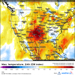
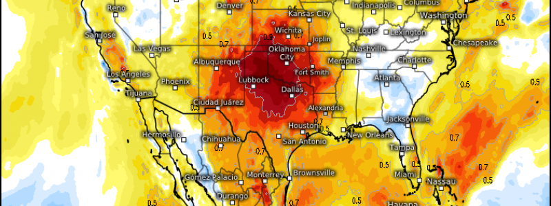
The Extreme Weather Index (EWI) is a tool that can highlight the potential for highly unusual weather, in this case, maximum temperatures well above or below what you’d typically expect. Maximum temperature EWI maps are given as values between -1 and 1. A value of -1 means that maximum temperatures are expected to be extremely cold compared to normal and that the forecast for these extreme values is very confident. A value of +1 indicates the same forecast confidence for an event just as extreme, just going in the other direction with maximum temps forecast to be much warmer than usual.
So, put simply, confidence is very high in temperatures much warmer than average for parts of Texas, Oklahoma, Kansas, and Arkansas tomorrow.
How hot might it be?
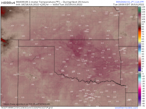
The HRRR, which has general agreement from most models, paints a grim picture.
Values like these are hard to attain here. Generally, the moisture from the nearby Gulf of Mexico helps to keep a lid on more extreme temperatures. However, this region has been extremely dry in the last month. Most of the region pictured in the above map is in some stage of drought. As we’ve discussed before, drier surface = less evaporation = more heating. The lack of rain will be helping to facilitate these scorching temperatures.
Though these temps likely won’t challenge the all-time high temperature record in Oklahoma (120 degrees F observed in 1936), they are likely to challenge local records.
Oklahoma City’s current record for July 19 is 109, set in 1936. Tying or perhaps exceeding this record is entirely possible. Similar records for the surrounding cities exist as well and could also easily be tied or broken.
Maybe it seems like I’m spending a bit too much time writing about records, but long-standing records are significant to me. 1936 was 86 years ago. If that record falls tomorrow, it is significant. And while no one long-standing record falling indicates climate change, the fact that many long-standing records are falling recently should clue us in that something is, in fact, changing.
Anyway, tomorrow’s heat will be dangerous to those not prepared to stay cool as best they can.
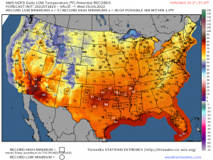
Daytime heat will be compounded by sweltering overnight lows that may not dip below 80 degrees. When the body can’t reset from daytime heat, heat stroke or heat exhaustion becomes much more likely.
Check on your family, friends, and neighbors. Stay hydrated and as cool as possible.
Heat safety tips can be found here if needed: https://www.weather.gov/safety/heat
