Cyclogenesis to Bring Heavy Rain, Snow, Ice, Low-Topped Convection to Corn Belt… Oh My!
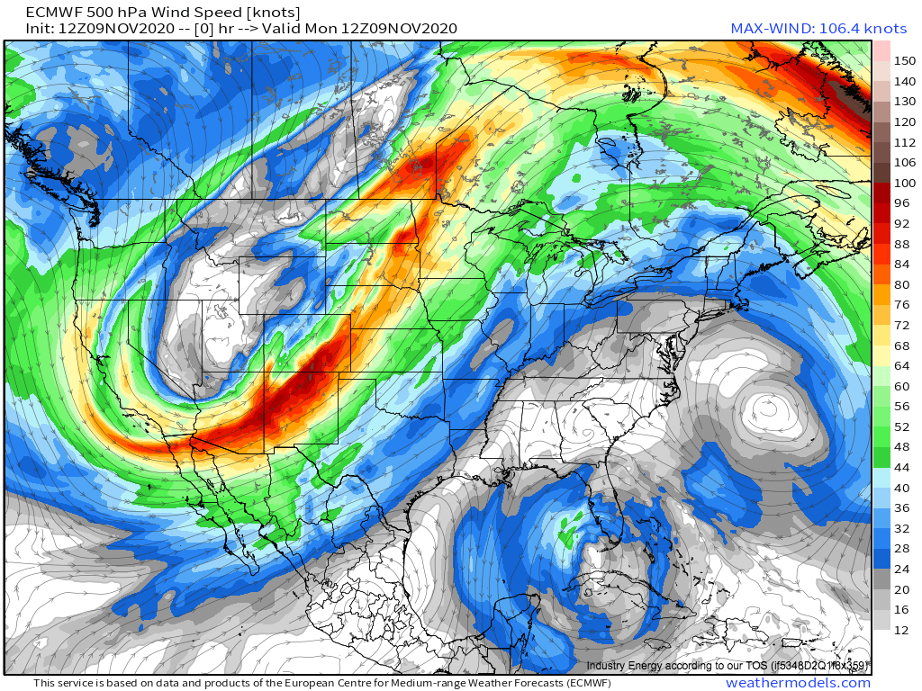
A massive midlevel low over the western US has been wrecking meteorological havoc across the US for days now, with record heat in the eastern US, a Montana blizzard, damaging winds across the middle of the country, and dramatic cold in the western third of the country.
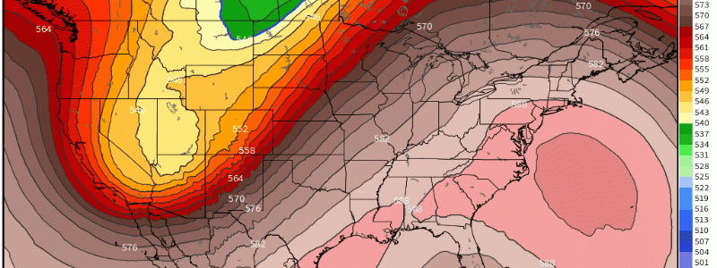
The huge trough can be seen in the pattern of midlevel flow across the US.
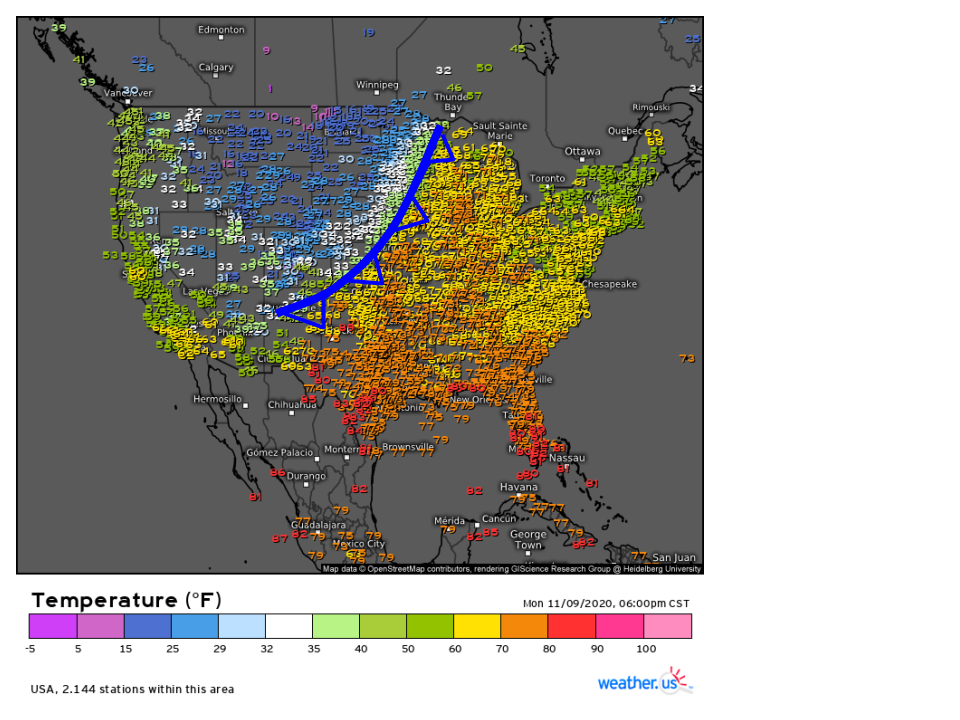
Let’s set the scene a little bit: as the midlevel low developed earlier this week, a surface low strengthened and moved north of the Canadian border near Montana. Enforced by a powerful low level jet and anomalous heights to both the east and west, a strong temperature gradient developed along the wind shift to the low’s south, marking a powerful cold front.
Link: https://weather.us/observations/temperature-f.html
This front will serve as the focal point for tomorrow’s major weather story. Now, back to the big trough from before.
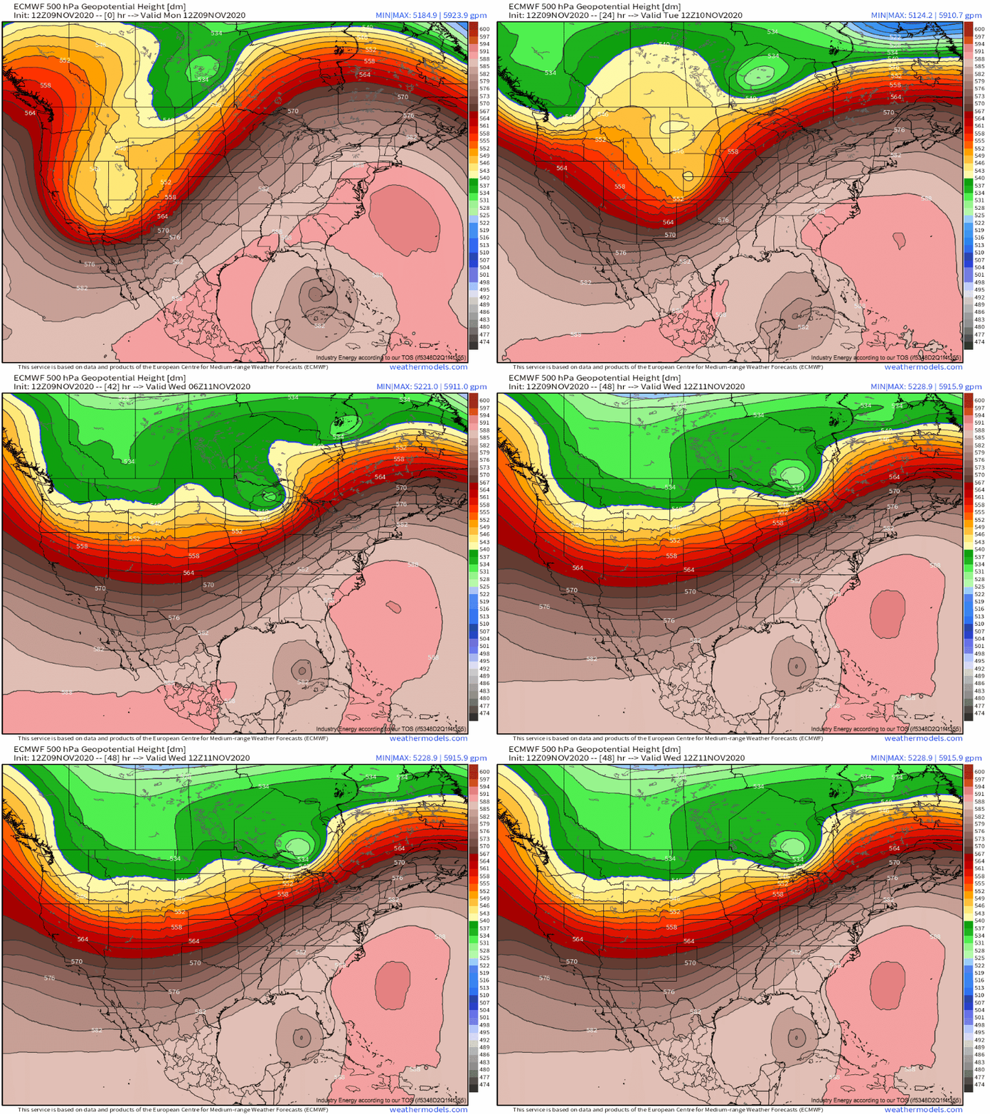
Another chapter in the midlevel low’s life will come tomorrow, as a compact shortwave spurns cyclogenesis that promises to bring heavy rain, gusty winds, and low-topped convection to the Corn Belt.
Tonight, the base of the longwave will begin accelerating northeast along the midlevel baroclinic zone stretching from the four corners region to the Wisconsin/Minnesota/Canadian border, intensifying into a compact midlevel low.
Immediately ahead of the intense trough, a zone of powerful directional divergence will develop as the ball of relatively low pressure forces air to its north and east to spread out. As a result, low level air will be encouraged to rise, and a surface cyclone will intensify as it moves northeast along the sharp surface front. 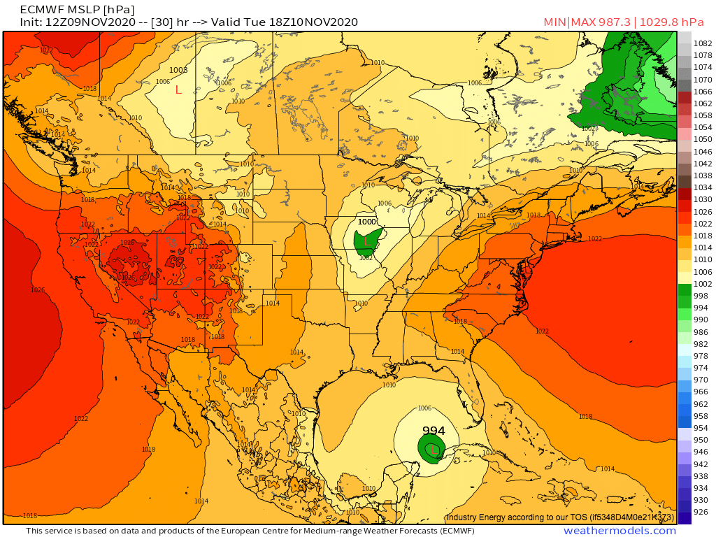
As the surface low strengthens, the front will suddenly find itself in an uncertain advection regime. On one hand, the Canadian low’s northerly flow west of the temperature gradient will encourage the wind shift to continue moving east as a cold front. On the other, the strengthening central US surface low will try to incite southerly advection with the curvature of an immature depression. This will encourage the wind shift to move north and west as a warm front. Stuck between these two competing advection regimes, the front to the northeast of the accelerating central US surface low will predominantly stop moving, taking on the characteristics of a stationary front.
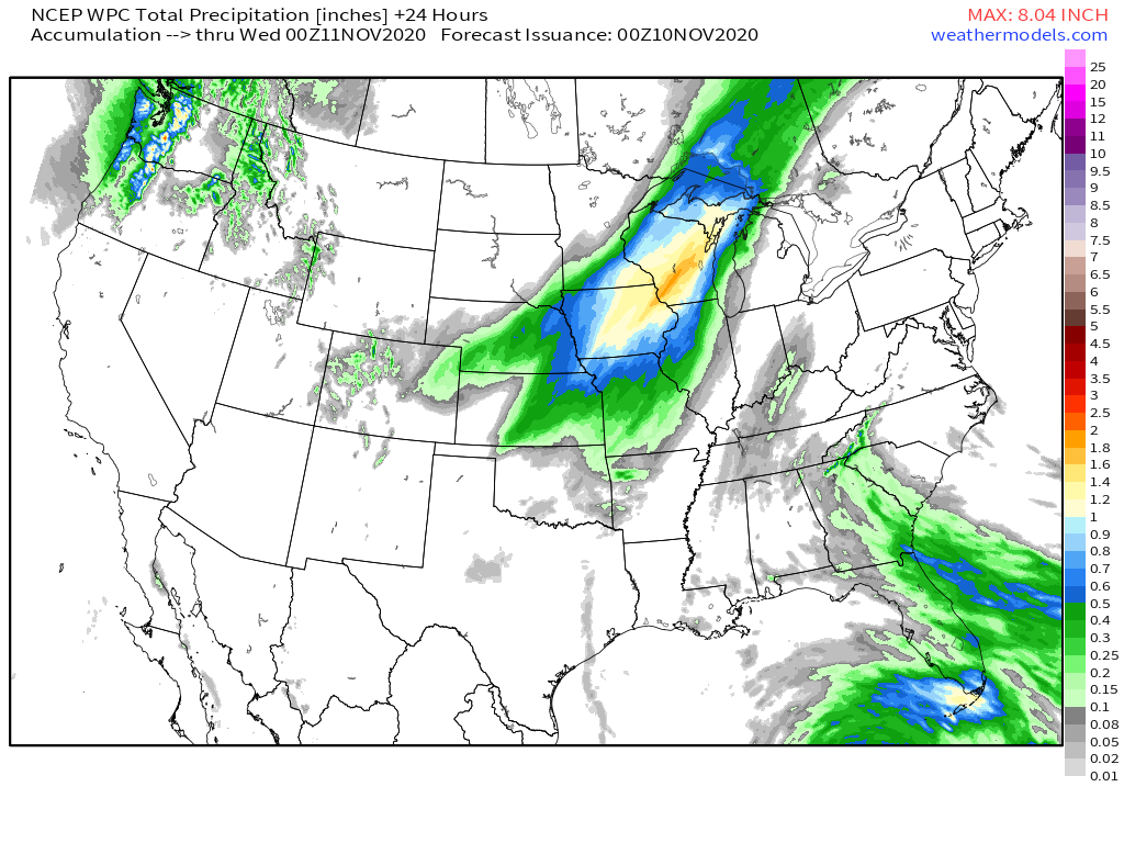
With a roaring LLJ pumping anomalous gulf moisture east of this wind shift, persistent moderate to heavy rain seems likely along this newly stalled convergent boundary. This will enable a somewhat quick 1-3″ of rain in a SW-NE oriented band along the stalled front, and flash flooding is possible where all of the precipitation falls as rain.
Link: https://lab.weathermodels.com/models/wpc/wpc_precip.php
Wait… what was that last bit?? Am I implying some of the precipitation won’t fall as rain??
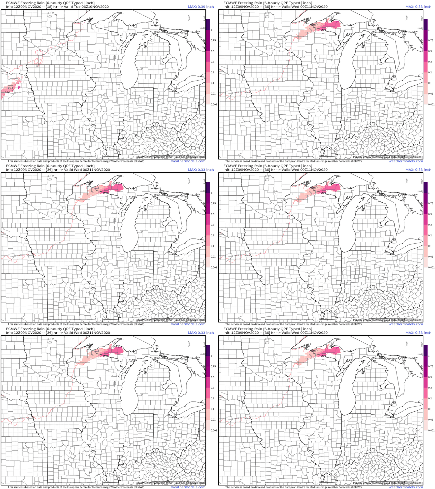
It looks increasingly likely that the low level jet will be able to bring southerly flow north of the surface frontal boundary, a potentially dangerous atmospheric setup that could yield above-freezing temperatures above a freezing ground… the type of atmosphere that yields freezing rain. A strip of the dangerous precipitation regime, most likely immediately north of the frontal boundary, should allow up to 0.5″ of ice to accumulate from parts of Nebraska through a strip of Iowa and into parts of Minnesota and Wisconsin. This is enough to cause isolated power outages and dangerous road conditions!
To the northeast of this band, snow is likely, as all levels of the atmosphere feature northerly flow and below-freezing temperatures. Up to 8″ is possible with this band, and it’s the type of atmosphere that could definitely see local overperformance to a foot.
So a mess of winter weather and heavy rain seems likely along the stalled front in the Corn Belt tomorrow into Wednesday. But there’s another potential threat with this northeast-moving surface low: a strongly forced squall line!
As the low moves through Nebraska and Iowa tomorrow, a surging cold front through Missouri and Illinois will feature very strong lift at the hands of a fierce temperature gradient, and will be accompanied by roaring mid and low level flow. And, with dewpoints exceeding 60°F in the low’s warm sector, there will be modest instability. This setup screams low-topped convection!
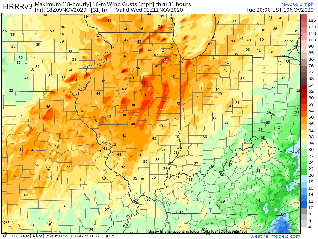
This exact threat is communicated by convective allowing hi-res models like the HRRR, which show a narrow band of storms in marginal instability along the surging cold front. 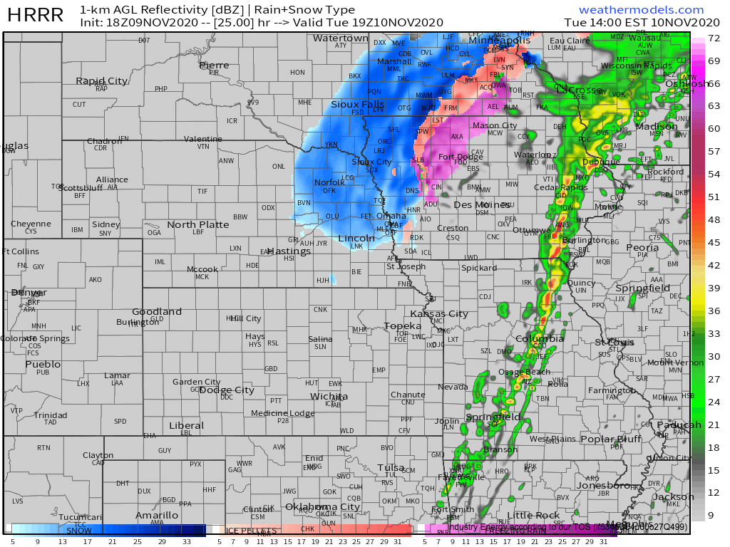
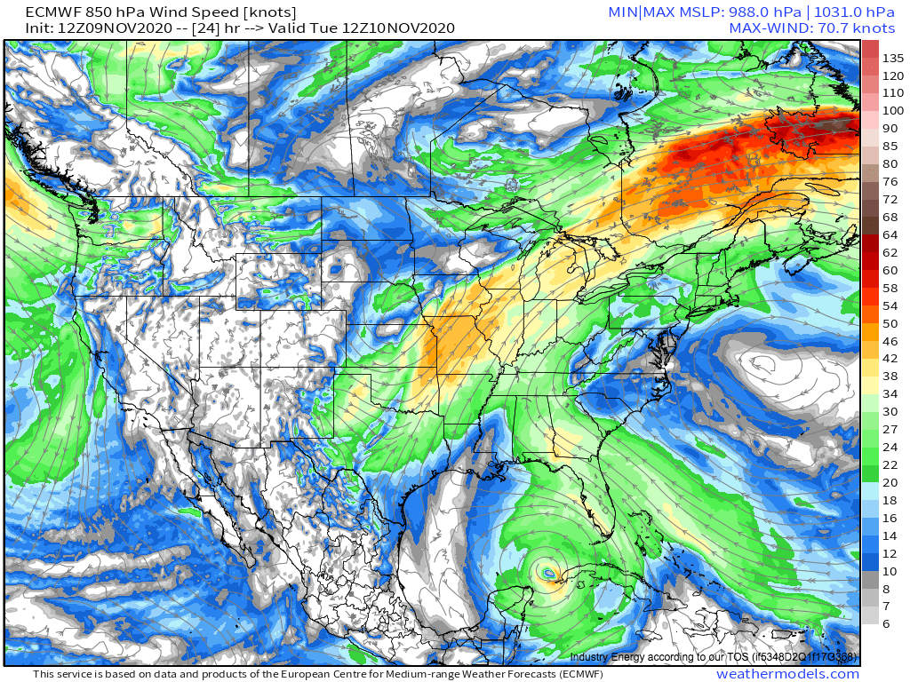
The big player in tomorrow’s potential convective setup will be the low-level jet. As the intensifying low level cyclone skirts an expansive ridge, winds at the 850mb layer will increase to ~50 knots over the low’s warm sector.
Besides advecting somewhat unstable air into Missouri, SE Iowa, and Illinois that will allow convection to blossom, this belt of strong flow near the surface ensures a potential threat with any strongly-forced convective development: momentum transfer of strong wind gusts to the surface.
This means that, as the aforementioned line of convection moves through Missouri, Iowa, and Illinois tomorrow, convective downward motion can easily transfer strong near-surface winds to the ground, which may cause damaging wind gusts!
The HRRR shows this threat, modeling parts of Missouri, Iowa, Illinois, and Wisconsin to see wind gusts locally exceeding 50 mph along the thin line of storms.
As a compact midlevel trough accelerates northeastward tonight and tomorrow, a surface cyclone will develop and strengthen along a sharp temperature gradient. Heavy rain, various winter weather threats, and a squall line capable of locally damaging wind gusts will impact the corn belt and central midwest. As usual, stay tuned to our twitter and blog for more!
