Critical Fire Risks Persists Through Mid-week, But Relief Is On The Horizon
I feel like every other blog we’ve written in the last few months has been pertaining to the fire threat in southern California. Unfortunately, this will be another one of those blogs.
Since June of 2020, only 1.95 inches of rain has been measured in downtown Los Angeles. Average rainfall from June to December is ~4.58 inches. So, needless to say, things are dry… really dry. We have seen an incredibly devastating fire season so far with a lot of the really active periods far outside of the “normal” fire season. The hot, dry Santa Ana winds that drive these fires have persisted long past their usual most active period of the autumn months. And today is yet another one of those days.
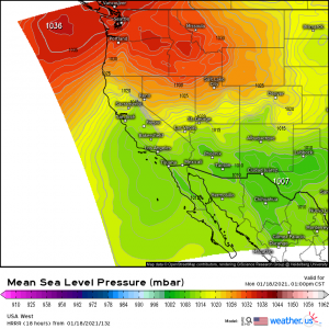
An increasing pressure gradient between a strong high over the Pacific Northwest and a developing low off the coast of Baja California will encourage the development of downsloping winds (Santa Ana winds) which brings today’s critical fire risk.
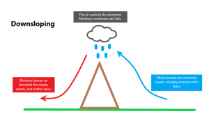
A quick review: what is downsloping?
It is, quite literally, the opposite of upsloping. When upsloping happens, the wind ascends the slopes of a mountain range, lifting any existing moisture with it. As it ascends, the air cools. Once the air reaches the dew point, moisture condenses into clouds and, if there is enough present, falls as rain or snow. The wind doesn’t just stop here but continues down the other side of the mountain. At this point, though, the moisture has been squeezed out of it. A dry, warming wind descends into the valley below the mountains. These gusty winds then raise the surface temperature and provide a very dry environment. Add in already dry conditions with plenty of fire fuel and you have a recipe for potentially disastrous wildfires, as is the case in southern California today.
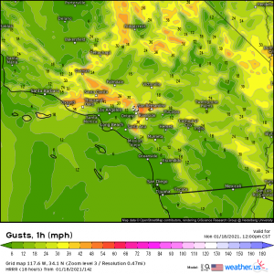
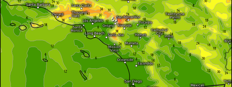
Winds will be roaring down the Santa Ana mountains through the day today, setting the stage for dangerous conditions. This set up is expected to last through Wednesday morning.
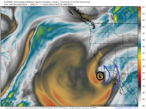
But, a glimmer of hope exists on the horizon. In response to a building ridge in the Pacific, the jet stream dives south heading into midweek, allowing the low to deepen. As it does, it will advect moisture into southern California.
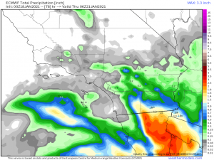
Now, we aren’t talking a drought-busting, flooding rain event. In fact, rainfall will be very little, if any:
I know these totals don’t look awe-inspiring but, as the southwest is still in the grips of a Severe to Exceptional drought, any rain we can get in these areas goes toward closing the gap between the deficit and the average rainfall.
We are, however, talking about enough moisture to raise the relative humidity significantly and temporarily alleviate the bone-dry conditions southern California has been suffering through for months. Any increase in moisture in the atmosphere is welcome as a wetter environment, whether it rains or not, lessens or even negates the chances for devastating fires. It will be just enough for the residents of southern California to be able to breathe a sigh of relief for a few days.
More chances for moisture in the southwest lay on the horizon as well, but that’s a topic for another blog as we get closer to that forecast period. Wishing y’all a wonderful day!
