Complex Severe Storm Setup Tomorrow
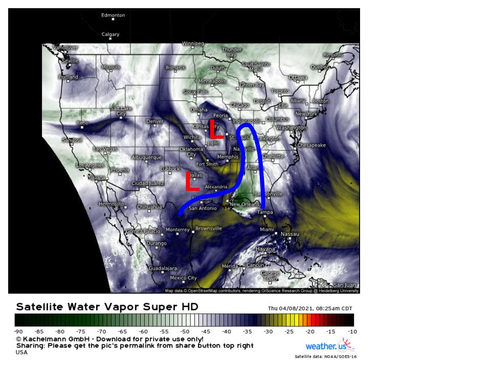
This morning, a large zone of cutoff midlevel energy is continuing to pivot north towards the Great Lakes, with a subtle upstream shortwave digging into the peripheral jet. Attendant surface features of note include two zones of relatively low pressure: a stronger, primary low colocated with the midlevel cyclone over Missouri, and a secondary low, barely detectable, ahead of shortwaving over Texas. Southerly flow responding to the primary cyclone has drawn a ribbon of Gulf moisture north into the central US, while the secondary low development over Texas is preventing moisture adjacent to the NW Gulf from being scoured by the primary low’s cold front.
I’ve drawn the approximate outline of these two surface cyclones and their moisture feed on the midlevel WV map, hopefully giving a little window into what the atmosphere is doing now.
This moisture feed, delicately stretched inland between the two surface cyclones, will frame a severe thunderstorm outbreak tomorrow.
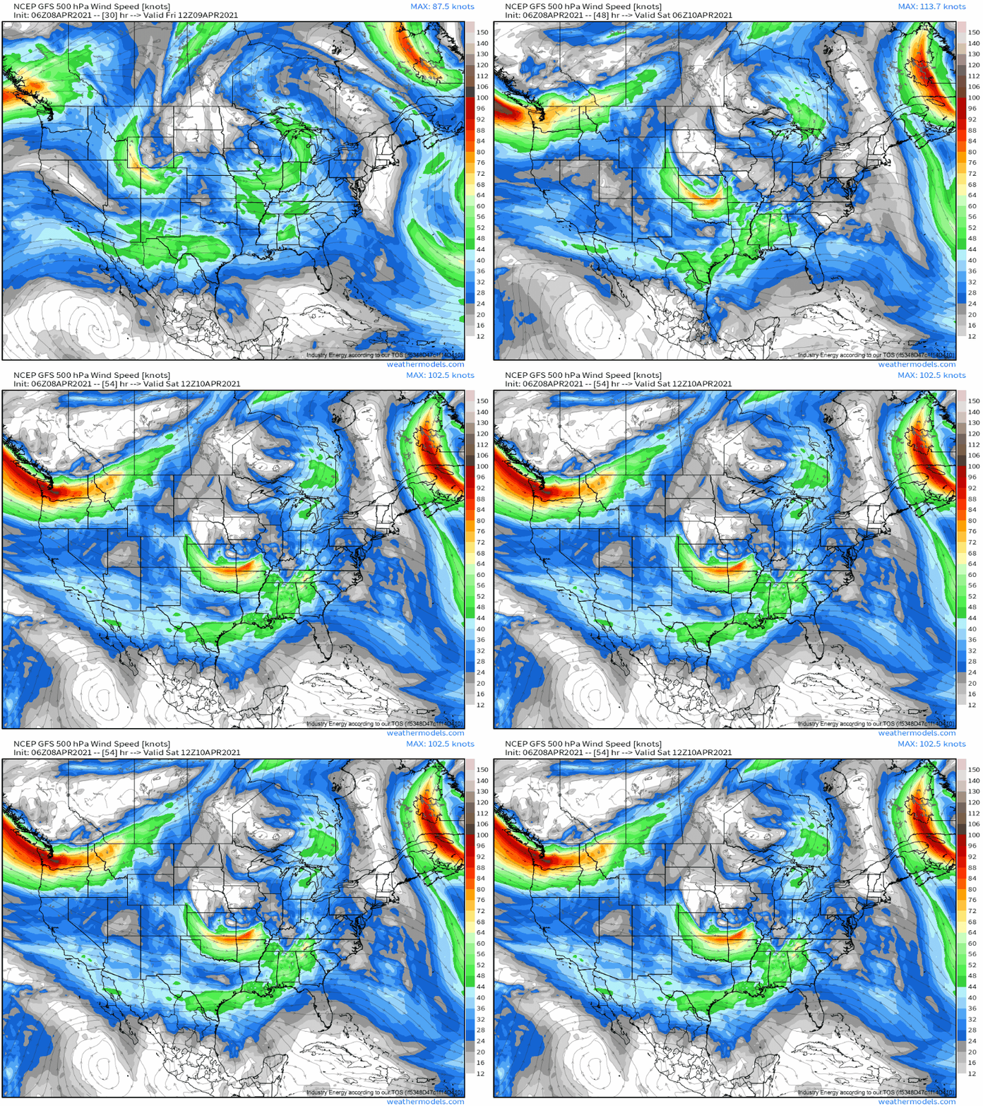
Fairly subtle shortwaving amidst a seasonally moderate midlevel jet will overshadow the south-central US with synoptic-scale ascent and 30-50 knot 500mb flow.
Subtle shortwaves like this often have trouble getting enthusiastic low level jets going, but the presence of an already established cyclone over the Great Lakes (as discussed above) with a pre-existing southerly low level jet means the shortwave’s influences will simply serve to locally enhance 850mb flow.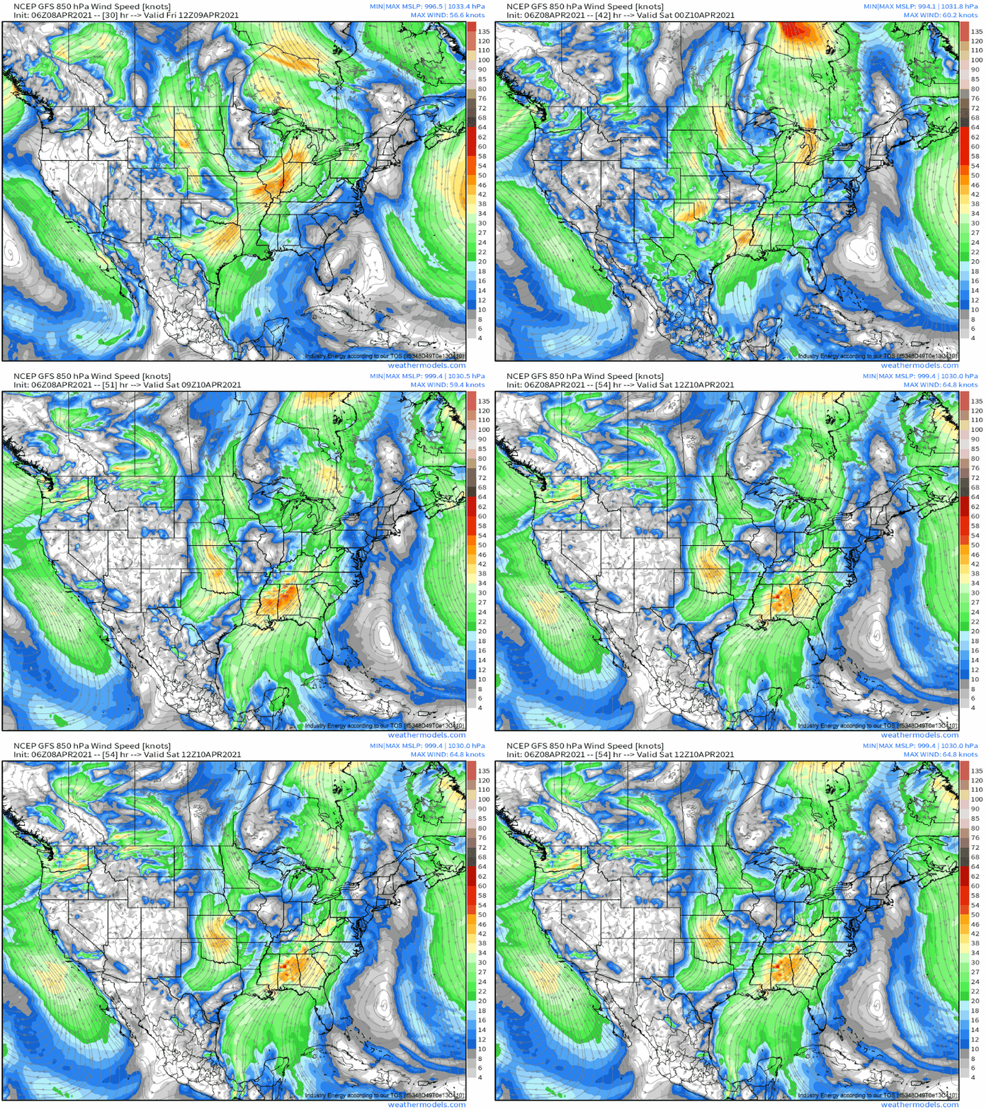
These fairly complex kinematic enhancements and shifts will occur above a surface airmass well moistened by several days of uninterrupted southerly advection of Gulf dewpoints, juxtaposed with a pronounced EML. With dewpoints approaching or locally exceeding 70ºF, and 700-500mb lapse rates exceeding 9ºC/km for some, explosive instability is likely.
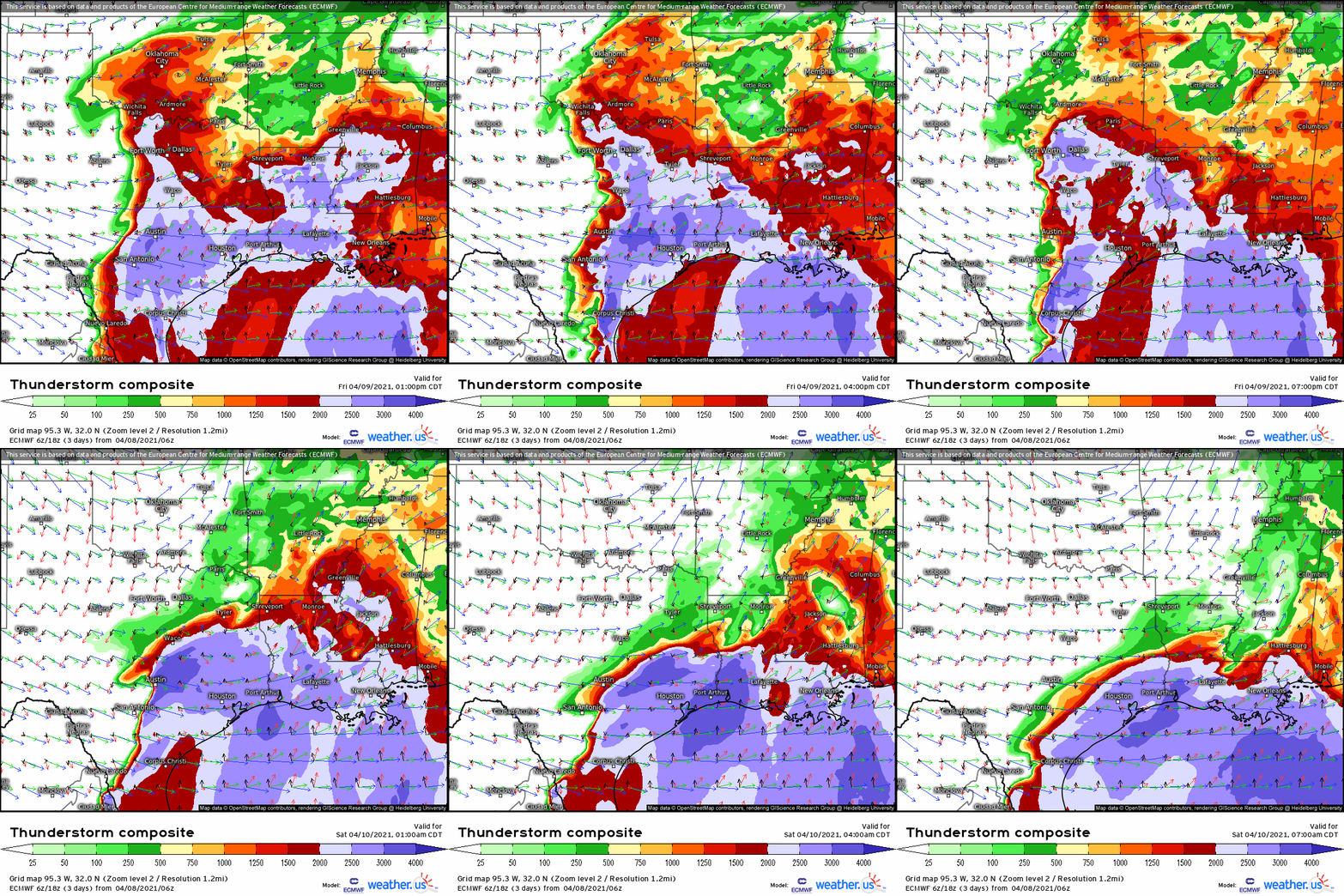
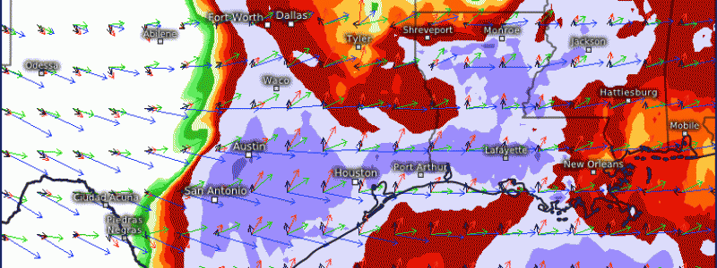
As hinted at above, the kinematics for this event won’t really be supportive as much as sufficient, at least at first. This is especially true compared to the immensely supportive instability A look at hodographs in the weather.us severe composite map sort of confirms this.
Marginal midlevel flow will provide deep layer shear sufficient for explosive updrafts to develop roaring supercells capable of large to giant hail over Texas, but probably not enough for more than an isolated tornado there. The wind profile will improve both spatially with westward extent and with time, though, which implies tornadoes will be most likely later and/or deeper into the SE, should discrete storms develop there too. Frankly, I think it’s not unlikely- despite fairly robust capping amidst the periphery of an EML, experience with past events (1/22/2017 and 4/19/2015, for example) suggest multicellular clusters will probably develop into the evening over LA and MS. These could well drop a tornado, and I wouldn’t be surprised if one is strong.
By nightfall, storms everywhere will coalesce. If this aforementioned LA/MS conditional activity occurs, the Texas supercells won’t have much of a warm sector to work with, and the greatest wind threat will evolve downstream of the LA/MS into early in the morning Saturday. If the cells don’t develop over LA/MS, or if they do but with less vigor and widespread-ness than is possible, the main wind threat will evolve downstream of the TX storms.
Regardless of where the QLCS develops overnight, it’ll probably bring a substantial threat for damaging wind, some of which could be hurricane force. This will be especially true if it evolves in juxtaposition with the LLJ intensification just downstream of the TX supercells.
So, really, it seems a lose-lose tomorrow: either discrete storms develop over the SE in the afternoon with a tornado threat, or they coalesce from upstream and roar through with significant wind (and, of course, the chance for a few spin-ups).
This will be a complex situation. Luckily, high-end tornadoes seem unlikely at the moment, but widespread significant severe storms seem likely.
Stay tuned!
