Compact Trough To Bring Moderate Fire; Marginal Severe Threat to South Central Plains
Spring is my favorite season. The slow progression to warmth, the beautiful complexity of the increasingly common convective setups, and the blooming nature. If you’re anything like me in those regards, this pattern is surely exciting; it’s about as spring as early March can get. And today, it will be delivering a very spring-esque threat; severe thunderstorms and critical fire risk in the south-central US.
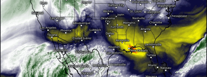
The big player in today’s sensible weather will be a compact, largely closed-off trough currently sliding east though the Rockies. It can be seen on water vapor imagery as a prominent cyclonic feature centered just south of Salt Lake City.
These compact midlevel cyclones can import the severe weather/fire weather ‘double threat’ to the south-central Plains pretty efficiently. It’s an interesting example of a topographical machine, in which relatively minimal atmospheric input can work with a landscape to unleash sensible weather. It largely works as a trough crosses the Rockies, acting as a source of divergence aloft and promoting lee cyclogenesis. Resulting low-level southerly flow to the cyclone’s east transports warm and moist Gulf air north, while southwesterly flow just west pulls in bone-dry air desert air. The broadly flat landscape tends to promote brisk flow down to almost the surface, especially in stronger cyclones, which can enhance helicity in the moist sector and can promote fire spread in the dry sector.
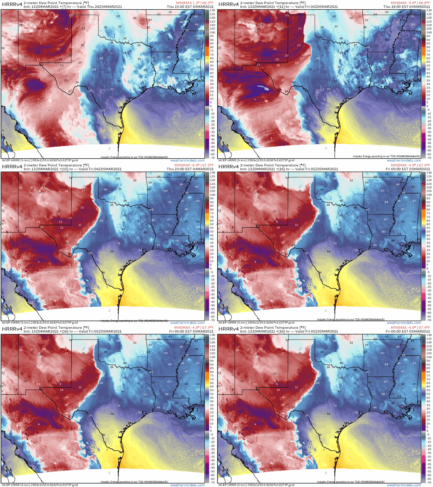
This all looks pretty likely today, as confirmed by a look at high-resolution imagery modeling of dewpoints in the cyclone’s vicinity.
Let’s divide the rest of this blog into two sections, then, for the two sectors of importance. First, we can talk about the severe threat.
It’s immediately apparent that southerly moisture transport isn’t as robust as we would look for in an attempt to diagnose deep convection. Clearly, recent northerly flow over the Gulf combined with a still fairly unfavorable time of year is taking a toll, prohibiting the type of enthusiastic dewpoint return necessary for significant thunderstorm activity. But with impressive surface convergence evident in the strength of the boundary seen on the HRRR, and a cold pool aloft associated with the compact trough diagnosed above, there is still some chance of convective showers capable of producing marginally severe wind gusts or hail. This will mostly be a threat overnight, as relatively enhanced dewpoints interact with the strongest encouragement for ascent.
Now, onto the fire sector!
Desert advection doesn’t just mean very low dewpoints. It also tends to promote substantial warm temperature anomalies, sunny skies, and can feature relatively significant flow right above the surface in association with the low level jet and flat terrain.
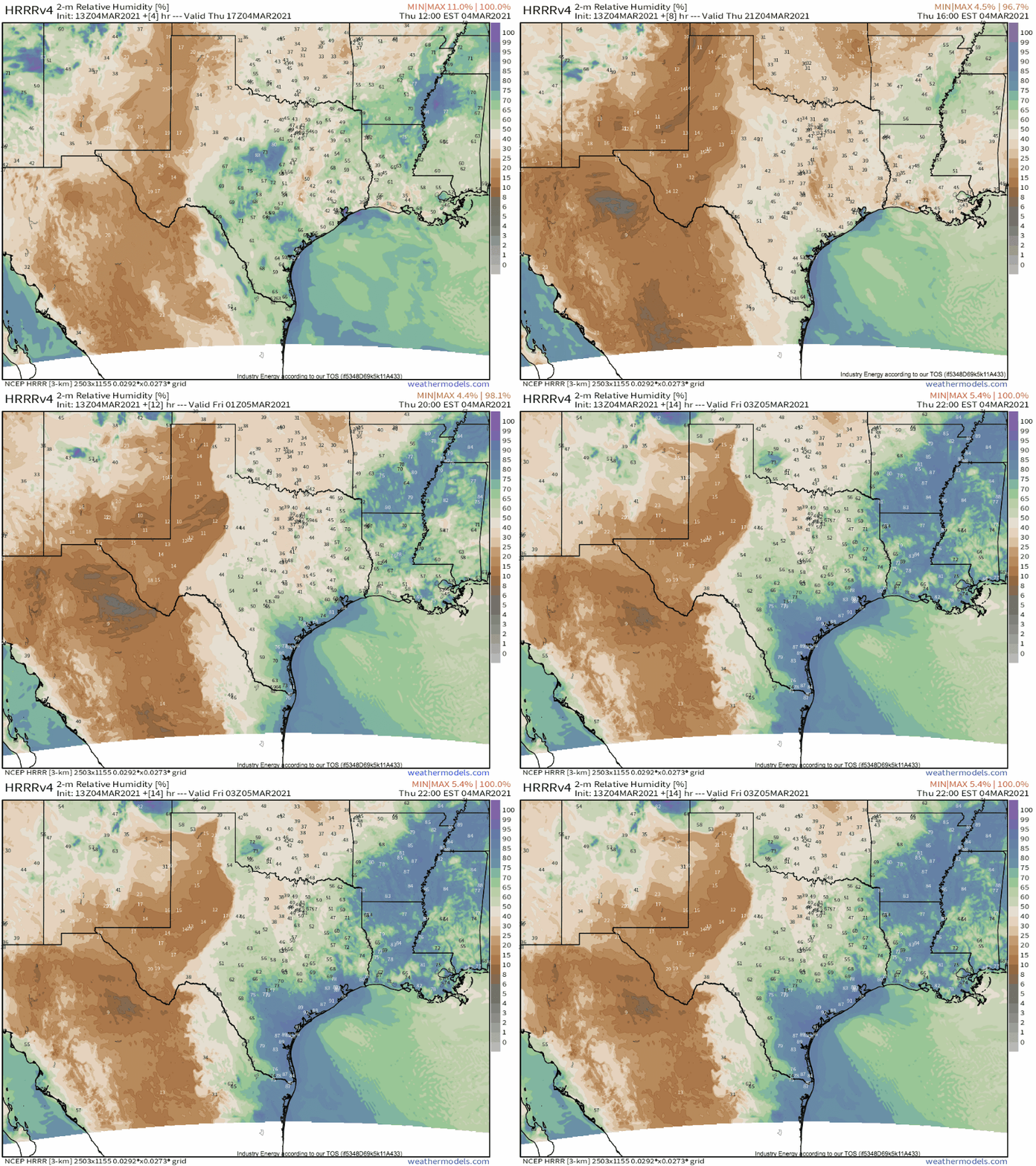
The combination of low specific humidity with warm temperatures means very low relative humidity, which can help keep fuels dry enough to allow wildfire spread. A look at model guidance confirms this suspicion.
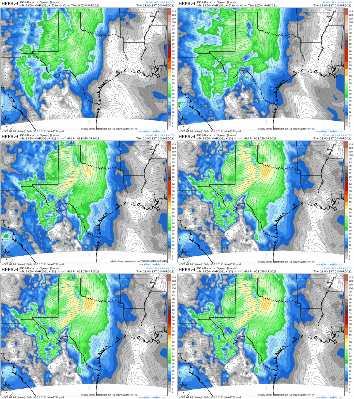
Impressive low level flow above a probable well mixed boundary layer will promote the aforementioned risk for some stiff wind gusts, which can help promote the fire threat by enhancing spread and oxygenation of fire.
So, a springtime pattern with a severe threat that will luckily fall flat, but a fire threat that could prove fairly substantial. Be safe, monitor local media, and avoid burning today!


