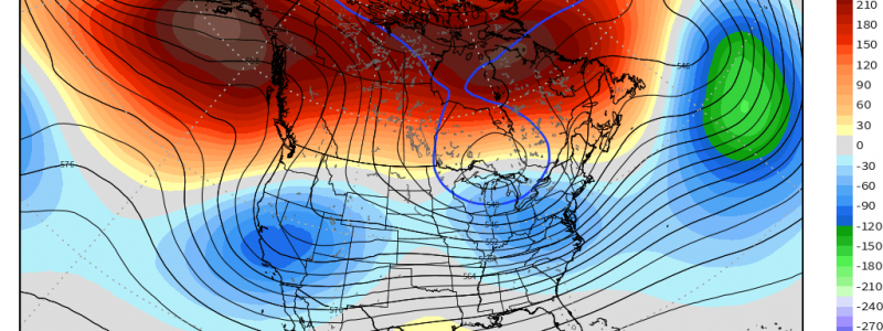
Cold Snap: Delayed or Denied?
Last week, we discussed the potential for all of our teleconnections to line up heading out of this upcoming weekend and, at the very least, deliver the eastern US some decently cold air (and maybe some snow chances?).
However, if you’ve looked at a 10 day forecast lately, you may have realized that’s not the case.
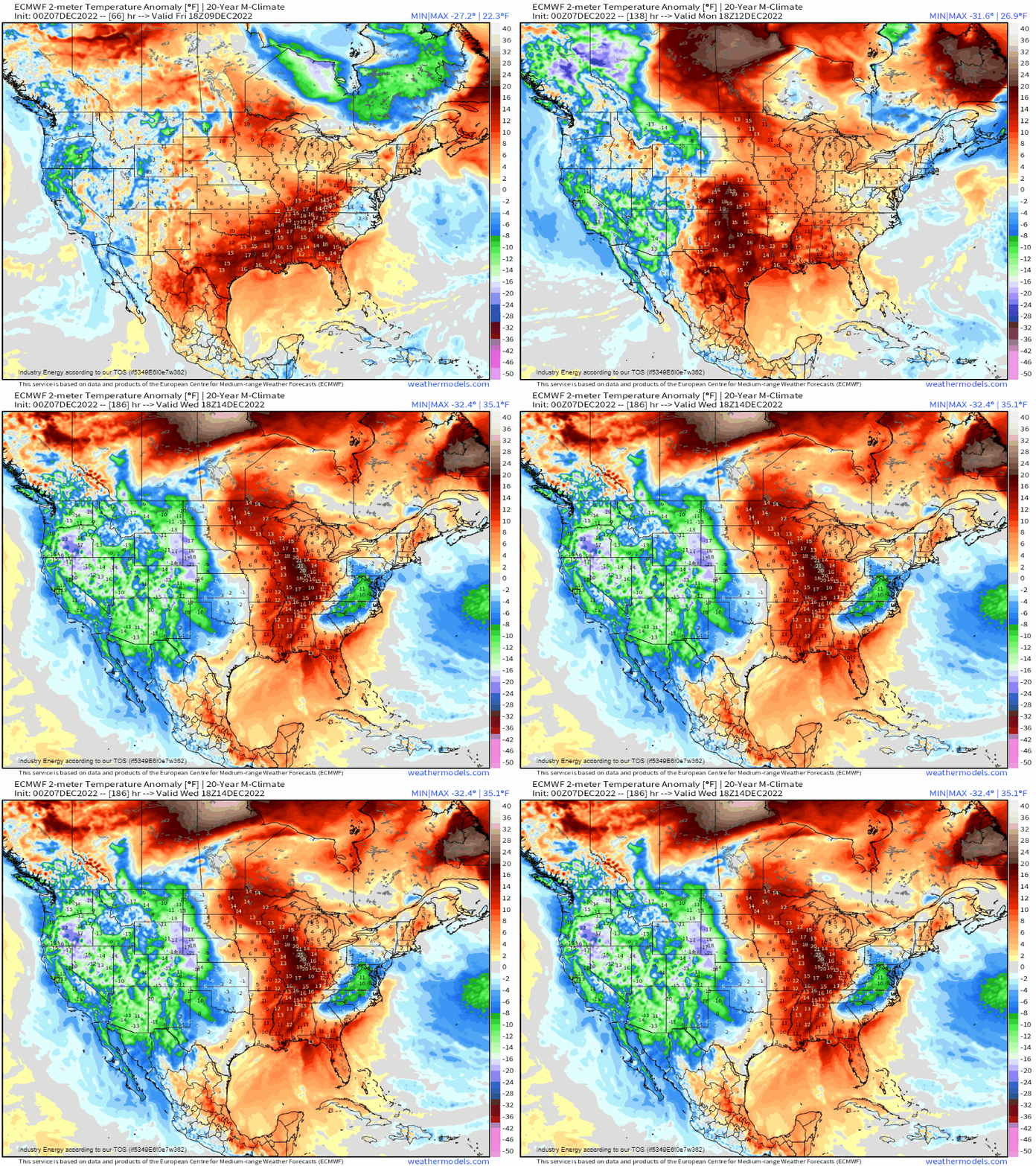
So what gives? Has our cold snap been denied or merely delayed? Let’s take a look at the state of our teleconnections and see if we can diagnose the problem.
Arctic Oscillation
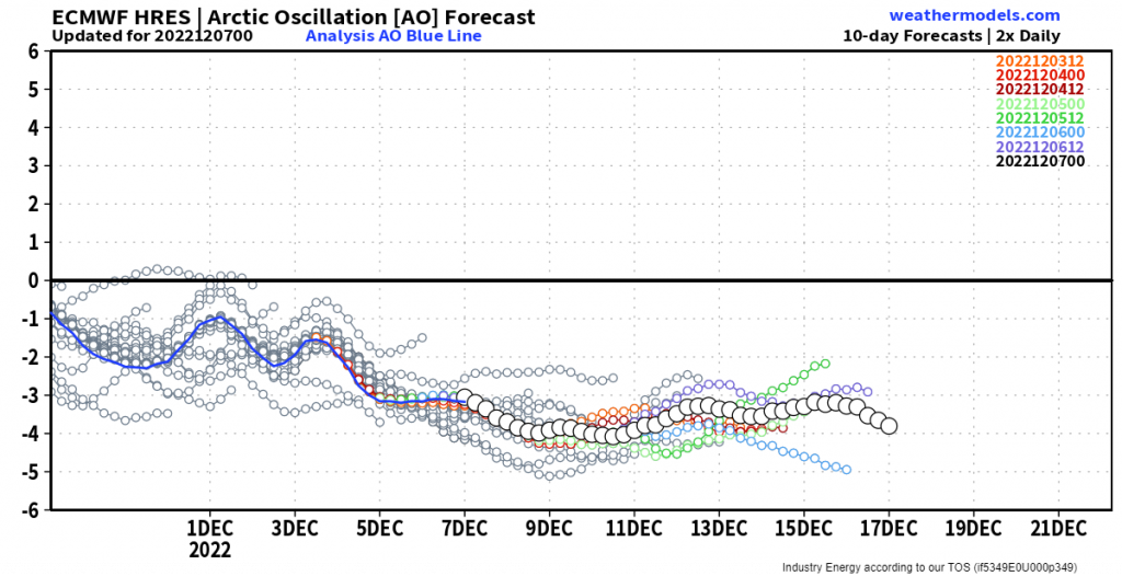
At the current time, the AO is still distinctly negative and forecast trends suggest it will stay this way at least through next week. Cold air is spilling south from the Arctic.
AO = not the problem
Eastern Pacific Oscillation
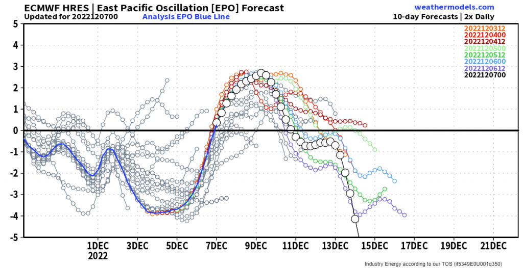
The EPO is currently neutral but, according forecast trends, is going to spike into positive territory this weekend. Ensemble forecasts we used last week weren’t really on board with a positive spike. This is less than ideal in terms of cold air flowing southward.
We really would like a solidly negative EPO if we want cold air east of the Rockies. It would be even better if the AO is also negative.
With forecast trends suggesting a solidly negative EPO in the second half of next week while the AO is still in negative territory, there’s a chance.
North Atlantic Oscillation
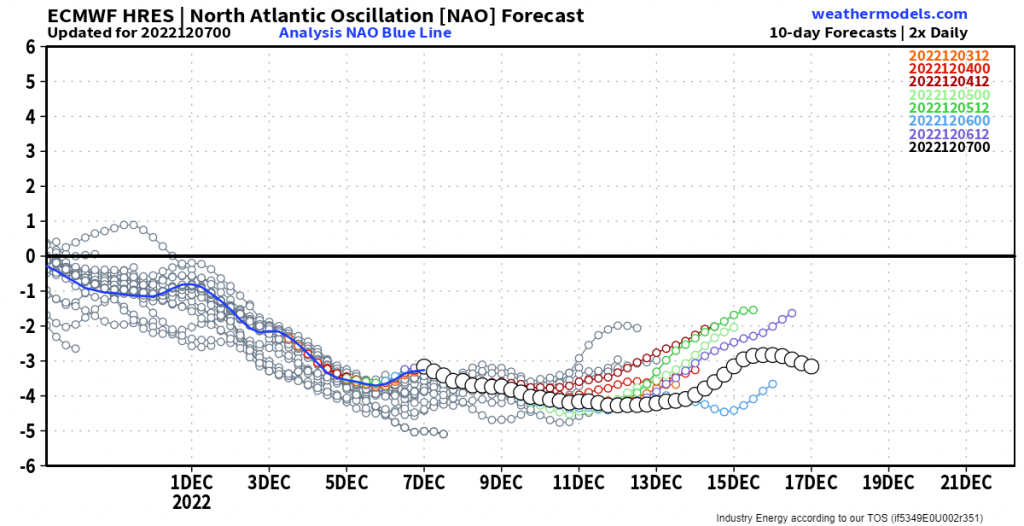
The NAO is still solidly negative, as evidenced by the strong blocking high in place over Greenland. Any cold air currently spilling south is prevented from immediately being ushered eastward by the regular flow.
If all plays out as currently forecast, a -EPO and -NAO will work together later next week to funnel the cold air from the -AO southward into the eastern US. It will simply have no other place to go – well, assuming we can get a +PNA. But more on that in a minute.
One thing we’ll need to watch, however, is the slight trend toward a more neutral NAO by next weekend. If that block breaks down significantly, it could have ramifications on the magnitude and duration of the cold air seen in the eastern US.
Pacific-North American Pattern
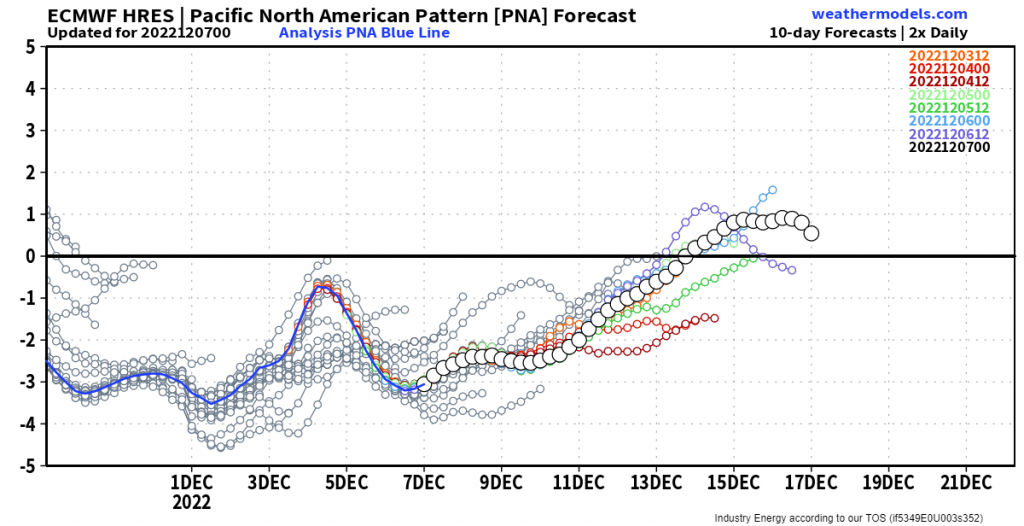
The PNA has been a problem, at least for eastern cold weather lovers. Though the EPO, AO, and NAO have been rather negative (at least until recently in the EPO’s case), the PNA has remained stubbornly negative. This has lead to some rather persistent ridging over some of the eastern US. Ridging which has been keeping that cold air from really filtering in.
Hope gleams on the horizon, however, as trends indicate that the PNA will approach neutral/positive territory near the middle of next week. To rehash: this would indicate ridging over the West and troughing in the East. The cold air would have an open door through which to flow south as the +PNA lines up with a -EPO, -AO, and -NAO.
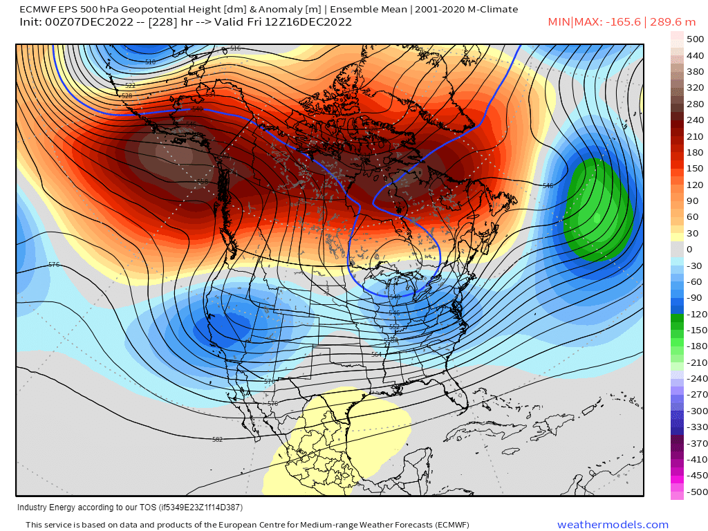
So, for now, it seems as if our cold snap has been delayed, but not yet denied.
I’d caution against calling this a lock, however. We’ll really need to watch the timing of it all and the breaking down/trend toward a neutral state of the NAO. If it is badly timed, it may make this shot of cold air not quite as potent/long lasting as some might be expecting.
One thing seems likely, however:
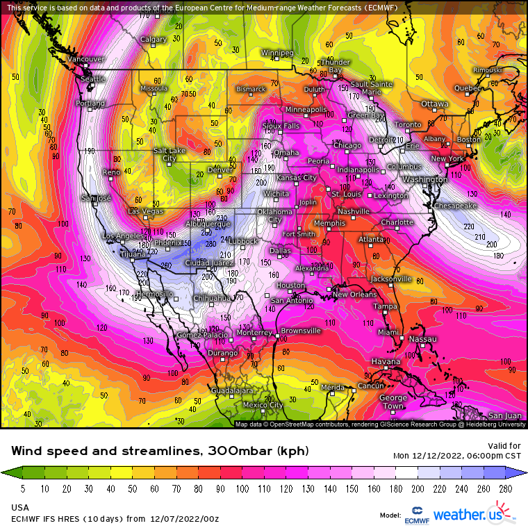
The impending blast of cold air will be ushered in with a bang – one of the potential severe weather persuasion. We’ll be watching early next week for a possible severe weather outbreak. More on that later this week.


