Cloud Cover Forecasts For Tonight’s Aurora Light Show
A large coronal mass ejection event, in which the sun spits plasma and associated magnetic field perturbations, is expected to impact the earth tonight. While sensible impacts should be effectively nonexistent, the geomagnetic storm will be strong enough to send the Aurora south into the northern tier of the United States. Now, I know very little about how solar storms work, and I encourage anybody curious to check out the NWS’s space weather forecasting site here. When it comes to forecasting the aurora itself, I will completely defer to their G3/K7 intensity forecast for tonight. According to their plot, this means a swath from northern OR through central ID and WY, northern NE, central IA, northern IL, IN, OH and PA, central NY, and northern MA will represent the furthest south points that may be able to see the Aurora. To the north of this line, then, Aurora viewing is magnetically possible.
From here, whether or not you can see the northern lights will be largely based on a few things: light pollution, cloud cover, and luck being big. Now, I have very little experience forecasting either luck or light pollution, but I figure it would be helpful to put out a discussion on where cloud cover is likely, and on what locations may actually have a spot to catch a rare glimpse of the aurora!
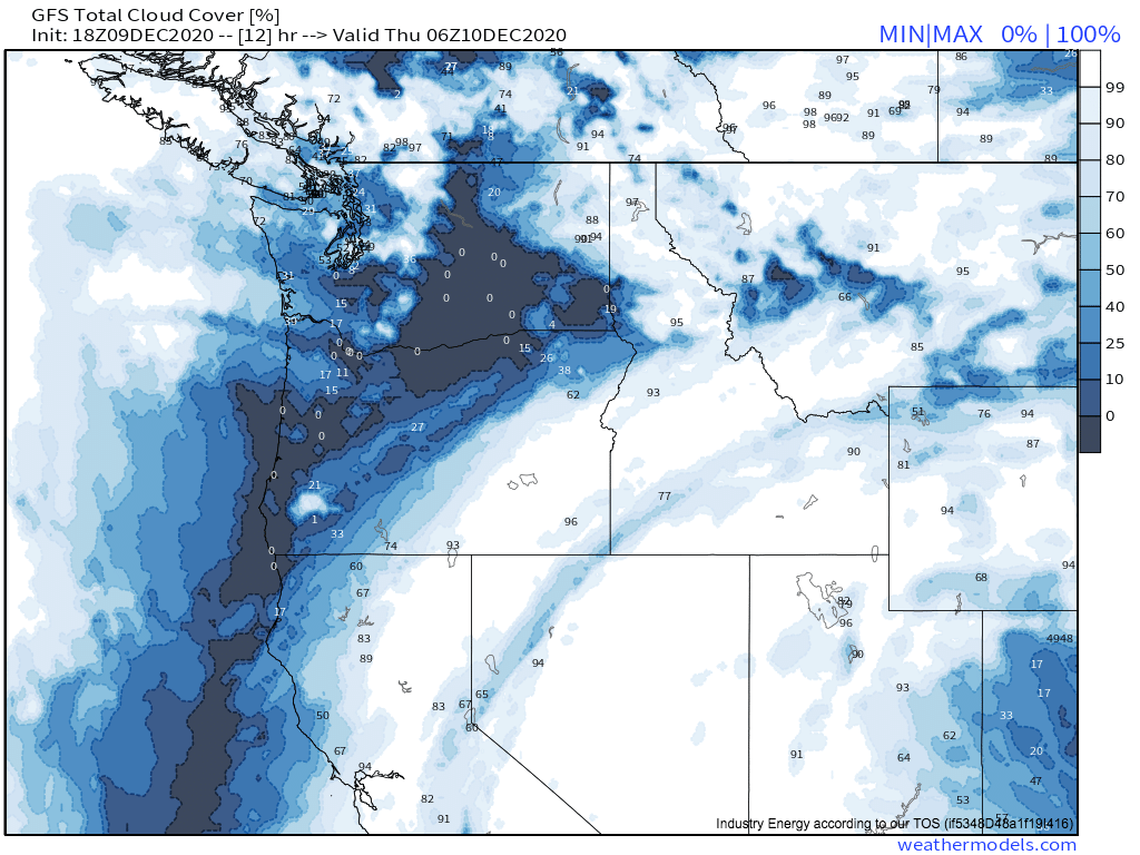
Let’s start in the Pacific Northwest. The big weather maker here will be a trough digging into Idaho and a stronger trough approaching the WA coast. Shockingly for an area that sees, well, a lot of weather, this combination will actually create brief ridging that should favorably align with peak aurora viewing hours (9:30pm to 1am, per a quick internet search) in parts of the region. The Pacific trough looks to bring some degree of lifting to the west of the Cascades in Washington, allowing moderate cloud cover to develop there by peak viewing hours, and a similar story will be likely with a subtle shortwave working with our California closed low to bring clouds to most of Idaho, Montana, and Wyoming. But between these features, over the Washington and Oregon lowlands, clear skies will likely bring great viewing conditions. Clear skies will also be present over sheltered valleys in Montana that typically remain cloudless under moderately moist westerly flow.
To summarize, good places to see the Aurora in the Pacific Northwest will be central Washington and north-central Oregon, alongside sheltered valleys in Montana. There’s also a fair chance of briefly alright viewing conditions in coastal Washington, including the Seattle region, although increasing cloud thickness with time will mean you shouldn’t bet on seeing much.
Next, let’s look at the north central states.
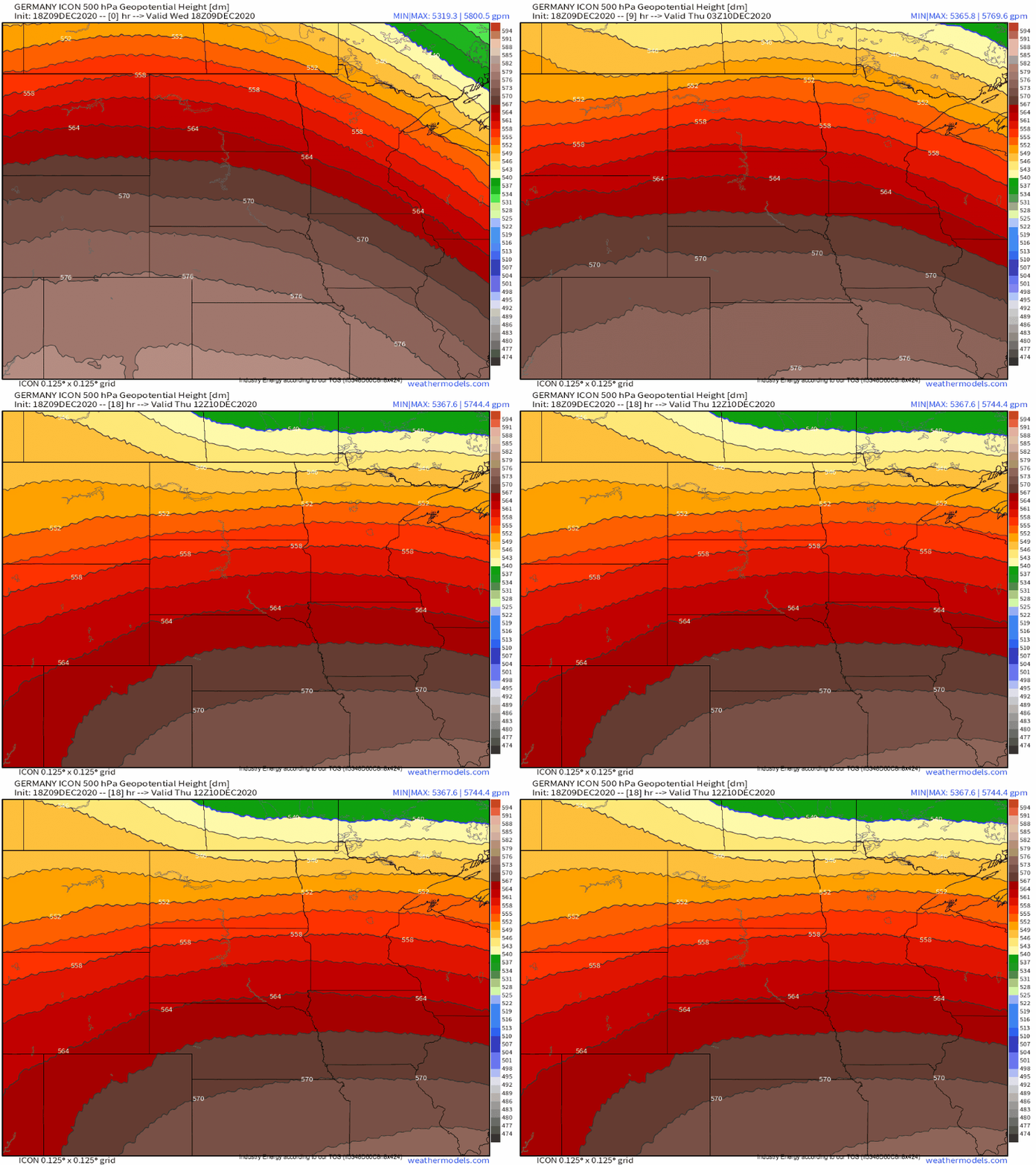
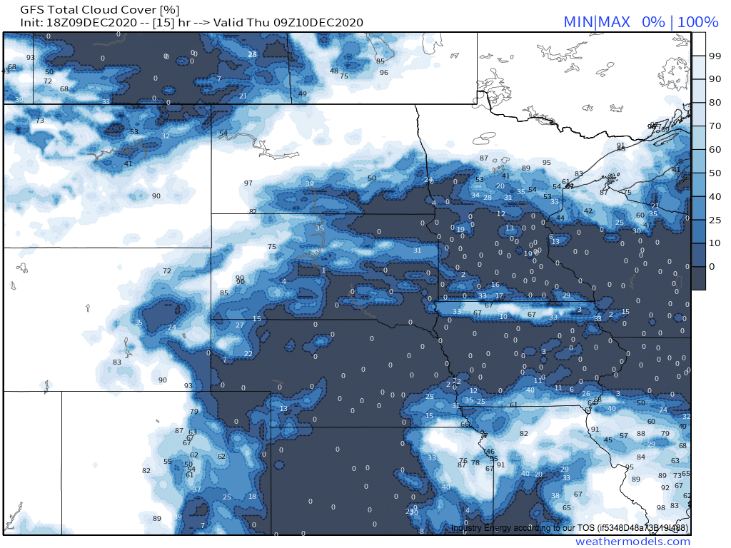
Relatively flat troughing will move with a large N-S component through the upper midwest through midnight, and clouds will spread from the NW into the region overnight. Now, some of north-eastern Montana will actually end up within a zone of convergence behind the shortwave during favorable viewing hours, leading to sinking air and a likely degree of clearing. But the motion of the same shortwave will likely serve to doom much of North Dakota, most of Wyoming, and west South Dakota to lifting and corresponding cloud cover. But otherwise, much of Wisconsin, eastern South Dakota, southern and central Minnesota, alongside some parts of N Iowa and the sheltered valleys downslope of westerly winds across eastern Wyoming, should all see mostly clear skies!
So, to summarize, a good chunk of the upper midwest will be good for potentially seeing some Aurora! Most of Minnesota, a swath of the Dakotas, and much of Wisconsin will be the best places. Some parts of Wyoming and slivers of Nebraska and Iowa could also potentially be favorable.
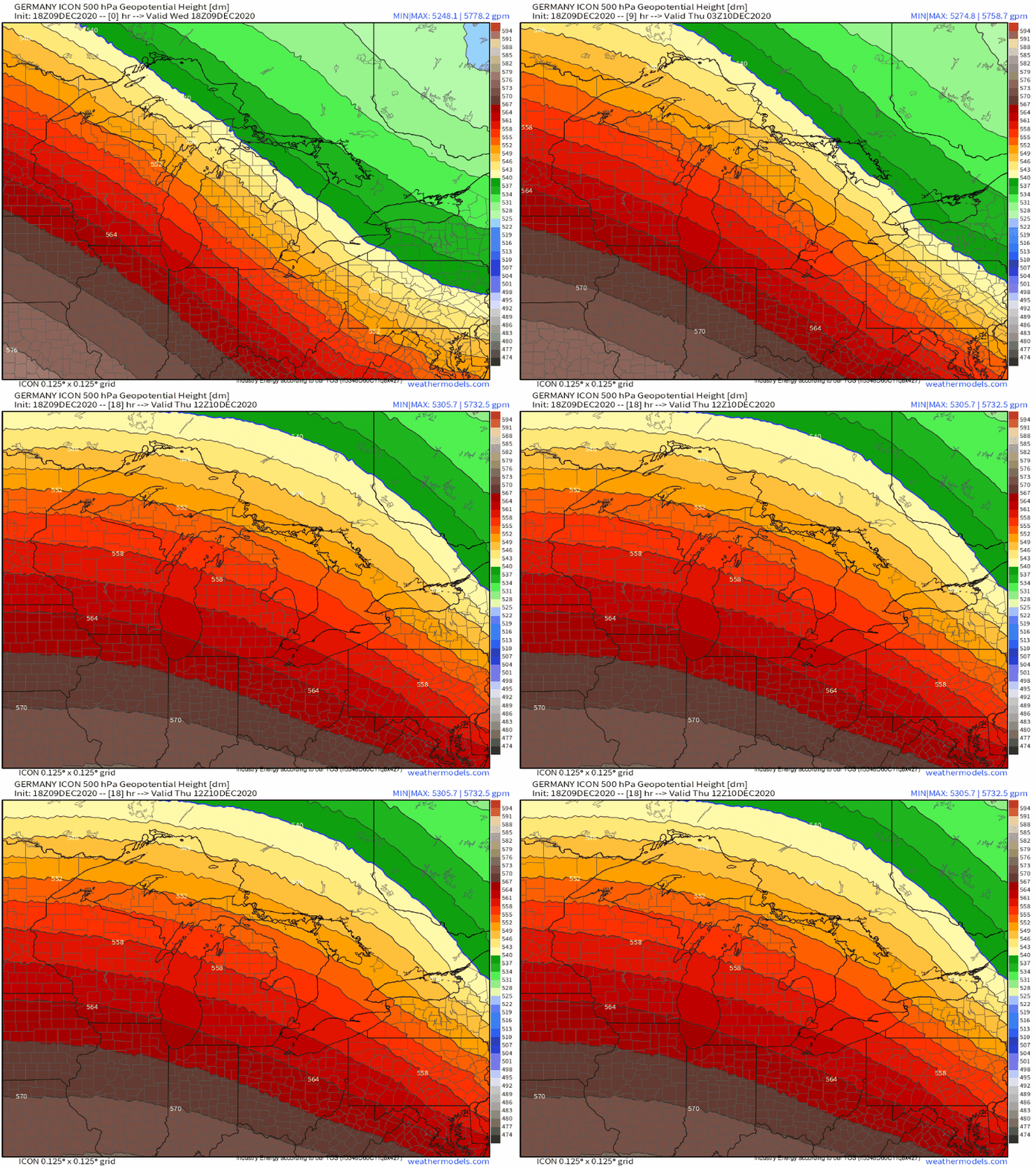
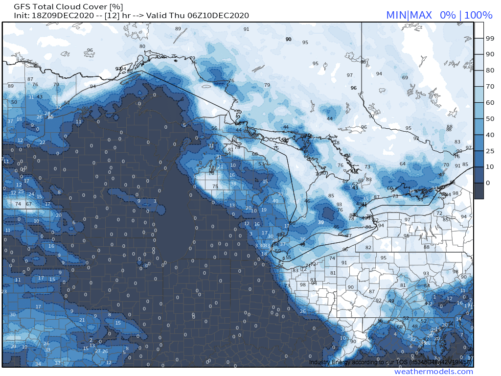
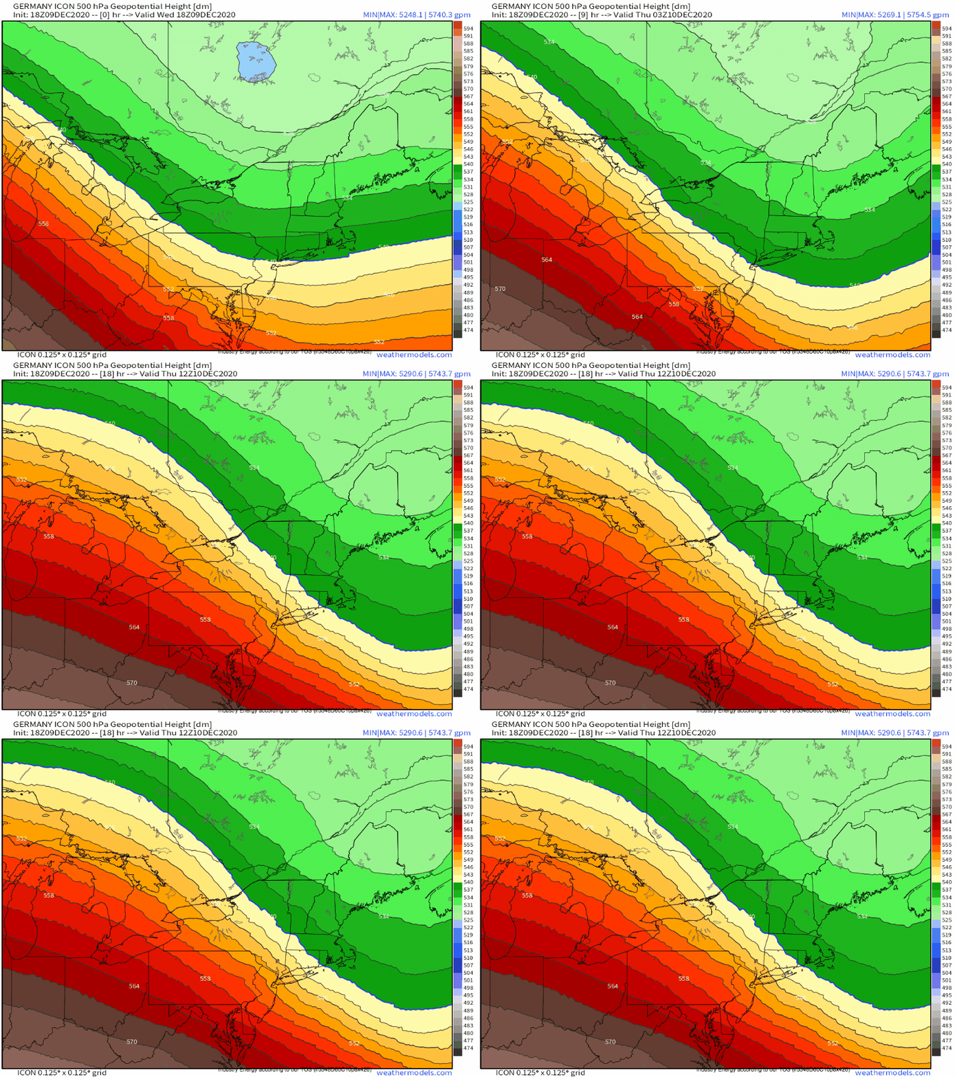
Moving right along, we get to the Great Lakes. Deep troughing shifting east over the Northeast will leave the Great Lakes with height rises as ridging builds in, which will foster sinking air and clear skies! Exceptions will be where NW flow will bring in fetches of lake effect clouds, which could overcome broad, synoptic scale descent in places. This looks most likely to occur over much of NE Michigan, W NY, W PA, and NE Ohio. But otherwise, the building ridging will foster an environment favorable for seeing the Aurora!
To summarize, most of Wisconsin, northern Illinois, northern Indiana, southwest LP Michigan and west UP Michigan, and perhaps a sliver of NE Ohio should be fair bets for clear skies and possible Aurora viewing, while parts of central and eastern LP Michigan could be edgy at the hands of lake clouds, and the rest of the region should be a no go thanks to the lakes.
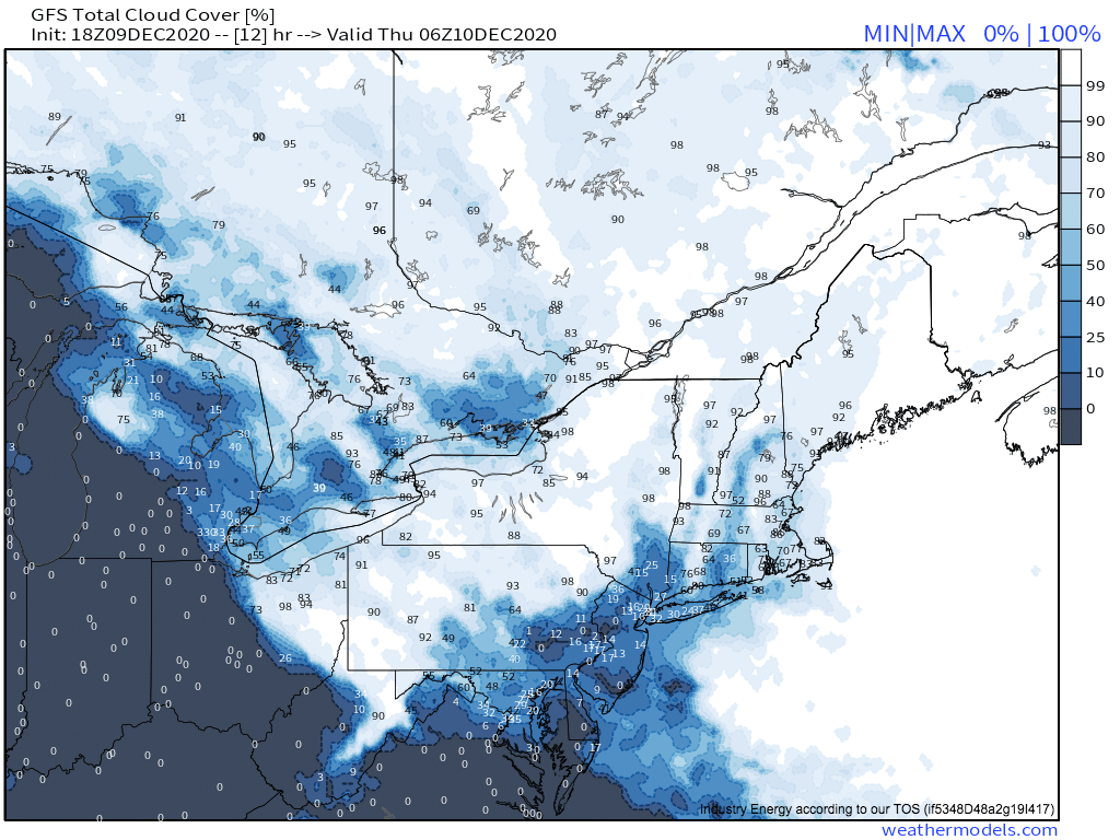
Finally, the northeast. A trough axis near Maine will allow lifting over eastern New England, and promote westerly lake-influenced flow over western parts of the region. This combination will make almost the entire area a no-go for Aurora viewing tonight.
The best anywhere could really feasibly get will be the relatively sheltered valleys of central NH and Vermont, although even here I wouldn’t count on it.
In conclusion, New England really won’t be very good anywhere for the Aurora. Central NH and VT will be the best bets, but neither will be particularly good. Darn troughing!
Happy Aurora hunting (:

