Classic Cold Air Damming Wintry Event This Weekend For The Northeast
Another week with quite an active stretch from severe weather today, to wintry weather tomorrow and into this weekend in the Great Lakes – Northeast regions.
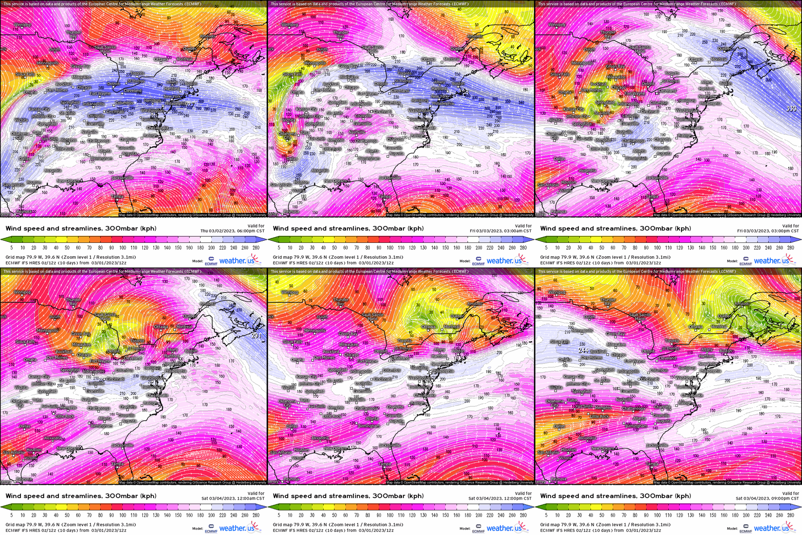
As I enjoy opening up these blogs utilizing the “top-down” approach, we see at 300mb plenty of upper-level divergence and diffluence downstream a potent upper-level trough! Notice the robust jet streak surging into the Ohio Valley while another jet streak is seen propagating across the Northeast into Nova Scotia. In between the left-exit region of the Midwest jet streak and right-rear entrance region, we see a healthy amount of mass evacuation in between – indicative of intense rising motion.
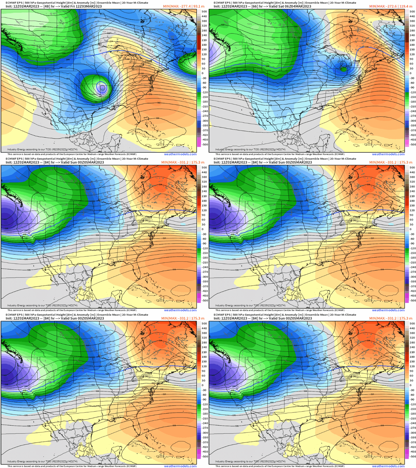
Making our way down to 500mb, you’ll notice a glaring deep anomalous “bowling ball” trough. This trough is the same catalyst that is responsible for providing strong forcing for the regional severe weather outbreak in the ArkLaTex / ArkLaMiss general areas. We see how this trough lifts into the Midwest before propagating into the Northeast, while it weakens.
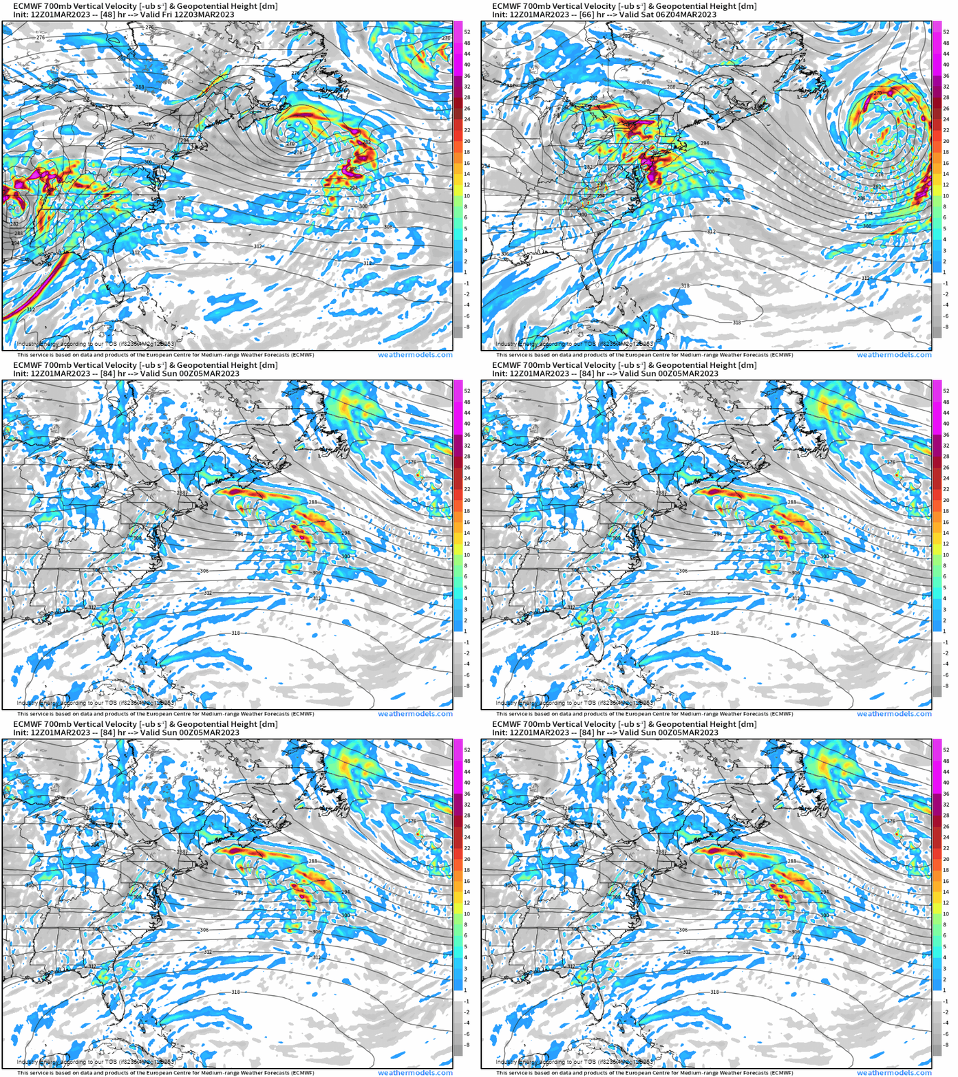
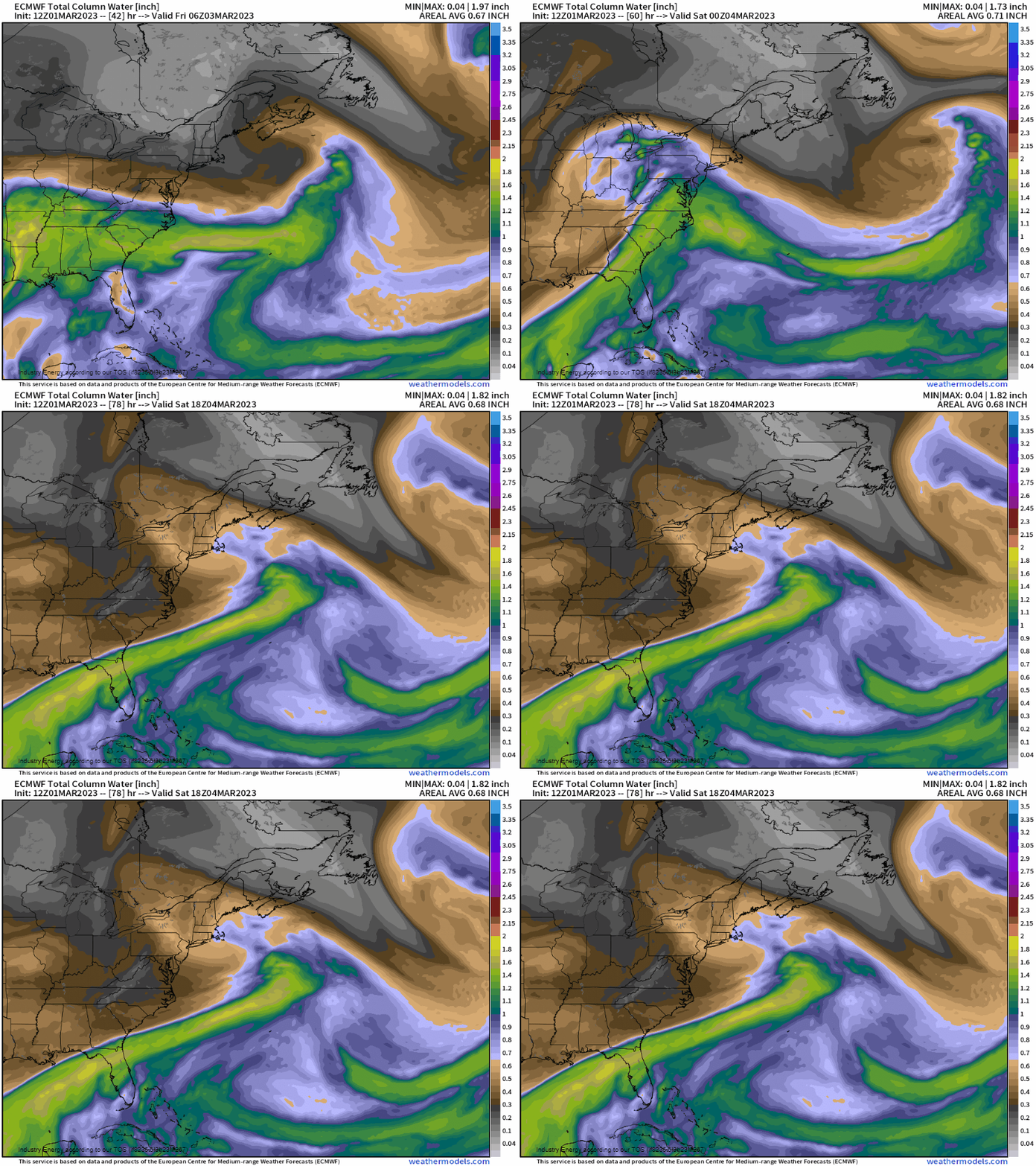
As we make our way closer to the boundary layer, here at 700mb we look to see where intense areas of rising motion in the form of omega, where the deeper colors are indicative of intense vertical ascent. Unsurprisingly with a deep cut-off trough lifting into the Midwest and Great Lakes, its low heights are proportional to the forcing for ascent. With such a potent mid-upper level trough ejecting from the Deep South and into the Midwest/Great Lakes, it also advects strong moisture via the Gulf. So we have strong forcing for ascent via potent trough and now we have moisture advection, along with strong rising motion. We’re seeing a great recipe for an anomalous system that’ll provide flooding rains to the Midwest, Ohio Valley, and over toward the Mid-Atlantic with heavy snowfall into the Great Lakes / Northeast.
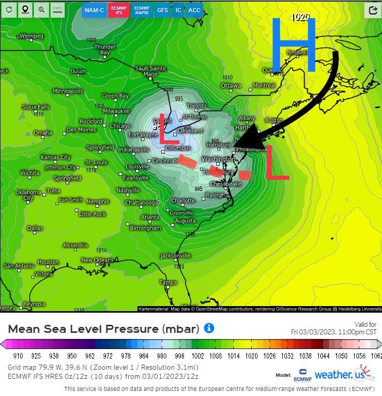
Once again, what we’ve seen several times now is a primary low head into MI / OH / PA, and a secondary low is transferred due to upper level confluence (or high pressure) over southern Canada. It’s upon approaching this transfer that we see a classic cold air damming signal, where northeasterlies via a surface high pressure wedges cold air down the spine of the Apps (leeward side) providing low-level cold air.

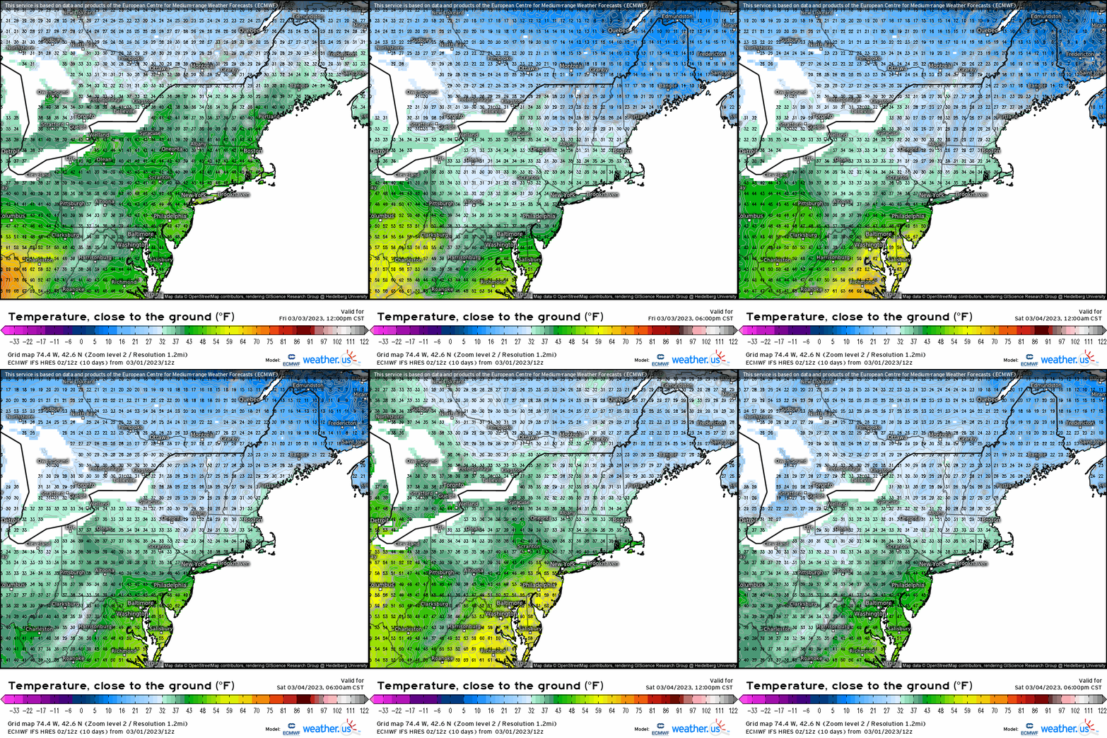
By taking a look at temperatures close to the ground, you can make out this “wedge” of low-level cold air that extends from Maine down into central PA. Now it’s during this transfer process, that warm air advection is allowed in between, and you can see this become reflected as all-of-a-sudden there’s a jump in temperatures up into BAL-NYC, while cold air stubbornly hangs across the typical areas from norther PA into the Hudson, and into SNE.
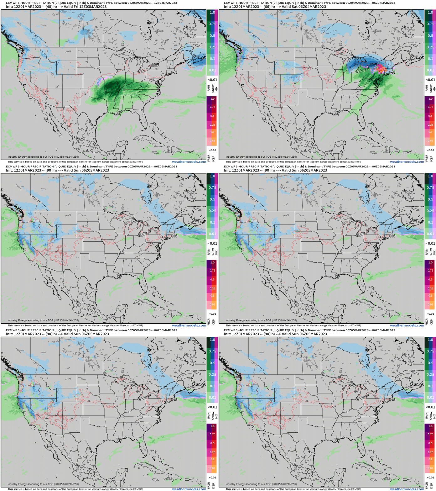
However, first we’re addressing that the heavy rain within the warm sector of this cyclone is bound to produce a widespread .50 – 1.00” of rain across the Midwest and into the Ohio Valley. Furthermore, this translates into the southern Mid-Atlantic and up the I-95 from DC to NYC.

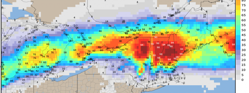
Now in terms of snowfall, once again from a probabilistic standpoint, we see a solid swath of 3”+ with higher confidence. Now despite being within the 24-36 hour timeframe, the track can still deviate, but this is a general consensus. Especially as you go further north, confidence is much greater. Now in the Northeast, this is still a but tricky, but probabilities of over 6”+ is pretty extensively great as this looks to be a major snowstorm for areas north of the Massachusetts turnpike and north of Albany, where ski resorts across NH, VT, and ME look to seriously help make up deficits.
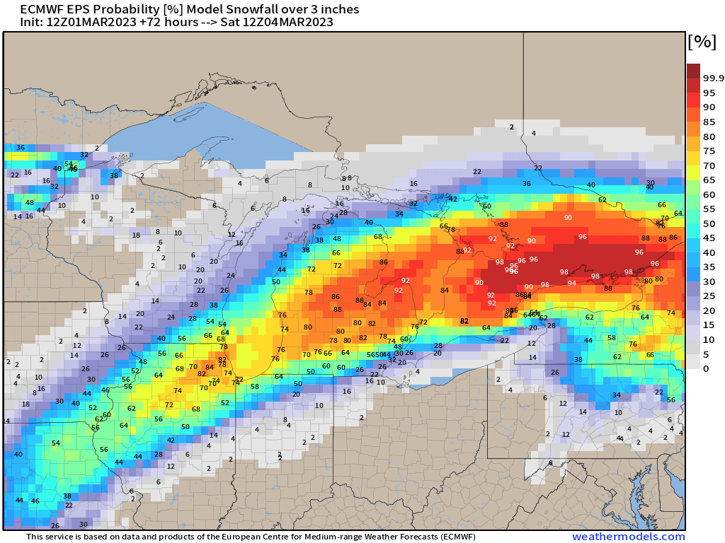

Now verbatim how this plays out (give or take) is as the low lifts into IL and IN, heavy rain will occur along the warm front that extends into southern Mid-Atlantic. Snow is going to be a close call for like Chicago metro, and more likely for SE WI and into MI. As the low lifts into western PA, we then see a transfer offshore somewhere south of LI due to the high pressure forcing that secondary low. It’s during this process we see a front-end wintry component for areas like in NE PA, lower Hudson, and possibly across CT, RI, and into southern MA. Further north, well we’re looking at quite a healthy snowstorm! Still likely to see some changes leading up to the storm, but this is one advantage of recognizing a cold air damming signal and knowing that cold air in the low levels hangs on stubbornly in situations like this for the Northeast!
