Chilly Rain and Even Wintry Precip for Parts of the Mid-Atlantic On This Friday
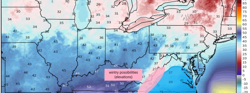
The first of multiple waves of locally heavy, persistent rain is making it’s way slowly across the southeast this morning. Jacob detailed this set-up and its effects in his blog yesterday if you haven’t read that one yet. Our topic today is a small part of the bigger picture for this weekend in regards to the rain, but it’s a feature somewhat unique to the mid-Atlantic that likes to rear it’s miserable head occasionally. We’ve seen a good deal of it this winter and this weekend will be no exception. I’m talking about Cold Air Damming. While the large part of the southeast sees generally warm rain and even thunderstorms today, parts of NC and VA will experience a cold rain and even freezing rain/snow in the elevations.
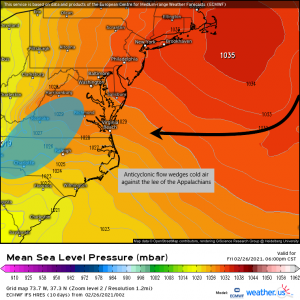
Cold Air Damming, at least in the mid-Atlantic, occurs when a strong high is located to the north/northeast of the aforementioned area. The clockwise circulation around the high funnels cold air onshore and down along the lee of the Appalachians. This air, being cold and dense, cannot rise over the mountains, has no way to spread out and modify, and instead stays wedged against them. Warmer air from the south is then forced to rise above the cold layer at the surface and creates an inversion. When the surface layer is below freezing, this sort of set up is ideal for freezing rain. If it is above freezing, however, it mainly means a miserable, cold rain.
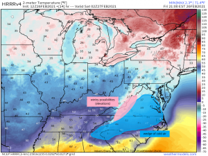
So that is what will materialize as the day progresses and the high strengthens. The air being funneled in by this high is cooler, but not frigid. Any wintry precip will be confined to the elevations, where it is already naturally cooler, while the valleys see cold rain.
Elevations of the Appalachians above 2,500 ft in northern NC, Virginia, and West Virginia have the chance to see a mix of sleet, snow, and ice. Accumulations are projected to be between 1 and 3 inches, mostly in the highest elevations only.
Fortunately, this won’t be a multi-day event as these sometimes tend to be. The high is forecast to move quickly off to the east and temperatures rebound tomorrow afternoon. It will still be rainy, but at least it won’t be chilly. For now, light those fireplaces and enjoy a cozy evening indoors before the spring-like warmth returns.


