Checking In On Invest 94L
Invest 94L remains more or less as we left it on Friday: an open wave expected to slowly organize over the next few days.
It has, in fact, strengthened some. The recent mission flown by the Hurricane Hunters indicated that tropical storm force winds exist in this wave, though mainly only on it’s north side.
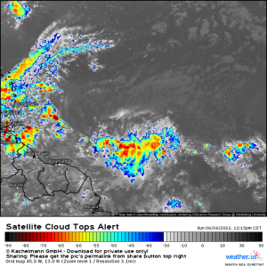
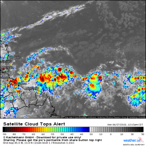
Until today, 94L has struggled with sustaining any convection gained from the diurnal maximum through the diurnal minimum.
Yesterday:
Today:
The difference is rather obvious. Today’s 94L has much more deep convection firing, though we can note that it is still elongated and disorganized.
So what will 94L need to do to gain TC status?
- It will need to detach itself from the ITCZ by “spinning off,” likely northward.
If you inspect the last satellite image, you can see sort of a bulge of convection on the northern side of the wave. It’s possible that 94L will attempt to pinch off from the ITCZ here overnight as we reach the diurnal maximum.
- It will then need to close off its circulation.
A few things may keep its evolution into a TC slow, however.
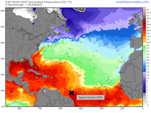
94L sits near a fairly tight gradient of SSTs. While the water it sits over is technically warm enough to fuel a TC, the water northeast of it is a bit cooler.
94L has been riding this boundary since it exited Africa. Part of its broad circulation may be passing over that cooler water and mixing it in, making it harder for deep convection to fire.
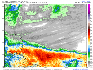
Most models don’t show 94L pulling its act together until it comes a bit closer to the Caribbean where abundant warm water awaits it.
Another issue is potential land interaction.
94L has been riding a mostly westerly course for awhile now. It will need to pull itself northward a bit or take on a more northwesterly course to avoid slamming in to South America. This course correction could occur when 94L detaches from the ITCZ.
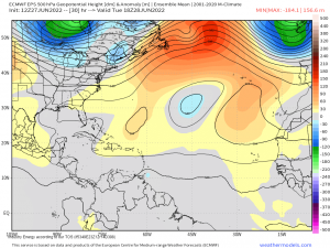
Assuming it does lift and acquire enough latitude to avoid most of South America, it will still have to deal with a blocking high building in. This leaves the disturbance nowhere to go but west, likely skimming along the northern periphery of the South American continent.
While it won’t strengthen as much as it would if it were over open ocean, if most of the circulation remains over the warm waters, it could still strengthen a bit.
Due to the blocking high forcing the disturbance/eventual TC west, this is unlikely to impact us here in the States.
The Lesser Antilles – the arc of islands located where the Caribbean meets the Atlantic – along with perhaps the coasts of Guyana and Venezuela are first up for impacts.
Remember that 94L is still unclassified. However, whether or not it is upgraded to a tropical depression in the next 24 hours or so, the impacts will remain the same.
Heavy rain along the coasts/over the more southern islands along with gusty winds. Per the findings of the Hurricane Hunter mission, the gustier winds are currently contained on the north side of the disturbance. Where ever that end passes through would likely see the stronger winds – most likely the southern islands.
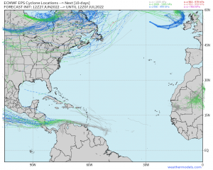
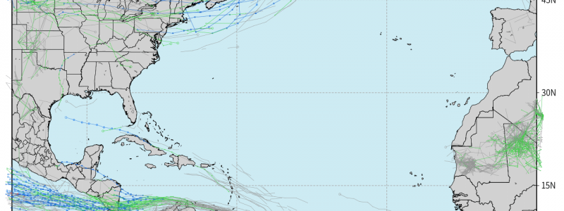
Guidance keeps 94L weak as it skims along the northern periphery of South America. Once it clears the land mass, it may have a chance to strengthen some before impacting Central America. But again, all this depends on 94L closing off a circulation relatively soon.
Stay up to date on 94L plus the wave behind it and the area of interest in the Gulf by checking our blogs and Twitter feed!
