Checking In On August
Well, here we are at the final day of July. Summer activities are winding down, children are returning to school soon, and some of us start looking forward to fall.
Can we expect a change in the pattern this week? Let’s take a look at what the first week of August has in store for us.
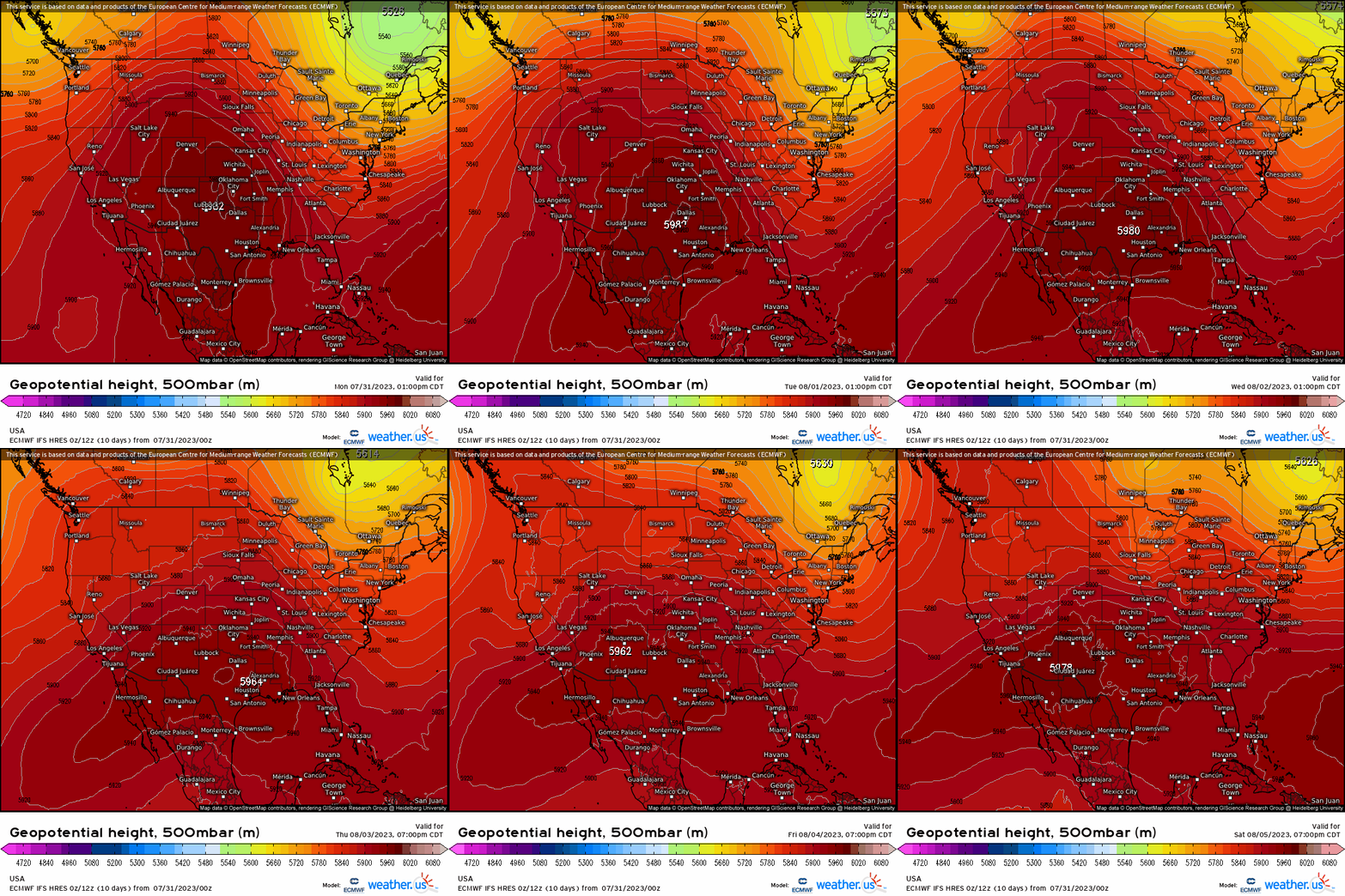
Unfortunately for those weary of the seemingly never-ending heat, the pattern won’t change too much this week.
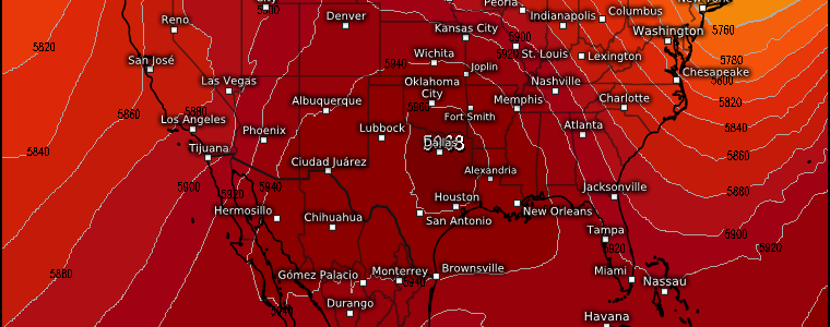
As we can see on the map above, a ridge will remain centered over the Central US for most of the week, before shifting more to the Southwest by the weekend. This means the heat will persist for the central and southern portions of the US.
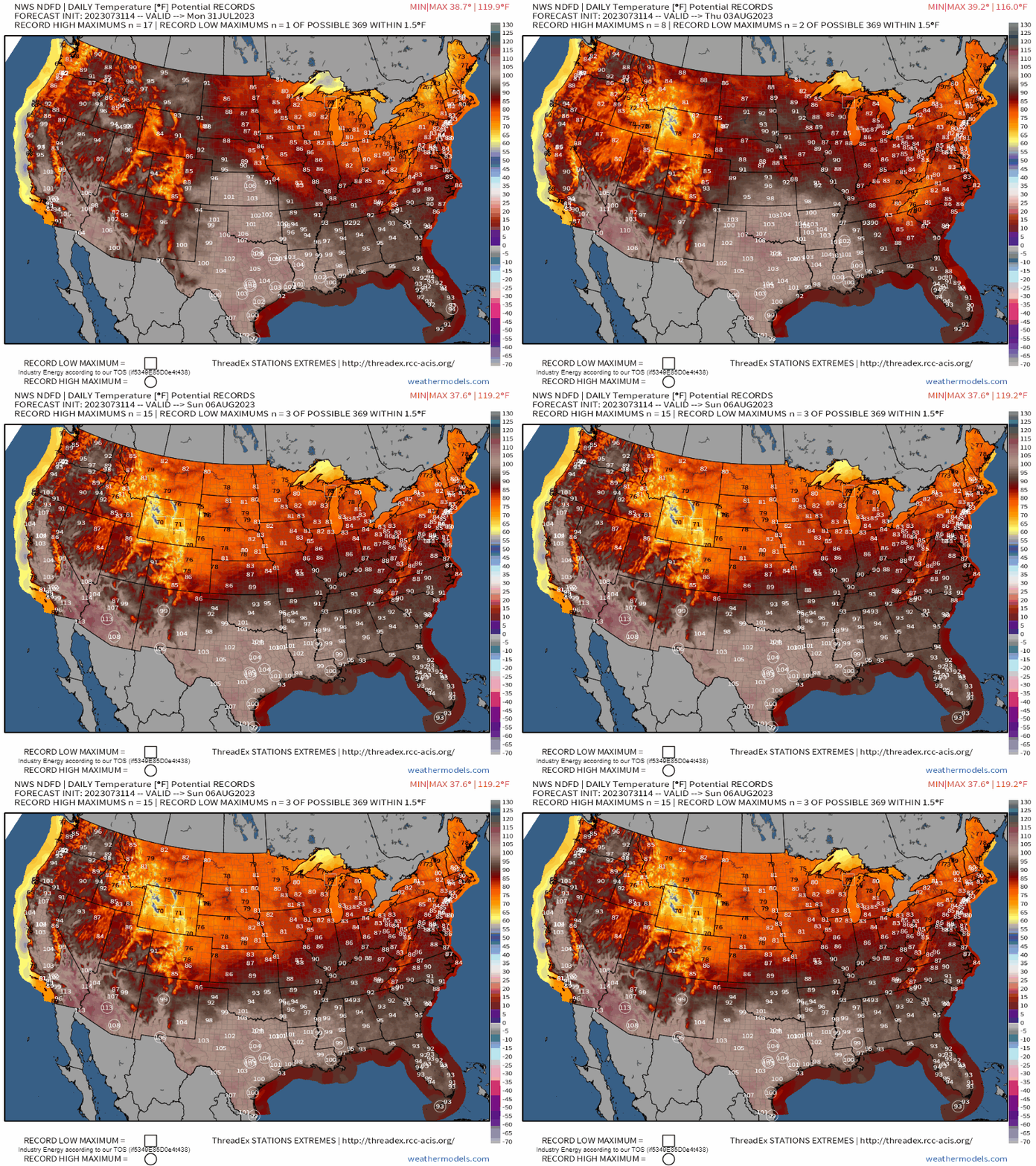
More records will be in jeopardy over the South-Central US in the first half of the week, and then for the Southwestern US by the end of the week as the aforementioned ridge crawls westward.
While the North-Central US starts the week off hot, once the ridge moves west, comparably cooler temperatures will settle in for the second half of the week.
The Northeast will remain under the influence of troughing for most of the week, allowing temperatures to be more seasonable – if not a little below average. This is, no doubt, a nice change from the sweltering temps experienced last week.
Though the West Coast will start off the week with temperatures average to slightly below average, heat levels will creep up as – you guessed it – the ridge slides westward later this week.
What about precipitation/storms?
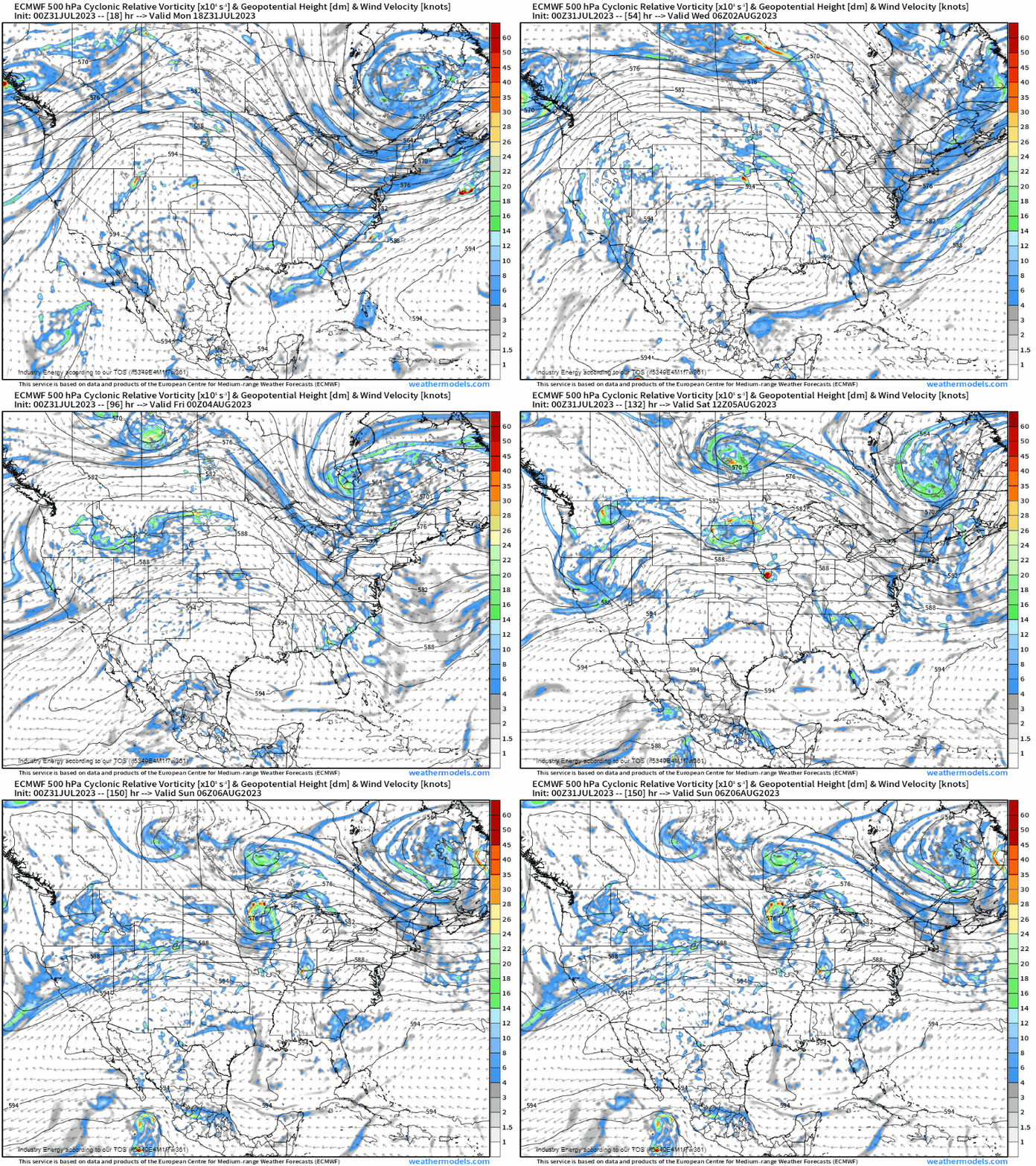
In addition to the air mass thunderstorms under the ridge, multiple disturbances will move around the periphery of the ridge throughout the week. Though chances for widespread, organized severe weather seem rather low right now and are confined to the areas over which these impulses pass, a decent portion of the country will have some risk of thunderstorms through the work week.
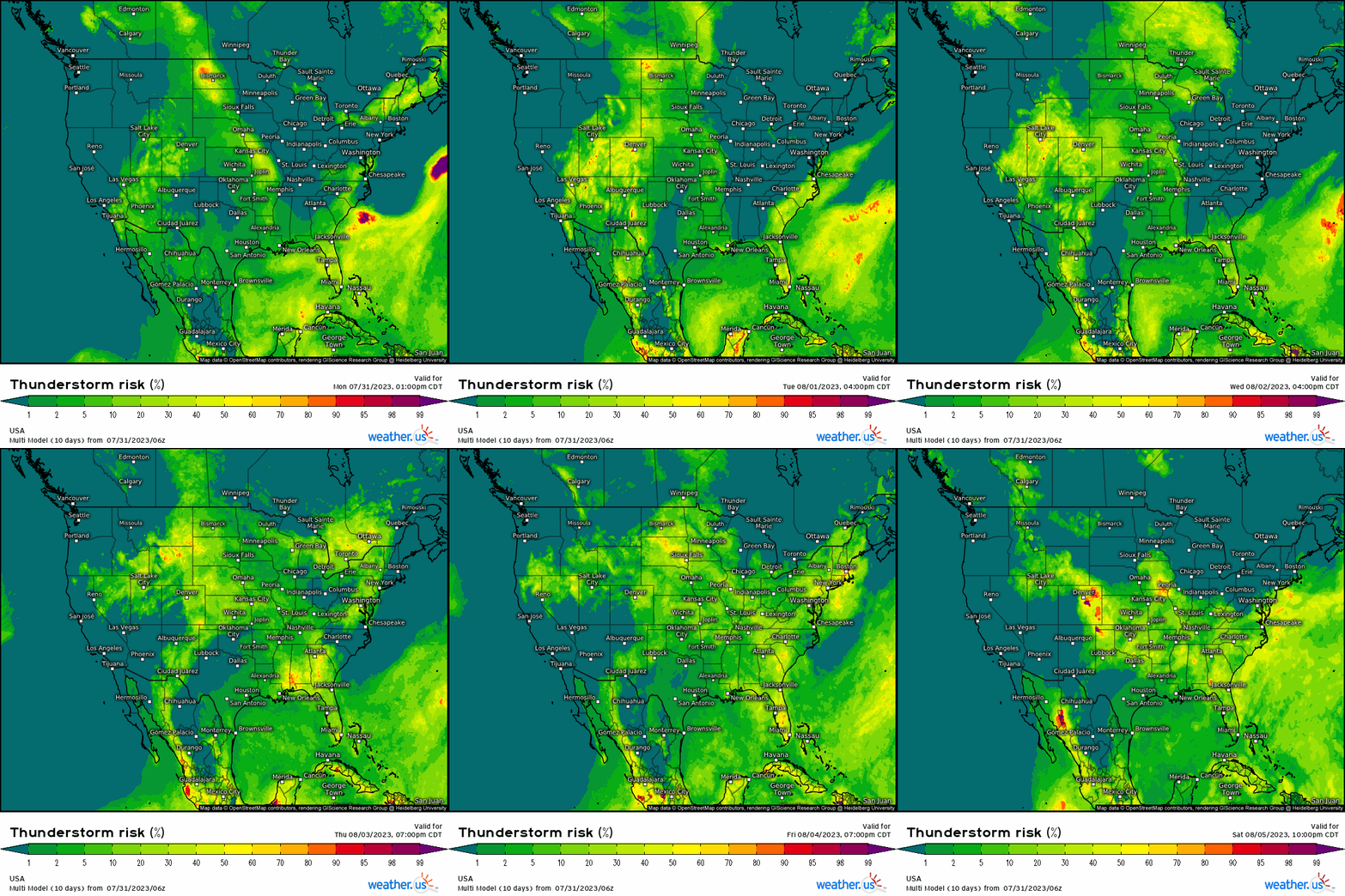
I know you’ve heard this from me (and other sources) before, but if you’re out enjoying the last bit of summer before school starts, stay weather aware.
With plenty of heat/instability to work with, these storms could be prolific lightning producers. If you’re close enough to hear thunder, you’re close enough to be struck by lightning – even if you can’t see the tell-tale dark clouds.
How does the rest of August look?
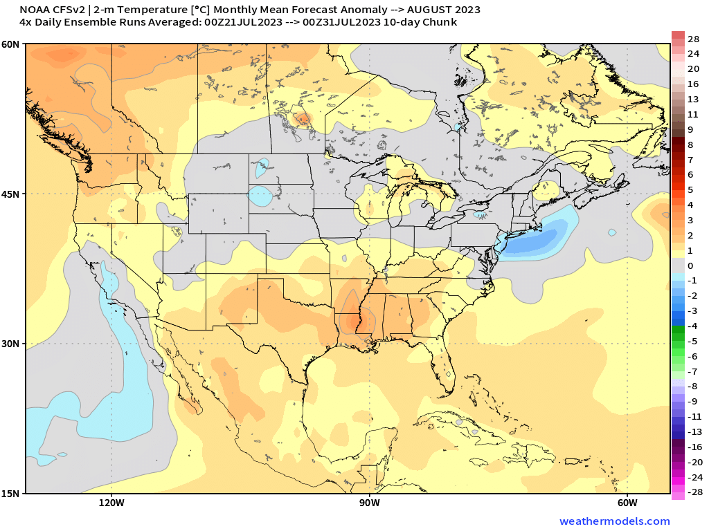
The monthly temperature forecast from the CFSv2 suggests that regions that have been hotter than average will stay that way while most of the northern half of the country will linger around average. This more or less lines up with the pattern we see developing toward the end of this week (ridging south and southwest, more zonal flow elsewhere).
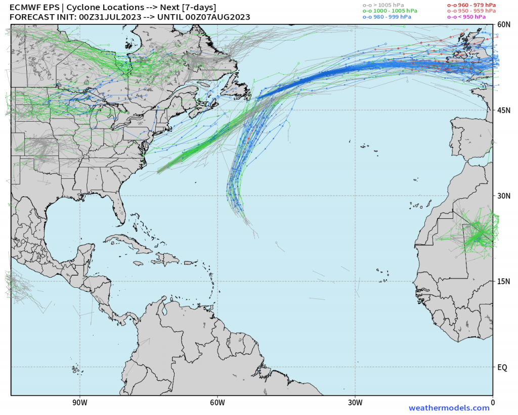
Further – since it is hurricane season – as we check in on the tropics, the overall pattern will favor keeping any developing systems well out to sea and away from the US mainland for the next 7 days at least. Those residing in coastal locations or with an upcoming vacation can breathe easy for a little while longer.


