Chaotic Storm Evolution This Weekend Across the Southeast & Mid-Atlantic: Update
What initially appeared as a pretty straightforward, low impact weather weekend east of the Mississippi River, has drastically shifted a more chaotic sensible solution. Megan in her blog from yesterday summed up this ideology very well!
I’m going to help emphasize this point regarding how truly unpredictable the atmosphere can be, despite the remarkable accomplishments meteorologists and forecasters have carried out for decades!!
We’re going to dive into this by simply showing the drastic differences in model prognostication using the ECMWF, which is characteristic of basically all of numerical weather models at this juncture. Here is a run from February 5th (00z) compared to February 8th (12z), to recently 00z February 11th. z500mb are on top (older to newest top to bottom) with surface reflection below respectively.
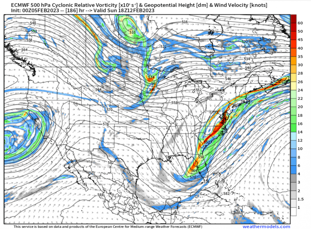
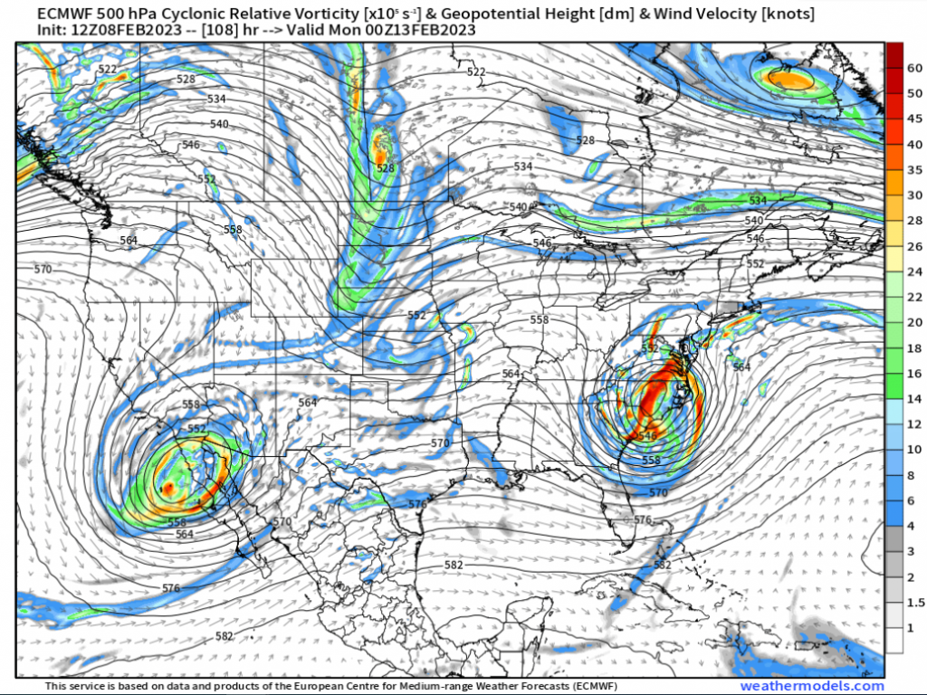
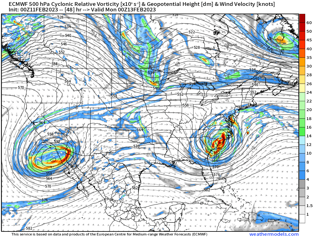
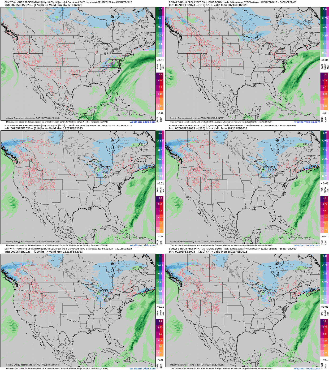
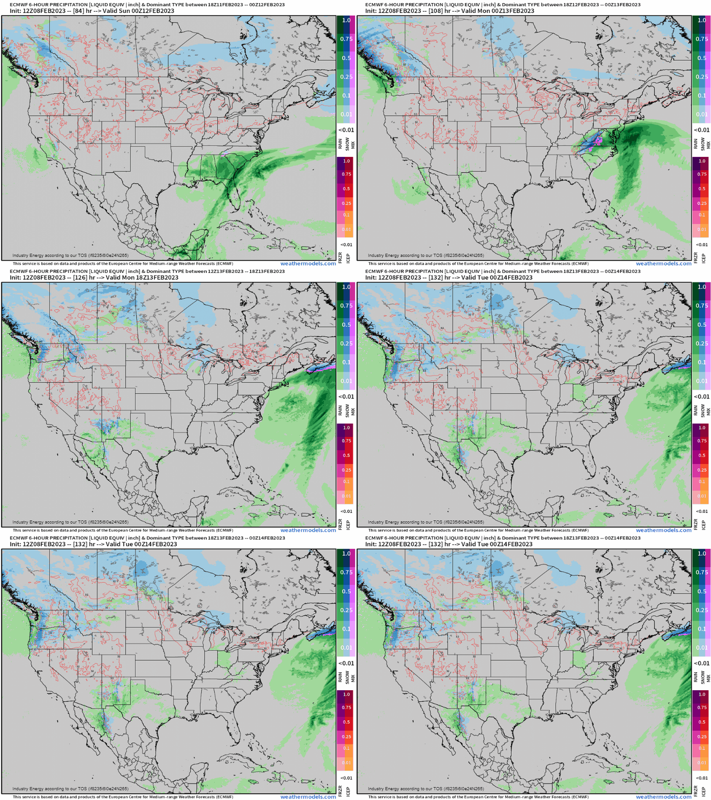
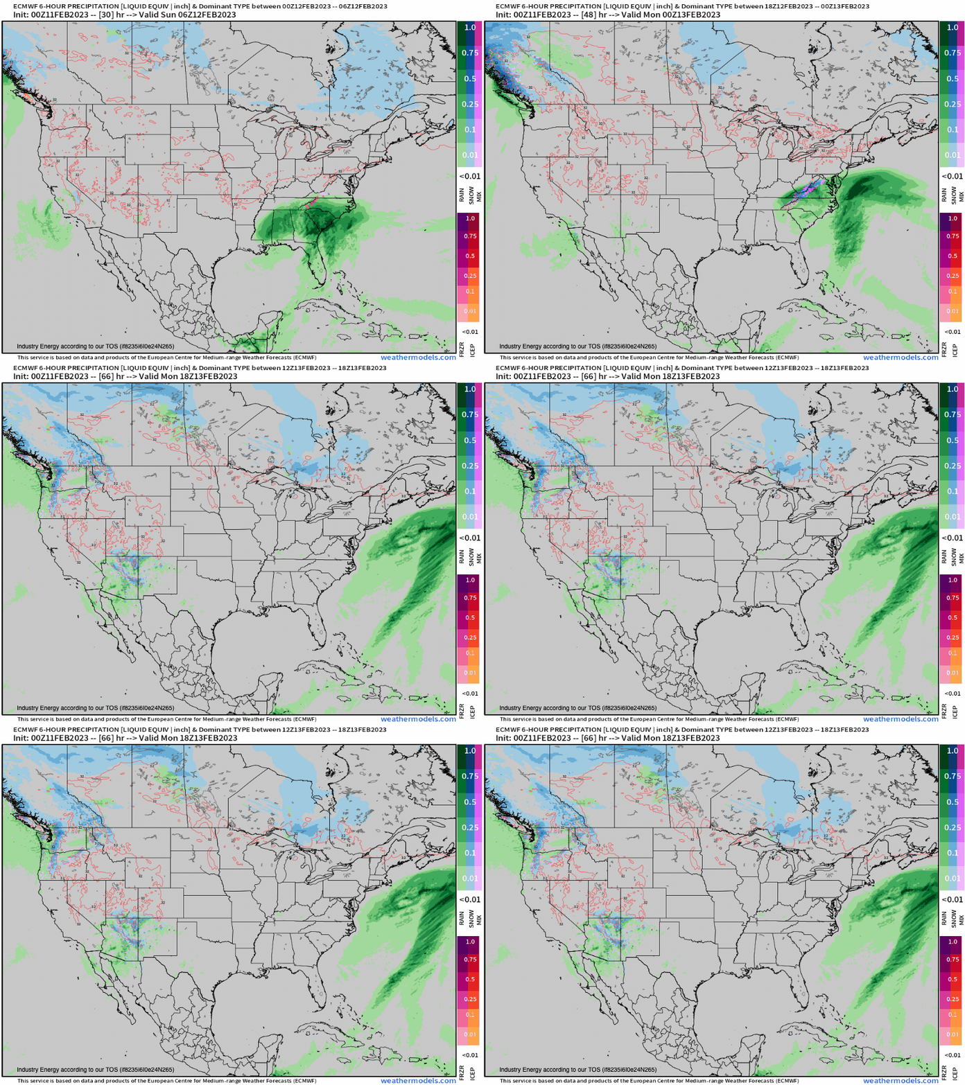
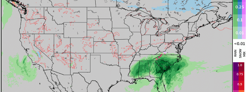
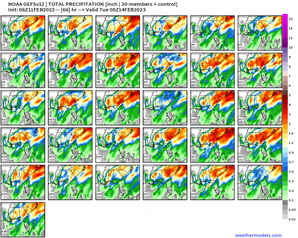
In just a matter of days, we’ve seen a progressive southern stream vorticity max that originally would zip by, to now it essentially cutting off from the mid-upper level flow. This has now become a cut-off low, that slowly traverses the southern branch of the jet stream and meanders off the Southeast coast before finally kicking off to the Northeast. The result now goes from hardly any forecasted original rain, to now 1-3”+ of rain (locally higher) along and near the I-95 corridor from Florida to Virginia. Here is the GEFS (31 ensemble members) depiction for total rainfall through tomorrow showing the strong consensus for a minimum of an 1” from AL to VA.
What about snow… it’s middle February, right?! Well, I can certainly say that in a remarkable winter as we’re currently enduring with how snow just has managed to evade many areas east the Apps, it really does not shock me one bit that with a crawling system from the south we’ll lack a key ingredient. The overall antecedent airmass is warm, and a high pressure that shifts over-the-top is modified continental polar air that just fails to supply any fresh cold air injection. Instead, we get a slowly moving mid level low that advects warm, moist air that wraps around creating a thermodynamically poor environment for widespread snow except for higher elevations, which also was very nicely stated by Megan as well in her aforementioned blog. Along with the former, we have lack of any connection to the polar jet as well since this vorticity max separated itself from the northern stream. Dynamically, if precipitation falls hard enough with some marginality given that it’s still the middle of February, the vertical column could still theoretically cool enough through melting (i.e. takes energy from the ambient environment to melt frozen particles aloft thereby the need for energy results in cooling). The consensus has become pretty clear as of now in terms of snow:
- Elevations above 2500-3000 ft have now > 60% of over 6” (>85% of 3”) of snow in the Blue Ridge mountains of NC into SW VA, where locally 8”+ look to occur.
- An inch is likely now from northern GA, into eastern TN (surrounding lower elevations of Smoky Mountains), western VA, and into eastern/northeastern WV; however, this is still somewhat elevation dependent and likely a nowcasting situation as these upper level lows are notorious for causing surprises when all said and done.
- Freezing rain has become a concern up until now thanks to near surface freezing levels and isothermally favored for frozen particles to be able to freeze on contact, though the degree of surface temperatures are marginal at best. As of now, we could be looking upwards to 0.1” of ice accretion in the Shenandoah valley, and generally around NW NC and SW VA.
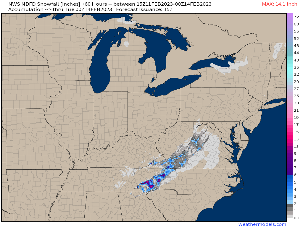
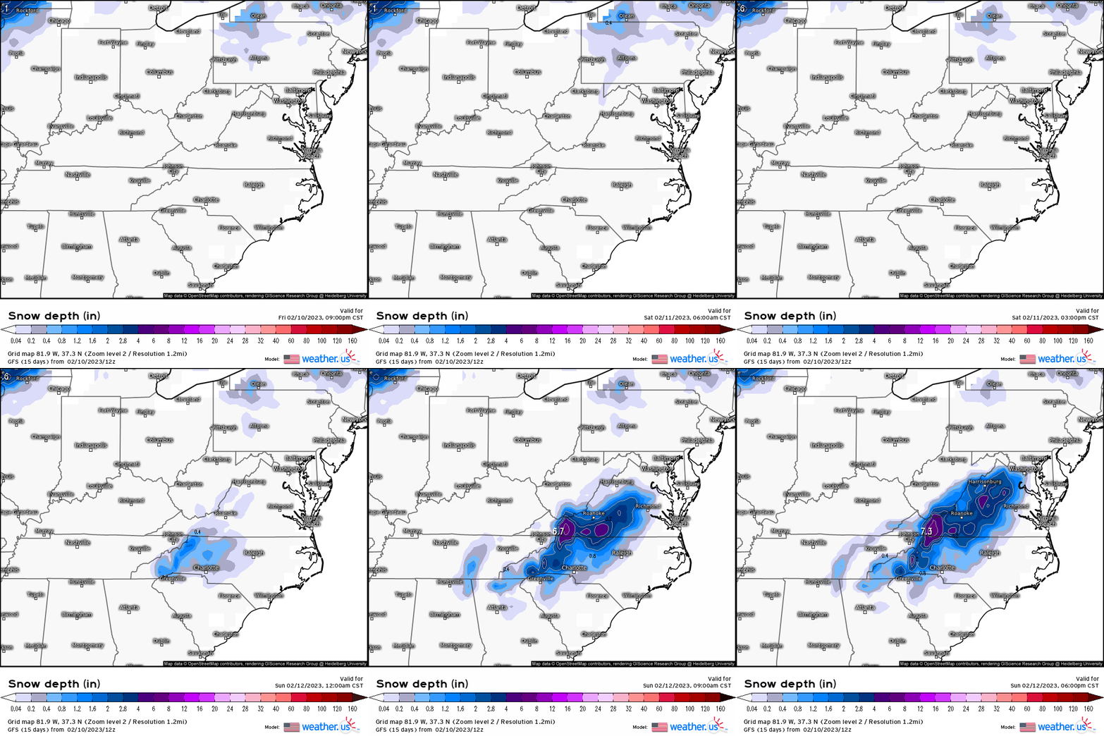
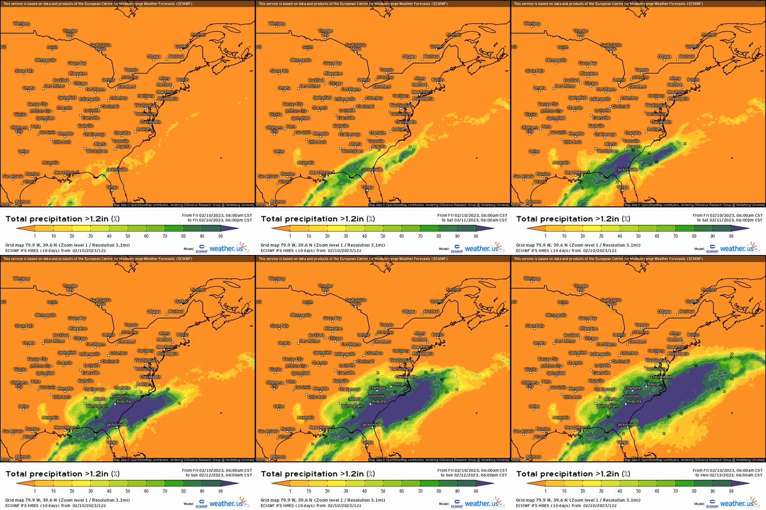
Elsewhere, we’re looking at mainly rain as we see a strong probability (>80%) for over an inch of rain from SE AL and northern FL, up through the entire SE coast, and into the southern Mid-Atlantic.
Weather truly can be unpredictably fascinating, but at least we can utilize ensembles to reveal the variance and uncertainty because some individual members can show this or hint at it. If not, one must immediately just adjust in the short-term to even a nowcasting situation, because the atmosphere loves to throw curveballs.


