Central Plains to See Severe Thunderstorms Threat Tomorrow
Thirty years ago today, a massive tornado outbreak tore through Oklahoma and Kansas with four EF4s and an EF5.
Twenty years ago today, there were no SPC storm reports in the entire CONUS.
Ten years ago today, day two of the largest known tornado outbreak in world history ripped through the southeast with a half dozen EF3s, setting the stage for catastrophe on the day to follow.
Today, a hail report or two is possible in the vicinity of South Dakota as elevated storms fire north of a strong warm front.
I discussed this threat, and began laying the groundwork for a discussion of tomorrow’s hazards, in a blog published Saturday. I’ll start this one from where I left off last time- a discussion about a fairly good environment for tornadoes with numerous failure modes, presenting a maze the atmosphere must thread.
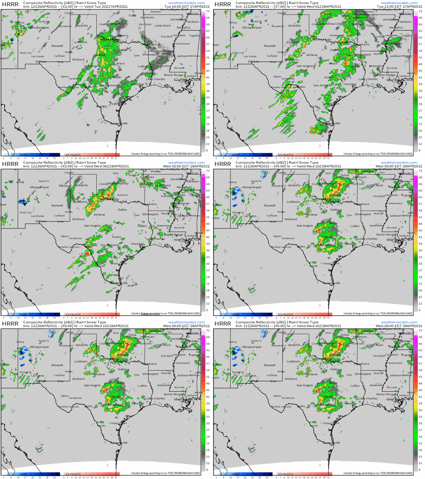
Of course, this will take place tomorrow from Texas to Nebraska, a swath of the country that’s been scrutinized in depth since the SPC uploaded a day 7 risk delineation there in the middle of last week. The setup is, frankly, looking to arrive with much lower potency than some forecasters expected, a good lesson in not counting chickens until high-resolution convective allowing models depict them hatching. This comes as a more progressive, disjointed trough than initially anticipated will result in a less consolidated, intense cyclone. A myriad of detriments to tornadic storms will follow:
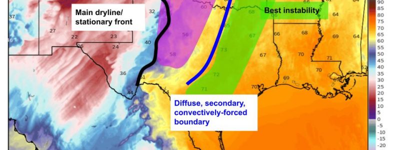
- The likely development of a secondary boundary to the east of prime kinematics by tomorrow afternoon along early convection, which will force the bifurcation of the warm sector over OK and TX such that prime instability to the west doesn’t really overlap with prime kinematics and forcing to the east. This is really, really detrimental for tornado risk.
 Link
Link
2. Midlevel flow with a northerly component, somewhat parallel to any conceivable initiating boundary, will lead to rapid upscale growth of any development that should occur in the best kinematic environment.
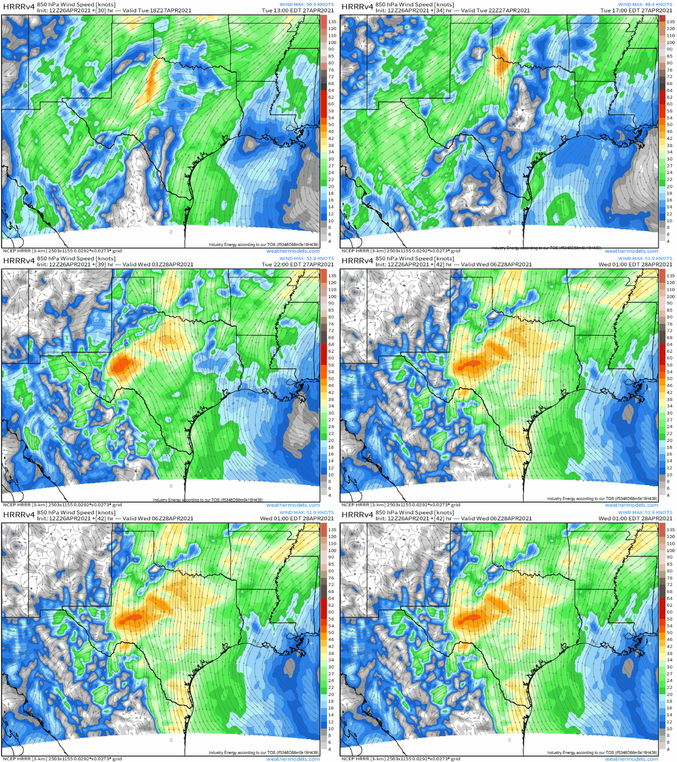
3.Weaker cyclogenesis won’t let much of a low-level jet strengthen. While what does develop will be strong *in places*, it won’t be everywhere, and even the relative wind maxima won’t be overly intense. This is yet another variable that will impact the forecast day of.
Because of these three factors, I forecast that, with less than average confidence, the environment from Texas through Oklahoma won’t support much of a tornado threat; any tornado that does form will probably be EF0-EF2 in intensity, and for a tornado to be stronger, an incredibly unfortunate overlap of locally maximized parameters beyond the realm of predictability would have to occur. This will be most likely just east of the TX panhandle or in E Oklahoma, where kinematics and instability, respectively, look to maximize, but it remains unlikely anywhere.
Further north, there is some CAM support for a few discrete supercells along the warm front in Nebraska. Near-surface stability makes me think that, while possible, such convection will probably be largely hail-producing, although a photogenic supercell could be possible.
Stay tuned for updates on our twitter!


