Category Four Ida Approaches Catastrophic Louisiana Landfall
A calamity is likely underway as hurricane Ida rapidly intensifies this morning on approach to an eastern Louisiana landfall.
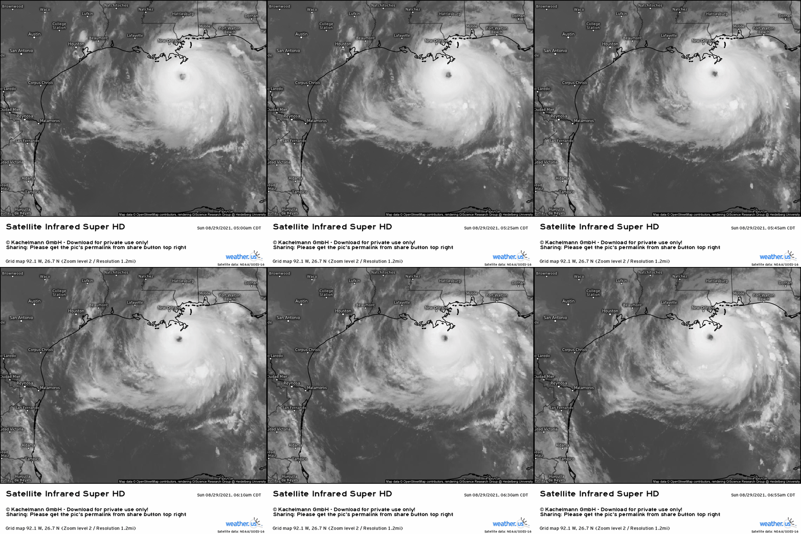
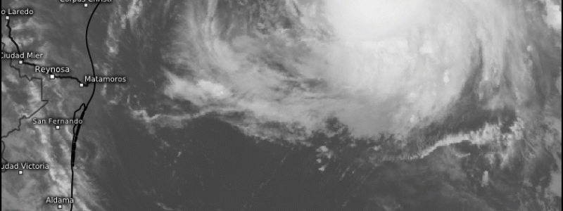
The storm is knocking on the door of category five intensity after a night of dramatic strengthening that brought Ida from a 105mph category 2 at 12am CDT to a 150mph category 4 at 7am CDT. Satellite shows an extremely organized hurricane this morning, with vigorous convection exploding symmetrically around a cleared out eye. On all sides, fanning cirrus clouds demonstrate the well-organized outflow that’s helped the storm deepen explosively, to 933mb as of 7 am CDT- a 30mb drop in the last 8 hours. Update: 15 minutes later, at 7:15am CDT, pressure has fallen once again to 928mb. Ida is still deepening at an extraordinary pace.
We have forecasted and analyzed Ida excruciatingly over the past few days, and it was always apparent that a storm this intense could occur. However, seeing it occur remains incredibly jarring- it is something we will never forget. Our atmosphere is incredible and terrible and produces both beautiful and horrific phenomena.
There’s no ambiguity left at this time- Ida presents impacts that will likely prove extremely life threatening to anybody in the vicinity of landfall, from Houma to New Orleans and inland to Baton Rouge. With landfall imminent, it’s far too late to leave, and preparations critical for survival must be rapidly completed. A terrible chapter in weather history is unfolding.
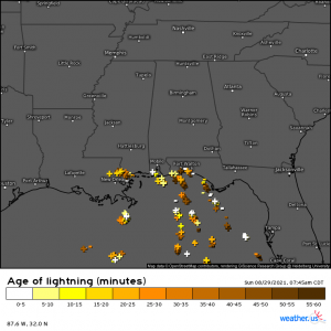
Even now, so close to shore, Ida is firing convection in its eyewall, using every second of time it has to further intensify before landfall.
Whether Ida does manage to reach low-end category 5 intensity or not, the effects will be the same:
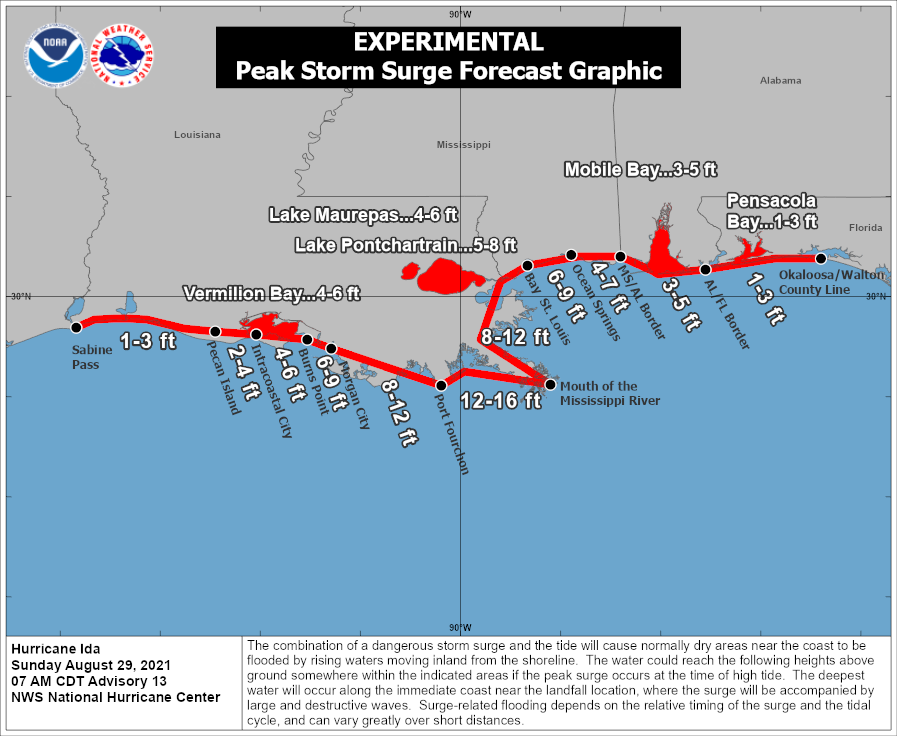
Storm surge will be disastrous across a wide swath of southeast Louisiana and far southwest Mississippi today, as a massive wall of water pulled vertically by the immense pressure drops of Ida slams ashore. Surge will NOT be as bad as it was during Katrina, as that storm was far larger and had a much stronger peak intensity, and the New Orleans levees are, at large, NOT likely to be overtopped in a similar way. Some overtopping of West Bank levees is possible, though secondary pumping defenses *should* be able to prevent flooding there.
Outside these levees, substantial inundations exceeding 9 feet will submerge property, destroy beaches, infrastructure, and roads, and threaten the lives of anybody close enough to the coast this morning to experience it. This is the type of surge that, at peak, could exceed 15 feet- nearly unsurvivable. Anybody still in threatened areas will want to be on the highest possible floor of a well-built building that will also be protected from wind.
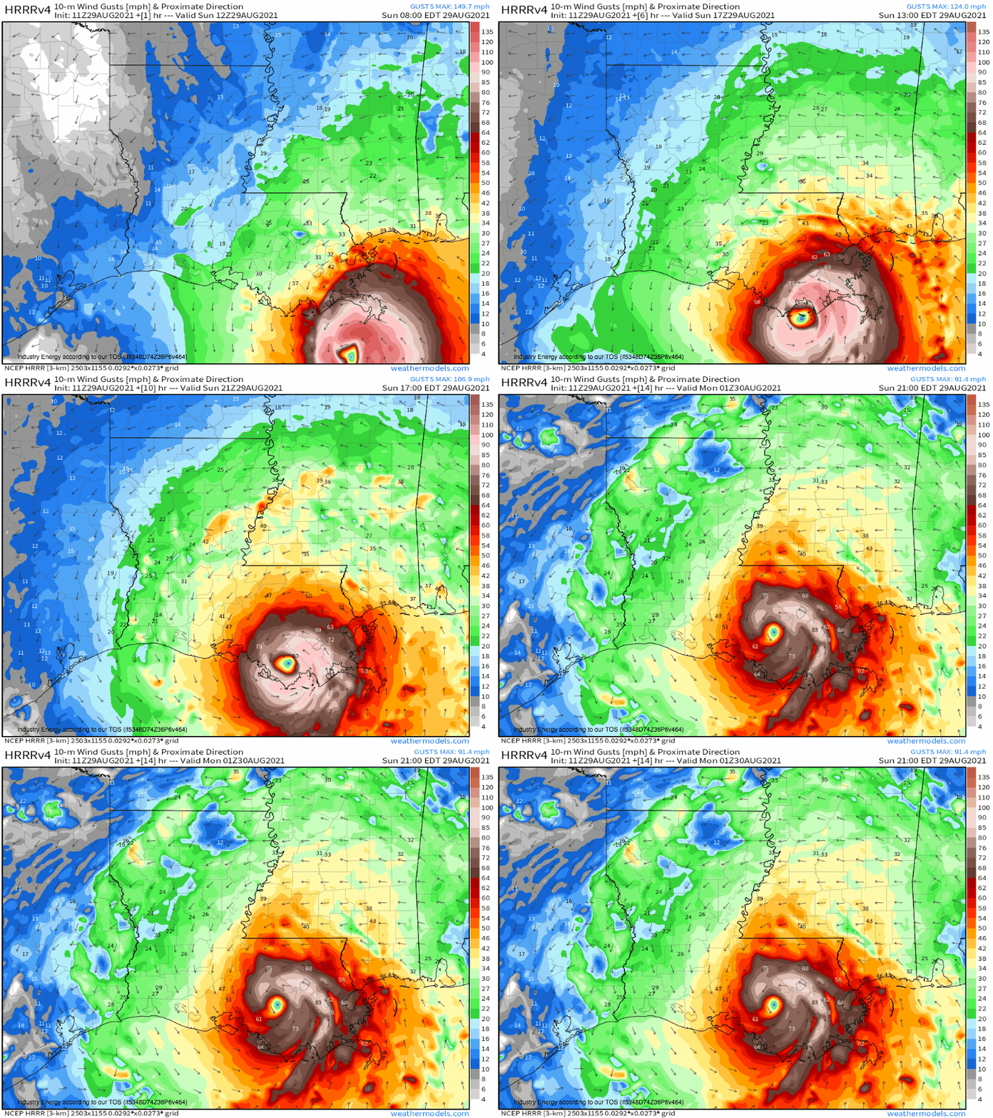
Winds will be similarly catastrophic. Ida may well be a category 5 by landfall, but that hardly matters- a huge swath of winds ≥100mph will destroy power infrastructure, likely plunging parts of the state into weeks of darkness as the electrical grid must be completely rebuilt. Winds to this speed will also turn anything not secured extremely well into projectiles capable of killing people and animals, and will damage some homes to the extent they’re unlivable. In New Orleans and Baton Rouge, buildings may channel wind further, proving extremely dangerous to anybody remaining outside or near windows. Vulnerable hospitals could well see critical power outages that threaten patients, and utilities like internet, cell service, and water purification will also certainly be destroyed for some.
If the eyewall passes your location, expect ‘extreme wind warnings’ to be issued. Treat these as you would a tornado warning, and immediately retreat to an interior bathroom on the lowest possible floor not threatened by surge.
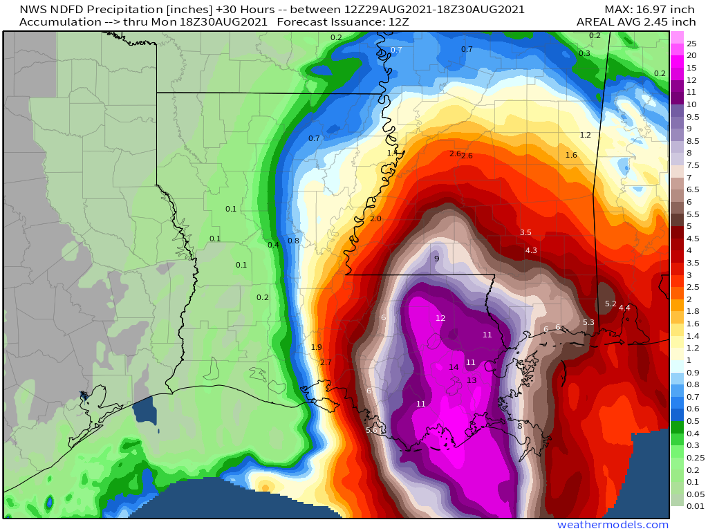
As surge stresses levees, so too will a deluge of prolific rainfall that will fall as tropical convection slowly trains over Louisiana. Rainfall could exceed a foot by day’s end, further stressing waterways and levee systems that are already seeing extraordinary impacts from surge. Further inland, rain will compete with wind to cause most devastation, as catastrophic freshwater flooding seems increasingly likely in places. This threat will extend across the entirety of eastern Louisiana and adjacent Mississippi.
Between rain and surge, New Orleans’ levee system, upgraded after Katrina, will see a test unlike anything since it was built. It’s a test the levees should be able to pass.
Ida, unfortunately, is doing exactly what was most feared. I have a pit in my stomach typing this, knowing catastrophe is likely for parts of southeast Louisiana. We are thinking of those in the path and hoping fervently that most, if not all, heeded evacuation orders.
This blog has been co-written by Jacob and Meghan.
